Posted:
Feb 20, 2018 @ 5:40 am

The avalanche danger is CONSIDERABLE for the West Central Montana backcountry. Wind loading has created dangerous avalanche conditions in specific areas. Careful snowpack evaluation, cautious route-finding, and conservative decision-making are essential for travel in the backcountry today.

Good morning, this is Logan King with the West Central Montana Avalanche Center’s avalanche advisory for Tuesday, February 20th, 2018. This danger rating does not apply to operating ski areas, expires at midnight tonight and is the sole responsibility of the U.S. Forest Service.

Weather and Snowpack

The storm has abated and cold and clear conditions have settled into the region. Temperatures this morning range from -1 to -10 degrees, and in the North Fork of the Jocko are -22. Winds are currently 16 mph gusting to 20 mph from the WNW at Point 6. A trace to one inch of snow fell at isolated mountain locations last night.

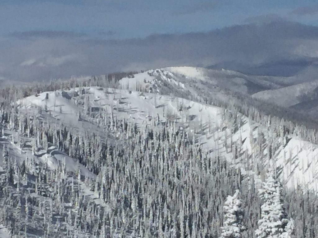
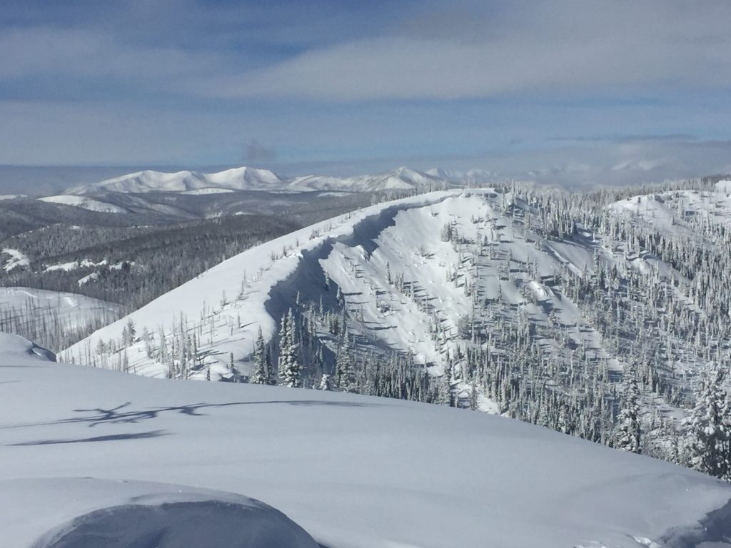
I toured near Lost Trail Pass yesterday. Conditions were calm and clear. The storm slab continued to gain strength, and the wind slabs were the most prominent concern yesterday.

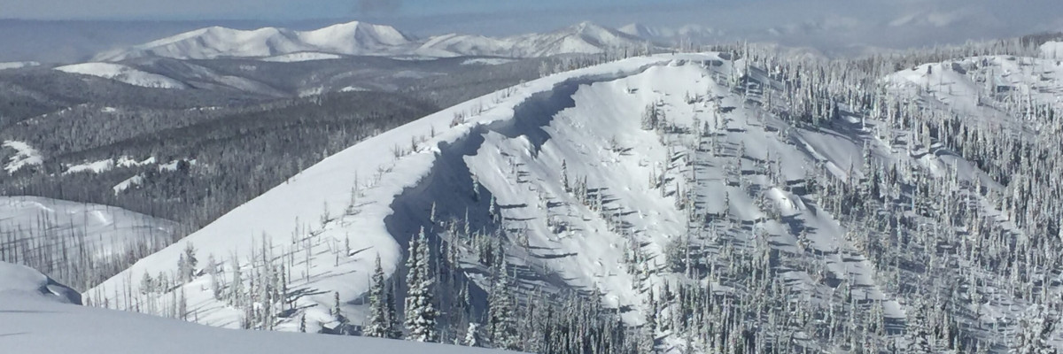
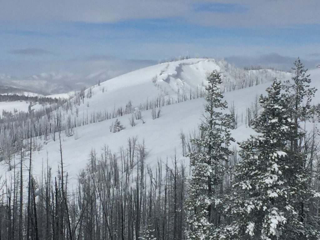
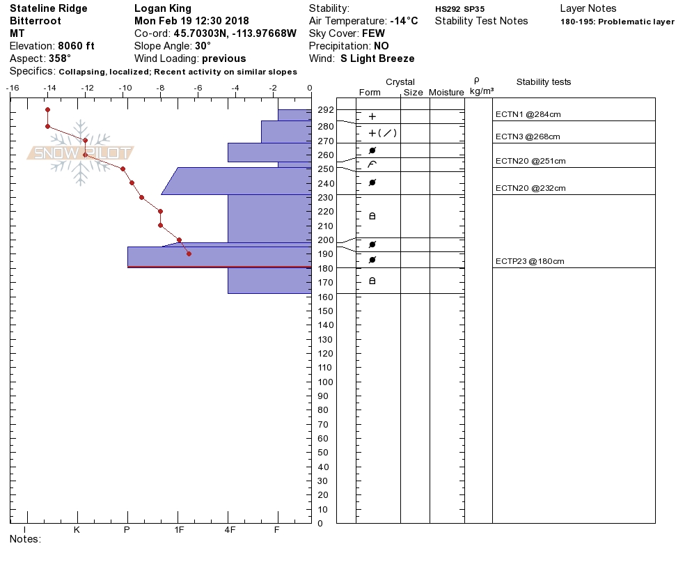
Large avalanches are likely in terrain that has been wind loaded and cross loaded. Avoid areas that show signs of wind loading like rounded pillows of snow or cracking/collapsing. Wind slabs continue to propagate in stability tests and have the potential to be pretty big, some of the propagations of late are up to three feet deep. Avoid traveling on or under wind loaded terrain.

There is a lot of dry surface snow that will make loose dry avalanches likely. These avalanches will be small but can be dangerous if there are terrain traps that increase consequences of getting caught. Evaluate not just the likelihood of the snow to move but the consequences before committing to steeper terrain.

The storm slab continues to gain strength but is variable in size and reactivity across the region. Carefully assess if the snow has bonded before traveling in avalanche terrain. The storm slabs have settled in many locations but there are isolated areas where a little more time is required before the new snow has fully settled.

Avalanche and Weather Outlook

A stable weather pattern looks to set up for the next few day, and cold temperatures will persist through the work week. The stable forecast will lead to continued decreasing avalanche danger.

The next advisory will be issued on Thursday, Ski and ride safe.

READ FULL ADVISORY  

Problem 1 - Wind Slabs

  • TYPE

    wind-slabs

    Wind Slabs

    Release of a cohesive layer of snow (a slab) formed by the wind.  Wind typically erodes snow from the upwind sides of terrain features and deposits snow on the downwind side.  Wind slabs are often smooth and rounded and sometimes sound hollow, and can range from soft to hard. Wind slabs that form over a persistent weak layer (surface hoar, depth hoar, or near-surface facets) may be termed Persistent Slabs or may develop into Persistent Slabs.

  • SIZE

    5-6

    2-3 (Large)

    The potential size of avalanche resulting from this problem.

  • LIKELIHOOD

    Likelihood-5

    Likely

    The likelihood of an avalanche resulting from this problem.

  • IMAGE

Wind slabs are still sensitive and propagating in stability tests.

Problem 2 - Loose Avalanches

  • TYPE

    loose-dry

    Loose Dry

    Release of wet unconsolidated snow or slush. These avalanches typically occur within layers of wet snow near the surface of the snowpack, but they may quickly gouge into lower snowpack layers. Like Loose-Dry Avalanches,they start at a point and entrain snow as they move downhill, forming a fan-shaped avalanche. They generally move slowly, but can contain enough mass to cause significant damage to trees, cars or buildings. Other names for loose-wet avalanches include point-release avalanches or sluffs. Loose-wet avalanches can trigger slab avalanches that break into deeper snow layers.

  • SIZE

    1-2

    < 1 (Small)

    The potential size of avalanche resulting from this problem.

  • LIKELIHOOD

    Likelihood-5

    Likely

    The likelihood of an avalanche resulting from this problem.

Loose surface snow sluffs will easily be triggered.

Problem 3 - Storm Slabs

  • TYPE

    storm-slabs

    Storm Slabs

    Release of a soft cohesive layer (a slab) of new snow which breaks within the storm snow or on the old snow surface. Storm-slab problems typically last between a few hours and few days. Storm-slabs that form over a persistent weak layer (surface hoar, depth hoar, or near-surface facets) may be termed Persistent Slabs or may develop into Persistent Slabs.

  • SIZE

    3-4

    1-2 (Small-Large)

    The potential size of avalanche resulting from this problem.

  • LIKELIHOOD

    Likelihood-2

    Unlikely/Possible

    The likelihood of an avalanche resulting from this problem.

Storm slabs continue to gain strength but should still be considered before entering avalanche terrain.

VIDEO

FORECAST & OUTLOOK

A stable weather pattern looks to set up for the next few day, and cold temperatures will persist through the work week.

This information is the sole responsibility of the Forest Service and does not apply to operating ski areas. The avalanche danger rating expires at midnight tonight but the information can help you make a more informed decision regarding travel in avalanche terrain for the next few days.

Our advisory area includes National Forest System lands in the Bitterroot Mountains from Lost Trail Pass north to Granite Pass, the Rattlesnake Mountains north of Missoula and the Southern Swan and Mission Mountains near Seeley Lake, MT. Avalanche information for the Lookout Pass/St. Regis Basin area is available from the Idaho Panhandle Avalanche Center.