Posted:
Feb 24, 2018 @ 6:06 am

The current avalanche danger is LOW for the west central Montana backcountry. Low danger does not mean no Avalanche danger. Look for high elevation wind slabs on isolated slopes. Use safe travel protocols, only exposing one person to a slope at a time.

Good morning, this is Travis Craft with the West Central Montana Avalanche Center’s avalanche advisory for February 24, 2018.  This danger rating does not apply to operating ski areas, expires at midnight tonight and is the sole responsibility of the U.S. Forest Service.

Weather and Snowpack

Mountain temperatures range from 7 F to 15 F in the region.  In the Bitterroot winds are 3 mph with gusts of 5 mph out of the South.  In the northern part of the advisory area, winds are reading 8 mph with gusts of 29 mph out of the WNW.  The forecast area received 0 to 1 inch of new snow in the last 24 hours.

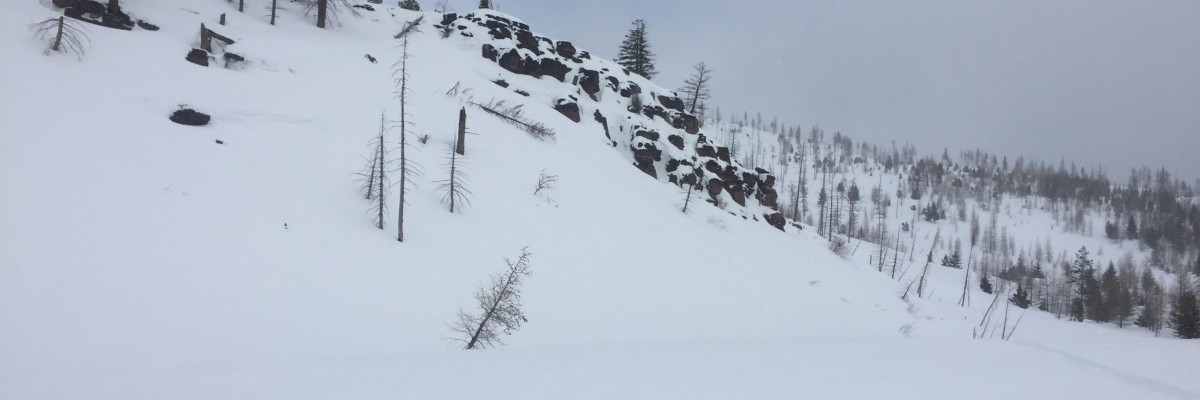
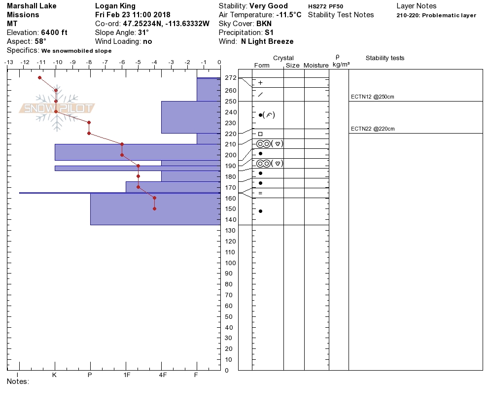
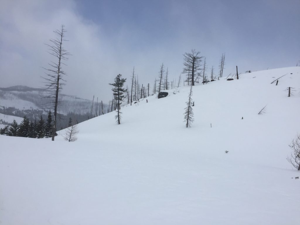
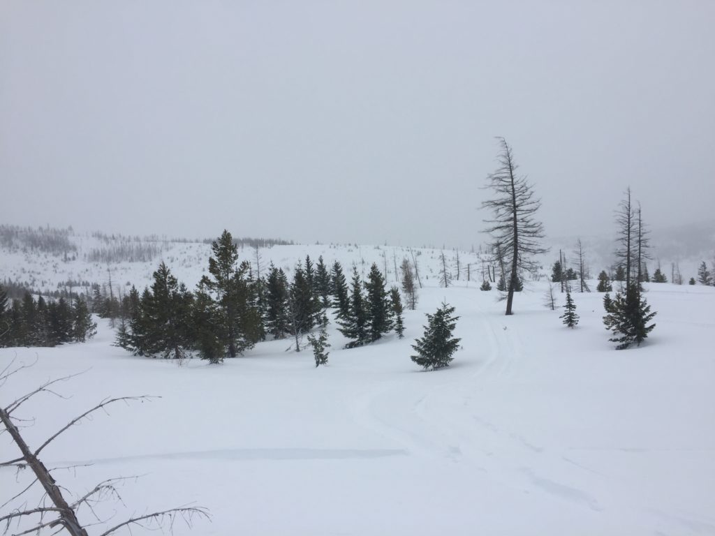
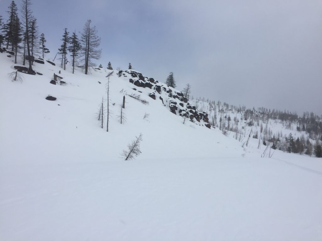
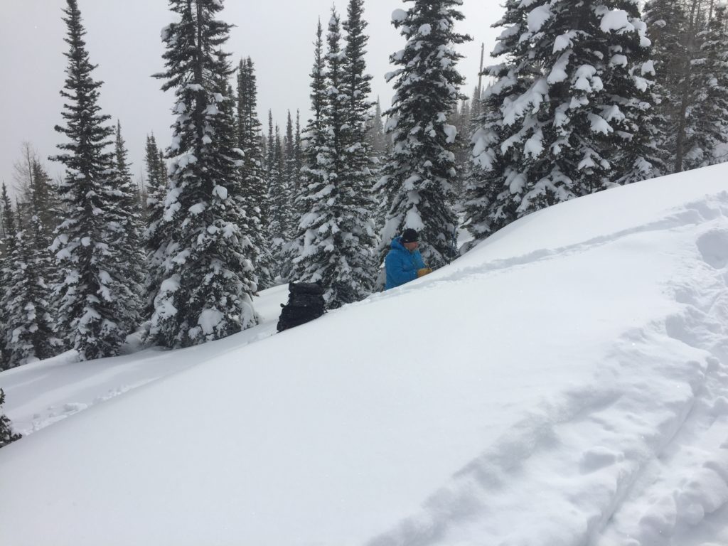
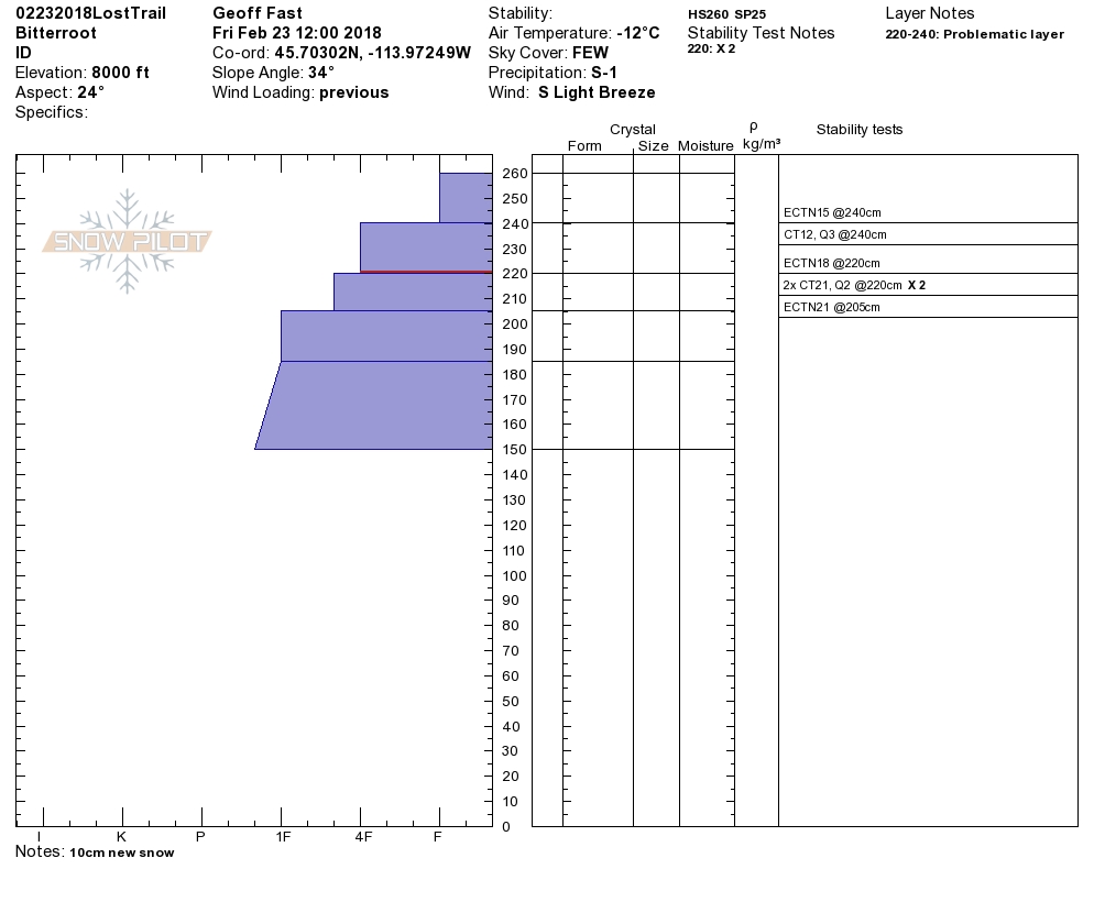
Logan and I went to the southern Missions yesterday with the sleds. We found a very well consolidated snowpack. We did not see any natural releases or human-triggered avalanches. We did not get any propagation in our snow pit tests. We did not get any shooting cracks from our skis on our machines.  Geoff was in the Lost Trail Pass backcountry in the southern Bitterroot.  He got a couple of small loose avalanches to release from ski cutting on steep North facing slopes(>38 degrees). He did not get any propagations in his pit tests. Overall our snowpack is strengthening. Low danger does not mean no danger. Ride slopes one at a time and dig a pit before committing to any steep slope.

The main avalanche problem is wind slabs. There are wind slabs above 7000 feet on isolated slopes that could be triggered by a rider. Recognize signs of instability such as cracking in the surface snow.

The second avalanche problem is persistent slabs. Before committing to a steep slope, dig a pit 3 feet down and identify any layers of concern, and see if they are reactive in pit tests.

Overall the snowpack has strengthened. There are still avalanche problems with Low danger. Do not let your guard down, practice safe travel protocols of only exposing one rider to a slope at a time and dig a pit 3 feet down to see if any weak layers are reactive. Pay attention to weather changes that can change the avalanche danger such as wind and additional loading from snow.

Avalanche and Weather Outlook

A storm system is entering our area today through Sunday. This system is forecasted to bring some additional snow today and 5-7 inches of snow on Sunday. See the forecast here. The new snow and winds will increase the avalanche danger.

If you are out in the backcountry, please send us your observation, these are very helpful in producing the advisory.

Ski and ride safe.

READ FULL ADVISORY  

Problem 1 - Wind Slabs

  • TYPE

    wind-slabs

    Wind Slabs

    Release of a cohesive layer of snow (a slab) formed by the wind.  Wind typically erodes snow from the upwind sides of terrain features and deposits snow on the downwind side.  Wind slabs are often smooth and rounded and sometimes sound hollow, and can range from soft to hard. Wind slabs that form over a persistent weak layer (surface hoar, depth hoar, or near-surface facets) may be termed Persistent Slabs or may develop into Persistent Slabs.

  • SIZE

    3-4

    1-2 (Small-Large)

    The potential size of avalanche resulting from this problem.

  • LIKELIHOOD

    Likelihood-1

    Unlikely

    The likelihood of an avalanche resulting from this problem.

There are wind slabs above 7000 feet on isolated slopes that could be triggered by a rider. Recognize signs of instability such as cracking in the surface snow.


Problem 2 - Persistent Slabs

  • TYPE

    persistent-slabs

    Persistent Slabs

    Release of a cohesive layer of soft to hard snow (a slab) in the middle to upper snowpack, when the bond to an underlying persistent weak layer breaks.  Persistent layers include: surface hoar, depth hoar, near-surface facets, or faceted snow. Persistent weak layers can continue to produce avalanches for days, weeks or even months, making them especially dangerous and tricky. As additional snow and wind events build a thicker slab on top of the persistent weak layer, this avalanche problem may develop into a Persistent, Deep-Slab.

  • SIZE

    3-4

    1-2 (Small-Large)

    The potential size of avalanche resulting from this problem.

  • LIKELIHOOD

    Likelihood-1

    Unlikely

    The likelihood of an avalanche resulting from this problem.

Before committing to a steep slope, dig a pit 3 feet down and identify any layers of concern, and see if they are reactive in pit tests.


VIDEO

Observations Seeley 02/23/2018

Observations 2/23/2018

FORECAST & OUTLOOK

A storm system is entering our area today through Sunday. This system is forecasted to bring some additional snow today and 5-7 inches of snow on Sunday. See the forecast here. The additional snow and winds will increase the avalanche danger.


This information is the sole responsibility of the Forest Service and does not apply to operating ski areas. The avalanche danger rating expires at midnight tonight but the information can help you make a more informed decision regarding travel in avalanche terrain for the next few days.

Our advisory area includes National Forest System lands in the Bitterroot Mountains from Lost Trail Pass north to Granite Pass, the Rattlesnake Mountains north of Missoula and the Southern Swan and Mission Mountains near Seeley Lake, MT. Avalanche information for the Lookout Pass/St. Regis Basin area is available from the Idaho Panhandle Avalanche Center.