Posted:
Mar 1, 2018 @ 6:22 am

A MODERATE avalanche danger exists across the West Central Montana backcountry. Avalanches are possible in specific terrain. Carefully evaluate the snow and terrain to identify areas of heightened concern.

Good morning, this is Logan King with the West Central Montana Avalanche Center’s avalanche advisory for March 1st, 2018.  This danger rating does not apply to operating ski areas, expires at midnight tonight and is the sole responsibility of the U.S. Forest Service.

Weather and Snowpack

Snow accumulation was minimal overnight and some areas received a trace to two inches of snow. Winds are currently from the East at 8 mph and gusting to about 20 mph at Point 6 and Mt. Sentinel. Stronger winds can be found in the Bitterroot where Deer Mountain is showing 19 mph winds gusting to 26 mph from the SSE. Mountain temperatures this morning range from 14-24 degrees.

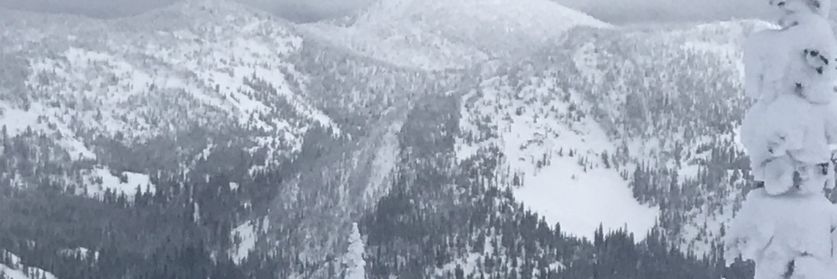
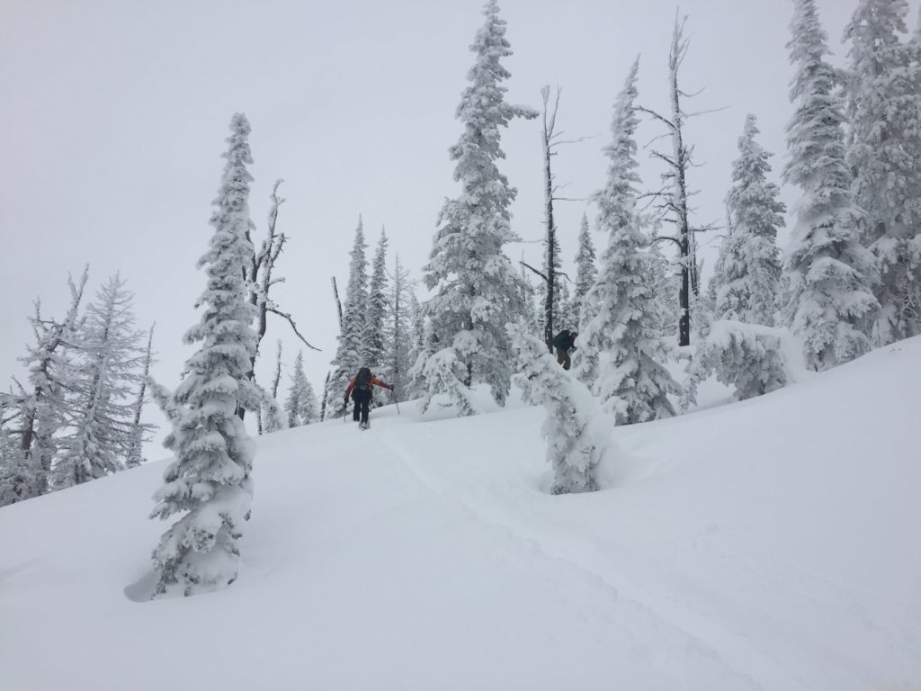
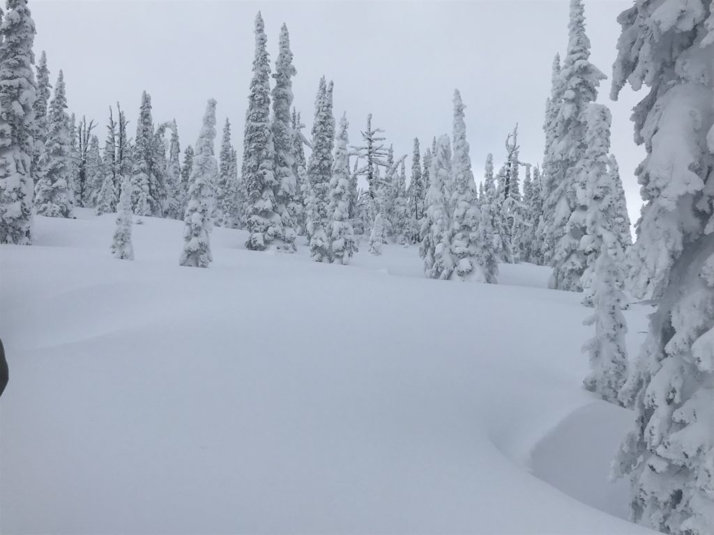
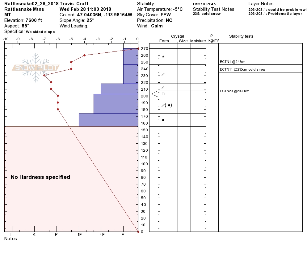
Yesterday we toured in the Rattlesnake. We found lots of deep low-density snow and continued settling, setting up for a pretty stable snowpack. The only concerns we could identify yesterday were small wind slabs in isolated terrain and persistent weak layers that were minimally reactive.

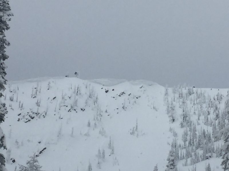
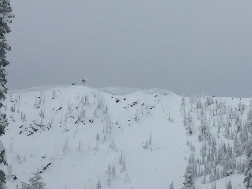
Wind slabs are small and in isolated pockets with the potential for some larger ones near ridge lines and below cornices. Wind slabs did not propagate in stability tests but showed potential to be problematic and have been for the last few days. Look for rounded pillows of snow or unusual surface snow to identify areas where wind has deposited snow.

There is a layer of cold preserved snow from the last storm cycle and a layer of facets that have formed across the region. These layers were quiet yesterday as there was no slab above them to transfer energy. This layer may become more reactive today as warm air temperatures will rapidly change the surface snow. There is the possibility that the surface snow will gain enough cohesion as the snow warms to develop into a slab. Take a minute to dig and identify if this layer is present, and if so re-evaluate it as the day progresses, and conditions change.

Loose wet avalanches will be another growing concern today. With warming temperatures and solar radiation, surface snow activity will increase throughout the day today. Look for roller balls and loose natural releases to identify when and where this problem is developing. Remember that loose wet slides can easily be managed with terrain selection, avoid terrain traps that will increase the consequences if you are seeing increasing signs of loose wet activity.

Avalanche and Weather Outlook

A southwesterly flow will bring warmer air today. Snow showers will be possible today before temperatures drop Friday and a colder moist system sets up for the weekend. While the weather may make some layers more reactive today, overall the avalanche danger shouldn’t climb too much and will remain mostly the same.

If you are out in the backcountry, please send us your observation, these are very helpful in producing the advisory.

Ski and ride safe.

READ FULL ADVISORY  

Problem 1 - Wind Slabs

  • TYPE

    wind-slabs

    Wind Slabs

    Release of a cohesive layer of snow (a slab) formed by the wind.  Wind typically erodes snow from the upwind sides of terrain features and deposits snow on the downwind side.  Wind slabs are often smooth and rounded and sometimes sound hollow, and can range from soft to hard. Wind slabs that form over a persistent weak layer (surface hoar, depth hoar, or near-surface facets) may be termed Persistent Slabs or may develop into Persistent Slabs.

  • SIZE

    3-4

    1-2 (Small-Large)

    The potential size of avalanche resulting from this problem.

  • LIKELIHOOD

    Likelihood-3

    Possible

    The likelihood of an avalanche resulting from this problem.

  • IMAGE

Isolated pockets of wind loaded snow will have the possibility of small slabs. Large wind slabs will be possible near ridge lines and below cornices.

Problem 2 - Persistent Slabs

  • TYPE

    persistent-slabs

    Persistent Slabs

    Release of a cohesive layer of soft to hard snow (a slab) in the middle to upper snowpack, when the bond to an underlying persistent weak layer breaks.  Persistent layers include: surface hoar, depth hoar, near-surface facets, or faceted snow. Persistent weak layers can continue to produce avalanches for days, weeks or even months, making them especially dangerous and tricky. As additional snow and wind events build a thicker slab on top of the persistent weak layer, this avalanche problem may develop into a Persistent, Deep-Slab.

  • SIZE

    3-4

    1-2 (Small-Large)

    The potential size of avalanche resulting from this problem.

  • LIKELIHOOD

    Likelihood-2

    Unlikely/Possible

    The likelihood of an avalanche resulting from this problem.

Facets and cold preserved storm snow have the potential to produce avalanches in areas where a slab has set up higher in the snowpack.

Problem 3 - Loose Wet

  • TYPE

    loose-wet

    Loose Wet

    Release of wet unconsolidated snow or slush. These avalanches typically occur within layers of wet snow near the surface of the snowpack, but they may quickly gouge into lower snowpack layers. Like Loose-Dry Avalanches,they start at a point and entrain snow as they move downhill, forming a fan-shaped avalanche. They generally move slowly, but can contain enough mass to cause significant damage to trees, cars or buildings. Other names for loose-wet avalanches include point-release avalanches or sluffs. Loose-wet avalanches can trigger slab avalanches that break into deeper snow layers.

  • SIZE

    1-2

    < 1 (Small)

    The potential size of avalanche resulting from this problem.

  • LIKELIHOOD

    Likelihood-3

    Possible

    The likelihood of an avalanche resulting from this problem.

Loose wet activity will develop as the temperature increases.

VIDEO

FORECAST & OUTLOOK

Warmer and mild conditions will settle in today before a cooler and active patter develops Friday and extending through the weekend.

This information is the sole responsibility of the Forest Service and does not apply to operating ski areas. The avalanche danger rating expires at midnight tonight but the information can help you make a more informed decision regarding travel in avalanche terrain for the next few days.

Our advisory area includes National Forest System lands in the Bitterroot Mountains from Lost Trail Pass north to Granite Pass, the Rattlesnake Mountains north of Missoula and the Southern Swan and Mission Mountains near Seeley Lake, MT. Avalanche information for the Lookout Pass/St. Regis Basin area is available from the Idaho Panhandle Avalanche Center.