Posted:
Mar 3, 2018 @ 6:18 am

The avalanche danger is MODERATE for the West Central Montana backcountry. Avalanches can be triggered in isolated locations across the region. Before traveling in avalanche terrain, carefully evaluate and identify areas of concern. 

Good morning, this is Logan King with the West Central Montana Avalanche Center’s avalanche advisory for March 3rd, 2018.  This danger rating does not apply to operating ski areas, expires at midnight tonight and is the sole responsibility of the U.S. Forest Service.

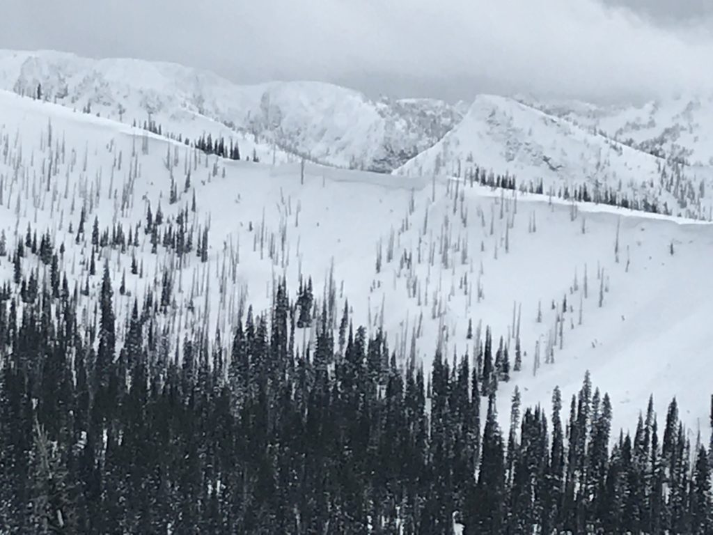
Weather and Snowpack

Mountain temperatures are cold again this morning ranging from 6-11 degrees across the advisory area. Winds across the region are light at 9 mph gusting to 11 mph from the SE. No new snow was picked up overnight but a brief period of snow yesterday brought 1-4 inches to some mountain locations.

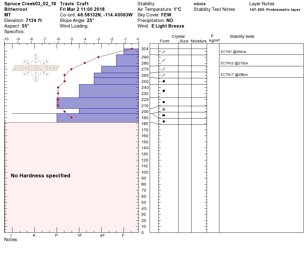
Travis and I were riding in Spruce Creek yesterday. We found the surface snow to be dense, even at upper elevations. Air and wind temps were mild until mid-day. A strong front pushed through dropping temperatures, and snow while winds increased drastically. The change was short-lived and cold clear conditions settled in overnight.

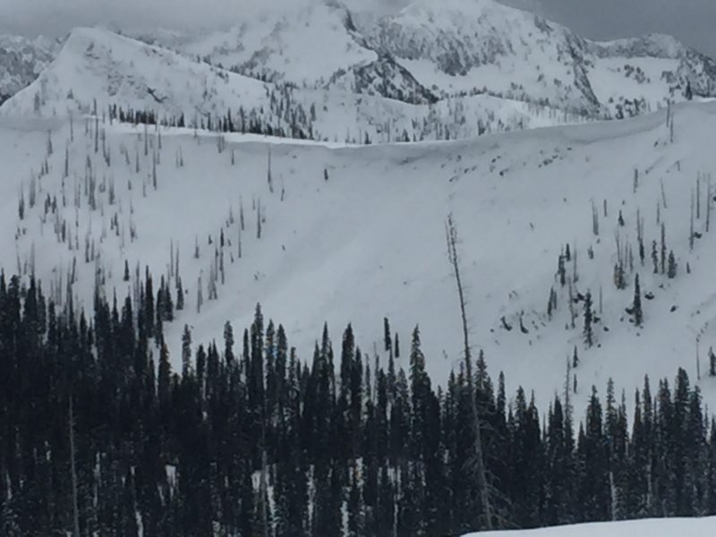
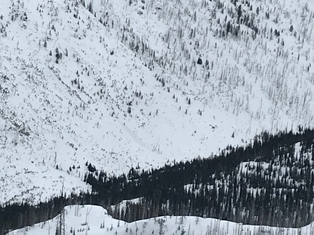
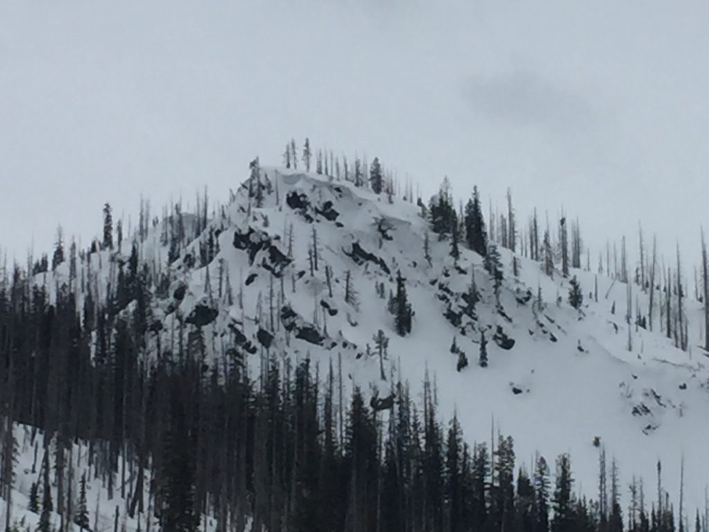
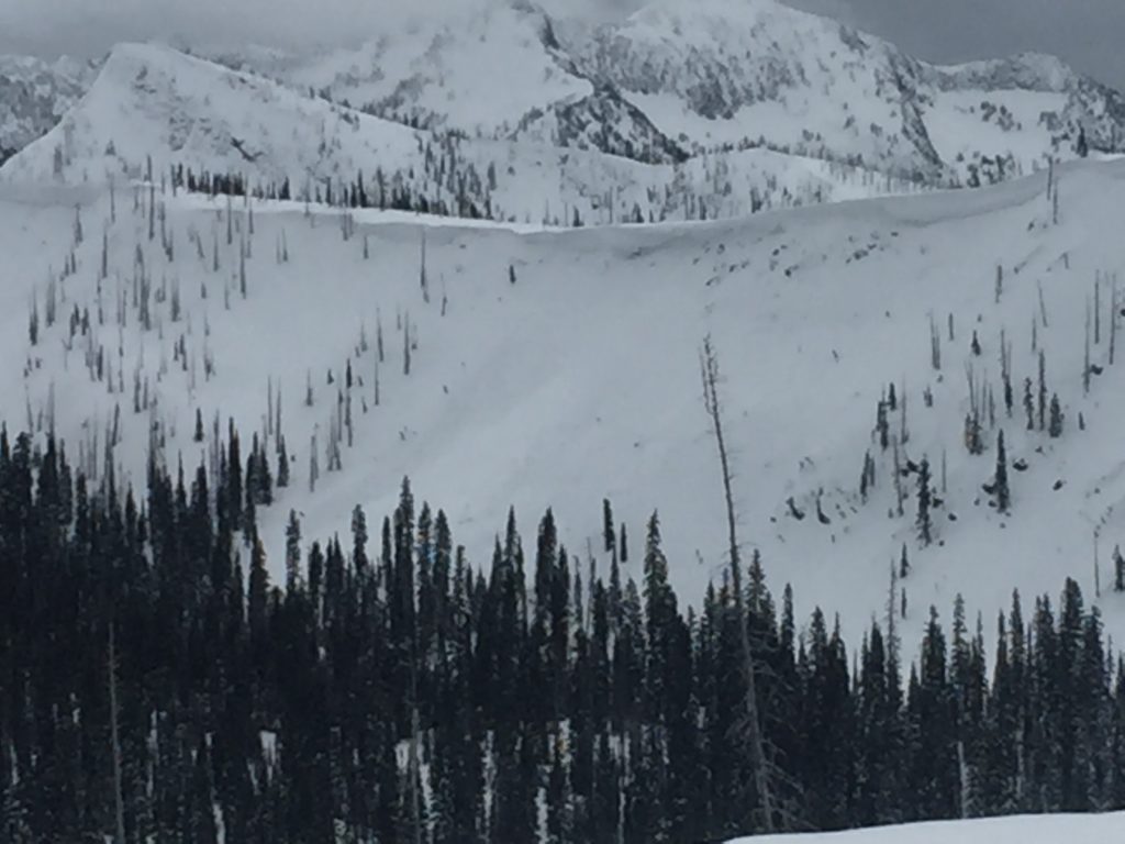
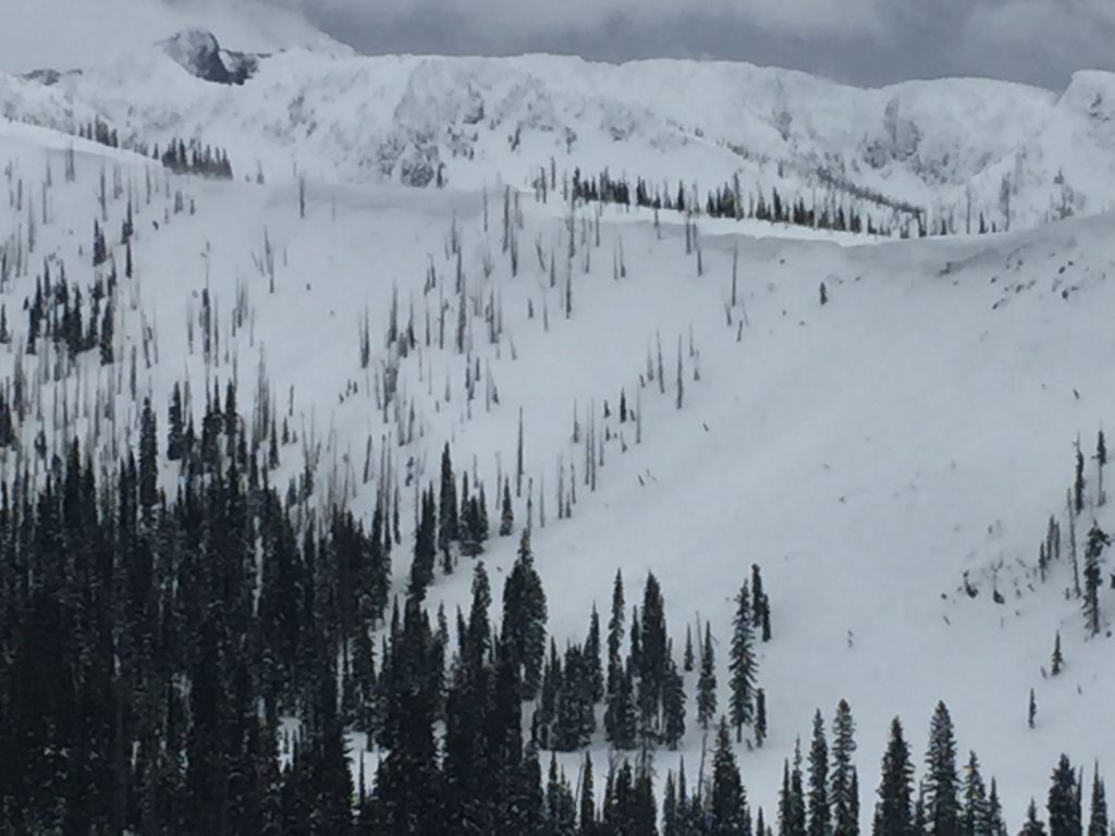
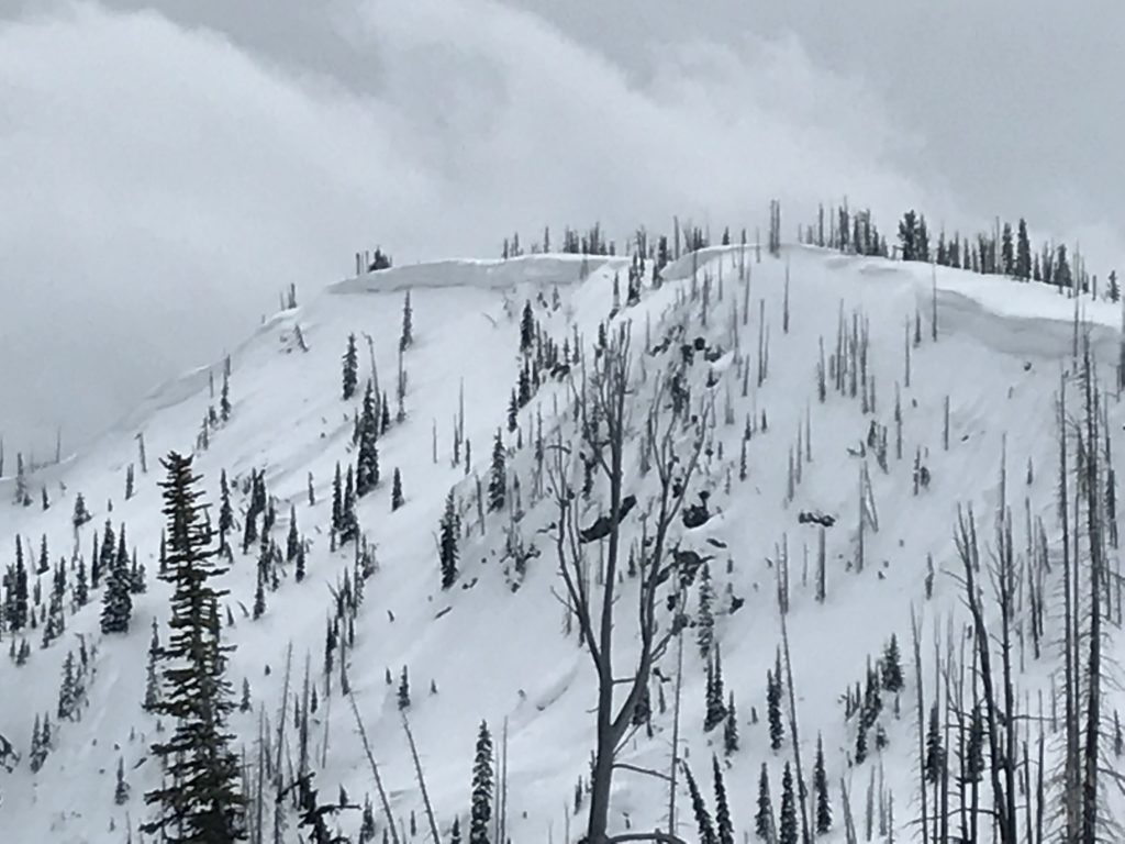
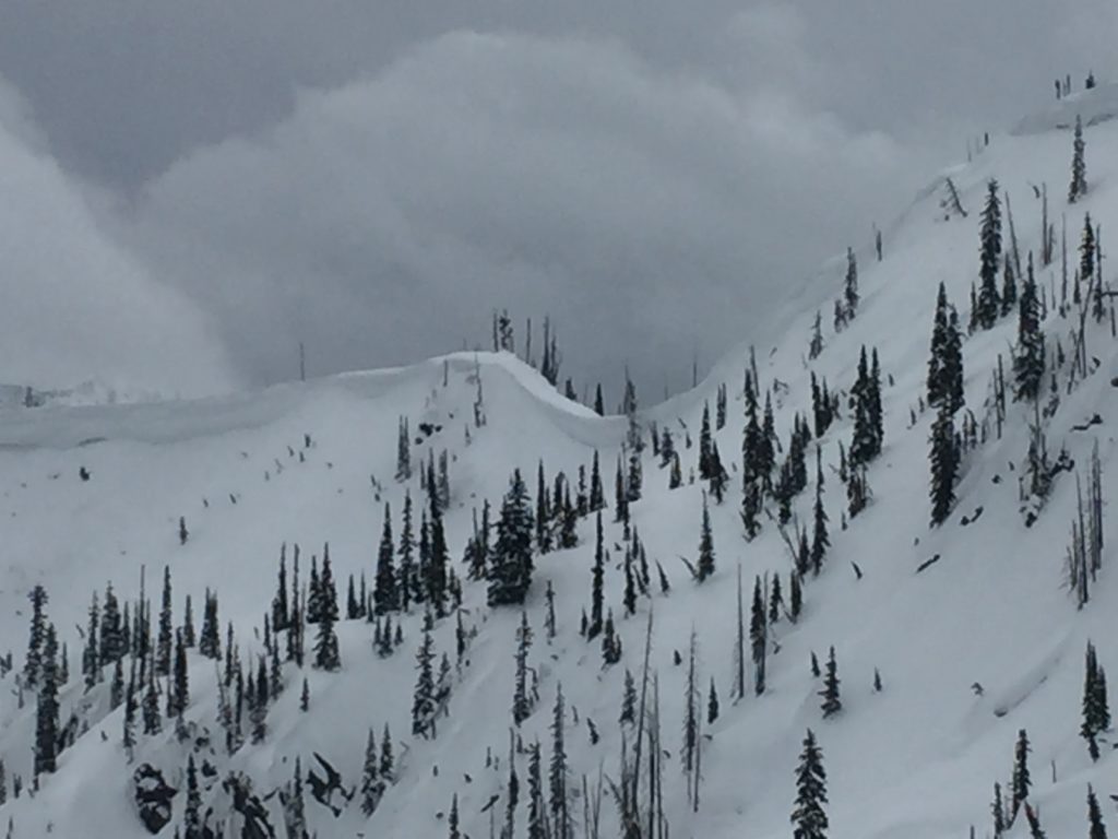
The primary avalanche concern is wind slabs above 6,000 feet. Before the surface snow got heavy, strong and shifting winds deposited snow into small pockets and near ridges. We observed multiple natural wind slab failures yesterday and have received reports of natural and human triggered wind slabs as well through the week. Wind slabs are spotty across various terrain so carefully look for identify features like drifts, rounded pillows of snow and striations in the snow surface to identify potential ares for avalanche activity. Before entering avalanche terrain thoroughly evaluate the snow to determine if it has been wind affected and has the potential to avalanche. 

Wet loose avalanches at upper elevations and wet slab avalanches at lower elevations are possible. Wet avalanche problems will primarily be focused on the southern half of the compass and will increase through the afternoon today. Look for indicators like rollerballs to identify that the surface is becoming saturated to key you into when a move to cooler aspects is required. 

Persistent slabs are also a concern today. Facets and cold preserved snow have created some weak layers in the snowpack and are suspect in areas where a slab is above the weak layers. These layers are widespread across the region but most locations still lack the overlying slab. Take a minute to dig a pit and identify if there is a harder layer above that will allow for slab failures.

Avalanche and Weather Outlook

Conditions will be clear today before another round of light snow sets up for tonight into Sunday morning. The avalanche danger will not change today other than the increasing wet activity as the temperatures rise through the day.

If you are out in the backcountry, please send us your observation, these are very helpful in producing the advisory.

Ski and ride safe.

READ FULL ADVISORY  

Problem 1 - Wind Slabs

  • TYPE

    wind-slabs

    Wind Slabs

    Release of a cohesive layer of snow (a slab) formed by the wind.  Wind typically erodes snow from the upwind sides of terrain features and deposits snow on the downwind side.  Wind slabs are often smooth and rounded and sometimes sound hollow, and can range from soft to hard. Wind slabs that form over a persistent weak layer (surface hoar, depth hoar, or near-surface facets) may be termed Persistent Slabs or may develop into Persistent Slabs.

  • SIZE

    3-4

    1-2 (Small-Large)

    The potential size of avalanche resulting from this problem.

  • LIKELIHOOD

    Likelihood-3

    Possible

    The likelihood of an avalanche resulting from this problem.

  • IMAGE

Small isolated wind slabs can be found in most terrain. Larger wind slabs have been failing on lee terrain near ridges above 6,000 feet.

Problem 2 - Wet Slabs and Loose Wet

  • TYPE

    wet-slabs

    Wet Slabs

    Release of a cohesive layer of snow (a slab) that is generally moist or wet when the flow of liquid water weakens the bond between the slab and the surface below (snow or ground). They often occur during prolonged warming events and/or rain-on-snow events. Wet slabs can be very destructive.

  • SIZE

    3-4

    1-2 (Small-Large)

    The potential size of avalanche resulting from this problem.

  • LIKELIHOOD

    Likelihood-3

    Possible

    The likelihood of an avalanche resulting from this problem.

  • ADDED DANGER

    Increased Slope Danger

    Increased/Added Danger

    There is an increased risk of avalanches on these slopes:

    E - East
    SE - Southeast
    S - South
    SW - Southwest
    W - West

Small loose wet avalanches will be possible on sunny aspects along with the potential for wet slab avalanches at lower elevations.

Problem 3 - Persistent Slabs

  • TYPE

    persistent-slabs

    Persistent Slabs

    Release of a cohesive layer of soft to hard snow (a slab) in the middle to upper snowpack, when the bond to an underlying persistent weak layer breaks.  Persistent layers include: surface hoar, depth hoar, near-surface facets, or faceted snow. Persistent weak layers can continue to produce avalanches for days, weeks or even months, making them especially dangerous and tricky. As additional snow and wind events build a thicker slab on top of the persistent weak layer, this avalanche problem may develop into a Persistent, Deep-Slab.

  • SIZE

    3-4

    1-2 (Small-Large)

    The potential size of avalanche resulting from this problem.

  • LIKELIHOOD

    Likelihood-2

    Unlikely/Possible

    The likelihood of an avalanche resulting from this problem.

There are two persistent weak layers that are widespread across the region, these layers will be suspect in locations where a slab overlays the weak layers.

VIDEO

FORECAST & OUTLOOK

  • Danger Trend

    same

    Same Danger

  • Area Forecast

    Clear

Calm and clear today with snow returning tonight and into Sunday.

This information is the sole responsibility of the Forest Service and does not apply to operating ski areas. The avalanche danger rating expires at midnight tonight but the information can help you make a more informed decision regarding travel in avalanche terrain for the next few days.

Our advisory area includes National Forest System lands in the Bitterroot Mountains from Lost Trail Pass north to Granite Pass, the Rattlesnake Mountains north of Missoula and the Southern Swan and Mission Mountains near Seeley Lake, MT. Avalanche information for the Lookout Pass/St. Regis Basin area is available from the Idaho Panhandle Avalanche Center.