Posted:
Mar 20, 2018 @ 6:11 am

The current avalanche danger is MODERATE in the west central Montana backcountry. Human triggered avalanches are possible. Heightened avalanche conditions exist on specific terrain features. Evaluate snow and terrain carefully and identify features of concern.

Good morning, this is Travis Craft with the West Central Montana Avalanche Center’s avalanche advisory for March 20, 2018.  This danger rating does not apply to operating ski areas, expires at midnight tonight and is the sole responsibility of the U.S. Forest Service.

Weather and Snowpack

Mountain temperatures range from 22 F to 26 F in the region. In the Bitterroot winds are 5 mph with gusts of 8 mph out of the SW.  In the northern part of the advisory area, winds are reading 18 mph with gusts of 24 mph out of the North. The forecast area received 0 to 1 inch of new snow in the last 24 hours.

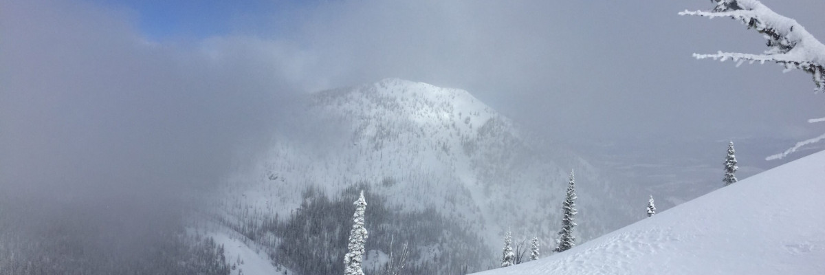
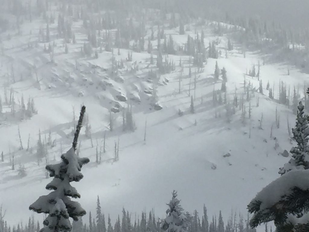
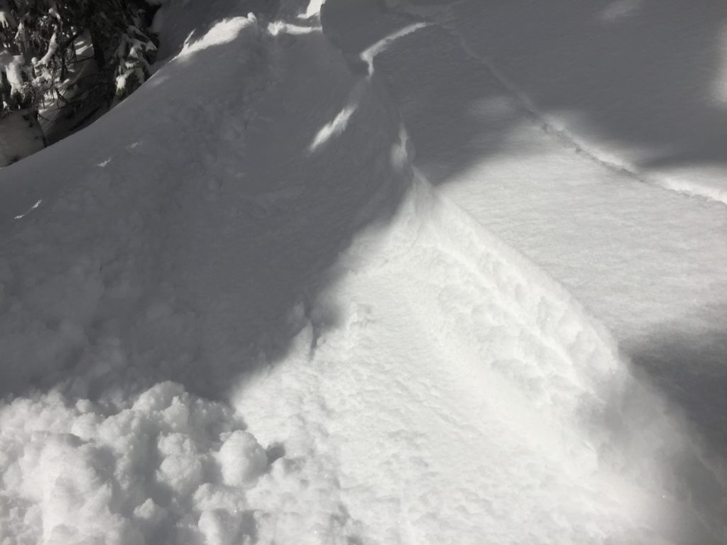
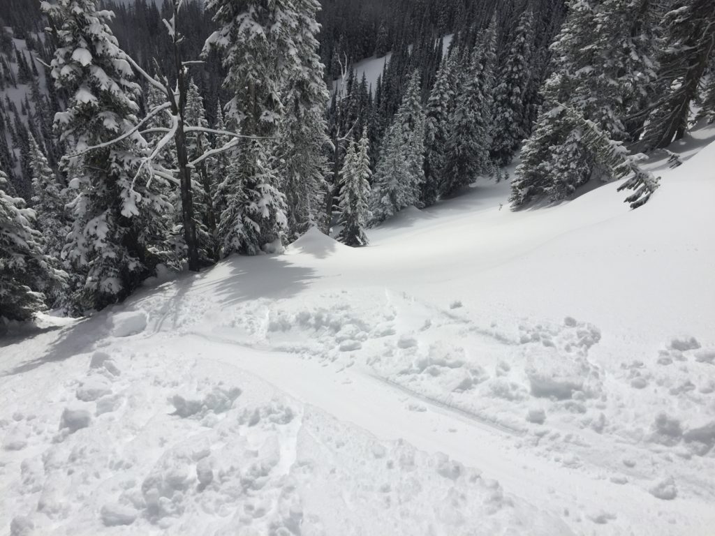
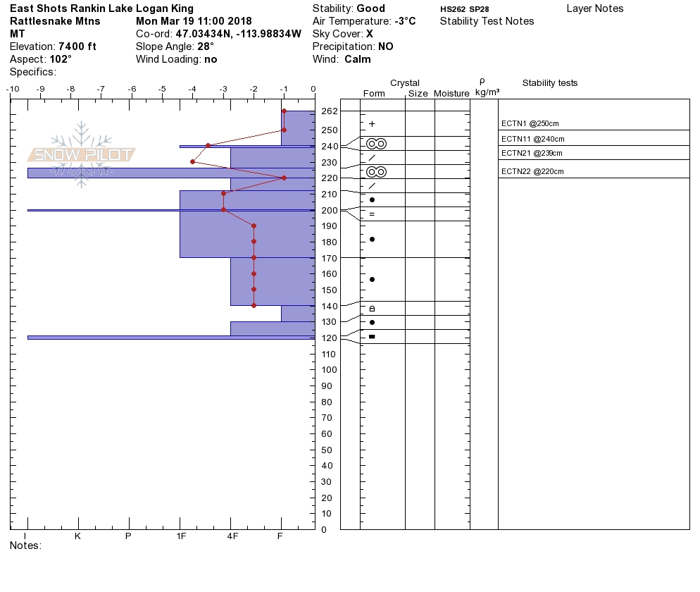
Logan and I toured in the Rattlesnake yesterday. We found a relatively stable snowpack with some storm snow instabilities. The advisory area received between 10 and 16 inches of snow in the last storm cycle on Sunday. The main concern is how the new snow is bonding to old snow surfaces. There was a natural slide that occurred in the Rattlesnake on steep wind-loaded terrain. Signs of natural activity are good indicators of slope instability.

The primary avalanche problem is wind slabs. Identify wind-loaded terrain. Look for rounded pillows of snow near ridgelines and on cross-loaded slopes. Recognize signs of instability such as cracking in the surface snow. Natural activity on slopes is a significant clue to slope instability. It is possible to cause a slab avalanche on wind-loaded terrain today.

The second avalanche concern is loose wet slides. Look for sun-exposed aspects to shed today with warming temperatures. Rollerballs are a sign of increasing hazard, change aspect to shadier ones when the surface snow starts to become supersaturated. These slides should not be a problem unless they knock you off your feet or machine and take you into a terrain trap.

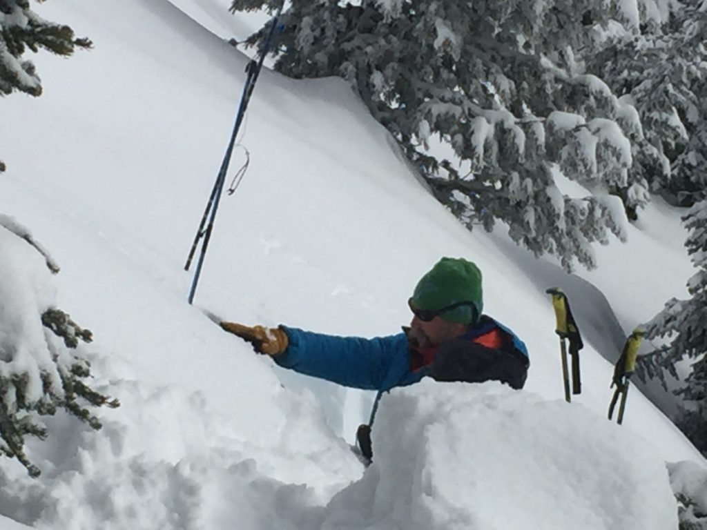
Take home points today look for natural activity to choose the best terrain today. Dig a pit 3 feet down to see if there are any concerns in pit tests. Look for bullseye clues such as shooting cracks, rollerballs, and pinwheels to give ideas of slope instability. Use small test slopes to see how the new snow is bonding to old snow surfaces. Cornices are very large this time of year and unpredictable in failure, give them a wide berth.

Avalanche and Weather Outlook

Light snow forecasted over the next couple of days. See the forecast here. Look for the avalanche danger to stay the same with these light accumulations. I will issue the advisory on Thursday, March 22.

If you are out in the backcountry, please send us your observation, these are very helpful in producing the advisory.

Ski and ride safe.


READ FULL ADVISORY  

Problem 1 - Wind Slabs

  • TYPE

    wind-slabs

    Wind Slabs

    Release of a cohesive layer of snow (a slab) formed by the wind.  Wind typically erodes snow from the upwind sides of terrain features and deposits snow on the downwind side.  Wind slabs are often smooth and rounded and sometimes sound hollow, and can range from soft to hard. Wind slabs that form over a persistent weak layer (surface hoar, depth hoar, or near-surface facets) may be termed Persistent Slabs or may develop into Persistent Slabs.

  • SIZE

    3-4

    1-2 (Small-Large)

    The potential size of avalanche resulting from this problem.

  • LIKELIHOOD

    Likelihood-3

    Possible

    The likelihood of an avalanche resulting from this problem.

Identify wind-loaded terrain. Look for rounded pillows of snow near ridgelines and on cross-loaded slopes. Recognize signs of instability such as cracking in the surface snow. It is possible to cause a slab avalanche on wind loaded terrain today.

Problem 2 - Loose Wet

  • TYPE

    loose-wet

    Loose Wet

    Release of wet unconsolidated snow or slush. These avalanches typically occur within layers of wet snow near the surface of the snowpack, but they may quickly gouge into lower snowpack layers. Like Loose-Dry Avalanches,they start at a point and entrain snow as they move downhill, forming a fan-shaped avalanche. They generally move slowly, but can contain enough mass to cause significant damage to trees, cars or buildings. Other names for loose-wet avalanches include point-release avalanches or sluffs. Loose-wet avalanches can trigger slab avalanches that break into deeper snow layers.

  • SIZE

    2-3

    1 (Small)

    The potential size of avalanche resulting from this problem.

  • LIKELIHOOD

    Likelihood-3

    Possible

    The likelihood of an avalanche resulting from this problem.

Look for sun-exposed aspects to shed today with warming temperatures. Rollerballs are a sign of increasing hazard, change aspect to shadier ones when the surface snow starts to become supersaturated. These slides should not be a problem unless they knock you off your feet or machine and take you into a terrain trap.


VIDEO

Observations 03/19/2018

Observations 03/19/2018

FORECAST & OUTLOOK

Light snow forecasted over the next couple of days. See the forecast here. Look for the avalanche danger to stay the same with these light accumulations. I will issue the advisory on Thursday, March 22.


This information is the sole responsibility of the Forest Service and does not apply to operating ski areas. The avalanche danger rating expires at midnight tonight but the information can help you make a more informed decision regarding travel in avalanche terrain for the next few days.

Our advisory area includes National Forest System lands in the Bitterroot Mountains from Lost Trail Pass north to Granite Pass, the Rattlesnake Mountains north of Missoula and the Southern Swan and Mission Mountains near Seeley Lake, MT. Avalanche information for the Lookout Pass/St. Regis Basin area is available from the Idaho Panhandle Avalanche Center.