Posted:
Mar 22, 2018 @ 6:09 am

The current avalanche danger is MODERATE in the west central Montana backcountry. Human triggered avalanches are possible. Heightened avalanche conditions exist on specific terrain features. Evaluate snow and terrain carefully and identify features of concern.

Good morning, this is Travis Craft with the West Central Montana Avalanche Center’s avalanche advisory for March 22, 2018.  This danger rating does not apply to operating ski areas, expires at midnight tonight and is the sole responsibility of the U.S. Forest Service.

Weather and Snowpack

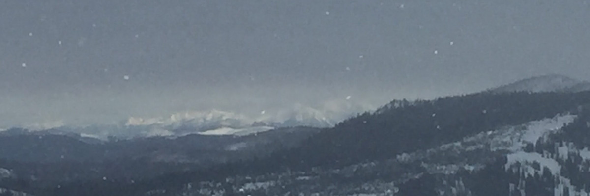
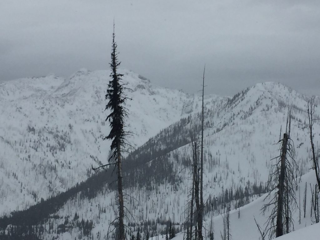
Mountain temperatures range from 29 F to 33 F in the region. In the Bitterroot winds are 13 mph with gusts of 24 mph out of the SE.  In the northern part of the advisory area, winds are reading 11 mph with gusts of 19 mph out of the North. The forecast area received 0 to 1 inch of new snow in the last 24 hours.

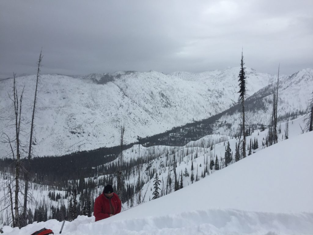
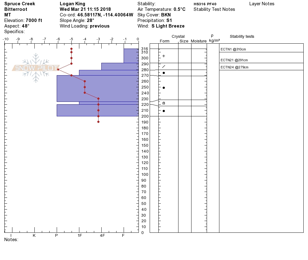
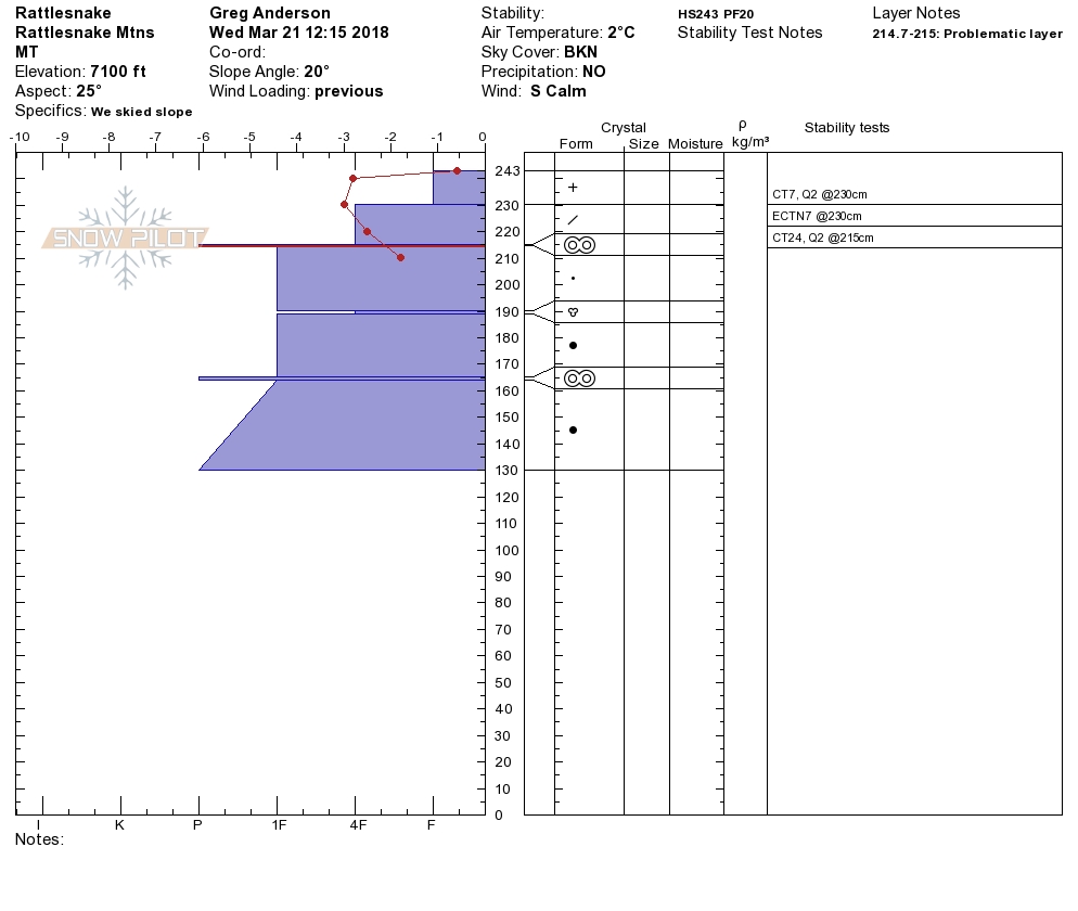
Logan and I were in the central Bitterroot yesterday. We found wind slabs and loose wet releases to be the avalanche problems. Tim and Greg were in the Rattlesnake. They found a relatively stable snowpack with wet loose releases to be the primary concern with rising temperatures and sun on southerly slopes in the afternoon. Most snotels did not freeze overnight, or if they did, it was for a very short time. Sites below 7500 feet are all at or above freezing this morning. Today rain is expected up to 6000 feet.

The primary avalanche problem will be loose wet releases. The warm temperatures and light freeze with the addition of rain will make these larger and more widespread on all aspects today.  These should not be a problem unless they knock you off your machine or feet and take you into a terrain trap. Rollerballs and pinwheels are signs that slopes are starting to get saturated.

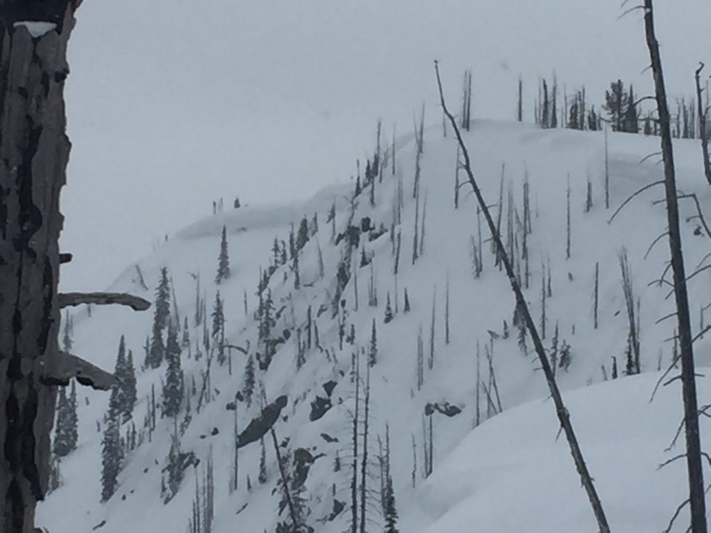
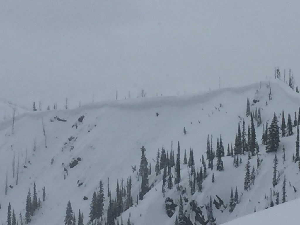
The second avalanche problem is wind slabs. There are still wind slabs located >7000 feet. Identify wind-loaded terrain. Look for rounded pillows of snow near ridgelines and on cross-loaded slopes. Recognize signs of instability such as cracking in the surface snow. It is possible to cause a slab avalanche on wind loaded terrain today.

Today will have changing conditions look for loose wet to increase with warming temperatures and rain at lower elevations and identify wind loaded terrain at higher elevations. Cornices are very large this time of year and unpredictable in failure, give them a wide berth. Keep a close eye out for changing weather conditions that will increase the avalanche danger like rain and wind.

Avalanche and Weather Outlook

Today rain and grapple to 6000 ft. A cold front will enter the area after midnight today. See the forecast here. With these conditions look for the avalanche danger to stay the same.

I will issue the next advisory on Thursday, March 24.

If you are out in the backcountry, please send us your observation, these are very helpful in producing the advisory.

Ski and ride safe.


READ FULL ADVISORY  

Problem 1 - Loose Wet

  • TYPE

    loose-wet

    Loose Wet

    Release of wet unconsolidated snow or slush. These avalanches typically occur within layers of wet snow near the surface of the snowpack, but they may quickly gouge into lower snowpack layers. Like Loose-Dry Avalanches,they start at a point and entrain snow as they move downhill, forming a fan-shaped avalanche. They generally move slowly, but can contain enough mass to cause significant damage to trees, cars or buildings. Other names for loose-wet avalanches include point-release avalanches or sluffs. Loose-wet avalanches can trigger slab avalanches that break into deeper snow layers.

  • SIZE

    3-4

    1-2 (Small-Large)

    The potential size of avalanche resulting from this problem.

  • LIKELIHOOD

    Likelihood-3

    Possible

    The likelihood of an avalanche resulting from this problem.

The primary avalanche problem will be loose wet releases. The warm temperatures and light freeze with the addition of rain will make these larger and more widespread on all aspects today.  These should not be a problem unless they knock you off your machine or feet and take you into a terrain trap. Rollerballs and pinwheels are signs that slopes are starting to get saturated.


Problem 2 - Wind Slabs

  • TYPE

    wind-slabs

    Wind Slabs

    Release of a cohesive layer of snow (a slab) formed by the wind.  Wind typically erodes snow from the upwind sides of terrain features and deposits snow on the downwind side.  Wind slabs are often smooth and rounded and sometimes sound hollow, and can range from soft to hard. Wind slabs that form over a persistent weak layer (surface hoar, depth hoar, or near-surface facets) may be termed Persistent Slabs or may develop into Persistent Slabs.

  • SIZE

    3-4

    1-2 (Small-Large)

    The potential size of avalanche resulting from this problem.

  • LIKELIHOOD

    Likelihood-3

    Possible

    The likelihood of an avalanche resulting from this problem.

There are still wind slabs located >7000 feet. Identify wind-loaded terrain. Look for rounded pillows of snow near ridgelines and on cross-loaded slopes. Recognize signs of instability such as cracking in the surface snow. It is possible to cause a slab avalanche on wind loaded terrain today.


VIDEO

Observation 03/21/2018

Observations 03/21/2018

FORECAST & OUTLOOK

Today rain and grapple to 6000 ft. A cold front will enter the area after midnight today. See the forecast here. With these conditions look for the avalanche danger to stay the same.


This information is the sole responsibility of the Forest Service and does not apply to operating ski areas. The avalanche danger rating expires at midnight tonight but the information can help you make a more informed decision regarding travel in avalanche terrain for the next few days.

Our advisory area includes National Forest System lands in the Bitterroot Mountains from Lost Trail Pass north to Granite Pass, the Rattlesnake Mountains north of Missoula and the Southern Swan and Mission Mountains near Seeley Lake, MT. Avalanche information for the Lookout Pass/St. Regis Basin area is available from the Idaho Panhandle Avalanche Center.