
The avalanche danger is CONSIDERABLE on wind loaded terrain for the West Central Montana backcountry. On non-wind loaded terrain, the avalanche danger is moderate. Avalanche activity has increased on wind loaded terrain making human trigger avalanches likely. Small to large to very large avalanches are possible dependent on the terrain where you choose to recreate.
Good morning, this is Logan King with the West Central Montana Avalanche Center’s avalanche advisory for Thursday, March 29th, 2018. This danger rating does not apply to operating ski areas, expires at midnight tonight and is the sole responsibility of the U.S. Forest Service.
Weather and Snowpack
As of 5:00 am this morning, mountain temperatures are in the twenties. Winds have been in the teen to twenties and gusting to the thirties primarily from the west. Since yesterday morning an additional 1-5 inches of snow have fallen bringing the two-day snow totals up to nearly a foot at some locations. The majority of mountain locations have received less than .5 inches of SWE.
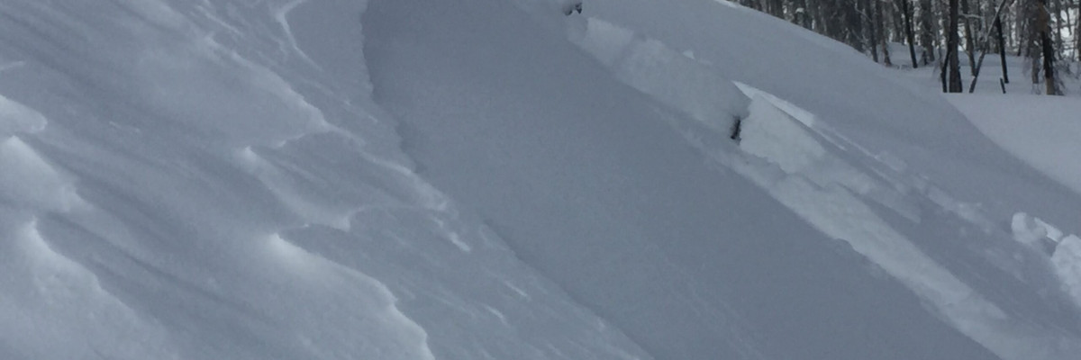
Gregg toured in the Rattlesnake yesterday and found wind slabs that were on the cusp of being classified as touchy. With heavy winds across the advisory area and concentrated to the northern regions paired with snow to the north, wind slabs will be increasingly sensitive today.
Strong winds have made wind slabs the primary concern. With plenty of new snow for transport and heavy winds, wind slabs have grown in size and sensitivity to triggers at elevations above 6,000 feet. Look for sastrugi, rounded pillows of snow, and wind drifts to identify aspects and elevations to avoid today. Human triggered avalanches will be likely on wind loaded terrain but will vary greatly in size and will are dependent on local topography.
Avalanche and Weather Outlook
Sustained westerly winds are expected to continue through the day today but will be less intense than yesterday. Snow showers will continue to diminish through the day today before another round of snow sets up for late Friday. Avalanche conditions will remain steady for the next 24 hours.
The final regular scheduled advisory will be issued on Saturday, March 31’st. Additional advisories and condition updates will be posted as necessary.
If you are out in the backcountry, please send us your observations, these are very helpful in producing the advisory.
Ski and ride safe.


