Posted:
Nov 10, 2018 @ 6:16 am

This is Travis Craft with an early season snowpack update, on Saturday, November 09, 2018.

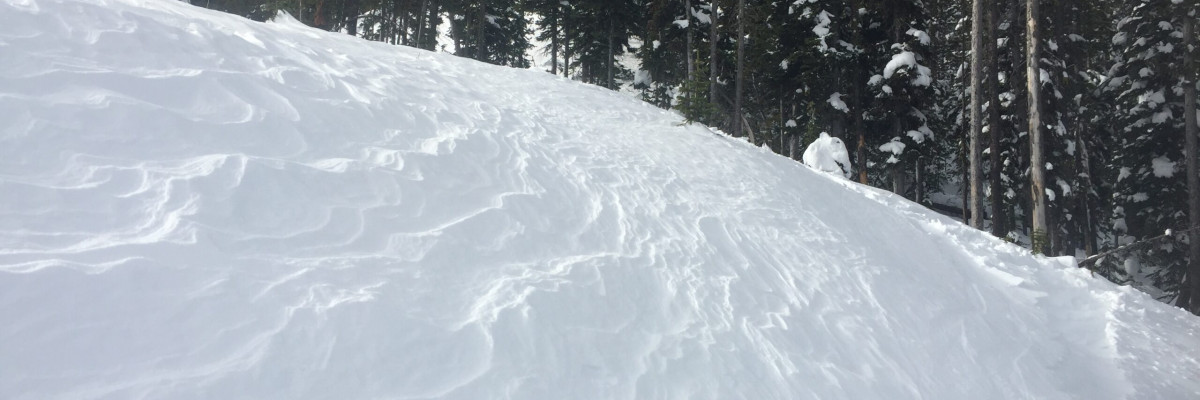
The primary concern at high elevations are shallow wind slabs. The second concern will be new snow instabilities this weekend. Beware of thin snow coverage and buried obstacles to amplify the consequences of an avalanche. The snowpack is generally too shallow on most mid and lower elevation terrain for avalanche concerns.

In the past, there have been several early season close calls and fatalities in Montana involving hunters, climbers and skiers.  Hunters and Climbers: Please keep avalanche safety on your mind as you travel across steep, open terrain. Consider traveling with a partner and carrying rescue equipment.  Skiers: If there is enough snow to ride, there is enough snow to slide!

If you see any of these clues signaling dangerous snow conditions, avoid being on or under open slopes steeper than 30 degrees:

  • Recent avalanche activity
  • Cracking or collapsing snowpack
  • Heavy snowfall
  • High winds
  • Rapid increase in temperature

If you spend time in the mountains during the winter, chances are you will encounter avalanche terrain. Understanding the terrain, weather and snowpack will significantly assist in making good decisions. To help you, we are offering several basic and advanced avalanche awareness classes this winter. This includes opportunities for private organizations who may be interested in a range of programs from introductory lectures to classes with a field component.

While out recreating, any information you can provide the WCMAC is appreciated and helps us inform the rest of the community about avalanche safety conditions. Please send a quick email to [email protected] or complete the easy to use public observation form.

In response to the growing number of folks recreating in the backcountry, we will be increasing our presence in the field and creating new ways to educate people about avalanche safety. Please take the time to fill out this survey and help us better serve our community.

We will update the advisory as the weather dictates and plan to begin issuing regular avalanche advisories with a danger rating in mid-December.

READ FULL ADVISORY  

Problem 1 - Wind Slabs

  • TYPE

    wind-slabs

    Wind Slabs

    Release of a cohesive layer of snow (a slab) formed by the wind.  Wind typically erodes snow from the upwind sides of terrain features and deposits snow on the downwind side.  Wind slabs are often smooth and rounded and sometimes sound hollow, and can range from soft to hard. Wind slabs that form over a persistent weak layer (surface hoar, depth hoar, or near-surface facets) may be termed Persistent Slabs or may develop into Persistent Slabs.

  • SIZE

    2-3

    1 (Small)

    The potential size of avalanche resulting from this problem.

  • LIKELIHOOD

    Likelihood-2

    Unlikely/Possible

    The likelihood of an avalanche resulting from this problem.

Small wind slabs are located on leeward slopes.

Problem 2 - New Snow

  • TYPE

    loose-dry

    Loose Dry

    Release of wet unconsolidated snow or slush. These avalanches typically occur within layers of wet snow near the surface of the snowpack, but they may quickly gouge into lower snowpack layers. Like Loose-Dry Avalanches,they start at a point and entrain snow as they move downhill, forming a fan-shaped avalanche. They generally move slowly, but can contain enough mass to cause significant damage to trees, cars or buildings. Other names for loose-wet avalanches include point-release avalanches or sluffs. Loose-wet avalanches can trigger slab avalanches that break into deeper snow layers.

  • SIZE

    2-3

    1 (Small)

    The potential size of avalanche resulting from this problem.

  • LIKELIHOOD

    Likelihood-2

    Unlikely/Possible

    The likelihood of an avalanche resulting from this problem.

New snow will fall on old snow surfaces creating small dry avalanches at higher elevations. Check to see how the new snow is bonding to the old snow by using small test slopes.

FORECAST & OUTLOOK

See the forecast.

This information is the sole responsibility of the Forest Service and does not apply to operating ski areas. The avalanche danger rating expires at midnight tonight but the information can help you make a more informed decision regarding travel in avalanche terrain for the next few days.

Our advisory area includes National Forest System lands in the Bitterroot Mountains from Lost Trail Pass north to Granite Pass, the Rattlesnake Mountains north of Missoula and the Southern Swan and Mission Mountains near Seeley Lake, MT. Avalanche information for the Lookout Pass/St. Regis Basin area is available from the Idaho Panhandle Avalanche Center.