
Good morning this is Logan King with an early season update to the weather and snowpack conditions for November 21st, 2018.
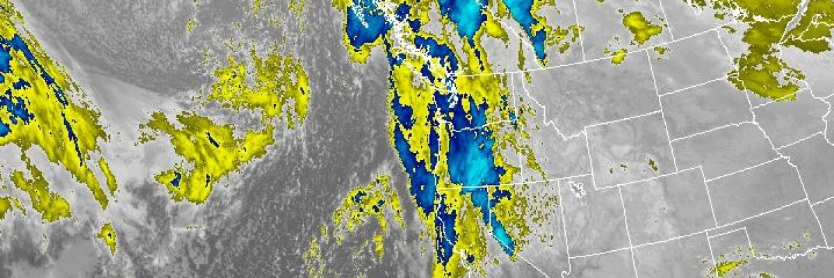
The pattern of seasonable temperatures and clear skies is drawing to a close over the next few days. The National Weather Service is predicting heavy snow to move into the region sometime Thursday with rain in the valleys and wet heavy snow above 5000ft. West Central Montana looks to pick up about 3-6″ of snow with the start of the system potentially bringing up to a half inch of snow water equivalent (SWE). Friday and into Saturday brings the potential of 6-12″ of snow with an additional 0.5-0.75″ of SWE along with snow to the valley floor. The National Weather Service has stated a moderate to high confidence level with the forecast.
So what does this mean? The temperatures have been cool enough for the snow to stick since early November at most locations. The snow is faceting and loosing strength at some locations while going through a freeze-thaw cycle at others creating a surface crust. This new load will stress the snowpack in areas where the snow is weak and will also have a difficult time bonding to surface crusts. In either case expect to see the avalanche danger climbing through the weekend.
If you plan to take advantage of some time off this week and the early season snow over the long Holiday weekend be aware of the significant changes and stress the snowpack will likely be under. Keep and eye out for indicators of avalanche potential like:
- Recent avalanche activity
- Cracking or collapsing of the snow
- Heavy snowfall rates and totals
- High winds
- Rapid changes in temperature
It is easy for bad habits to creep into our lives this time of year, so if you are out in avalanche country stay diligent and follow your protocols to stay safe and safely assess the avalanche hazards.
If you do make it out into the hills feel free to share what you see on our public observations page. They are not only helpful to your community but extremely helpful to us, especially this time of year as data is sparse, conditions are variable and rapidly changing. If you haven’t had a chance yet please take a minute to fill out a quick survey and sign a petition to help improve the advisories and education program.
We will update the advisory as the weather dictates and plan to begin issuing regular avalanche advisories with a danger rating sometime in December.


