Posted:
Dec 6, 2018 @ 6:25 am

The current avalanche danger is LOW  in the west central Montana backcountry. Generally safe avalanche conditions. Watch for unstable snow on isolated terrain features.

Good morning, this is Travis Craft with the West Central Montana Avalanche Center’s avalanche advisory for December 06, 2018.  This danger rating does not apply to operating ski areas, expires at midnight tonight and is the sole responsibility of the U.S. Forest Service.

Weather and Snowpack

Mountain temperatures range from -6 F to 6 F in the region.  In the Bitterroot winds are 10 mph with gusts of 14 mph out of the SSE.  In the northern part of the advisory area, winds are reading 13 mph with gusts of 15 mph out of the WSW.  The forecast area received 0 to 1 inch of new snow in the last 24 hours.

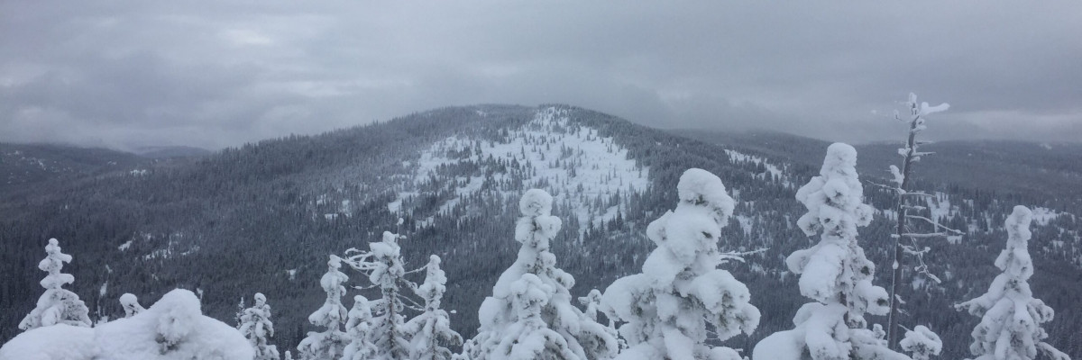
The forecast area has a relatively shallow snowpack ranging from 2 to 3 feet of snow. The upper elevations have the most snow and are where you may encounter isolated avalanche problems.

The primary concern is wind slabs. The forecast area received strong winds over the last couple of days drifting snow on ridgelines and leeward slopes. Look for smooth and rounded deposits of snow and avoid wind drifted snow in steep terrain. Early season obstacles can increase the consequences of an avalanche.

The second problem is persistent slabs. The cold temperatures have weakened the snowpack. There is a crust with weak snow above and below it throughout our forecast region. It has not been reactive yet in our tests. Dig a pit to the ground and identify the weak layers. These layers will become a concern with more snow in the upcoming week.

Overall we have safe avalanche conditions. Remember that the shallow snow will increase the risk of trauma if caught in a slide as more rocks, stumps, and down trees will be exposed in the slide path. Use normal caution, continue to keep your guard up and look for any signs of snow instability. Evaluate snow and weather conditions as you travel.

Avalanche and Weather Outlook

High pressure moves into the area with valley inversions today and through the weekend. The next chance for precipitin looks like Saturday. The high pressure will keep the avalanche danger the same. Click here for the backcountry forecast.

If you do make it out into the hills feel free to share what you see on our public observations page. They are not only helpful to your community but extremely helpful to us, especially this time of year as data is sparse, conditions are variable and rapidly changing.

Join us tonight for an avalanche awareness night. Click here for details.

Logan will issue the next forecast on Saturday, December 08, 2018.

Ski and ride safe.

READ FULL ADVISORY  

Problem 1 - Wind Slabs

  • TYPE

    wind-slabs

    Wind Slabs

    Release of a cohesive layer of snow (a slab) formed by the wind.  Wind typically erodes snow from the upwind sides of terrain features and deposits snow on the downwind side.  Wind slabs are often smooth and rounded and sometimes sound hollow, and can range from soft to hard. Wind slabs that form over a persistent weak layer (surface hoar, depth hoar, or near-surface facets) may be termed Persistent Slabs or may develop into Persistent Slabs.

  • SIZE

    2-3

    1 (Small)

    The potential size of avalanche resulting from this problem.

  • LIKELIHOOD

    Likelihood-2

    Unlikely/Possible

    The likelihood of an avalanche resulting from this problem.

Look for snowdrifts and smooth, rounded deposits of snow on ridgelines. There are small wind slabs on leeward terrain. Avoid wind-drifted snow in steep terrain. Early season obstacles can increase the consequences of an avalanche.

Problem 2 - Persistent Slabs

  • TYPE

    persistent-slabs

    Persistent Slabs

    Release of a cohesive layer of soft to hard snow (a slab) in the middle to upper snowpack, when the bond to an underlying persistent weak layer breaks.  Persistent layers include: surface hoar, depth hoar, near-surface facets, or faceted snow. Persistent weak layers can continue to produce avalanches for days, weeks or even months, making them especially dangerous and tricky. As additional snow and wind events build a thicker slab on top of the persistent weak layer, this avalanche problem may develop into a Persistent, Deep-Slab.

  • SIZE

    2-3

    1 (Small)

    The potential size of avalanche resulting from this problem.

  • LIKELIHOOD

    Likelihood-1

    Unlikely

    The likelihood of an avalanche resulting from this problem.

There is a crust with weak snow above it about 2 feet from ground. This layer is one to keep in mind as we continue to get more snow in the upcoming week. Dig a pit to see if this layer is reactive. Dig your pit all the way to the ground to find this layer.

FORECAST & OUTLOOK

High pressure moves into the area with valley inversions today and through the weekend. The next chance for precipitin looks like Saturday. The high pressure will keep the avalanche danger the same. Click here for the backcountry forecast.


This information is the sole responsibility of the Forest Service and does not apply to operating ski areas. The avalanche danger rating expires at midnight tonight but the information can help you make a more informed decision regarding travel in avalanche terrain for the next few days.

Our advisory area includes National Forest System lands in the Bitterroot Mountains from Lost Trail Pass north to Granite Pass, the Rattlesnake Mountains north of Missoula and the Southern Swan and Mission Mountains near Seeley Lake, MT. Avalanche information for the Lookout Pass/St. Regis Basin area is available from the Idaho Panhandle Avalanche Center.