The current avalanche danger for the West Central Montana backcountry is Considerable on wind loaded terrain. Large human triggered avalanches are likely in specific locations. On all non-wind loaded terrain the avalanche danger is moderate. Careful snowpack evaluation and cautious route finding are essential to safely travel in the backcountry today.
Good morning, this is Logan King with the West Central Montana Avalanche Center’s avalanche advisory for December 13th, 2018. This danger rating does not apply to operating ski areas, expires at midnight tonight and is the sole responsibility of the U.S. Forest Service.
Weather and Snowpack
Over Tuesday night, winter made a return to the region and deposited between 8-14 inches of snow with some locations picking up an inch of SWE. The snow tapered off yesterday as the winds intensified. Since Tuesday afternoon the winds have calmed a bit and shifted from a westerly flow to a SSW-S and are currently 13 mph gusting to 20 mph at ridge tops. Over the past 24 hours area snotels have recorded an additional 1-3 inches of snow.
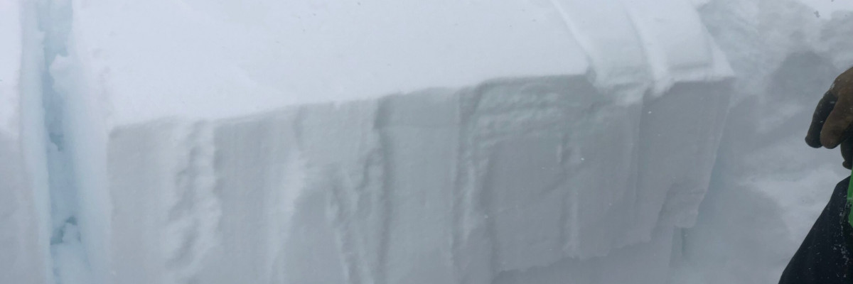
Yesterday we found the new snow had caused natural releases that were 8-10 inches deep over night, but conditions were already settling down by morning. Collapsing, whumphing and shooting cracks were localized to terrain where the wind was depositing snow. On a wind loaded slope we had and extended column test propagate at about 16″ deep on only 2 taps. This means that the primary avalanche concern today is wind drifted snow near ridglelines and on leeward slopes.
The secondary avalanche concern is storm slabs. The are some weaknesses within the new snow that will lead to reactive surface layers that will produce small loose snow sluffs. Loose snow avalanches are primarily problematic in steep exposed terrain where the consequences are higher. There is lots of loose snow that will easily be en-trained in small sluffs and can knock you off your feet or sled.
Finally, all of the new snow is sitting on a layer of surface hoar that formed over the last few weeks. The buried surface hoar is extremely weak but the new snow is lacking some of the slab properties needed to propagate and create large avalanches (except where wind affected). Below the buried surface hoar is a weak unconsolidated snowpack that is also suspect, but continues to be un-reactive in stability tests. Even though these weak layers are not overly reactive in tests, they will be hard to trust and will be a lingering problem for the foreseeable future.
Avalanche and Weather Outlook
A ridge of high pressure looks to set up for the next couple of days. Winds preceding the ridge will continue to load lee terrain but avalanche conditions will slowly settle as the snow adjusts and bonds over the next few days. The next few days should set up with above normal temperatures and gusty winds. The next loading event looks to impact the region sometime over the weekend (Forecast).
If you make it out into the backcountry feel free to share what you see on our public observations page. They are not only helpful to your community but extremely helpful in producing the forecasts.
Ski and ride safe.


