Posted:
Dec 18, 2018 @ 6:36 am

The current avalanche danger is Considerable in the west central Montana backcountry on all slopes. Dangerous avalanche conditions exist. Careful snowpack evaluation, cautious route-finding, and conservative decision-making are essential today. Look for the avalanche danger to increase throughout the day and go to High with the predicted weather forecast.

Good morning, this is Travis Craft with the West Central Montana Avalanche Center’s avalanche advisory for December 18, 2018.  This danger rating does not apply to operating ski areas, expires at midnight tonight and is the sole responsibility of the U.S. Forest Service.

Weather and Snowpack

Mountain temperatures range from 28 F to 31 F in the region. In the Bitterroot winds are 17 mph with gusts of 25 mph out of the SSE. In the northern part of the advisory area, winds are reading 11 mph with gusts of 17 mph out of the SE. The forecast area received 1 to 2 inches of new snow in the last 24 hours.

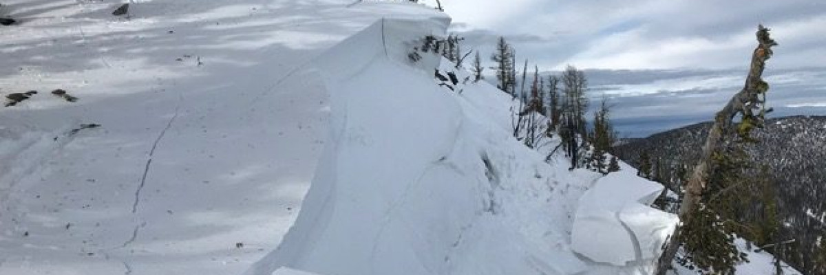
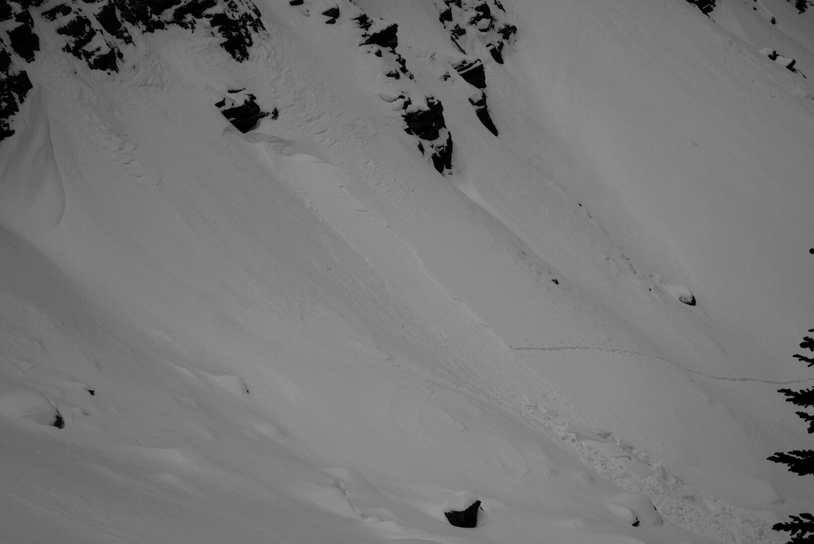
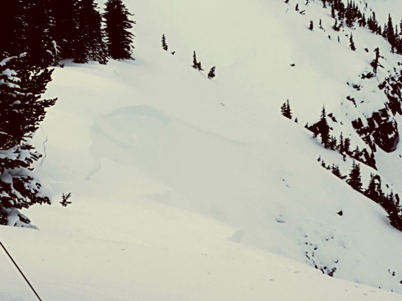
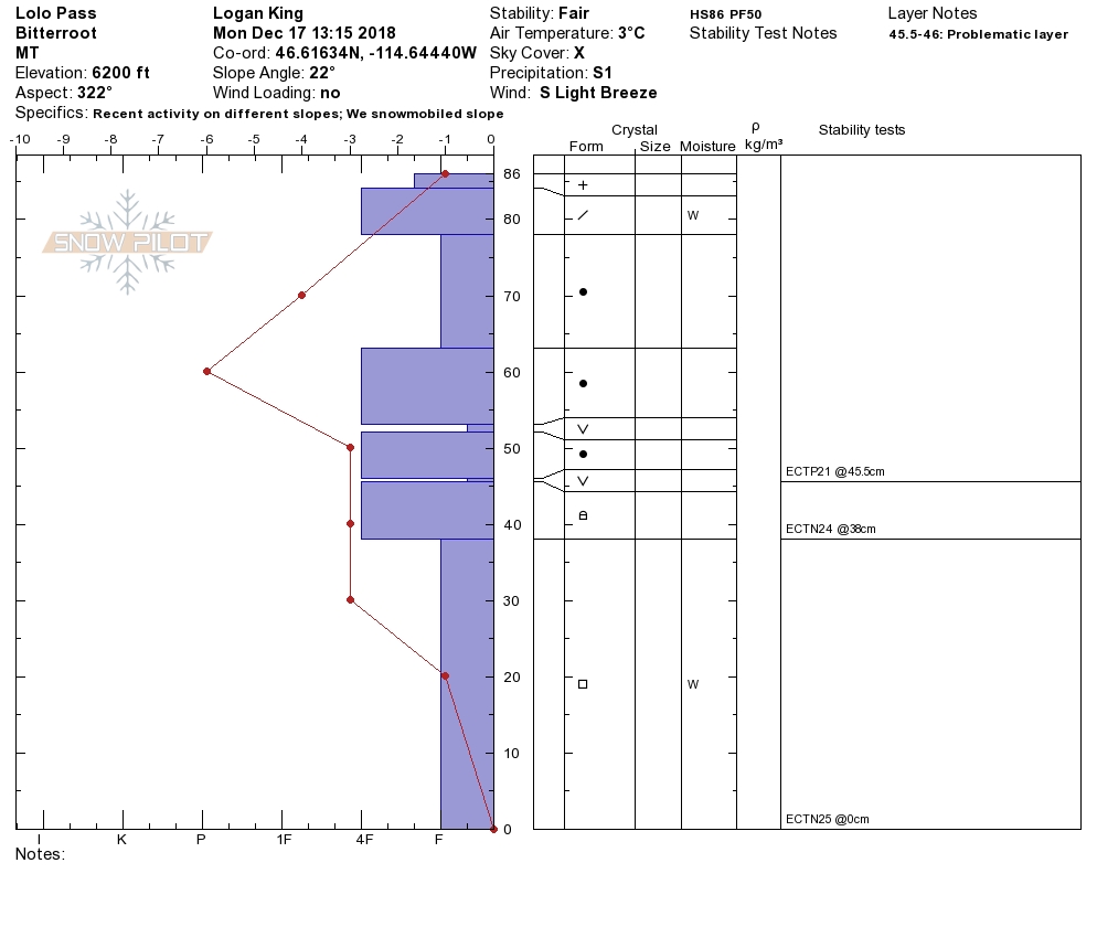
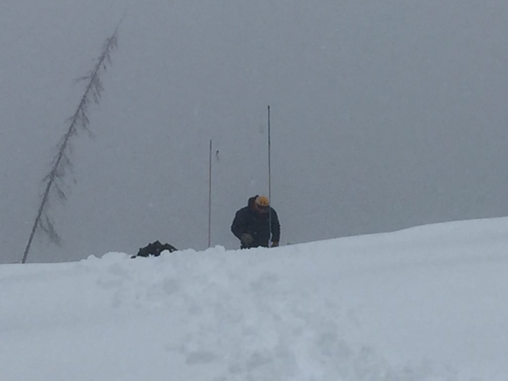
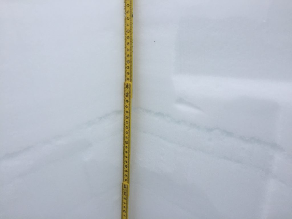
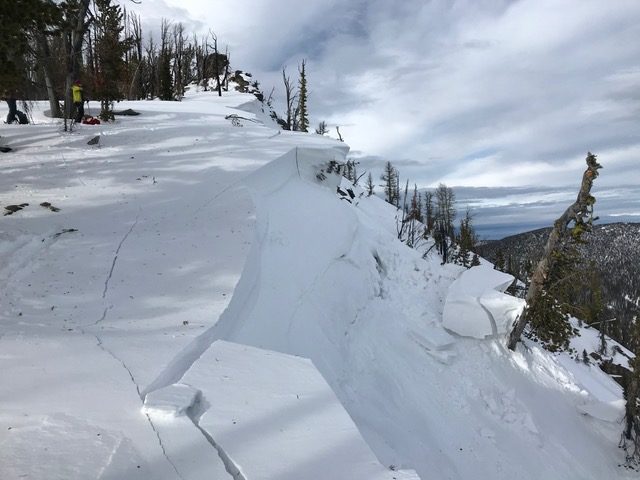
We have a very poor snowpack structure(video). There is buried surface hoar that is 12 to 24 inches from the surface. The other is a layer of facets or weak snow on the ground. These two layers are responsible for the near misses and the remote triggering of avalanches from this weekend. (Remote Trigger 01, Cornice Remote Trigger, Remote Trigger 02) See the public observations here. Thank you to everyone who has contributed public observations. These help the community and us the forecasters to be more informed and learn from them.

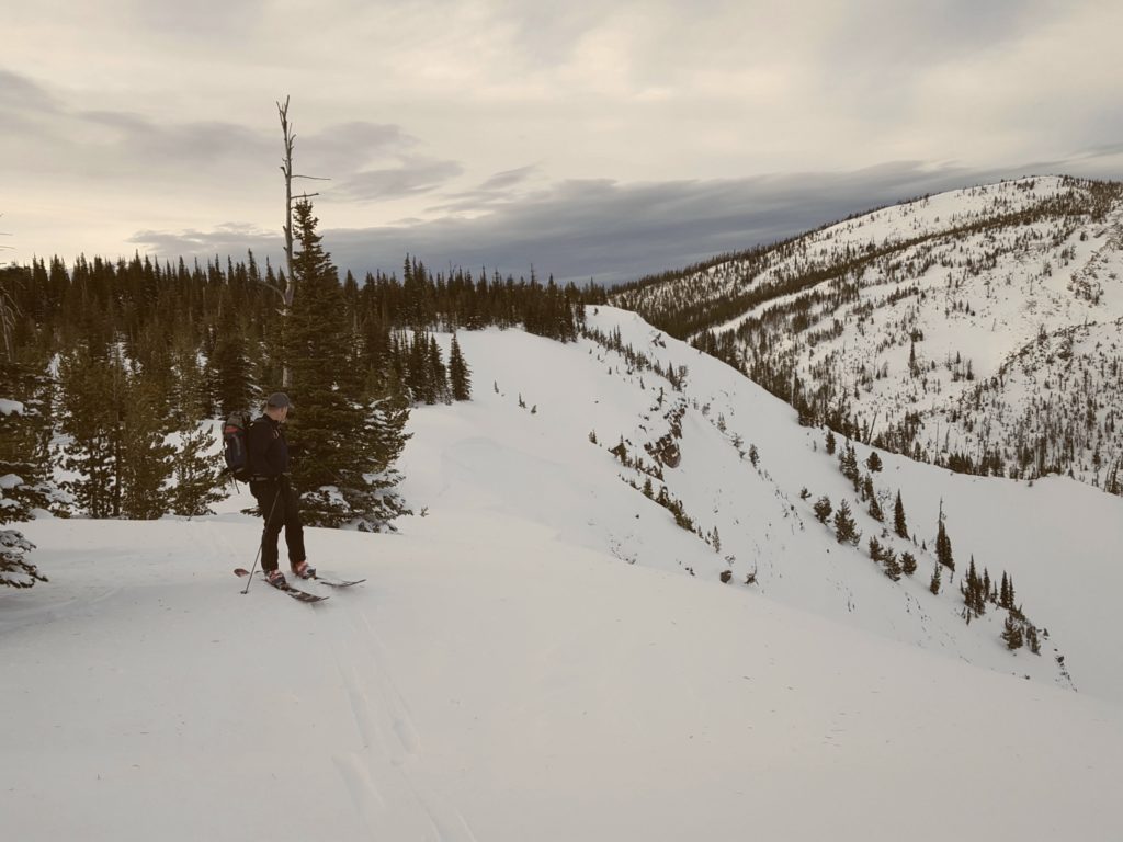
The primary avalanche problem is persistent slabs. Look for red flags such as whumpfing, collapsing and shooting cracks. Yesterday Logan and I would get off our machines and punch all the way to the ground; this is a sign of instability. Dig a pit to the ground and look for our buried layers and see how reactive they are in stability tests. Avoid traveling under runout zones and think of what terrain is above and below you. The layers in the snowpack are reactive to human triggers and are widespread throughout our forecast area. Travel and recreate on slopes less than 25 degrees.

The second avalanche problem is wind slabs. Look for snowdrifts and smooth, rounded deposits of snow on ridgelines. Avoid traveling on wind drifted terrain. Wind loaded terrain will have a higher likelihood of triggering an avalanche today.

Bottom line the snowpack is weak and can not be trusted. The new snow and wind today will increase the avalanche danger. Recreate on low angle terrain and pay close attention to changing weather conditions.

Avalanche and Weather Outlook

A warm, weak system will move over our area today. It will produce up to 6 inches of snow and have a fluctuating rain line around 5000 ft. See the forecast here. Look for the avalanche danger to increase with this weather event. Pay close attention to changing conditions.

If you do make it out into the hills feel free to share what you see on our public observations page. They are not only helpful to your community but extremely helpful to us.

Ski and ride safe.

READ FULL ADVISORY  

Problem 1 - Persistent Slabs

  • TYPE

    persistent-slabs

    Persistent Slabs

    Release of a cohesive layer of soft to hard snow (a slab) in the middle to upper snowpack, when the bond to an underlying persistent weak layer breaks.  Persistent layers include: surface hoar, depth hoar, near-surface facets, or faceted snow. Persistent weak layers can continue to produce avalanches for days, weeks or even months, making them especially dangerous and tricky. As additional snow and wind events build a thicker slab on top of the persistent weak layer, this avalanche problem may develop into a Persistent, Deep-Slab.

  • SIZE

    4-5

    2 (Large)

    The potential size of avalanche resulting from this problem.

  • LIKELIHOOD

    Likelihood-6

    Likely/Very Likely

    The likelihood of an avalanche resulting from this problem.

  • IMAGE

We have a very poor snowpack structure throughout our forecast area(Here is a video). Look for red flags such as whumpfing, collapsing and shooting cracks. Yesterday Logan and I would get off our machines and punch all the way to the ground; this is a sign of instability. Dig a pit to the ground and look for our buried layers and see how reactive they are in stability tests. Avoid traveling under runout zones and think of what terrain is above and below you. The layers in the snowpack are reactive to human triggers and are widespread throughout our forecast area. Travel and recreate on slopes less than 25 degrees.

Problem 2 - Wind Slabs

  • TYPE

    wind-slabs

    Wind Slabs

    Release of a cohesive layer of snow (a slab) formed by the wind.  Wind typically erodes snow from the upwind sides of terrain features and deposits snow on the downwind side.  Wind slabs are often smooth and rounded and sometimes sound hollow, and can range from soft to hard. Wind slabs that form over a persistent weak layer (surface hoar, depth hoar, or near-surface facets) may be termed Persistent Slabs or may develop into Persistent Slabs.

  • SIZE

    5-6

    2-3 (Large)

    The potential size of avalanche resulting from this problem.

  • LIKELIHOOD

    Likelihood-5

    Likely

    The likelihood of an avalanche resulting from this problem.

  • IMAGE

Look for snowdrifts and smooth, rounded deposits of snow on ridgelines. Avoid traveling on wind drifted terrain. Wind loaded terrain will have a higher likelihood of triggering an avalanche today.

VIDEO

Observation Video

Observations

FORECAST & OUTLOOK

A warm, weak system will move over our area today. It will produce up to 6 inches of snow and have a fluctuating rain line around 5000 ft. See the forecast here. Look for the avalanche danger to increase with this weather event. Pay close attention to changing conditions.


This information is the sole responsibility of the Forest Service and does not apply to operating ski areas. The avalanche danger rating expires at midnight tonight but the information can help you make a more informed decision regarding travel in avalanche terrain for the next few days.

Our advisory area includes National Forest System lands in the Bitterroot Mountains from Lost Trail Pass north to Granite Pass, the Rattlesnake Mountains north of Missoula and the Southern Swan and Mission Mountains near Seeley Lake, MT. Avalanche information for the Lookout Pass/St. Regis Basin area is available from the Idaho Panhandle Avalanche Center.