
The current avalanche danger is CONSIDERABLE for the West Central Montana backcountry. Human triggered avalanches are likely on specific terrain. Dangerous avalanche conditions exist and careful snowpack evaluation, cautious route-finding, and conservative decision making are critical for anyone traveling in the backcountry today.
Good morning, this is Logan King with the West Central Montana Avalanche Center’s avalanche advisory for Saturday, December 22nd, 2018. This danger rating does not apply to operating ski areas, expires at midnight tonight and is the sole responsibility of the U.S. Forest Service.
Weather and Snowpack
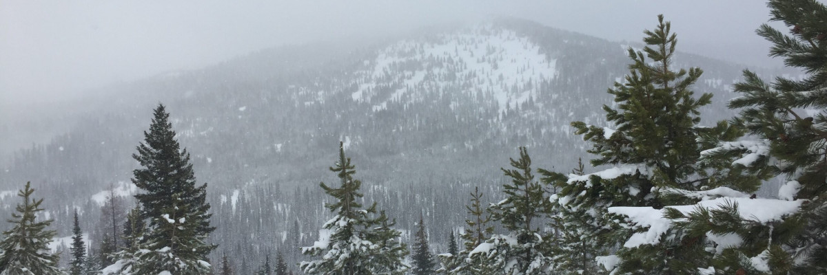
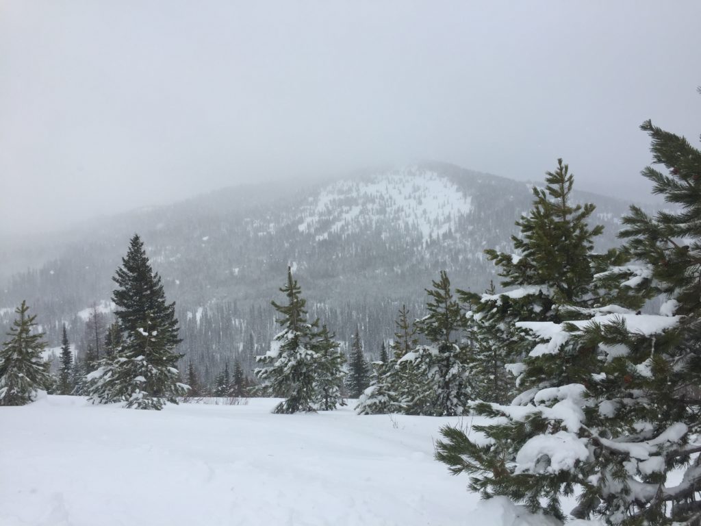
On Friday morning an additional 3-9 inches of snow had accumulated across the region. Over the past 24 hours an additional 1-6 inches of snow fell and added up to 0.4 inches of SWE to the snowpack. Winds this morning are 9 mph gusting to 14 mph from the WSW. As of 4 am mountain temperatures range from 11 to 22 degrees Fahrenheit across the advisory area.
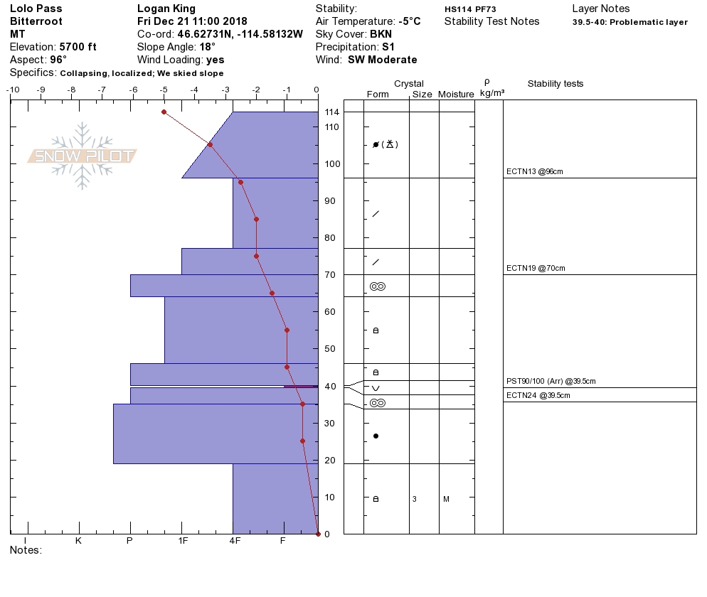
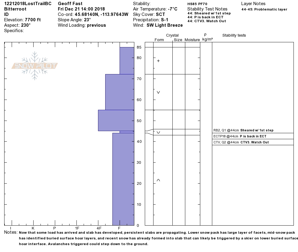
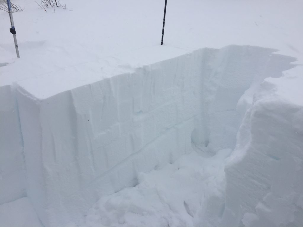
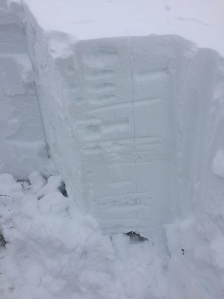
Winds slabs are one of the avalanche problems that you are likely to encounter today. They are not as touchy as they were earlier this week but are still problematic. Yesterday we observed localized collapsing and whumphing on wind loaded terrain. Wind slabs were not as reactive in stability tests as earlier this week but still need some time to settle. Avoid traveling on or under wind loaded terrain as wind slabs are likely to fail under the weight of a skier or sled especially in areas that also have buried surface hoar.
Persistent slabs are the other major concern today. In the northern half of the advisory area the surface hoar is breaking down and slowly gaining strength making it harder to identify at some locations but can easily be found while performing stability tests. Further south the snowpack remains weaker and has more prominent facets and surface hoar. Yesterday observers found the surface hoar to be very reactive under the new load of snow and reported widespread whumphing and collapsing. In areas with very weak snow structure any new load will have the potential to increase avalanche activity on the buried weak layers.
The take away is that there are still abundant red flag warnings of where avalanches are likely. Whumphing, shooting cracks, and collapsing continue to be a great indicator of suspect areas. Take a few minutes to dig a quick pit and make sure that there are no buried weak layers before committing to traveling in avalanche terrain. If you are seeing any red flags adjust your travel accordingly to avoid hazards. Remember that if you are in a suspect area it is LIKELY that you will trigger an avalanche.
Avalanche and Weather Outlook
Light and scattered snow flurries will continue today. Sunday will bring a significant change in the weather pattern and has the potential for a series of storms next week. Avalanche conditions will remain the same until the next round of precipitation starts to reload the snow structure.
If you do make it out into the hills feel free to share what you see on our public observations page. They are not only helpful to your community but extremely helpful to us.
Ski and ride safe.


