
The current avalanche danger is considerable for the West Central Montana backcountry. Human triggered avalanches are likely in specific areas across the region. Safe travel in the backcountry will be achieved with keen hazard identification, cautious route-finding and careful snowpack evaluation.
Good morning, this is Logan King with the West Central Montana Avalanche Center’s avalanche advisory for Thursday, December 27th, 2018. This danger rating does not apply to operating ski areas, expires at midnight tonight and is the sole responsibility of the U.S. Forest Service.
Weather and Snowpack
Light snowfall developed overnight and across the region 1-4 inches of snow has accumulated. Mountain temperatures were cold overnight keeping the snow drier with SWE values of 0.1-0.2 inches being recorded. As of this morning mountain temperatures are 14-22 degrees. Winds are light from the WSW at 2 mph gusting to 3 mph, however strong winds were reported over the weekend and holiday for parts of the advisory area.
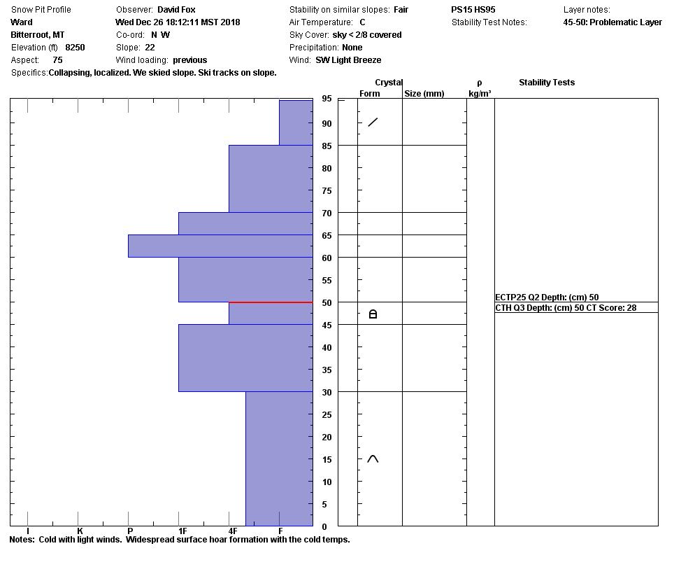
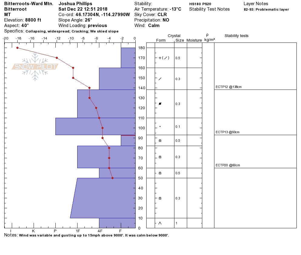
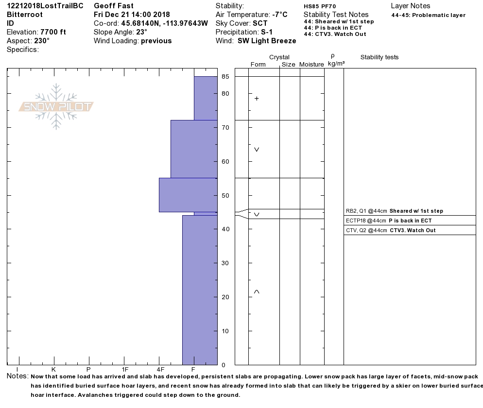
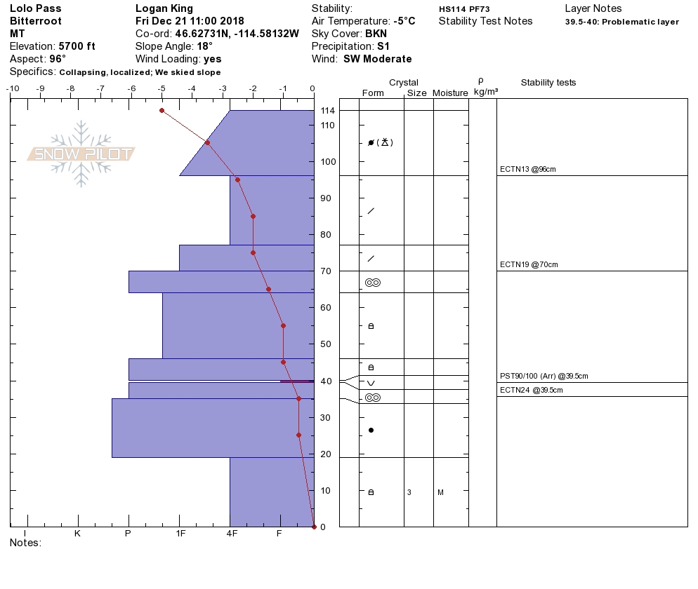
The snowpack varies greatly across the region. As some areas gain strength others continue to have a weak structure that can not be trusted. The biggest problem that we continue to see are persistent weak layers. The buried surface hoar is still reactive when present and facets near the ground continue to cause problems in certain areas. At the southern end of our forecast area the snowpack is unconsolidated, and consists of sugary weak snow. While stronger snow can be found there is a mixed bag of snow structure for the norther half of the forecast area.
Persistent slabs are the main concern today. In areas where there is any sort of slab overlying a layer of buried surface hoar or facets continues to be reactive in stability tests and will be easily triggered if traveled on or near. Careful snowpack evaluation is needed to identify areas of heightened concern. The only way to know if facets or buried surface hoar is present on a slope is to dig a pit and perform stability tests.
Wind slabs continue to gain strength and are becoming less reactive but are ideally suited to fail in locations where facets or buried surface hoar are also present. The combination of very weak layers and firm wind slabs will create dangerous avalanche conditions. Verify that any location that has a slab doesn’t also have facets. The strong winds over the holiday have created some big wind slabs and will make for some touchy conditions across specific terrain.
The take away today is that conditions are complex and the consequences are high if you make a mistake. Don’t be lulled into a false sense of security. Take the time to do your due diligence; dig a pit and test the snowpack before travelling in avalanche terrain.
Avalanche and Weather Outlook
Light snow showers are expected to continue through the morning before a break in the weather. Avalanche conditions will not change much with light accumulations and dissipating snowfall. The next round of snow is setting up to arrive Friday night but there is uncertainty around snow levels and the snow has the potential to be warm and wet (forecast).
If you make it out into the mountains feel free to share what you see on our public observations page. They are not only helpful to your community but extremely helpful to us.
Ski and ride safe.


