Posted:
Jan 3, 2019 @ 6:30 am

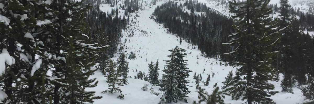
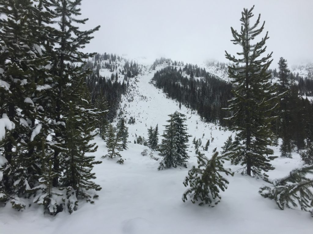
The avalanche danger for the west central Montana backcountry is MODERATE. Large avalanches can be triggered in isolated locations, and smaller avalanches are possible in specific terrain. Careful evaluation is needed to identify features of concern.

Good morning, this is Travis Craft with the West Central Montana Avalanche Center’s avalanche advisory for January 03, 2019. This danger rating does not apply to operating ski areas, expires at midnight tonight and is the sole responsibility of the U.S. Forest Service.

Weather and Snowpack

Mountain temperatures range from 12 F to 27 F. In the Bitterroot winds are 9 mph with gusts of 12 mph out of the SW. In the northern part of the advisory area, winds are 6 mph and gusting to  12 mph out of the South(here is link for wind data). The region received 2 to 3 inches of new snow in the last 24 hours.

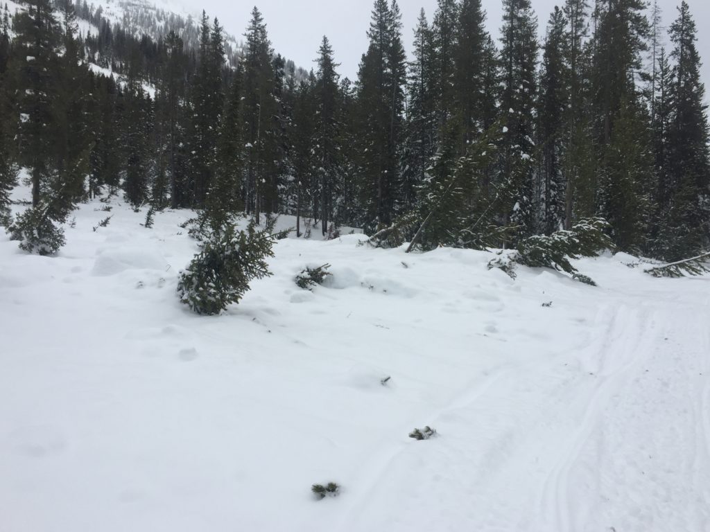
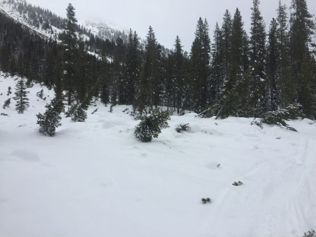
The primary avalanche problem is wind slabs. These slabs are located on leeward slopes, and any wind drifted piece of terrain. These slabs will be sensitive to human triggers and may have the potential to step down to weaker layers in the snowpack.

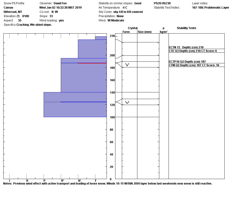
The second avalanche problem is persistent slabs. Dig a pit and pay attention to red flag data while traveling. The buried surface hoar and depth hoar are becoming less reactive in deeper snowpacks but are still able to be triggered in shallow snowpacks.

Bottom line the weak layers in our snowpack are gaining strength. But these weak layers are guilty until proven otherwise. Look for snowdrifts and smooth, rounded deposits of snow on ridgelines. There are small wind slabs on leeward terrain. Avoid likely trigger spots near rock outcrops and convexities on slope transitions.

Avalanche and Weather Outlook

Look for temperatures to moderate in the next couple of days and high winds. See the forecast here. The avalanche will rise with these conditions. Pay attention to changing weather conditions which mean that avalanche danger will change too.

Join us tonight at 6:00 pm at Big Sky Brewing for Beers with Forecasters.

If you get out into the mountains, please share what you see on our public observations page. They are not only helpful to your community but extremely helpful to us.

Ski and ride safe.


READ FULL ADVISORY  

Problem 1 - Wind Drifted Snow

  • TYPE

    wind-slabs

    Wind Slabs

    Release of a cohesive layer of snow (a slab) formed by the wind.  Wind typically erodes snow from the upwind sides of terrain features and deposits snow on the downwind side.  Wind slabs are often smooth and rounded and sometimes sound hollow, and can range from soft to hard. Wind slabs that form over a persistent weak layer (surface hoar, depth hoar, or near-surface facets) may be termed Persistent Slabs or may develop into Persistent Slabs.

  • SIZE

    3-4

    1-2 (Small-Large)

    The potential size of avalanche resulting from this problem.

  • LIKELIHOOD

    Likelihood-3

    Possible

    The likelihood of an avalanche resulting from this problem.

Look for snowdrifts and smooth, rounded deposits of snow on ridgelines. There are small wind slabs on leeward terrain. Avoid likely trigger spots near rock outcrops and convexities on slope transitions.

Problem 2 - Persistent Slabs

  • TYPE

    persistent-slabs

    Persistent Slabs

    Release of a cohesive layer of soft to hard snow (a slab) in the middle to upper snowpack, when the bond to an underlying persistent weak layer breaks.  Persistent layers include: surface hoar, depth hoar, near-surface facets, or faceted snow. Persistent weak layers can continue to produce avalanches for days, weeks or even months, making them especially dangerous and tricky. As additional snow and wind events build a thicker slab on top of the persistent weak layer, this avalanche problem may develop into a Persistent, Deep-Slab.

  • SIZE

    4-5

    2 (Large)

    The potential size of avalanche resulting from this problem.

  • LIKELIHOOD

    Likelihood-3

    Possible

    The likelihood of an avalanche resulting from this problem.

Dig a pit and look for red flag data while traveling. The buried surface hoar and depth hoar are becoming less reactive in deeper snowpacks but are still able to be triggered in  shallow snowpacks(near rock bands and cliffs).

VIDEO

Observations

Observations

FORECAST & OUTLOOK

Look for temperatures to moderate in the next couple of days and high winds. See the forecast here. The avalanche will rise with these conditions. Pay attention to changing weather conditions which mean that avalanche danger will change too.


This information is the sole responsibility of the Forest Service and does not apply to operating ski areas. The avalanche danger rating expires at midnight tonight but the information can help you make a more informed decision regarding travel in avalanche terrain for the next few days.

Our advisory area includes National Forest System lands in the Bitterroot Mountains from Lost Trail Pass north to Granite Pass, the Rattlesnake Mountains north of Missoula and the Southern Swan and Mission Mountains near Seeley Lake, MT. Avalanche information for the Lookout Pass/St. Regis Basin area is available from the Idaho Panhandle Avalanche Center.