
The avalanche danger for the West Central Montana backcountry is MODERATE. Heightened avalanche conditions exist on specific terrain features and human triggered avalanches are possible. Carefully evaluate snow conditions to identify areas of heightened concern before committing to avalanche terrain.
Good morning, this is Logan King with the West Central Montana Avalanche Center’s avalanche advisory for Thursday, January 10th, 2019. This danger rating does not apply to operating ski areas, expires at midnight tonight and is the sole responsibility of the U.S. Forest Service.
Weather and Snowpack
Mountain temperatures as of 4 am this morning are just above freezing and did not get below 32 overnight at the majority of locations in the forecast area. Winds are light and out of the SW-SE. A few locations picked up 1-2 inches of snow overnight and saw light rain at lower elevations but the majority of the region remained dry overnight.
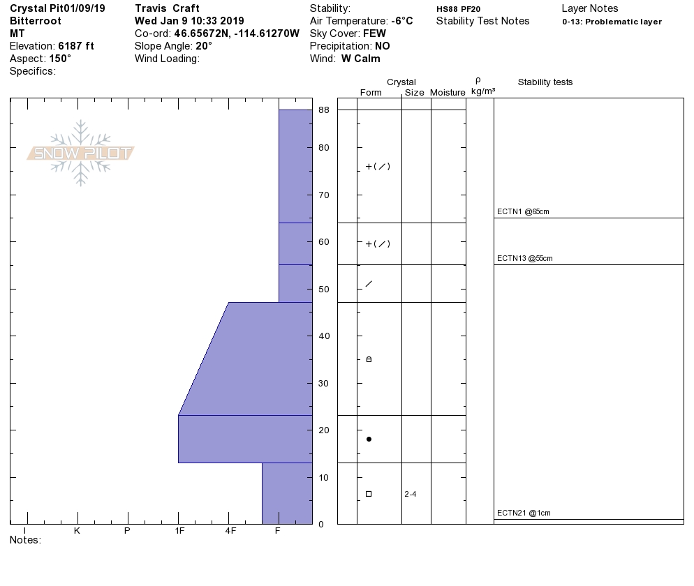
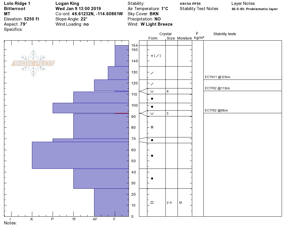
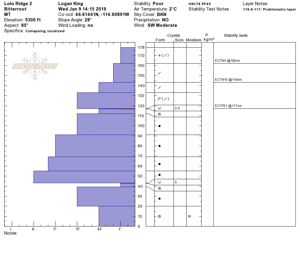
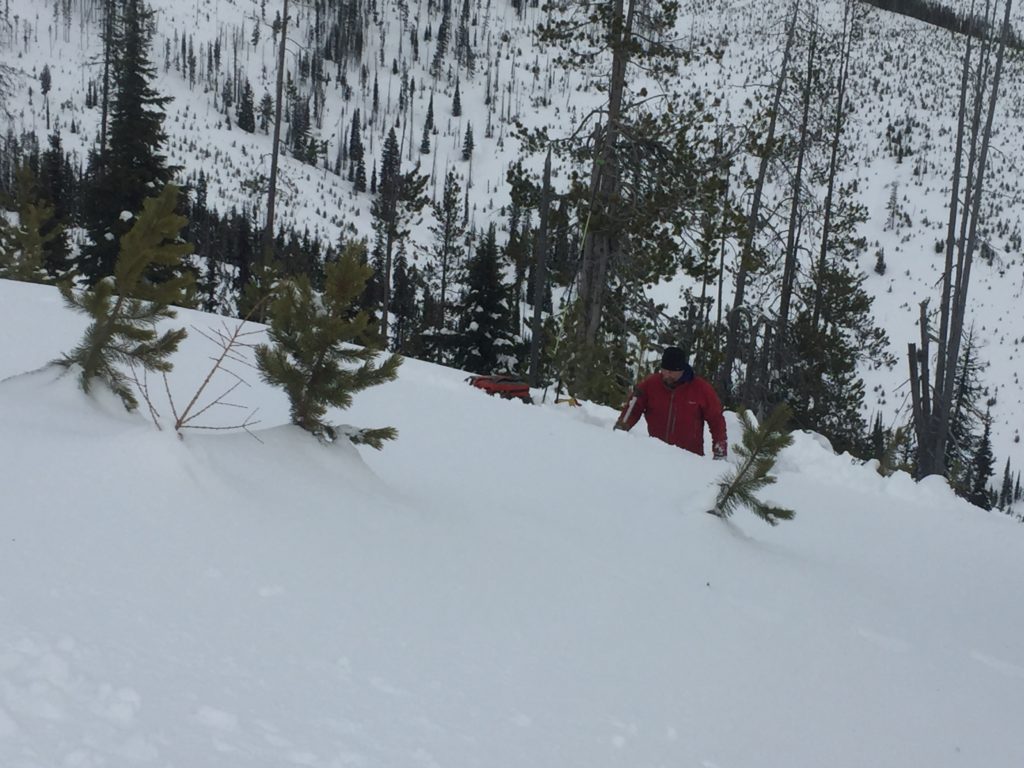
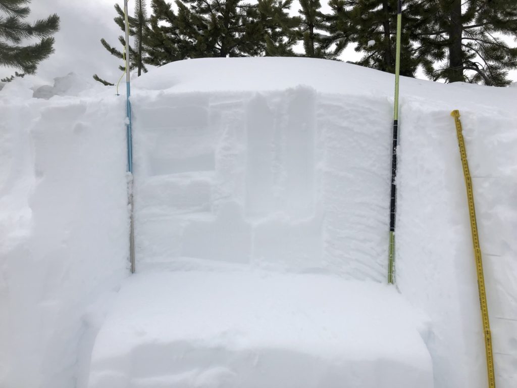
Conditions continue to settle and the snowpack is slowly gaining strength. The primary concern today is persistent slab avalanches. Yesterday we found isolated areas that had buried surface hoar that was breaking down and rounding but propagated readily in stability tests. The BSH appears to only be reactive in isolated areas as we received reports over the last few days of mixed results of where theses layers are reactive. Because this layer is breaking down it can be hard to identify but is easily seen when performing stability tests (video). Furthermore, areas of shallow snow can still be found throughout the region and will be another persistent problem. With facets at the bottom of our snowpack shallow snow, rocky terrain and steep rollovers will all be likely trigger points for persistent weak layers near the ground.
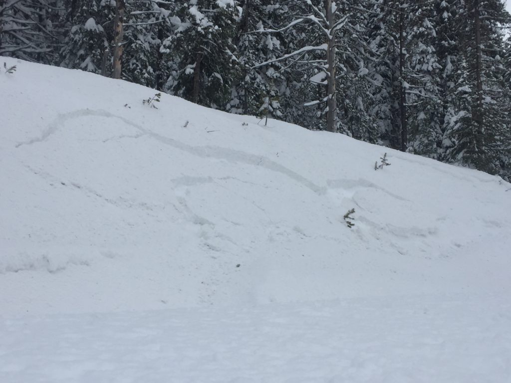
Wind slabs are the second avalanche concern today. They are primarily at upper elevations above about 6,000 ft but can be found in some unusual places with the predominant southern flow we’ve been seeing this winter. Winds have calmed and slab growth has diminished but there are still some wind slabs near ridges and hiding in pockets that are primed and waiting for a trigger. Carefully evaluate wind loaded terrain before traveling on or below any slope.
The curve ball today is wet avalanches. With mountain temperatures forecasted to reach the 40’s today the potential for wet avalanches may develop. Keep in mind that the snowpack doesn’t like rapid changes and a quick warm up with lots of sun is a perfect example of a rapid change that can increase avalanche activity. If you start to observe pinwheels and rollerballs change aspects or elevations to find a cooler zone as they are the first indicators of wet avalanche potential.
Conditions right now are very complex and highly variable. Don’t be fooled by the moderate danger rating into thinking things are safe or straight forward. I’ll say it again, heightened avalanche conditions exist on specific terrain. Remember that the danger rating is based on distribution, likelihood, and size of potential avalanches and with our current conditions there are places where you can/will trigger avalanches if you are in the wrong place at the wrong time. Carefully evaluate the snowpack before venturing into avalanche terrain.
Avalanche and Weather Outlook
Scattered showers are possible today with minimal accumulations. The forecast is calling for temperatures approaching 40 degrees but cloudy. The avalanche danger will increase slightly through the day today due to warming and will likely climb further tomorrow with warm temperatures and mostly sunny skies. Some of the scattered snow showers will have the potential to rain to just below 5,000ft. Rain on snow will create more instability at lower elevations.
Tonight Big Sky Brewing is hosting another beers with forecasters from 6-8pm. Feel free to stop by and ask Travis and I some questions, give us some feed back or just talk shop. There is also a fully function beacon park to practice your rescue skills. We hope to see you there. As always, if you make it out please feel free to share what you find on our public observations page.
Ski and ride safe.


