
The current avalanche danger is MODERATE for the West Central Montana backcountry. Heightened avalanche conditions exist on specific terrain where avalanches can easily be triggered. Carefully evaluate how likely the snow is to slide and how severe the consequences will be before venturing into avalanche terrain.
Good morning, this is Logan King with the West Central Montana Avalanche Center’s avalanche advisory for Saturday, January 12th, 2019. This danger rating does not apply to operating ski areas, expires at midnight tonight and is the sole responsibility of the U.S. Forest Service.
Weather and Snowpack
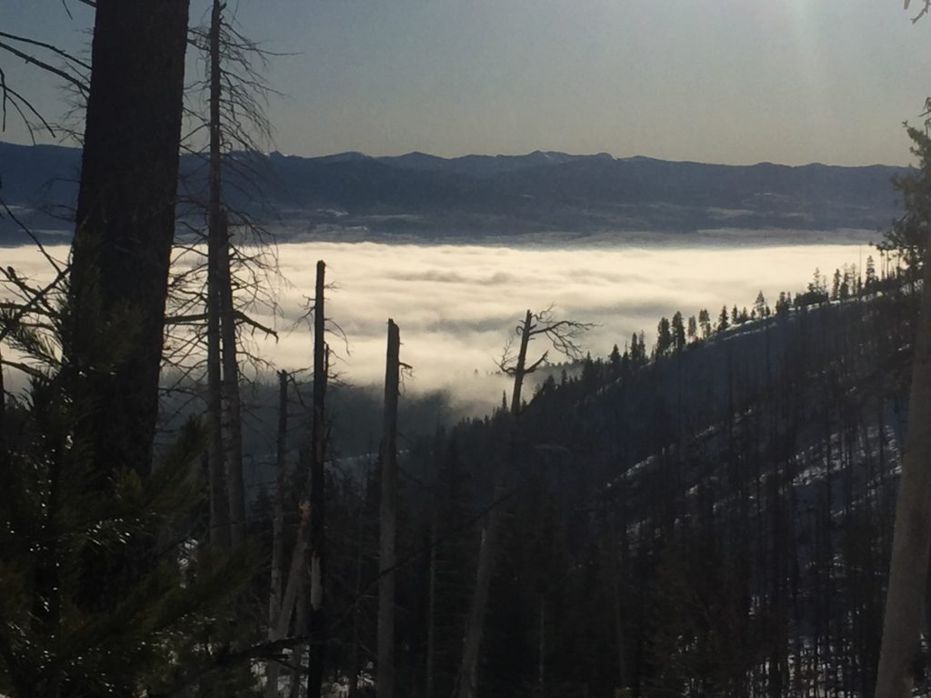
Winds are calm this morning and no new snow fell overnight. As expected with the inversion lower elevation snotels have temperatures in the low teens and upper elevation snotel temperatures are in the low twenties.
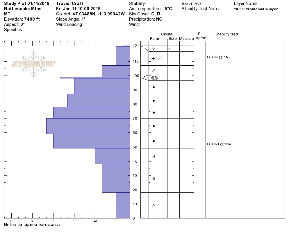
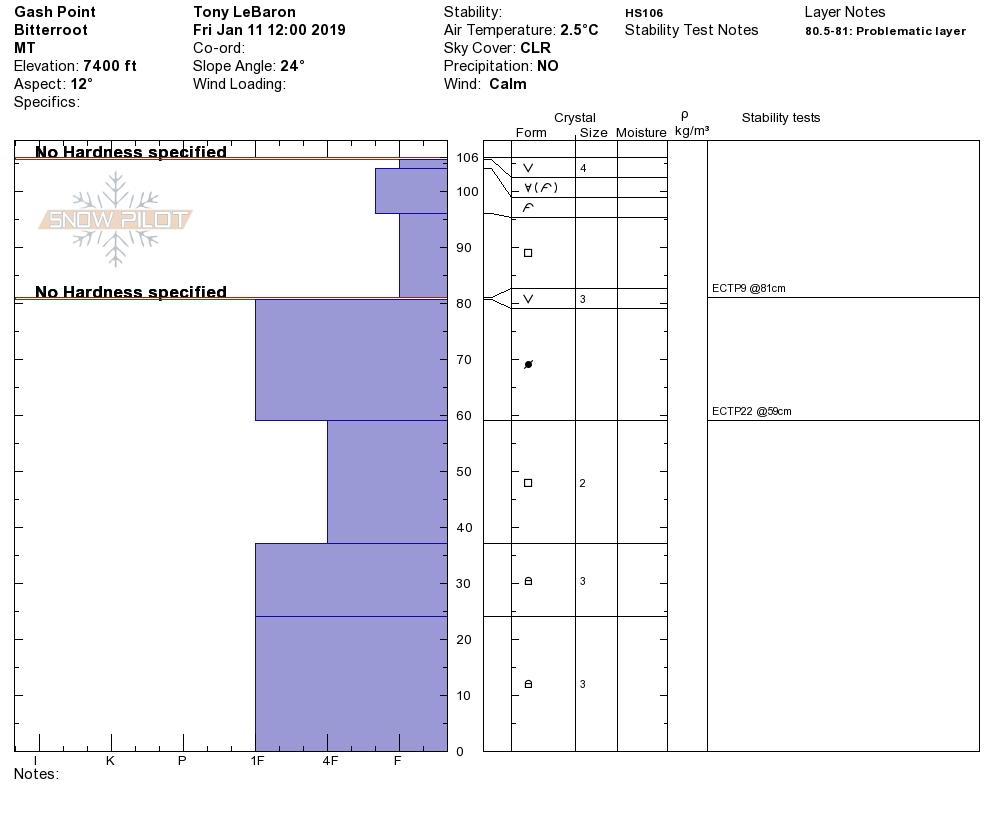
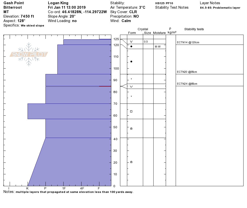
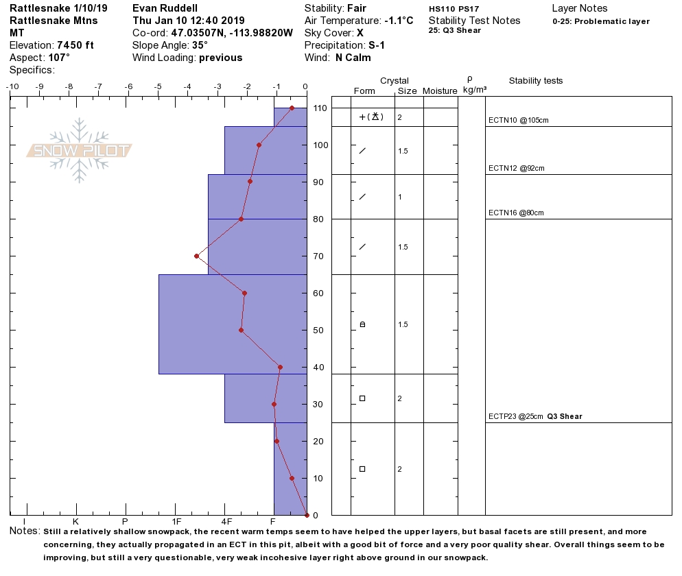
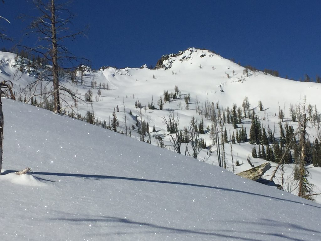
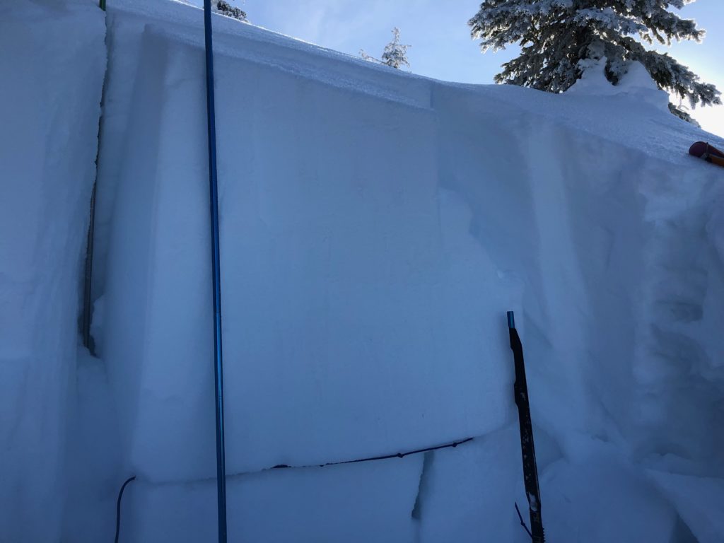
The primary concern today continues to be persistent slab avalanches. On cool shaded aspects with shallow snowpacks facets and surface hoar continue to propagate in stability tests. Yesterday Travis found weak facets near the ground that were propagating in the Rattlesnake (video) and I found buried surface hoar and facets, both of which were propagating in the Central Bitterroot (video). The common denominator was that all of the propagations were occurring in colder shaded areas with shallow snow depths. The concern is that you don’t know if the persistent weak layers are present and reactive until you dig a pit and perform stability tests. Alarmingly, if the persistent layers fail they will create a large avalanche with very high consequences. Now is not the time to roll the dice, make conservative decisions because the avalanches that we are dealing with would be very dangerous.
Stay aware as conditions change throughout the day. The potential for wet avalanches will develop through the day with warm temperatures and plenty of sunshine in the mountains. If you see rollerballs and pinwheels start to roll down slopes and the snow starts to get wet and heavy move to a cooler aspect.
Avalanche and Weather Outlook
An inversion will dominate the region this weekend. Expect to see valley fog and warm daytime temperatures in the mountains with cold clear nights leading to continued surface hoar growth. Avalanche conditions will remain the same through the weekend (forecast).
The Snowbowl beacon park was put in yesterday and is up and running. If you are up there stop in and get some practice with your gear. If you get out this weekend, please feel free to share what you find on our public observations page.
Ski and ride safe.


