Posted:
Jan 17, 2019 @ 6:44 am

The avalanche danger for the west central Montana backcountry is MODERATE on slopes with a shallow snowpack. All other slopes are Low. Large avalanches can be triggered in isolated locations, and smaller avalanches are possible in specific terrain. Careful evaluation is needed to identify features of concern. The danger will rise throughout the day and may reach considerable by Friday morning.

Good morning, this is Travis Craft with the West Central Montana Avalanche Center’s avalanche advisory for January 17, 2019. This danger rating does not apply to operating ski areas, expires at midnight tonight and is the sole responsibility of the U.S. Forest Service.

Weather and Snowpack

Mountain temperatures range from 23 F to 28 F. In the Bitterroot winds are 15 mph with gusts of 23 mph out of the ESE. In the northern part of the advisory area, winds are 9 mph and gusting to 13 mph out of the ESE. It has just started to snow this morning.

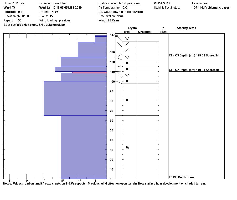
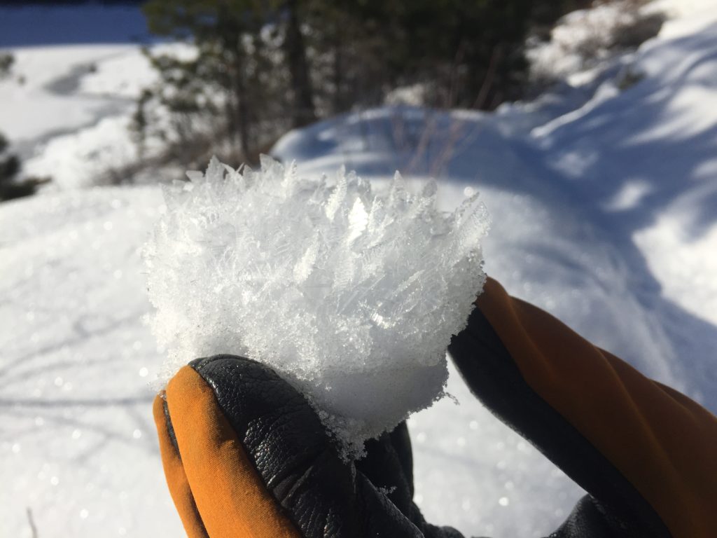
The snowpack is relatively stable this morning. There are a variety of old snow surfaces (melt-freeze crusts, surface hoar, and near surface facets) for the new snow to land on. The fresh snow will take time to bond to the old snow. The addition of snow will make our buried weak layers(facets and buried surface hoar) more sensitive to natural triggers(new weight from snow) and human triggers. With the weather change the avalanche conditions will change.

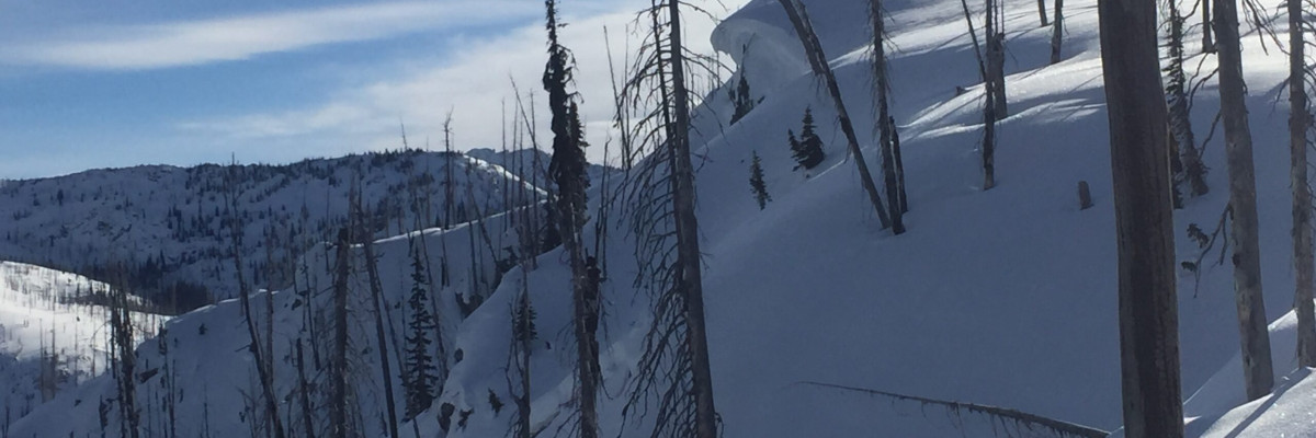
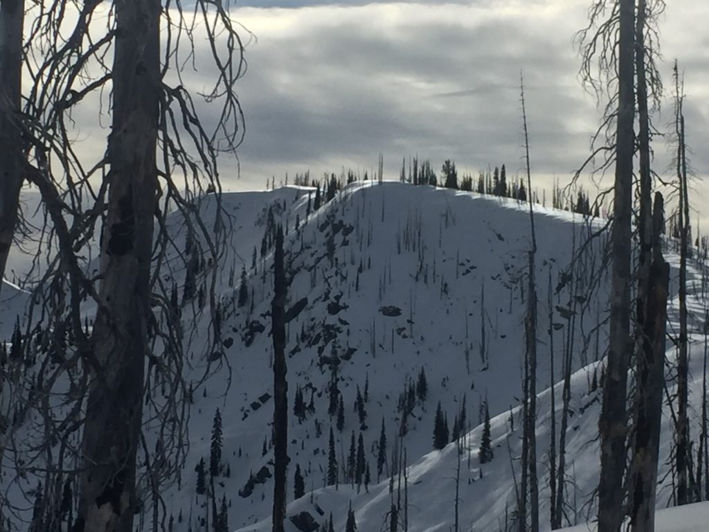
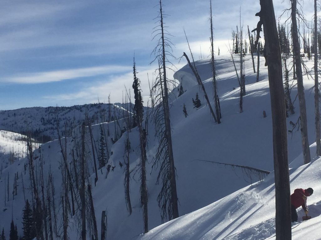
The primary avalanche problem today is persistent slabs. The buried weak layers in our snowpack are getting harder to trigger. These layers are more reactive in shallow, weak snowpacks less than 3 feet deep(video).

The other two problems will be wind drifted snow and new snow. The new snow will land on a variety of old snow surfaces and winds will load leeward slopes on the old snow surfaces too. These slabs will be sensitive to human triggers today and Friday.

Bottom line: The snowpack is fairly stable this morning. The new snow will create new problems throughout the day into Friday. Pay attention to the changing weather and changing avalanche conditions. Constantly reevaluate your route and carefully assess each slope when recreating today.

Avalanche and Weather Outlook

It is starting to snow this morning and is predicted to continue through Friday. See the forecast here. The new snow will be landing on a variety of old snow surfaces and buried weak layers. This recipe will increase the avalanche danger.

If you get out into the mountains, please share what you see on our public observations page. They are not only helpful to your community but extremely helpful to us.

Ski and ride safe.

READ FULL ADVISORY  

Problem 1 - Persistent Slabs

  • TYPE

    persistent-slabs

    Persistent Slabs

    Release of a cohesive layer of soft to hard snow (a slab) in the middle to upper snowpack, when the bond to an underlying persistent weak layer breaks.  Persistent layers include: surface hoar, depth hoar, near-surface facets, or faceted snow. Persistent weak layers can continue to produce avalanches for days, weeks or even months, making them especially dangerous and tricky. As additional snow and wind events build a thicker slab on top of the persistent weak layer, this avalanche problem may develop into a Persistent, Deep-Slab.

  • SIZE

    5-6

    2-3 (Large)

    The potential size of avalanche resulting from this problem.

  • LIKELIHOOD

    Likelihood-2

    Unlikely/Possible

    The likelihood of an avalanche resulting from this problem.

The buried weak layers in our snowpack are getting harder to trigger. These layers are more reactive in shallow, weak snowpacks less than 3 feet deep(video).

Problem 2 - New Snow

  • TYPE

    storm-slabs

    Storm Slabs

    Release of a soft cohesive layer (a slab) of new snow which breaks within the storm snow or on the old snow surface. Storm-slab problems typically last between a few hours and few days. Storm-slabs that form over a persistent weak layer (surface hoar, depth hoar, or near-surface facets) may be termed Persistent Slabs or may develop into Persistent Slabs.

  • SIZE

    3-4

    1-2 (Small-Large)

    The potential size of avalanche resulting from this problem.

  • LIKELIHOOD

    Likelihood-3

    Possible

    The likelihood of an avalanche resulting from this problem.

New snow is falling on variety of old snow surfaces. It will take time to bond to the old snow surfaces. The new snow will be sensitive to skiers and riders on slopes greater than 30 degrees.

Problem 3 - Wind Drifted Snow

  • TYPE

    wind-slabs

    Wind Slabs

    Release of a cohesive layer of snow (a slab) formed by the wind.  Wind typically erodes snow from the upwind sides of terrain features and deposits snow on the downwind side.  Wind slabs are often smooth and rounded and sometimes sound hollow, and can range from soft to hard. Wind slabs that form over a persistent weak layer (surface hoar, depth hoar, or near-surface facets) may be termed Persistent Slabs or may develop into Persistent Slabs.

  • SIZE

    3-4

    1-2 (Small-Large)

    The potential size of avalanche resulting from this problem.

  • LIKELIHOOD

    Likelihood-4

    Possible/Likely

    The likelihood of an avalanche resulting from this problem.

Winds will transport the new snow onto leeward slopes which have a variety of old snow surfaces for these slabs to land on. These slabs will be sensitive to human triggers.

VIDEO

01/16/2019

Observations

FORECAST & OUTLOOK

The forecast is calling for snow to start today and into Friday. See the forecast here. The new snow will be landing on a variety of old snow surfaces and on buried weak layers. This recipe will increase the avalanche danger.


This information is the sole responsibility of the Forest Service and does not apply to operating ski areas. The avalanche danger rating expires at midnight tonight but the information can help you make a more informed decision regarding travel in avalanche terrain for the next few days.

Our advisory area includes National Forest System lands in the Bitterroot Mountains from Lost Trail Pass north to Granite Pass, the Rattlesnake Mountains north of Missoula and the Southern Swan and Mission Mountains near Seeley Lake, MT. Avalanche information for the Lookout Pass/St. Regis Basin area is available from the Idaho Panhandle Avalanche Center.