
A CONSIDERABLE avalanche danger exists across the West Central Montana backcountry. Cautious route finding, conservative decision making, and careful snowpack and terrain evaluation are essential. Human triggered avalanches are likely throughout the forecast region.
Good morning, this is Logan King with the West Central Montana Avalanche Center’s avalanche advisory for Thursday, January 24th, 2019. This danger rating does not apply to operating ski areas, expires at midnight tonight and is the sole responsibility of the U.S. Forest Service.
Weather and Snowpack
Mountain temperatures this morning are in the low 20’s. Winds are out of the W in the Southern Bitterroot at 3 mph gusting to 6 mph. In the Northern half of the advisory area winds are out of the WSW at 7 mph gusting to 12 mph. Little to no new snow fell over night. Yesterday’s snow totaled between 8-14 inches across the region and added a load of 0.6-1.0 inches of SWE.
There are three different problems that you will have to deal with in the backcountry today. Any of these problems can be found at a given location and it is up to you to determine which is the greatest concern for a specific slope.
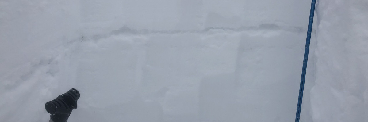
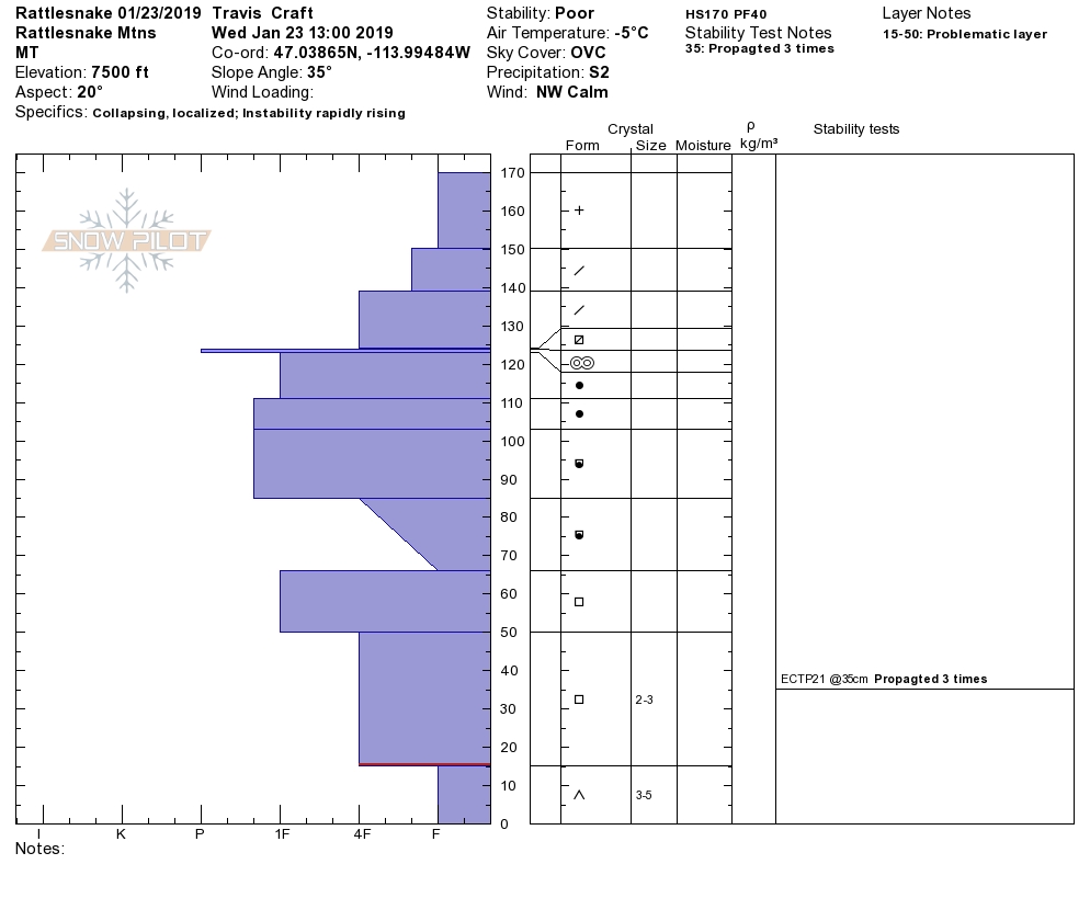
The obvious first problem is storm slabs. Soft storm slabs started to develop later in the day yesterday as temperatures began to warm. The changing temperatures resulted in an upside-down slab with heavy warm snow overlying cold dry snow. The interface in the new snow was increasingly reactive through the day yesterday and was even yielding shallow failures in tests with easy propagation (profile). The storm slabs are widespread and can be found at most locations, carefully assess the snow to identify if there is a soft storm slab that will be reactive. The storm slabs will need another day or two to settle and bond before this problem subsides.
The second avalanche problem to be aware of today are wind slabs. Winds started out of the S and shifted to the NW and created wind slabs on lee terrain. The wind slabs are more touchy than the storm slabs and will create slightly larger avalanches as well. Look for signs of wind loading to identify areas of increased risk. Wind slabs will be primarily located near ridges but will also be found in isolated pockets across terrain.
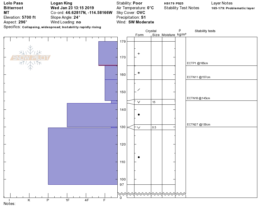
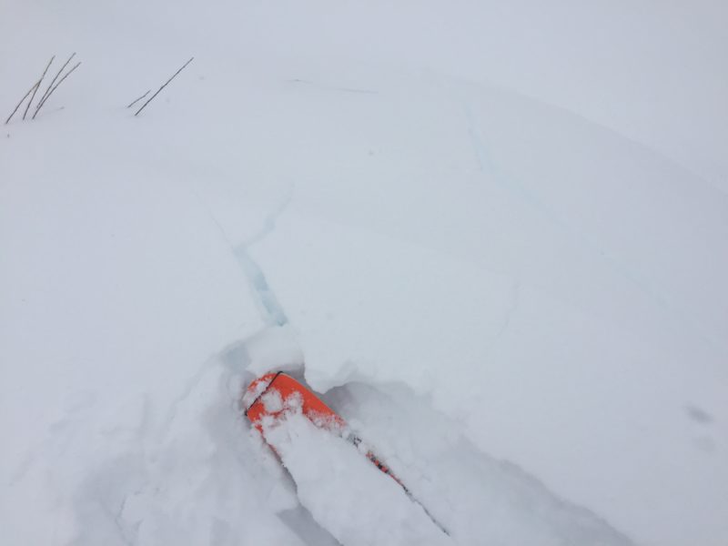
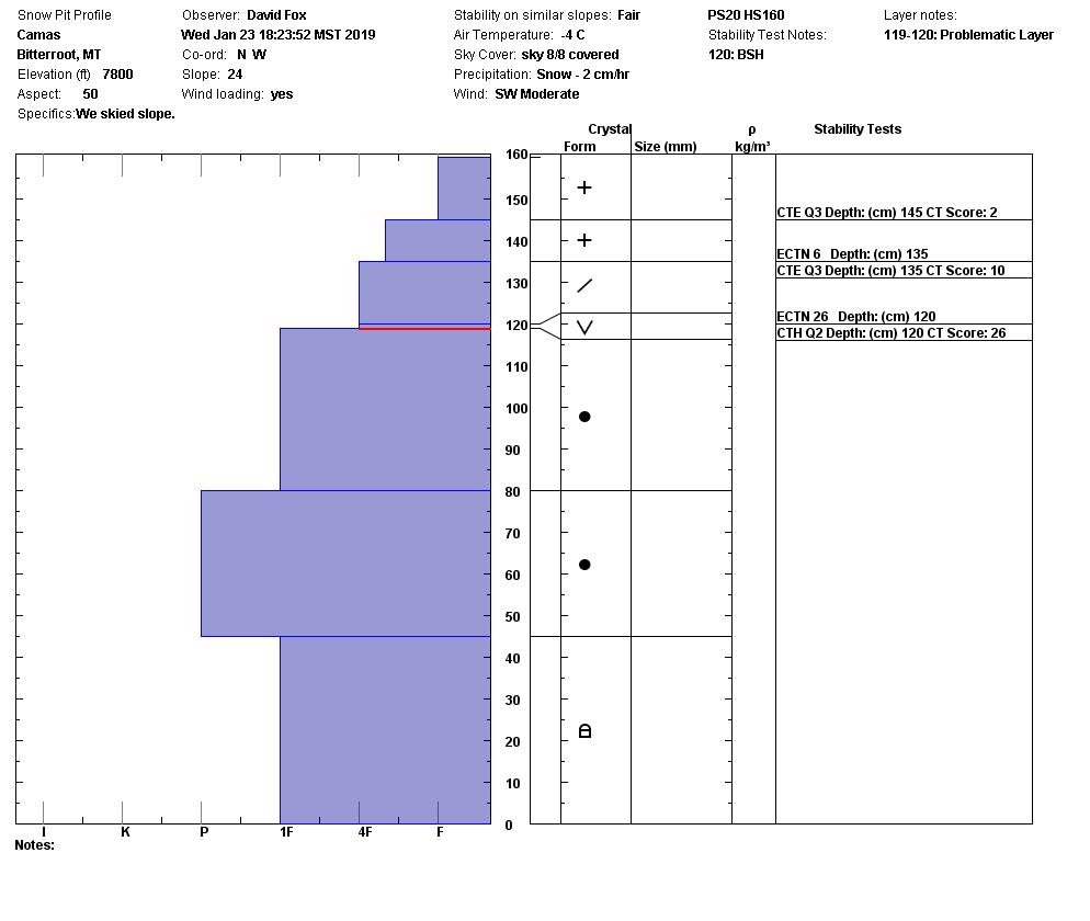
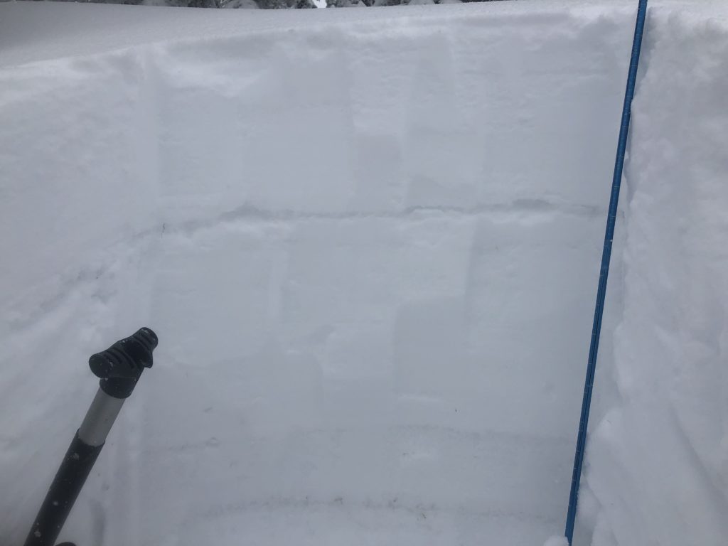
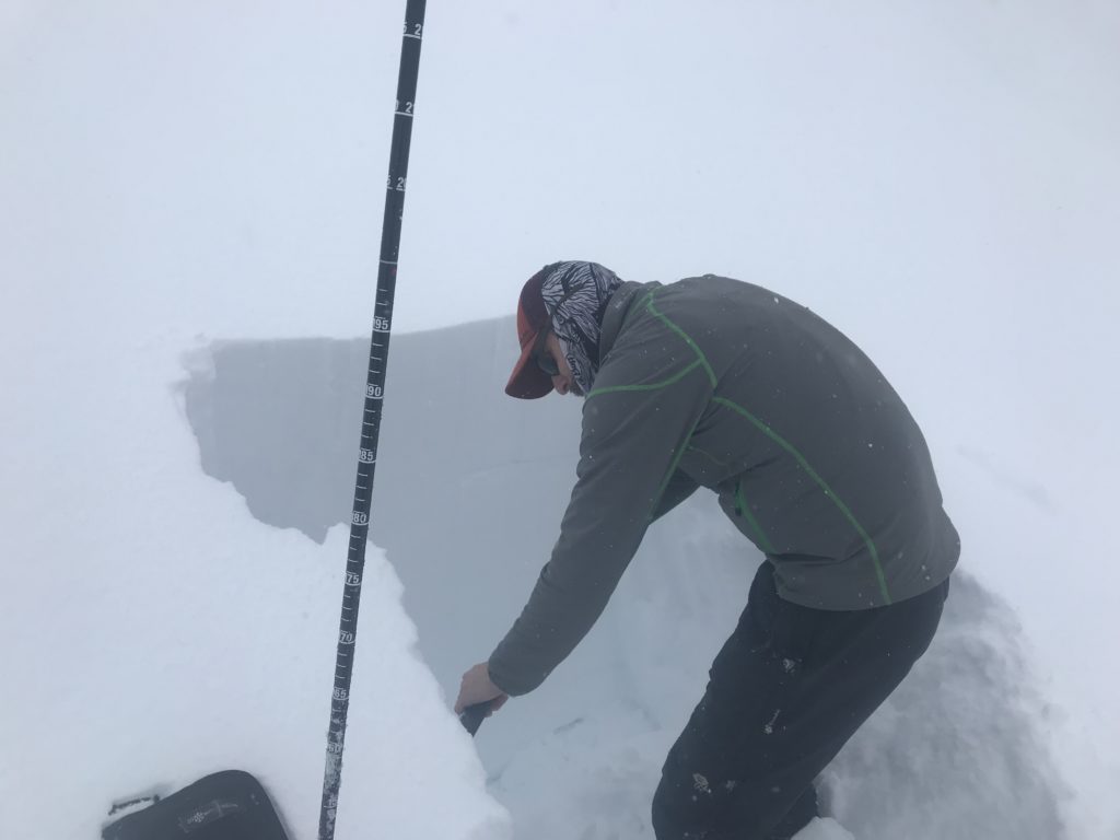
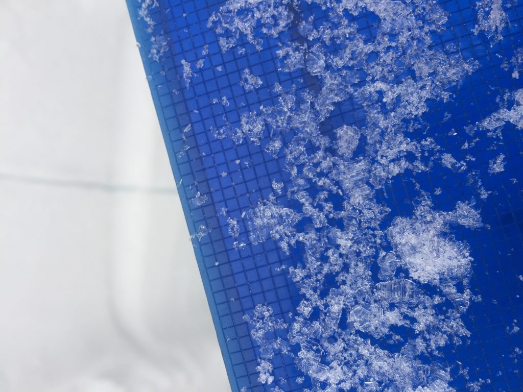
The next problem, and most challenging to deal with is persistent slabs. There are 3 different layers that you will need to look out for; first is buried surface hoar. There are multiple layers of BSH, one of which is the newest which is large and obvious at many locations and will be reactive if the slab above is stiff enough, also the older BSH has become reactive again under the new load and was resulting in deeper failures yesterday (Video 1). The deeper BSH will result in large avalanches with high consequences, as will the second persistent layer which is depth hoar/basal facets. That’s right, the new load has re-activated the weak snow near the ground at some locations (Video 2). Finally there is a melt freeze crust that formed at the same time as the surface hoar which is providing a slick bed surface for the newer snow to slide on.
The bottom line is that there are multiple problems that are requiring complex analysis and are making decisions challenging to make. Slow down, take your time to perform stability tests, talk with your partners and come back another day if you are unsure. Not only is the likelihood of triggering an avalanches high but the consequences of some of them would be severe. Err on the side of caution if you are in the backcountry today.
Avalanche and Weather Outlook
Other than the potential for an uptick in wind speeds today the weather looks to be benign (forecast). Avalanche danger will mostly remain the same today until the next loading event which looks to be setting up for Friday.
We hope to see you tonight at Big Sky Brewing from 6-8, for our final Beers with Forecasters for the season. If you are out into the mountains today, please share what you see on our public observations page. Your observations are not only a great resource to us but can be extremely helpful to our community.
Ski and ride safe.


