
The current avalanche danger is CONSIDERABLE for the West Central Montana backcountry. Conditions are improving but are still touchy. Human triggered avalanches are likely on specific terrain. Utilize conservative decisions, thorough snowpack evaluation and keen terrain evaluation to safely travel in the backcountry today.
Good morning, this is Logan King with the West Central Montana Avalanche Center’s avalanche advisory for Saturday, January 26th, 2019. This danger rating does not apply to operating ski areas, expires at midnight tonight and is the sole responsibility of the U.S. Forest Service.
Weather and Snowpack
Winds this morning are out of the WSW at 10 mph with gusts up to 18 mph. Mountain temperatures as of 4 am range from 23-28 degreees Fahrenheit. Light and scattered showers yesterday and last night added up to 5 inches in the northern part of the advisory area while most locations only received a trace to 3 inches.
The storm slabs have settled out and the new snow is bonding to the old snow surface but the avalanche dangers is still considerable, as human triggered avalanches are likely on specific terrain and there is also potential for very large avalanches.
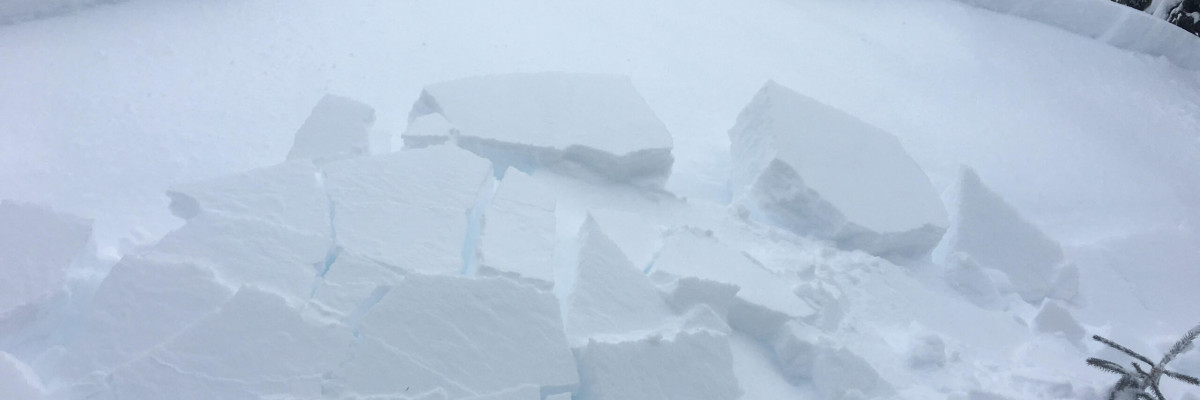
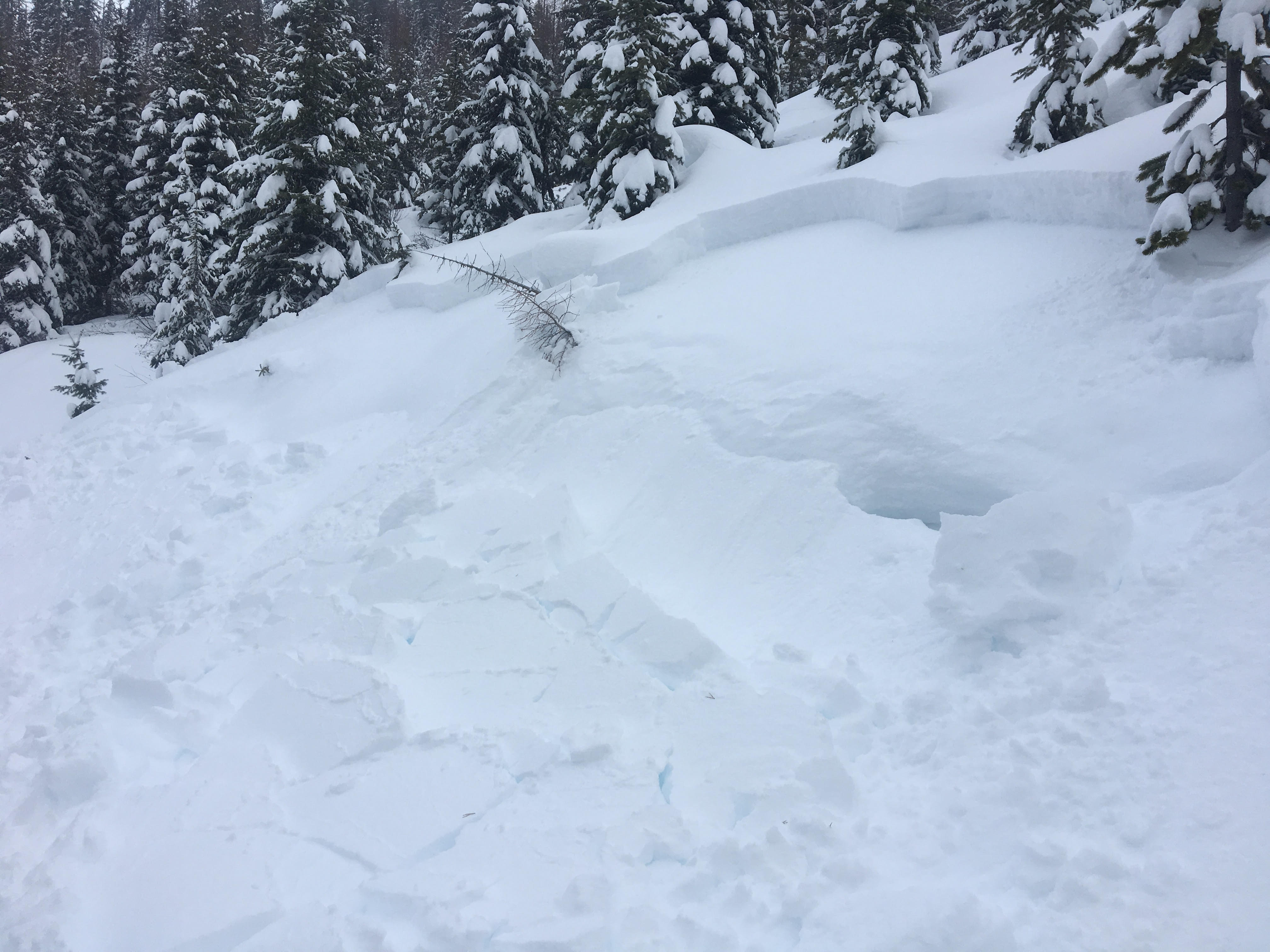
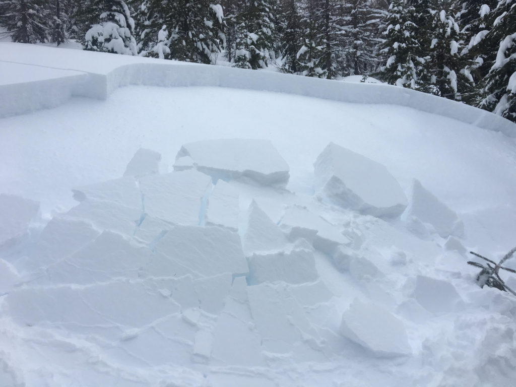
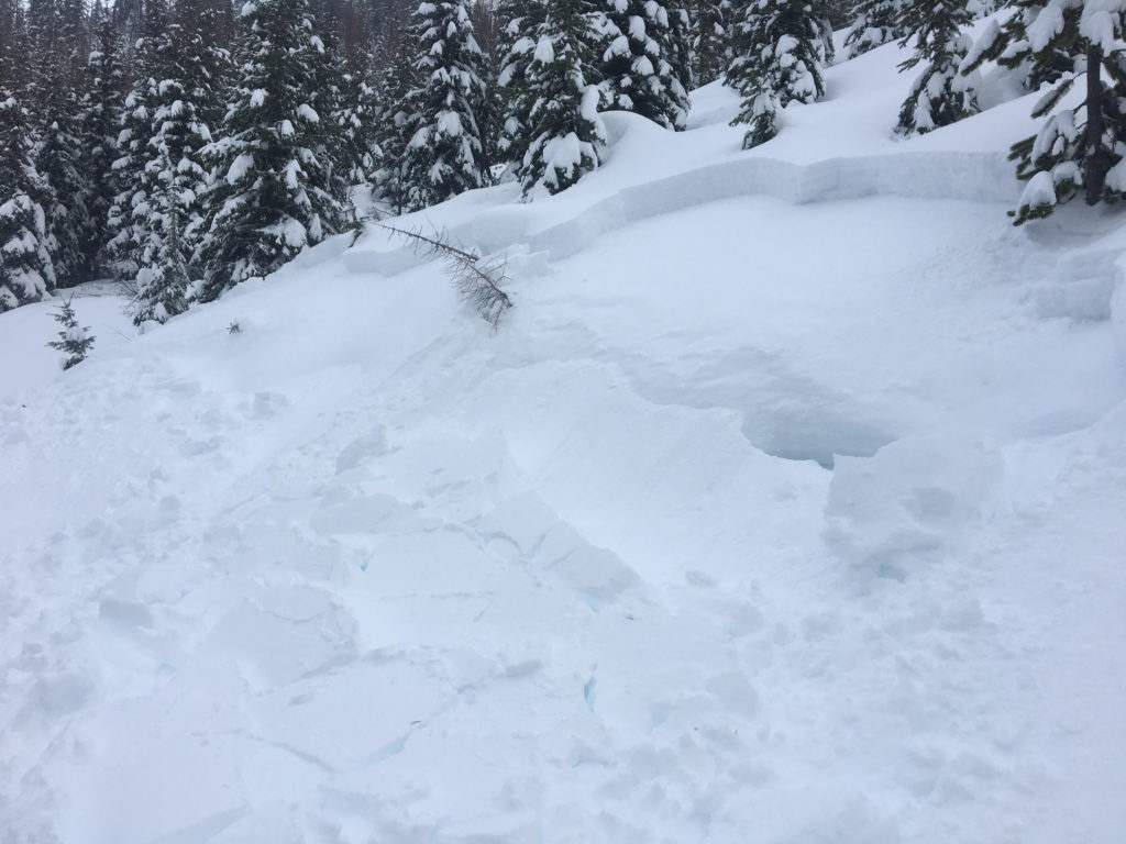
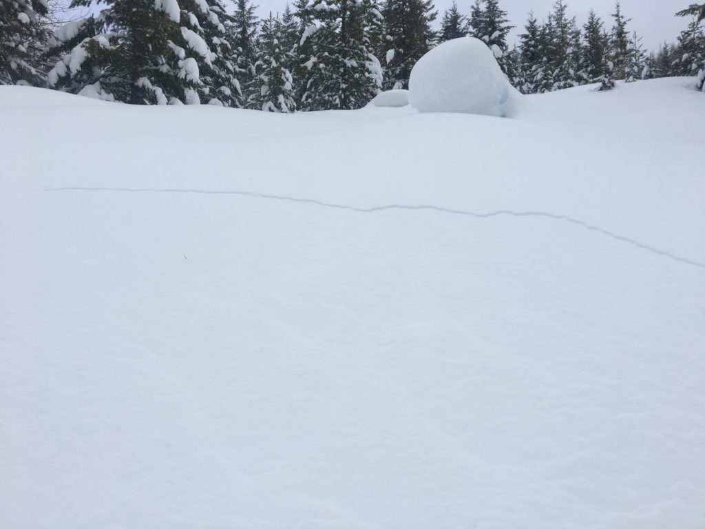
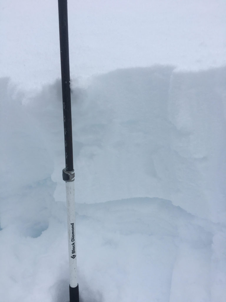
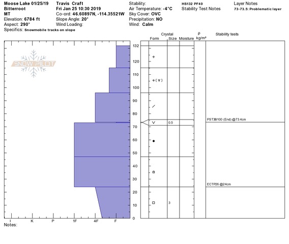
Persistent slabs continue to be a concern across the forecast area. There are multiple layers of buried surface hoar that continue to be reactive and propagate in stability tests. This layer is also responsible for natural releases on steep roll overs at lower elevations (pic). The facets near the ground and depth hoar continue to propagate in tests as well. These layers are not as reactive as a few days ago but are still failing at some locations and would result in large to very large avalanches. Whumphing and shooting cracks (pic) are becoming less prominent so the only way to know if these layers are present is to dig a pit and perform stability tests.
The other concern today is wind slabs. At upper elevations, near ridges and in isolated pockets wind slabs can be found that will be sensitive to human triggers. There is plenty of snow available for transport and wind slabs continue to grow in size. Look for rounded pillows of snow, cornices, and snow plastered to trees to see what locations are getting an additional load of snow and will be possible locations of avalanches. Shooting cracks have been observed on wind loaded terrain. Avoid traveling on any wind loaded terrain steeper than 30 degrees.
Conditions are improving but are not quite to the point of being trusted yet. Carefully evaluate the snowpack before committing to avalanche terrain. Keep in mind that there is a significant potential for very large avalanches, so carefully assess not just the likelihood but also the consequences of a slide.
Avalanche and Weather Outlook
Winds are expected to increase over the weekend as a cold front approaches (forecast bc). Late Sunday the winds will shift to NE and the temperature will drop as the cold front pushes in. A rapid transition is expected and the short time of frontal passage will limit the snowfall to only a few inches (snow amount) (forecast disc.). Wind slabs will continue to grow over the weekend but overall avalanche conditions will continue to slowly improve until the weather changes on Sunday.
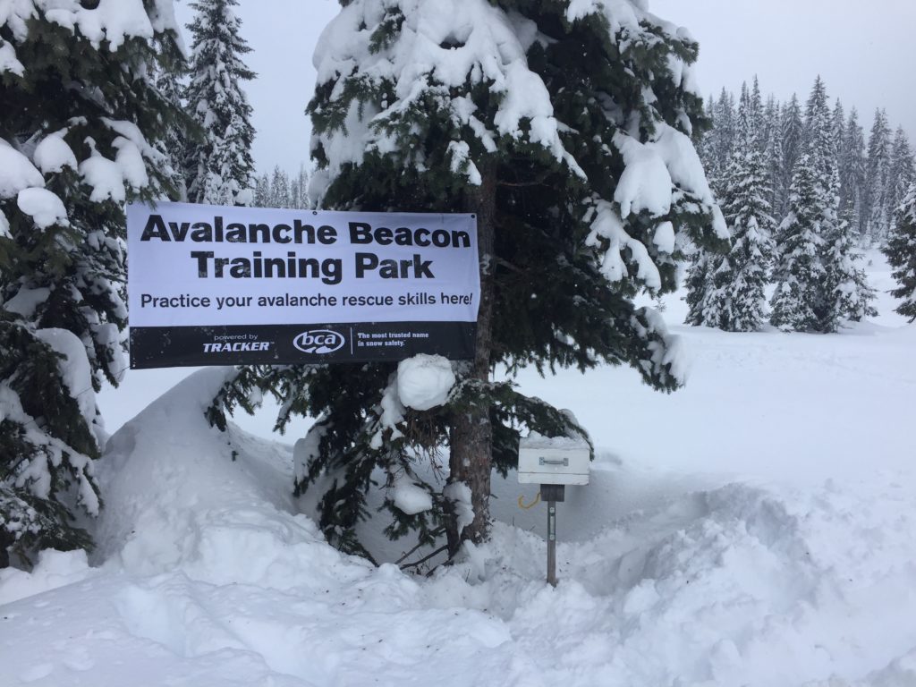
The beacon parks at Lolo Pass, on top of Snowbowl, at Lost Trail, and at Big Sky Brewing are all up and running. Be prepared and practice your rescue skills. If you are out in the mountains today, please share what you see on our public observations page. Your observations are not only a great resource to us but can be extremely helpful to your community.
Ski and ride safe.


