Posted:
Jan 31, 2019 @ 5:54 am

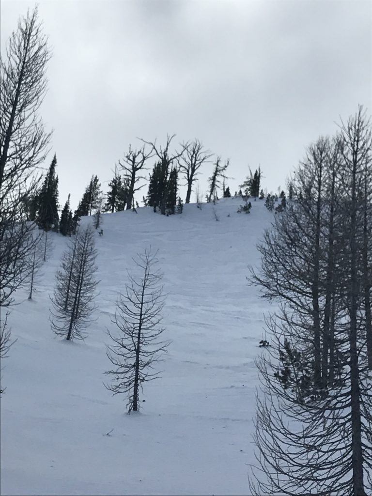
The avalanche danger for the west central Montana backcountry is MODERATE. Large avalanches can be triggered in isolated locations, and smaller avalanches are possible in specific terrain. Careful evaluation is needed to identify features of concern.

Good morning, this is Travis Craft with the West Central Montana Avalanche Center’s avalanche advisory for January 31, 2019. This danger rating does not apply to operating ski areas, expires at midnight tonight and is the sole responsibility of the U.S. Forest Service.

Weather and Snowpack

Mountain temperatures range from 20 F to 26 F. In the Bitterroot winds are 13 mph with gusts of 18 mph out of the South. In the northern part of the advisory area, winds are calm. No new snow overnight.

Our snowpack is gaining strength. High pressure is allowing some of the weak layers to bond. Remember buried surface hoar is guilty until proven otherwise.

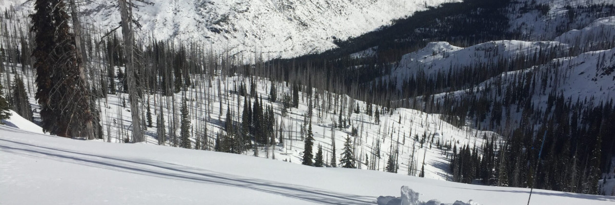
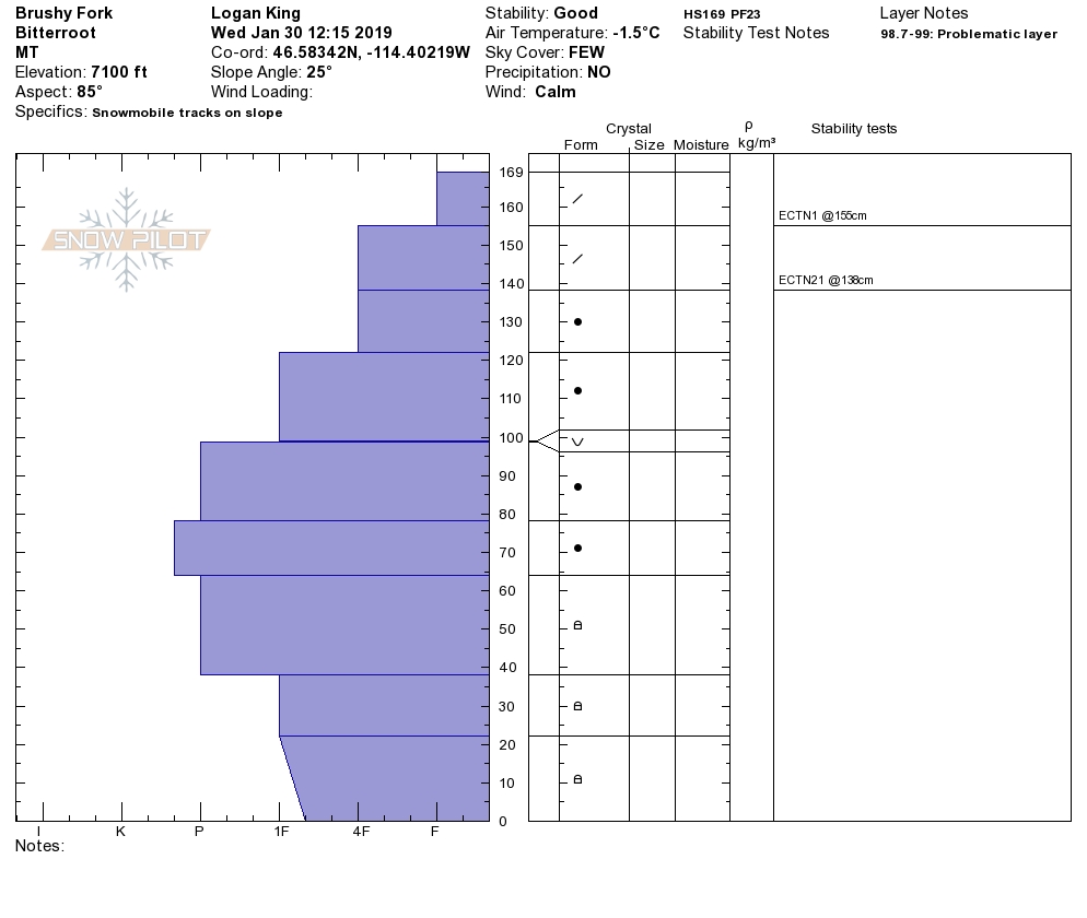
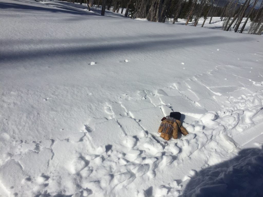
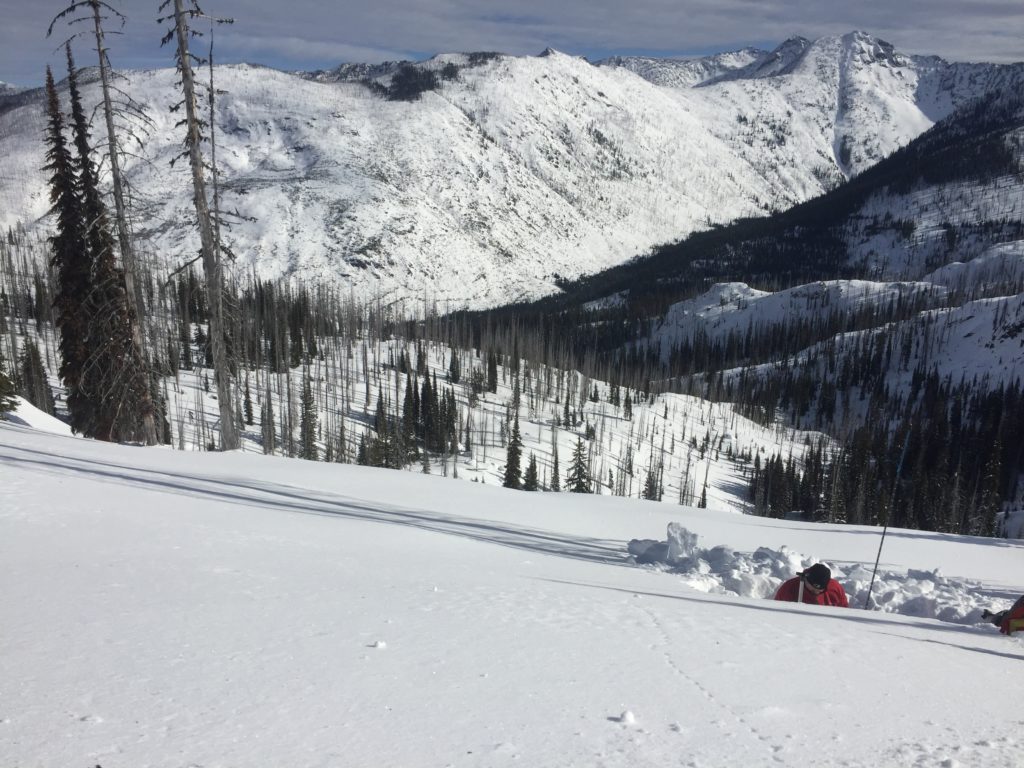
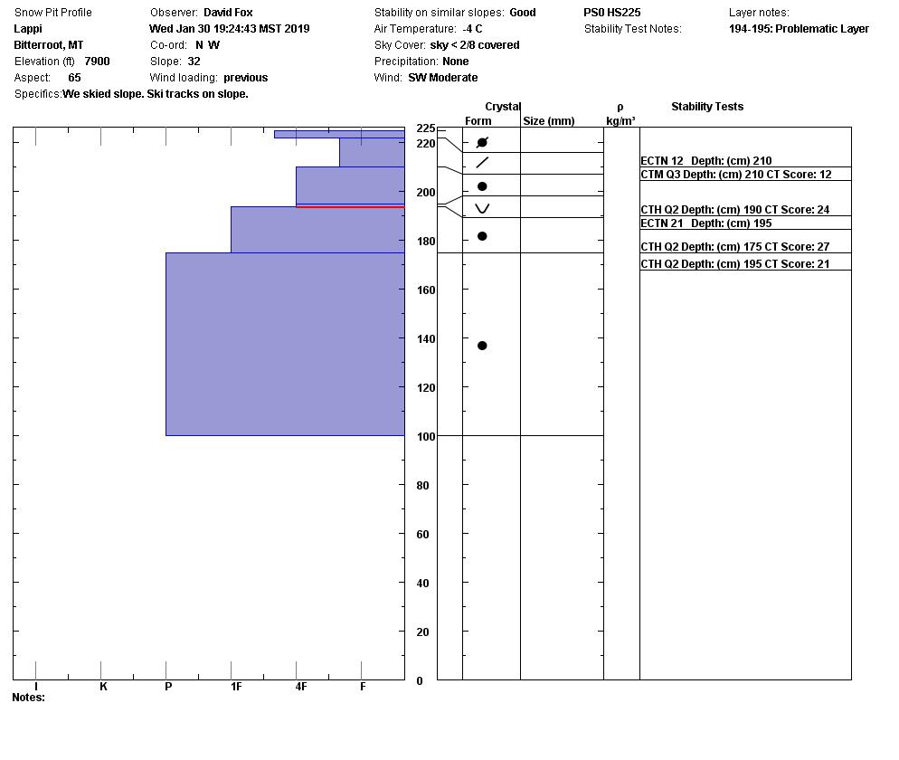
The primary avalanche problem is persistent slabs. There are layers of buried surface hoar in our snowpack. There are three layers, to identify them, dig a pit 3 feet deep and perform pit tests. There are facets located at the bottom of our snowpack. Dig a pit to see if they are reactive in tests and are present on the slope you want to ride. All of these layers are getting harder to trigger. If you trigger the facets on the ground, it will be a high consequence avalanche. Avoid likely trigger points on slopes(cliff bands, rock outcrops, and slope transitions) where the snowpack is shallow. Choose slopes with clean runout zones that avoid terrain traps(cliffs, trees, and rocks).

The second avalanche problem is wind drifted snow. There are small wind slabs located on mid-elevation leeward slopes. Look for snowdrifts and smooth, rounded deposits of snow. Avoid traveling on wind loaded terrain.

Bottom line: The snowpack is getting stronger. Put your shovel in the snow and check for buried weak layers. Look for signs of wind loading and avoid steep slopes with wind drifted snow.

Avalanche and Weather Outlook

High pressure will dominate until Friday. New snow will have a multitude of old snow surfaces to try to bond with, surface hoar, wind crusts, and melt-freeze crusts. Look for warming on sun-exposed slopes which will produce wet loose avalanche problems if we get the forecasted temperatures. See the forecast.

As always, if you make it out please, feel free to share, what you find on our public observations page.

Ski and ride safe.

READ FULL ADVISORY  

Problem 1 - Persistent Slabs

  • TYPE

    persistent-slabs

    Persistent Slabs

    Release of a cohesive layer of soft to hard snow (a slab) in the middle to upper snowpack, when the bond to an underlying persistent weak layer breaks.  Persistent layers include: surface hoar, depth hoar, near-surface facets, or faceted snow. Persistent weak layers can continue to produce avalanches for days, weeks or even months, making them especially dangerous and tricky. As additional snow and wind events build a thicker slab on top of the persistent weak layer, this avalanche problem may develop into a Persistent, Deep-Slab.

  • SIZE

    6-7

    3 (Large-Very Large)

    The potential size of avalanche resulting from this problem.

  • LIKELIHOOD

    Likelihood-2

    Unlikely/Possible

    The likelihood of an avalanche resulting from this problem.

There are layers of buried surface hoar in our snowpack. There are three layers, to identify them, dig a pit 3 feet deep and perform pit tests. There are facets located at the bottom of our snowpack. Dig a pit to see if they are reactive in tests and are present on the slope you want to ride. All of these layers are getting harder to trigger. If you trigger the facets on the ground, it will be a high consequence avalanche. Avoid likely trigger points on slopes(cliff bands, rock outcrops, and slope transitions) where the snowpack is shallow. Choose slopes with clean runout zones that avoid terrain traps(cliffs, trees, and rocks).

Problem 2 - Wind Drifted Snow

  • TYPE

    wind-slabs

    Wind Slabs

    Release of a cohesive layer of snow (a slab) formed by the wind.  Wind typically erodes snow from the upwind sides of terrain features and deposits snow on the downwind side.  Wind slabs are often smooth and rounded and sometimes sound hollow, and can range from soft to hard. Wind slabs that form over a persistent weak layer (surface hoar, depth hoar, or near-surface facets) may be termed Persistent Slabs or may develop into Persistent Slabs.

  • SIZE

    2-3

    1 (Small)

    The potential size of avalanche resulting from this problem.

  • LIKELIHOOD

    Likelihood-3

    Possible

    The likelihood of an avalanche resulting from this problem.

The second avalanche problem is wind drifted snow. There are small wind slabs located on mid-elevation leeward slopes. Look for snowdrifts and smooth, rounded deposits of snow. Avoid traveling on wind loaded terrain.


VIDEO

Observations

Observations

FORECAST & OUTLOOK

High pressure will dominate until Friday. New snow will have a multitude of old snow surfaces to try to bond with, surface hoar, wind crusts, and melt-freeze crusts. Look for warming on sun-exposed slopes which will produce wet loose avalanche problems if we get the forecasted temperatures. See the forecast.


This information is the sole responsibility of the Forest Service and does not apply to operating ski areas. The avalanche danger rating expires at midnight tonight but the information can help you make a more informed decision regarding travel in avalanche terrain for the next few days.

Our advisory area includes National Forest System lands in the Bitterroot Mountains from Lost Trail Pass north to Granite Pass, the Rattlesnake Mountains north of Missoula and the Southern Swan and Mission Mountains near Seeley Lake, MT. Avalanche information for the Lookout Pass/St. Regis Basin area is available from the Idaho Panhandle Avalanche Center.