
A MODERATE avalanche danger exists for the West Central Montana backcountry. Human triggered avalanches are possible and will produce small avalanches in specific areas with the potential for large avalanches in isolated areas. Heightened avalanche conditions exists on specific terrain and careful assessment is critical to identify areas of increased concern.
Good morning, this is Logan King with the West Central Montana Avalanche Center’s avalanche advisory for Tuesday, February 05th, 2019. This danger rating does not apply to operating ski areas, expires at midnight tonight and is the sole responsibility of the U.S. Forest Service.
Weather and Snowpack
As of 4am this morning a temperature inversion has developed. Mountain temperatures above about 6,500 feet are in the low twenties and at lower elevations are approximately 5-10 degrees Fahrenheit. Light snow and scattered showers yesterday have left most locations with 1-3 inches of new snow with low SWE values. Winds are light at 1-5mph and gusts up to 7 mph out of the S-SSW.
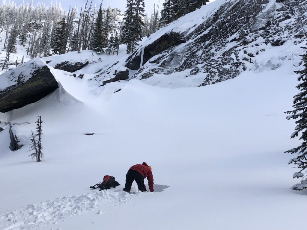
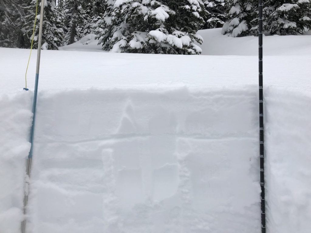
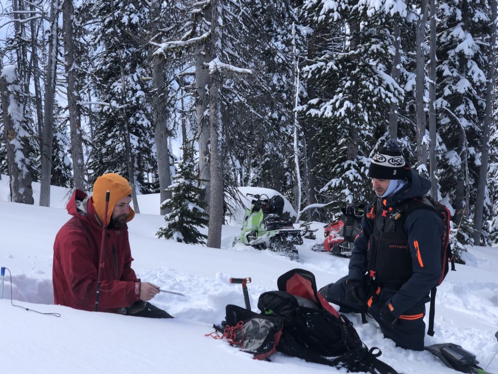
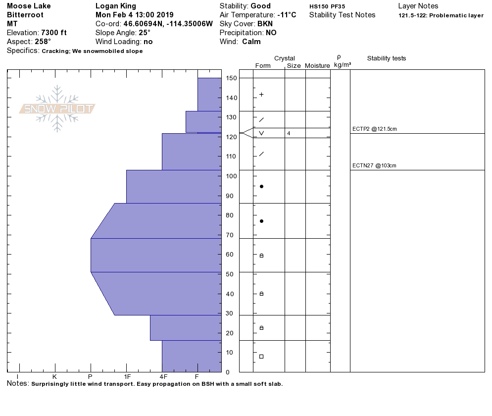
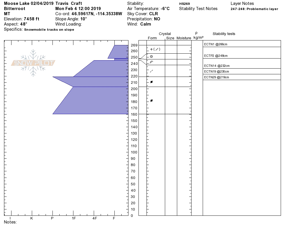
We have observed and received reports of a variety of conditions that are dependent on elevation across the forecast area, all of which will make persistent slabs the first concern today. The new snow is bonding well, but may be reactive at lower elevations where a slick rain crusts is present. At other elevations, there is surface hoar scattered across the advisory area that is creating easy propagations in stability tests, it will not be found everywhere and even when found it doesn’t always propagate. The facets near the ground are becoming less likely to trigger but can still fail in shallow areas and can’t be written off yet. The big take away with persistent slabs are that depending on your elevation, aspect, and terrain you will need to look out for a different culprit. Be vigilant with your observations and take the time to dig pits to identify what weak layers are present and how reactive they are.
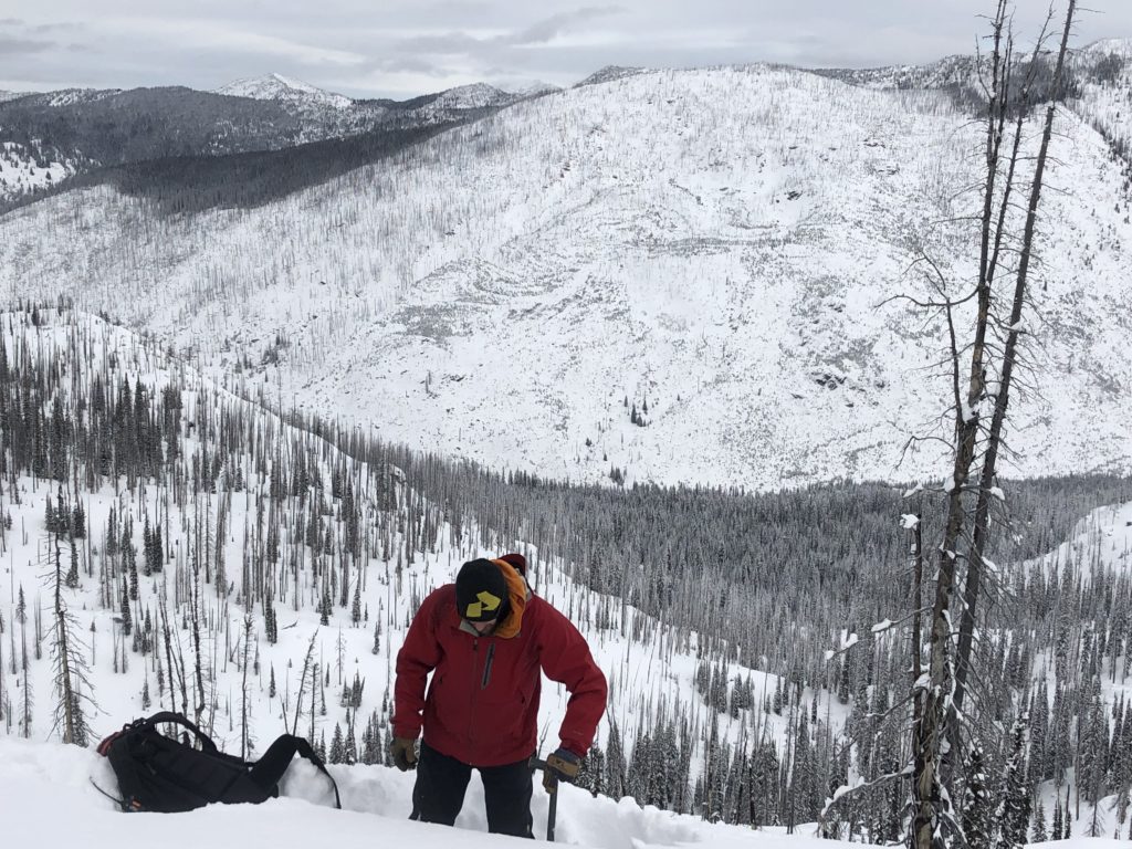
The second concern today is wind drifted snow. We have seen strong Easterly winds over the last few days and there is plenty of snow for transport. The unusual direction and variability of the winds have left a lot of question marks as to where to find wind slabs and how sensitive they will be. Winds have been funneled, creating localized areas of significantly increased winds and will create wind slabs in isolated locations that are not spots you would typically see wind loading. Carefully look for indications of wind loading before committing to steep terrain and keep an eye out for cross loaded slopes.
Avalanche and Weather Outlook
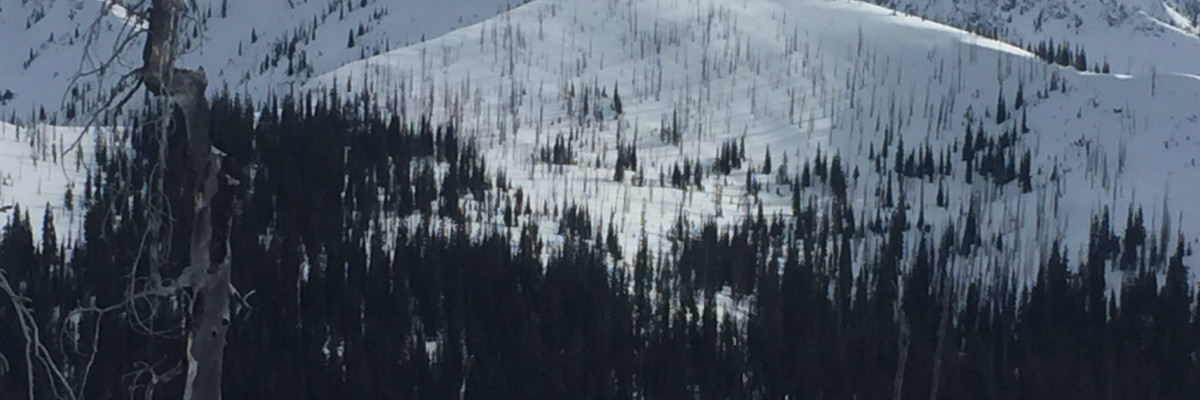
Light snow showers are expected today and into tonight with minimal accumulations for the northern half of the forecast area. The southern half of the region has a greater potential of snowfall with a total accumulation of about 2-5 inches today (forecast). Winds have a chance to ramp up, but will continue to be variable across the forecast area. The avalanche danger has the potential to increase at locations receiving more snow or higher winds but should remain the same for most of the forecast area.
As always, if you make it out, please, feel free to share, what you find on our public observations page. Join us tonight for Into to Avalanches(link for Info).
Ski and ride safe.


