Posted:
Feb 7, 2019 @ 6:49 am

The current avalanche danger for the West Central Montana backcountry is Low. Low danger does not mean no danger! Be on the lookout for avalanches in isolated or extreme terrain.

Good morning, this is Logan King with the West Central Montana Avalanche Center’s avalanche advisory for Thursday, February 7th, 2019. This danger rating does not apply to operating ski areas, expires at midnight tonight and is the sole responsibility of the U.S. Forest Service.

Weather and Snowpack

Mountain temperatures this morning range from -11 to 5 degrees Fahrenheit. Winds are light out of the SW at 4 mph with gust of 6 mph. During the day yesterday the area received another 1-3 inches of new snow. Overnight mountain locations picked up a trace to an inch of new low density snow.

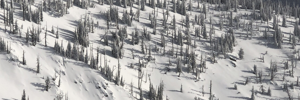
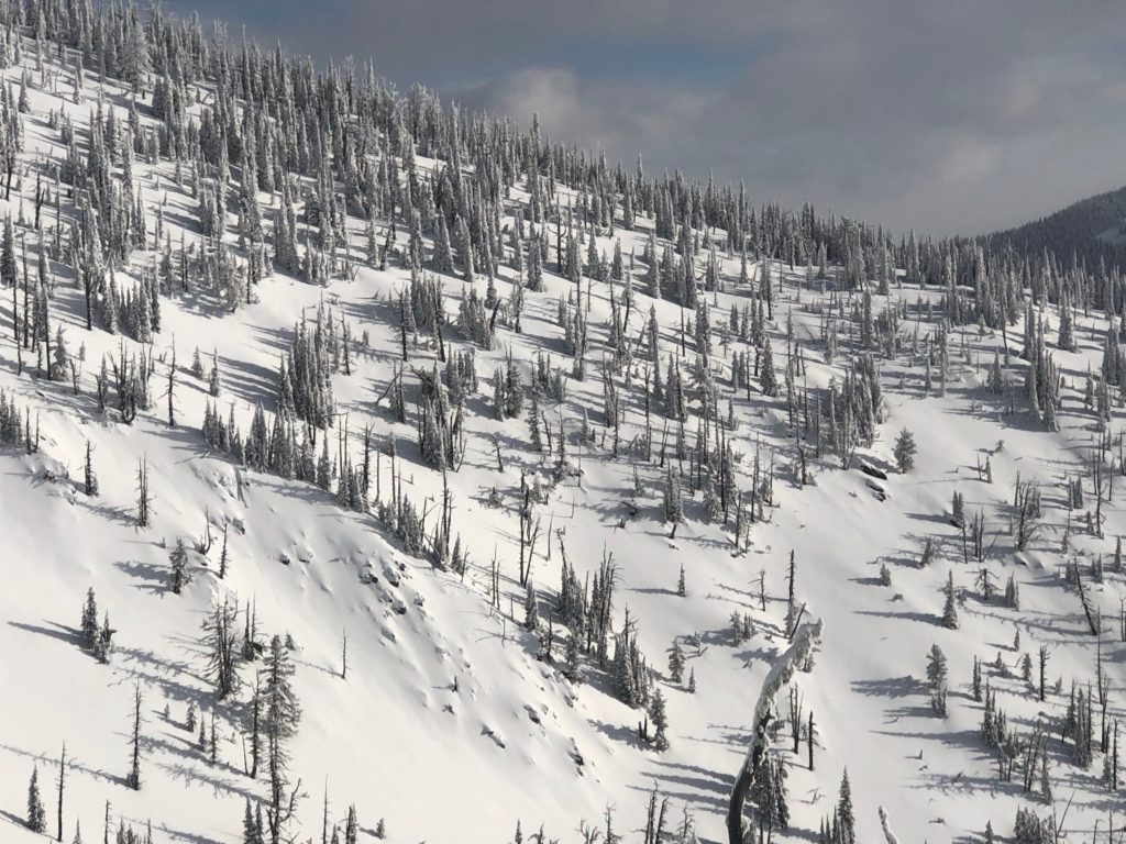
The most widespread problem today will be loose snow avalanches. Light and dry surface snow is moving readily throughout the advisory area. These avalanches are small and generally don’t pack much of a punch but can be dangerous if terrain traps are present. Look for cliffs, trees, gullies and anything that may increase the consequences of getting knocked off your feet or sled before committing to steep terrain.

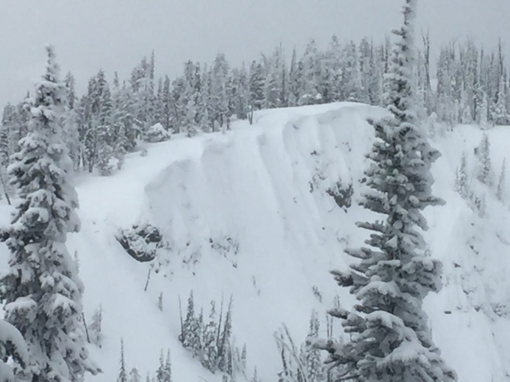
The next problem to be aware of today are wind slabs. Lots of snow is available for transport but winds have been isolated or light. Small wind slabs are primarily confined to isolated slopes and tend to be small and soft. Winds have been erratic and blown snow back and forth over ridges so cross loading will be a problem and locations of wind slabs may be hard to identify. Carefully look for signs of wind loading before traveling in avalanche terrain.

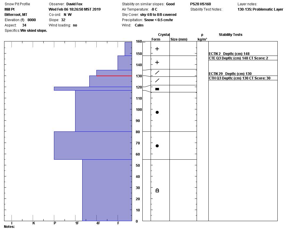
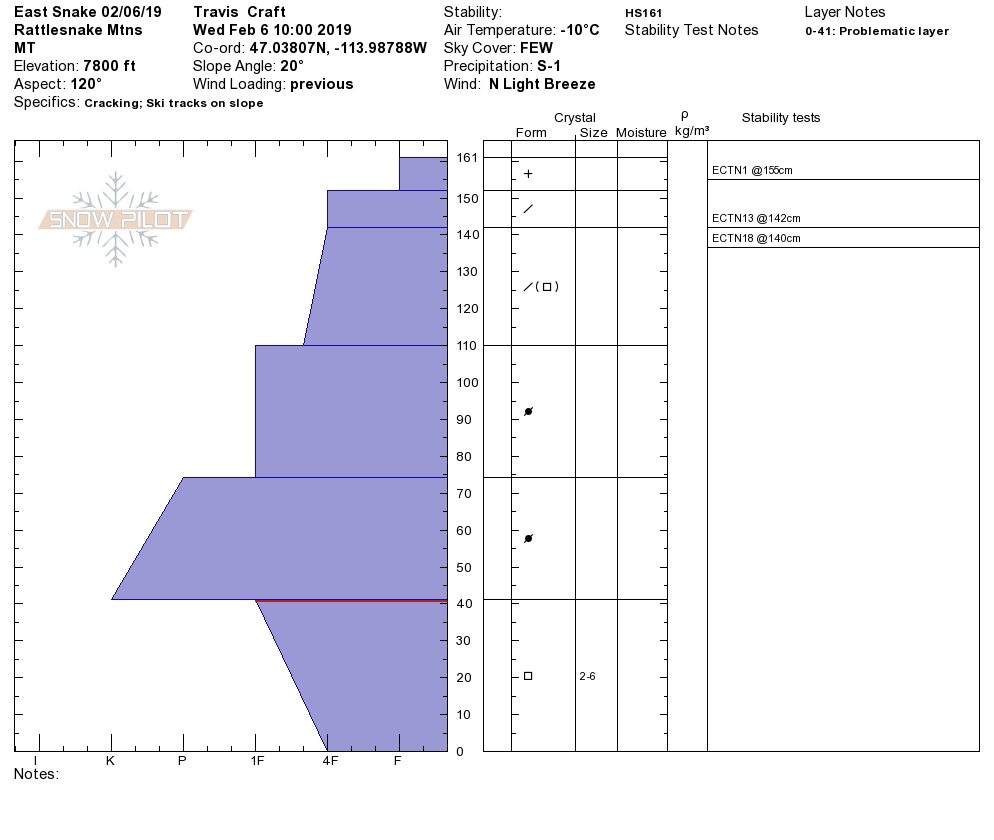
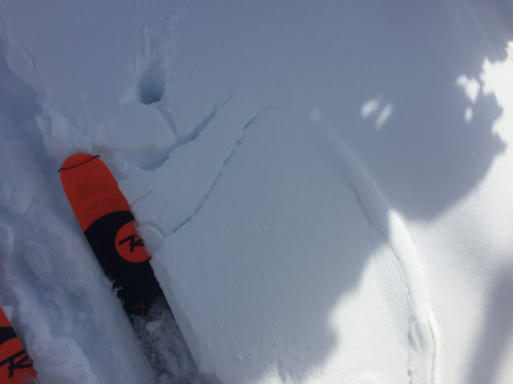
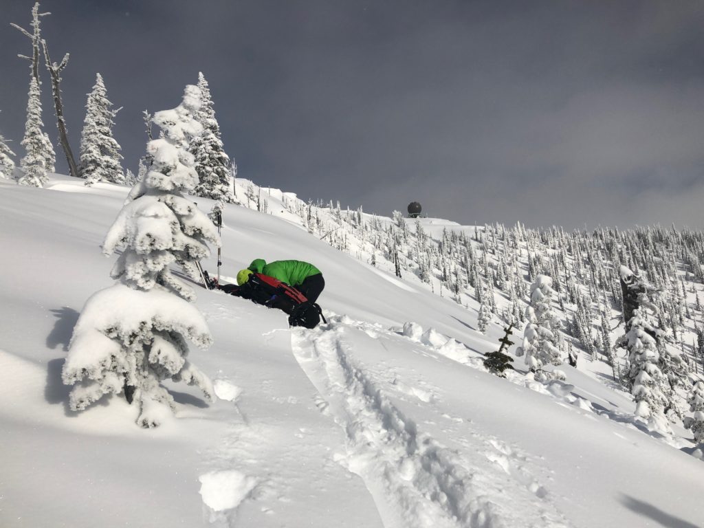
Another problem to be on the look out for are persistent slabs. Buried surface hoar can still be found in the forecast area but is increasingly isolated and continues to gain strength. Facets near the ground are unlikely to be triggered at this point but would result in large avalanches so should be considered before venturing into big terrain. At lower elevations the new snow is bonding well with the crusts and continues to gain strength. Dig a pit to determine if these layers are present and adjust travel plans accordingly.

Big Picture: The avalanche danger continues to trend downward and is rated at low. I will say it again; Low danger does not mean no danger! It is a stout low right now and avalanches are possible if you are in the wrong place at the wrong time. Carefully evaluate the likelihood and potential consequences of avalanches before committing to avalanche terrain. Don’t treat the low rating as a green light and jump straight into big terrain, start on smaller slopes with lower consequences and test the snow before going for a big line. Stay aware of changing conditions and continue to utilize safe travel protocols and don’t but lulled into complacency.

Avalanche and Weather Outlook

Cold will dominate the region today before a small disturbance develops Friday (forecast). Another system looks to set up over the weekend that will be reminiscent of last weekends system. Cold and snow showers will continue for the next few days. The avalanche danger will remain the same unless wind loading increases or an area picks up a significant load of new snow.

As always, if you make it out, please, feel free to share, what you find on our public observations page.

Ski and ride safe.

READ FULL ADVISORY  

Problem 1 - Loose Snow Avalanches

  • TYPE

    loose-dry

    Loose Dry

    Release of wet unconsolidated snow or slush. These avalanches typically occur within layers of wet snow near the surface of the snowpack, but they may quickly gouge into lower snowpack layers. Like Loose-Dry Avalanches,they start at a point and entrain snow as they move downhill, forming a fan-shaped avalanche. They generally move slowly, but can contain enough mass to cause significant damage to trees, cars or buildings. Other names for loose-wet avalanches include point-release avalanches or sluffs. Loose-wet avalanches can trigger slab avalanches that break into deeper snow layers.

  • SIZE

    1-2

    < 1 (Small)

    The potential size of avalanche resulting from this problem.

  • LIKELIHOOD

    Likelihood-4

    Possible/Likely

    The likelihood of an avalanche resulting from this problem.

Light and dry surface snow is easily entrained in small sluff avalanches on slopes steeper than 35 degrees.

Problem 2 - Wind Drifted Snow

  • TYPE

    wind-slabs

    Wind Slabs

    Release of a cohesive layer of snow (a slab) formed by the wind.  Wind typically erodes snow from the upwind sides of terrain features and deposits snow on the downwind side.  Wind slabs are often smooth and rounded and sometimes sound hollow, and can range from soft to hard. Wind slabs that form over a persistent weak layer (surface hoar, depth hoar, or near-surface facets) may be termed Persistent Slabs or may develop into Persistent Slabs.

  • SIZE

    2-3

    1 (Small)

    The potential size of avalanche resulting from this problem.

  • LIKELIHOOD

    Likelihood-3

    Possible

    The likelihood of an avalanche resulting from this problem.

Isolated pockets of wind slabs are scattered throughout the forecast area.

Problem 3 - Persistent Slabs

  • TYPE

    persistent-slabs

    Persistent Slabs

    Release of a cohesive layer of soft to hard snow (a slab) in the middle to upper snowpack, when the bond to an underlying persistent weak layer breaks.  Persistent layers include: surface hoar, depth hoar, near-surface facets, or faceted snow. Persistent weak layers can continue to produce avalanches for days, weeks or even months, making them especially dangerous and tricky. As additional snow and wind events build a thicker slab on top of the persistent weak layer, this avalanche problem may develop into a Persistent, Deep-Slab.

  • SIZE

    3-4

    1-2 (Small-Large)

    The potential size of avalanche resulting from this problem.

  • LIKELIHOOD

    Likelihood-3

    Possible

    The likelihood of an avalanche resulting from this problem.

Weak layers of snow are gaining strength but can be triggered under the right circumstances.

VIDEO

FORECAST & OUTLOOK

  • Danger Trend

    same

    Same Danger

  • Area Forecast

    Cold

Today will be cold and mostly calm as light snow develops tonight into tomorrow.

This information is the sole responsibility of the Forest Service and does not apply to operating ski areas. The avalanche danger rating expires at midnight tonight but the information can help you make a more informed decision regarding travel in avalanche terrain for the next few days.

Our advisory area includes National Forest System lands in the Bitterroot Mountains from Lost Trail Pass north to Granite Pass, the Rattlesnake Mountains north of Missoula and the Southern Swan and Mission Mountains near Seeley Lake, MT. Avalanche information for the Lookout Pass/St. Regis Basin area is available from the Idaho Panhandle Avalanche Center.