Posted:
Feb 12, 2019 @ 6:17 am

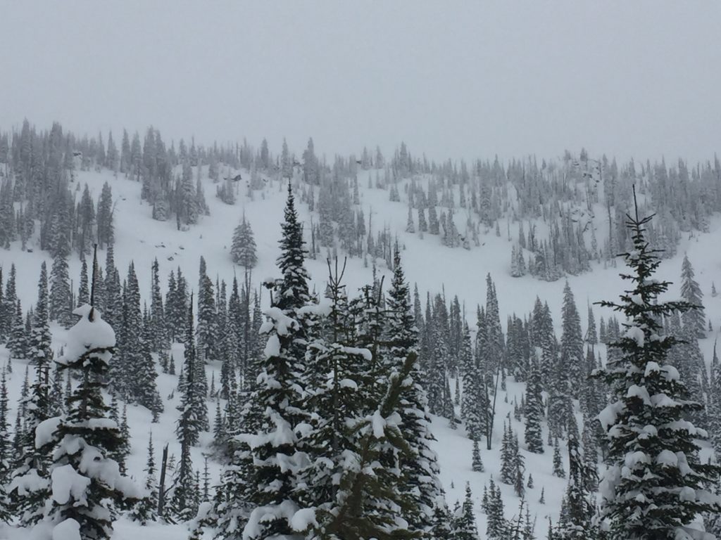
The avalanche danger for the west central Montana backcountry is CONSIDERABLE. Dangerous avalanche conditions are present in our forecast area. Identify wind loaded slopes and avoid traveling on or under them. Human triggered avalanches are likely today, and natural avalanches are possible. Careful snowpack evaluation, cautious route-finding, and conservative-decision making are essential today.

Good morning, this is Travis Craft with the West Central Montana Avalanche Center’s avalanche advisory for February 12, 2019. This danger rating does not apply to operating ski areas, expires at midnight tonight and is the sole responsibility of the U.S. Forest Service.

Weather and Snowpack

Mountain temperatures range from 17 F to 24 F. In the Bitterroot winds are 6 mph with gusts of 10 mph out of the South. In the northern part of the advisory area, winds are 7 mph and gusting 16 mph out of the South. Snotels are reporting between .5 and 1.2 inches of SWE for the last 24 hours.

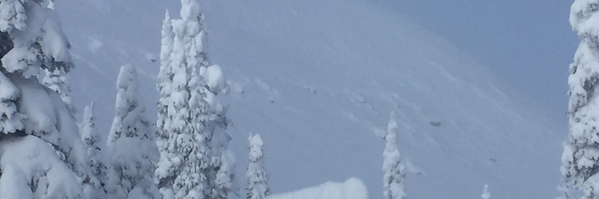
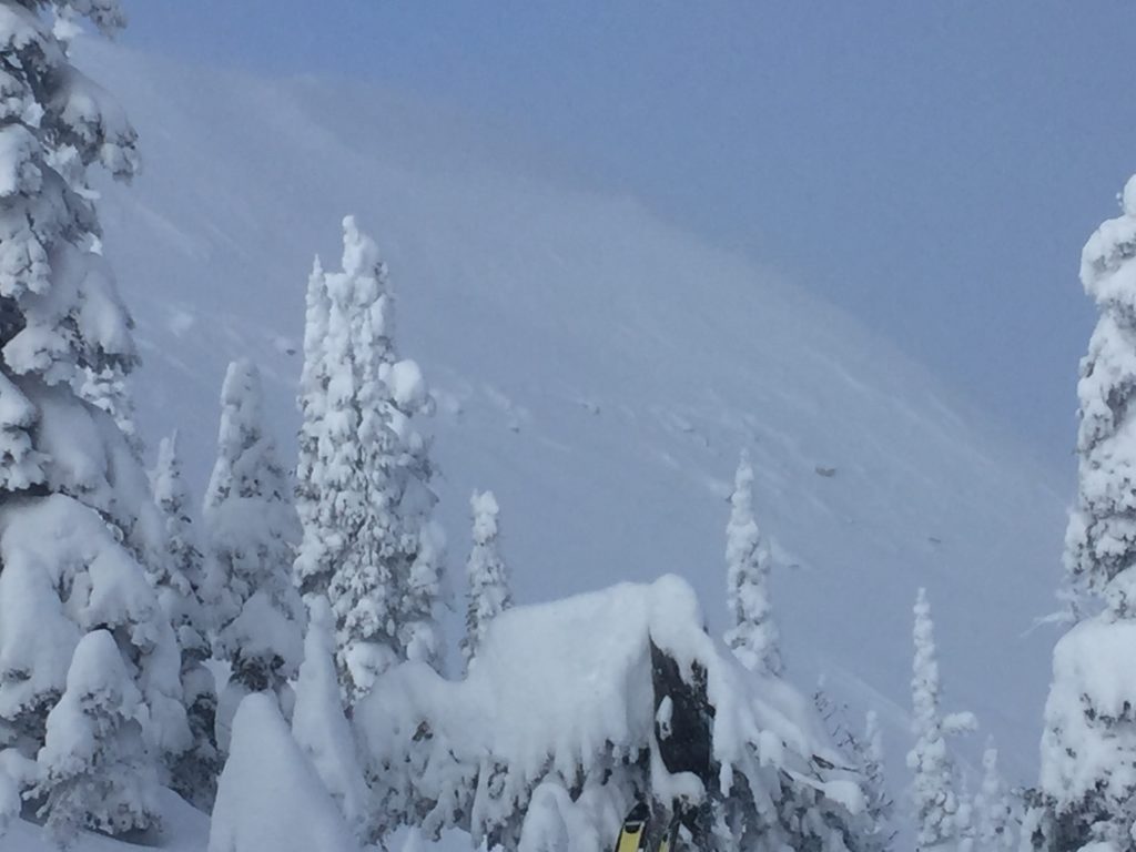
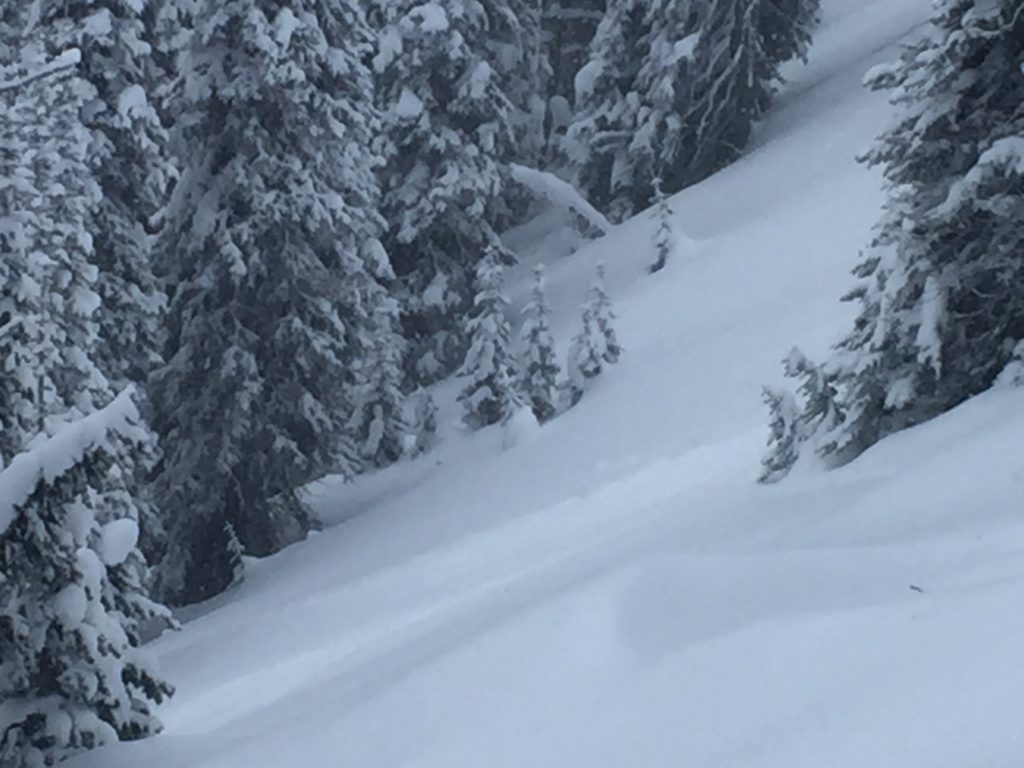
The primary avalanche problem today is wind drifted snow. Look for wind slabs on leeward slopes.  Moderate to strong winds were cross loading some slopes, ridgetops, and creating large cornices. We got shooting cracks and saw a cornice fail naturally, all signs of instability. Look for wind deposits lower down on slopes with the strong winds and in unusual places. Identify these slopes and avoid traveling on them. (Video)

The second avalanche problem is new snow. Several new inches of snow has fallen in the forecast area. Look for large loose snow avalanches and storm slabs. We saw several point releases yesterday and saw the new snow start to slab up later in the day. Shooting cracks and natural avalanche activity are red flags of instability. Use small test slopes with low consequences to see how the new snow is bonding to old snow surfaces.

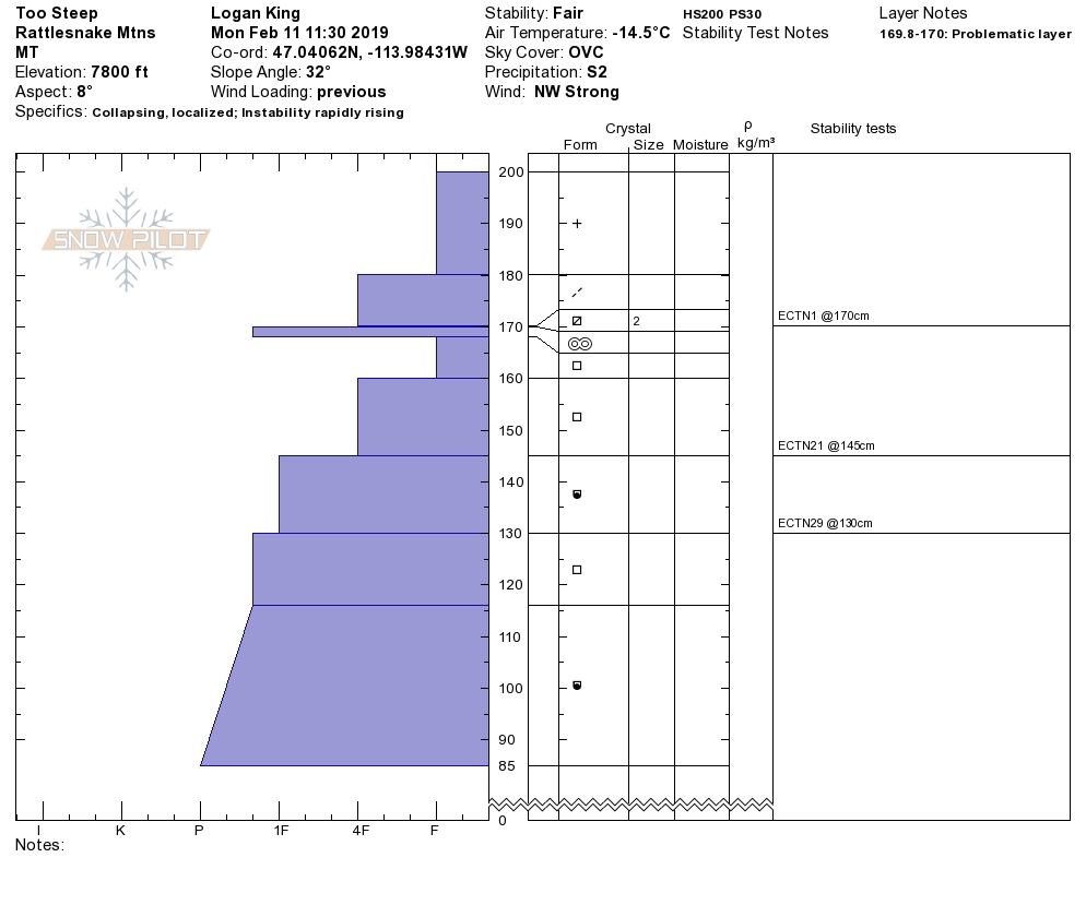
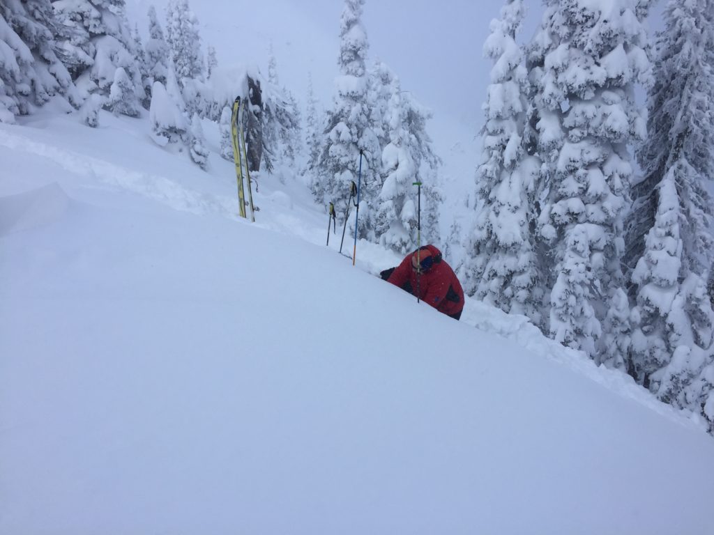
The final avalanche problem is persistent slabs. We have weak layers in our snowpack, buried surface hoar, and facets. Dig a pit 3 feet down and see if any of our weak layers are reactive in pit tests.

Bottom line: Dangerous avalanche conditions exist today.  Avoid traveling on and under wind loaded slopes. New snow will be sensitive to human triggers. Use test slopes and lower angle terrain to check the bonding of new snow to old snow surfaces. Pay attention to changing conditions and look for red flags(shooting cracks, natural avalanche activity, collapsing, and new loading). Dig a pit 3 feet down to check for the dragons lurking(weak layers) in our snowpack.

Avalanche and Weather Outlook

Snow is predicted today and through the night.  See the forecast here. With the predicted snow totals look for the avalanche danger to increase.

If you get out into the mountains, please share what you see on our public observations page. They are not only helpful to your community but extremely helpful to us.

Ski and ride safe.

READ FULL ADVISORY  

Problem 1 - Wind Drifted Snow

  • TYPE

    wind-slabs

    Wind Slabs

    Release of a cohesive layer of snow (a slab) formed by the wind.  Wind typically erodes snow from the upwind sides of terrain features and deposits snow on the downwind side.  Wind slabs are often smooth and rounded and sometimes sound hollow, and can range from soft to hard. Wind slabs that form over a persistent weak layer (surface hoar, depth hoar, or near-surface facets) may be termed Persistent Slabs or may develop into Persistent Slabs.

  • SIZE

    4-5

    2 (Large)

    The potential size of avalanche resulting from this problem.

  • LIKELIHOOD

    Likelihood-5

    Likely

    The likelihood of an avalanche resulting from this problem.

Look for wind slabs on leeward slopes.  Moderate to strong winds were cross loading some slopes, ridgetops, and creating large cornices. We got shooting cracks and saw a cornice fail naturally, all signs of instability. Look for wind deposits lower down on slopes with the strong winds and in unusual places. Identify these slopes and avoid traveling on them. (Video)

Problem 2 - New Snow

  • TYPE

    storm-slabs

    Storm Slabs

    Release of a soft cohesive layer (a slab) of new snow which breaks within the storm snow or on the old snow surface. Storm-slab problems typically last between a few hours and few days. Storm-slabs that form over a persistent weak layer (surface hoar, depth hoar, or near-surface facets) may be termed Persistent Slabs or may develop into Persistent Slabs.

  • SIZE

    4-5

    2 (Large)

    The potential size of avalanche resulting from this problem.

  • LIKELIHOOD

    Likelihood-4

    Possible/Likely

    The likelihood of an avalanche resulting from this problem.

Several new inches of snow has fallen in the forecast area. Look for large loose snow avalanches and storm slabs. We saw several point releases yesterday and saw the new snow start to slab up later in the day. Shooting cracks and natural avalanche activity are red flags of instability. Use small test slopes with low consequences to see how the new snow is bonding to old snow surfaces.


Problem 3 - Persistent slabs

  • TYPE

    persistent-slabs

    Persistent Slabs

    Release of a cohesive layer of soft to hard snow (a slab) in the middle to upper snowpack, when the bond to an underlying persistent weak layer breaks.  Persistent layers include: surface hoar, depth hoar, near-surface facets, or faceted snow. Persistent weak layers can continue to produce avalanches for days, weeks or even months, making them especially dangerous and tricky. As additional snow and wind events build a thicker slab on top of the persistent weak layer, this avalanche problem may develop into a Persistent, Deep-Slab.

  • SIZE

    5-6

    2-3 (Large)

    The potential size of avalanche resulting from this problem.

  • LIKELIHOOD

    Likelihood-2

    Unlikely/Possible

    The likelihood of an avalanche resulting from this problem.

We have weak layers in our snowpack, buried surface hoar, and facets. Dig a pit 3 feet down and see if any of our weak layers are reactive in pit tests.

VIDEO

Observations

Observations

FORECAST & OUTLOOK

Snow is predicted today and through the night.  See the forecast here. With the predicted snow totals look for the avalanche danger to increase.


This information is the sole responsibility of the Forest Service and does not apply to operating ski areas. The avalanche danger rating expires at midnight tonight but the information can help you make a more informed decision regarding travel in avalanche terrain for the next few days.

Our advisory area includes National Forest System lands in the Bitterroot Mountains from Lost Trail Pass north to Granite Pass, the Rattlesnake Mountains north of Missoula and the Southern Swan and Mission Mountains near Seeley Lake, MT. Avalanche information for the Lookout Pass/St. Regis Basin area is available from the Idaho Panhandle Avalanche Center.