Posted:
Feb 15, 2019 @ 6:30 am

The avalanche danger for the west central Montana backcountry is CONSIDERABLE. Dangerous avalanche conditions are present in our forecast area. Identify wind loaded slopes and avoid traveling on or under them. Human triggered avalanches are likely today, and natural avalanches are possible. Careful snowpack evaluation, cautious route-finding, and conservative-decision making are essential today.

Good morning, this is Travis Craft with the West Central Montana Avalanche Center’s avalanche advisory for February 15, 2019. Today’s advisory is sponsored by Yurtski. This danger rating does not apply to operating ski areas, expires at midnight tonight and is the sole responsibility of the U.S. Forest Service.

Weather and Snowpack

Mountain temperatures range from 24 F to 32 F. In the Bitterroot winds are 16 mph with gusts of 24 mph out of the SW. In the northern part of the advisory area, winds are 7 mph and gusting 11 mph out of the NW. Snotels are reporting between .4 and .7 inches of SWE for the last 24 hours.

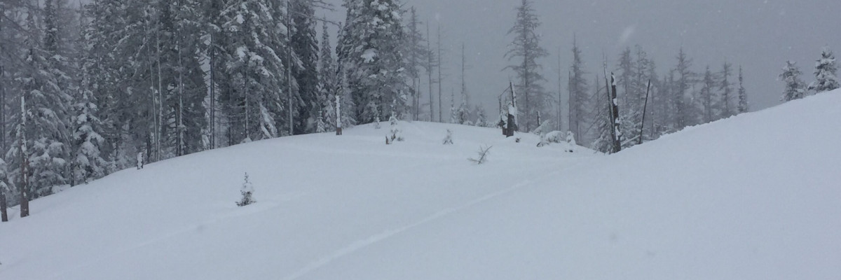
The primary avalanche problem is wind drifted snow. The advisory area experienced strong winds yesterday afternoon and through the night. Look for wind slabs on leeward terrain. These slabs are sensitive to human triggers. Look for smooth rounded pillows and drifts on ridges and cross-loaded slopes. Identify these slopes and avoid traveling on them.

The second avalanche problem is new snow. Heavier denser snow is falling on a variety of old snow surfaces. The new snow will need time to bond. Look for large loose snow avalanches and storm slabs. Shooting cracks and natural avalanche activity are red flags of instability. Use small test slopes with low consequences to see how the new snow is bonding to old snow surfaces.

The final avalanche problem is persistent slabs. We have weak layers in our snowpack, buried surface hoar, and facets. Dig a pit 3 feet down and see if any of our weak layers are reactive in pit tests.

Bottom line: The region has received a new load of heavier denser snow accompanied with strong winds. This combination has created dangerous avalanche conditions. The snowpack is adjusting to the new load of snow. Avoid wind drifted slopes. Dig a pit and see how the fresh snow is bonding and if the persistent weak layers are reactive in pit tests. Pay attention to changing weather conditions and avalanche conditions. Look for shooting cracks, natural activity, and collapses; these are clues to instabilities in the snowpack. Choose lower angle terrain(less than 30 degrees).

Avalanche and Weather Outlook

A cold front pushes in tonight. Snow is expected for today through Saturday. See the forecast here. New snow and wind will increase the avalanche danger.

As always, if you make it out, please, feel free to share, what you find on our public observations page.

Ski and ride safe.

READ FULL ADVISORY  

Problem 1 - Wind Drifted Snow

  • TYPE

    wind-slabs

    Wind Slabs

    Release of a cohesive layer of snow (a slab) formed by the wind.  Wind typically erodes snow from the upwind sides of terrain features and deposits snow on the downwind side.  Wind slabs are often smooth and rounded and sometimes sound hollow, and can range from soft to hard. Wind slabs that form over a persistent weak layer (surface hoar, depth hoar, or near-surface facets) may be termed Persistent Slabs or may develop into Persistent Slabs.

  • SIZE

    4-5

    2 (Large)

    The potential size of avalanche resulting from this problem.

  • LIKELIHOOD

    Likelihood-5

    Likely

    The likelihood of an avalanche resulting from this problem.

The advisory area experienced strong winds yesterday afternoon and through the night. Look for wind slabs on leeward terrain. These slabs are sensitive to human triggers. Look for smooth rounded pillows and drifts on ridges and cross-loaded slopes. Identify these slopes and avoid traveling on them.


Problem 2 - New Snow

  • TYPE

    storm-slabs

    Storm Slabs

    Release of a soft cohesive layer (a slab) of new snow which breaks within the storm snow or on the old snow surface. Storm-slab problems typically last between a few hours and few days. Storm-slabs that form over a persistent weak layer (surface hoar, depth hoar, or near-surface facets) may be termed Persistent Slabs or may develop into Persistent Slabs.

  • SIZE

    4-5

    2 (Large)

    The potential size of avalanche resulting from this problem.

  • LIKELIHOOD

    Likelihood-5

    Likely

    The likelihood of an avalanche resulting from this problem.

Heavier denser snow is falling on a variety of old snow surfaces. The new snow will need time to bond. Look for large loose snow avalanches and storm slabs. Shooting cracks and natural avalanche activity are red flags of instability. Use small test slopes with low consequences to see how the new snow is bonding to old snow surfaces.

Problem 3 - Persistent Slabs

  • TYPE

    persistent-slabs

    Persistent Slabs

    Release of a cohesive layer of soft to hard snow (a slab) in the middle to upper snowpack, when the bond to an underlying persistent weak layer breaks.  Persistent layers include: surface hoar, depth hoar, near-surface facets, or faceted snow. Persistent weak layers can continue to produce avalanches for days, weeks or even months, making them especially dangerous and tricky. As additional snow and wind events build a thicker slab on top of the persistent weak layer, this avalanche problem may develop into a Persistent, Deep-Slab.

  • SIZE

    5-6

    2-3 (Large)

    The potential size of avalanche resulting from this problem.

  • LIKELIHOOD

    Likelihood-2

    Unlikely/Possible

    The likelihood of an avalanche resulting from this problem.

We have weak layers in our snowpack, buried surface hoar, and facets. Dig a pit 3 feet down and see if any of our weak layers are reactive in pit tests.

FORECAST & OUTLOOK

A cold front pushes in tonight. Snow is expected for today through Saturday. See the forecast here. New snow and wind will increase the avalanche danger.

As always, if you make it out, please, feel free to share, what you find on our public observations page.

Ski and ride safe.

This information is the sole responsibility of the Forest Service and does not apply to operating ski areas. The avalanche danger rating expires at midnight tonight but the information can help you make a more informed decision regarding travel in avalanche terrain for the next few days.

Our advisory area includes National Forest System lands in the Bitterroot Mountains from Lost Trail Pass north to Granite Pass, the Rattlesnake Mountains north of Missoula and the Southern Swan and Mission Mountains near Seeley Lake, MT. Avalanche information for the Lookout Pass/St. Regis Basin area is available from the Idaho Panhandle Avalanche Center.