Posted:
Feb 16, 2019 @ 6:24 am

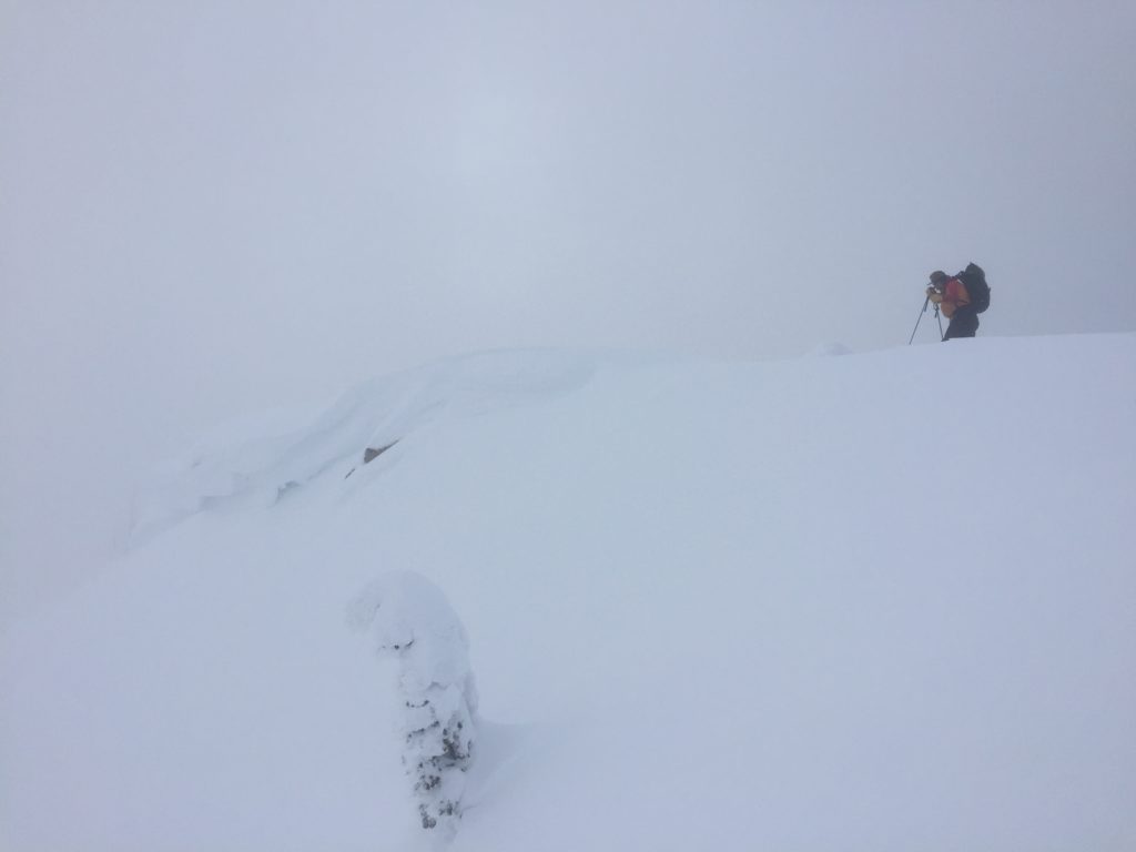
The current avalanche danger is MODERATE for the West Central Montana Backcountry. Human triggered avalanches are possible on specific terrain and conditions have been in a constant state of change for the last few days. Carefully and continuously evaluate terrain and snowpack to identify areas of increased concern. The southern Missions and Southern Swan ranges have the potential to move to CONSIDERABLE later today as snow accumulates, but there is significant uncertainty in predicted snowfall.

Good morning, this is Logan King with the West Central Montana Avalanche Center’s avalanche advisory for Saturday, February 16th, 2019. Today’s advisory is sponsored by Yurtski. This danger rating does not apply to operating ski areas, expires at midnight tonight and is the sole responsibility of the U.S. Forest Service.

Weather and Snowpack

As of 5 am, this morning mountain temperatures range from 15 to 25 degrees Fahrenheit. Winds are out of the SW at 13 mph and gusting to 18 mph in the northern part of the region while winds in the southern Bitterroot are 3 mph with gusts to 9 mph from the SE. 24-hour snow totals range from 1-6 inches, and snotels have picked up an additional 0.1-0.5 inches of SWE.

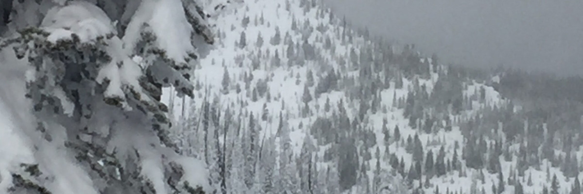
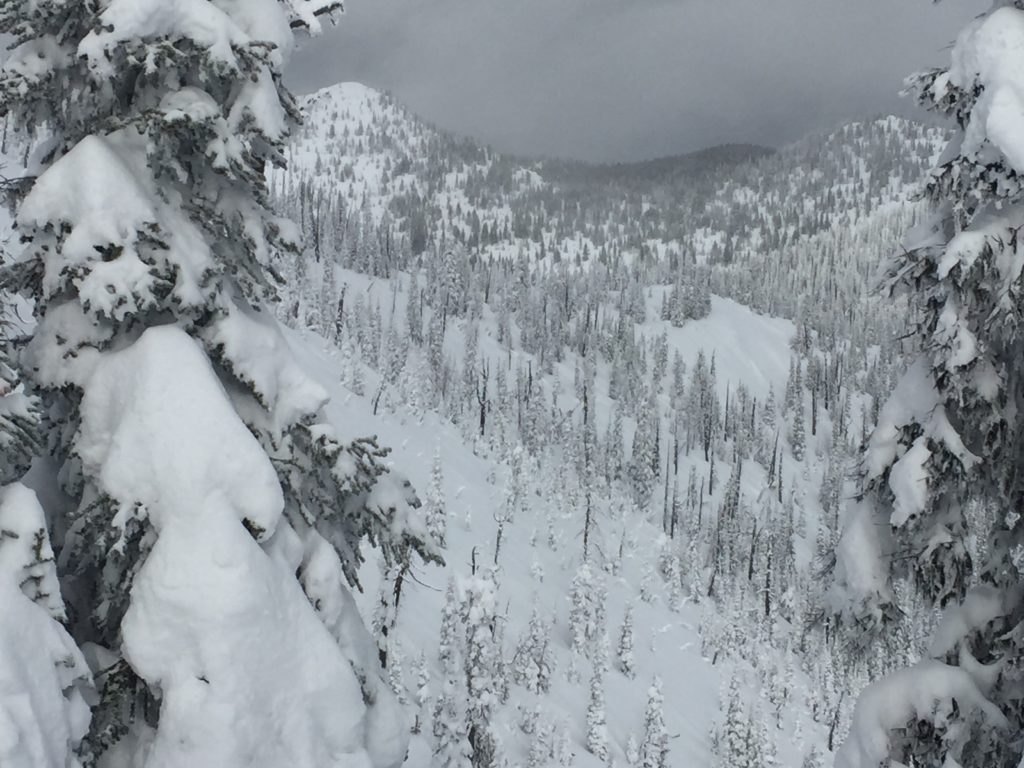
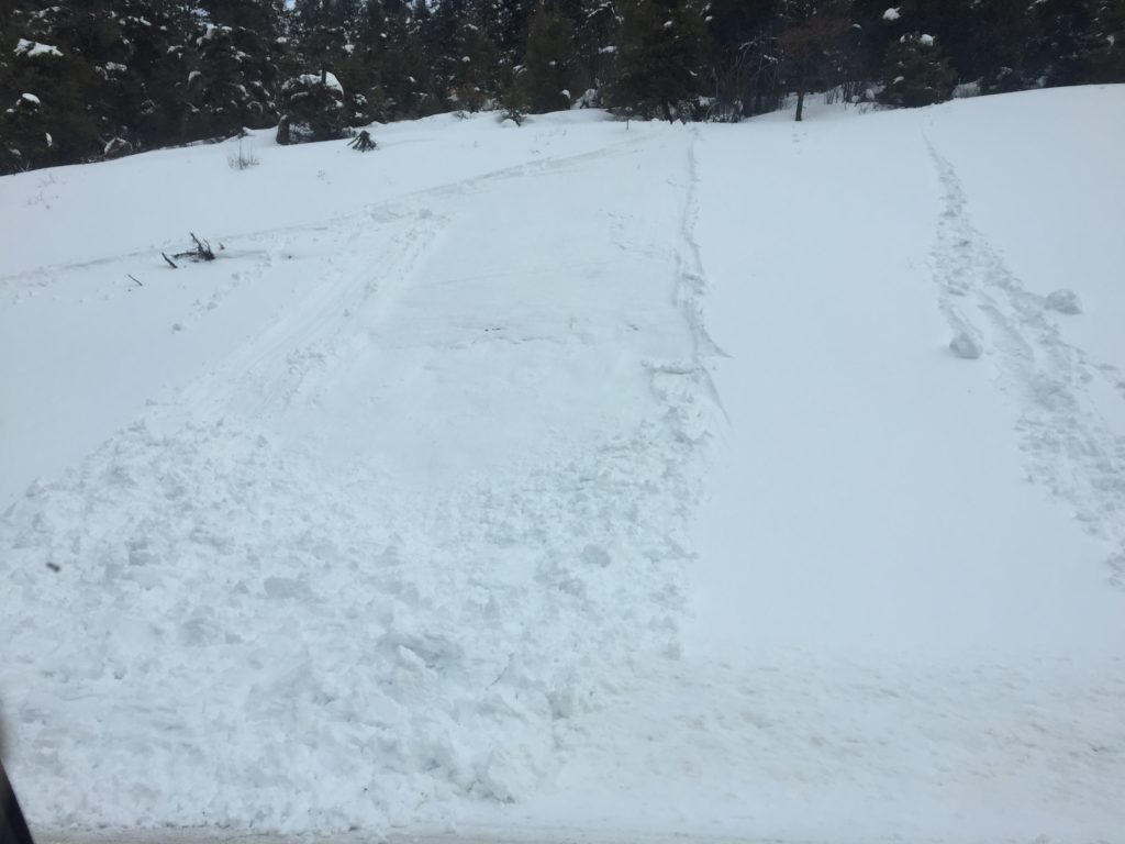
Today, the new snow is a primary avalanche concern. The new snow can be problematic for a multitude of reasons. The first problem is storm slabs. The new snow is bonding well to the old snow surface at most locations and is gaining strength but needs another day or two to fully settle and bond. Secondly, the new snow sluffs easily and creates loose snow avalanches that can be dangerous if terrain traps are present. If the sun comes out and temperatures are mild be aware that small loose wet avalanches may develop later in the day.

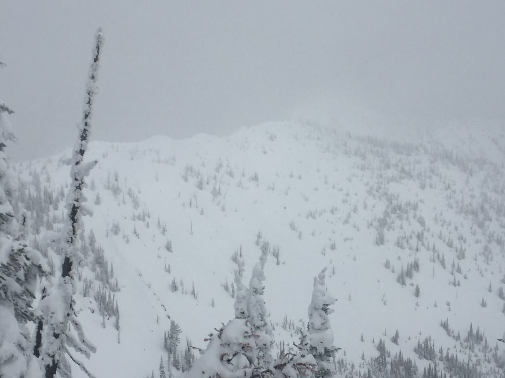
Wind slabs are the second avalanche problem today. Winds have shifted back and forth and come and gone periodically over the last few days. Wind loading can be found on any aspect, but due to the variable nature of the winds, most wind slabs are relatively small and soft slabs. Look for signs of wind loading like rounded pillows of snow and cornices to identify what slopes have been loaded. More significant loading can be found at upper elevations and will have the potential for larger slabs.

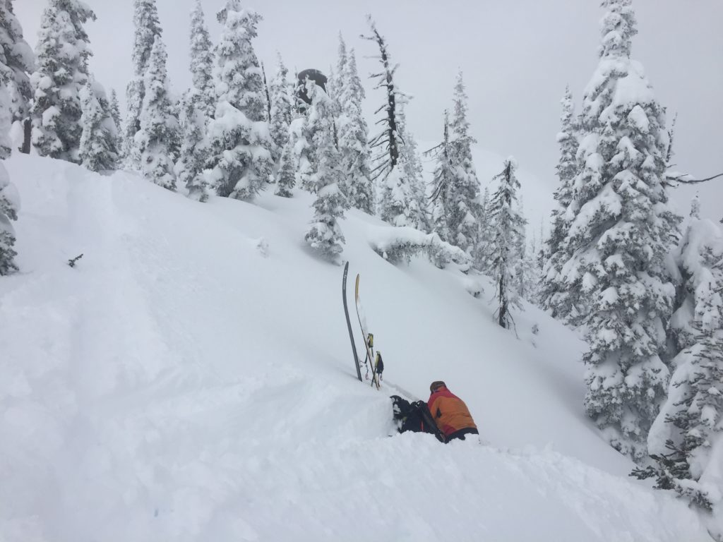
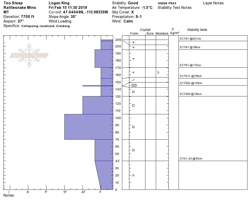
Persistent slabs are still possible in isolated areas and are most prevalent in the southern portion of the advisory area. Facets and buried surface hoar can still be found in the southern Bitterroot. The persistent weak layers are continuing to gain strength slowly. Take a few minutes to dig a pit and perform stability tests to identify if persistent weak layers are present and reactive.

Big Picture: Given our recent weather, loading events and persistent weak layers lingering at some locations, there is plenty of reason to be suspicious of the snowpack. The snow is settling and bonding well but don’t forget to listen to your gut, if you have a feeling there is something you are missing you probably are. The snowpack requires attentive evaluation to gather all the pieces and clues in order to make an informed decision.

Avalanche and Weather Outlook

Today will bring scattered snowfall with accumulations of 1-3 inches at most locations. The caveats are the southern Missions and Swan ranges where more snow is possible today. However, there is a fair bit of uncertainty as to timing and total snowfall for the northern part of the forecast area. Stay aware of changing conditions and continually re-evaluate avalanche hazard throughout the day. A cold front is expected to move into the area tonight and bring increased wind and cold conditions again for Sunday. Avalanche hazard today will remain the same for the majority of the region. You can get the full forecast here.

If you make it out into the backcountry, let us know what you find on our public observations page.

Ski and ride safe.

READ FULL ADVISORY  

Problem 1 - New Snow

  • TYPE

    storm-slabs

    Storm Slabs

    Release of a soft cohesive layer (a slab) of new snow which breaks within the storm snow or on the old snow surface. Storm-slab problems typically last between a few hours and few days. Storm-slabs that form over a persistent weak layer (surface hoar, depth hoar, or near-surface facets) may be termed Persistent Slabs or may develop into Persistent Slabs.

  • SIZE

    2-3

    1 (Small)

    The potential size of avalanche resulting from this problem.

  • LIKELIHOOD

    Likelihood-3

    Possible

    The likelihood of an avalanche resulting from this problem.

New snow is beginning to bond and settle.

Problem 2 - Loose Snow

  • TYPE

    loose-dry

    Loose Dry

    Release of wet unconsolidated snow or slush. These avalanches typically occur within layers of wet snow near the surface of the snowpack, but they may quickly gouge into lower snowpack layers. Like Loose-Dry Avalanches,they start at a point and entrain snow as they move downhill, forming a fan-shaped avalanche. They generally move slowly, but can contain enough mass to cause significant damage to trees, cars or buildings. Other names for loose-wet avalanches include point-release avalanches or sluffs. Loose-wet avalanches can trigger slab avalanches that break into deeper snow layers.

  • SIZE

    1-2

    < 1 (Small)

    The potential size of avalanche resulting from this problem.

  • LIKELIHOOD

    Likelihood-4

    Possible/Likely

    The likelihood of an avalanche resulting from this problem.

Loose dry avalanches are possible today in steep terrain and the potential for loose wet avalanches will develop at some locations.

Problem 3 - Wind Slabs

  • TYPE

    wind-slabs

    Wind Slabs

    Release of a cohesive layer of snow (a slab) formed by the wind.  Wind typically erodes snow from the upwind sides of terrain features and deposits snow on the downwind side.  Wind slabs are often smooth and rounded and sometimes sound hollow, and can range from soft to hard. Wind slabs that form over a persistent weak layer (surface hoar, depth hoar, or near-surface facets) may be termed Persistent Slabs or may develop into Persistent Slabs.

  • SIZE

    2-3

    1 (Small)

    The potential size of avalanche resulting from this problem.

  • LIKELIHOOD

    Likelihood-3

    Possible

    The likelihood of an avalanche resulting from this problem.

Small soft wind slabs are possible on wind loaded terrain.

Problem 4 - Persistent Slabs

  • TYPE

    persistent-slabs

    Persistent Slabs

    Release of a cohesive layer of soft to hard snow (a slab) in the middle to upper snowpack, when the bond to an underlying persistent weak layer breaks.  Persistent layers include: surface hoar, depth hoar, near-surface facets, or faceted snow. Persistent weak layers can continue to produce avalanches for days, weeks or even months, making them especially dangerous and tricky. As additional snow and wind events build a thicker slab on top of the persistent weak layer, this avalanche problem may develop into a Persistent, Deep-Slab.

  • SIZE

    4-5

    2 (Large)

    The potential size of avalanche resulting from this problem.

  • LIKELIHOOD

    Likelihood-2

    Unlikely/Possible

    The likelihood of an avalanche resulting from this problem.

Persistent weak layers are lingering in the snowpack primarily in the southern half of the advisory area.

VIDEO

FORECAST & OUTLOOK

  • Danger Trend

    same

    Same Danger

  • Area Forecast

    Snow

Periods of light snow today and dropping temperatures tonight.

This information is the sole responsibility of the Forest Service and does not apply to operating ski areas. The avalanche danger rating expires at midnight tonight but the information can help you make a more informed decision regarding travel in avalanche terrain for the next few days.

Our advisory area includes National Forest System lands in the Bitterroot Mountains from Lost Trail Pass north to Granite Pass, the Rattlesnake Mountains north of Missoula and the Southern Swan and Mission Mountains near Seeley Lake, MT. Avalanche information for the Lookout Pass/St. Regis Basin area is available from the Idaho Panhandle Avalanche Center.