
The avalanche danger for the West Central Montana backcountry is MODERATE. Natural avalanches are unlikely but human triggered avalanches are possible. With heightened avalanche conditions on specific terrain, carefully evaluate snow and terrain to identify features of concern.
Good morning, this is Logan King with the West Central Montana Avalanche Center’s avalanche advisory for Tuesday, February 19th, 2019. This danger rating does not apply to operating ski areas, expires at midnight tonight and is the sole responsibility of the U.S. Forest Service.
Weather and Snowpack
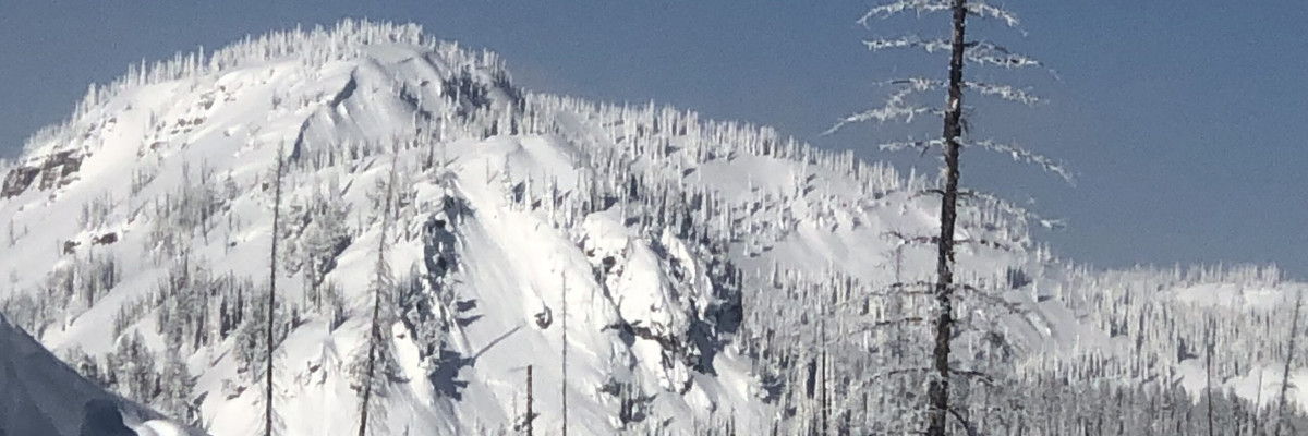
Early this morning mountain temperatures are in the single digits with calm winds. Light snow yesterday brought an additional 1-2 inches of low-density snow and overnight isolated areas received an additional inch. Overall snow accumulation has been minimal and what areas have had flurries had very small increases in SWE, as not much load has been added to the snowpack.
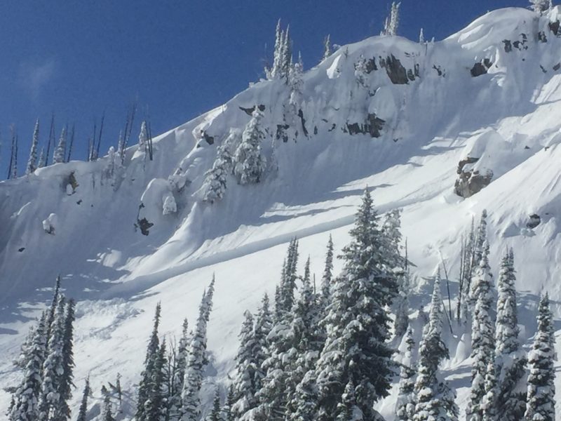
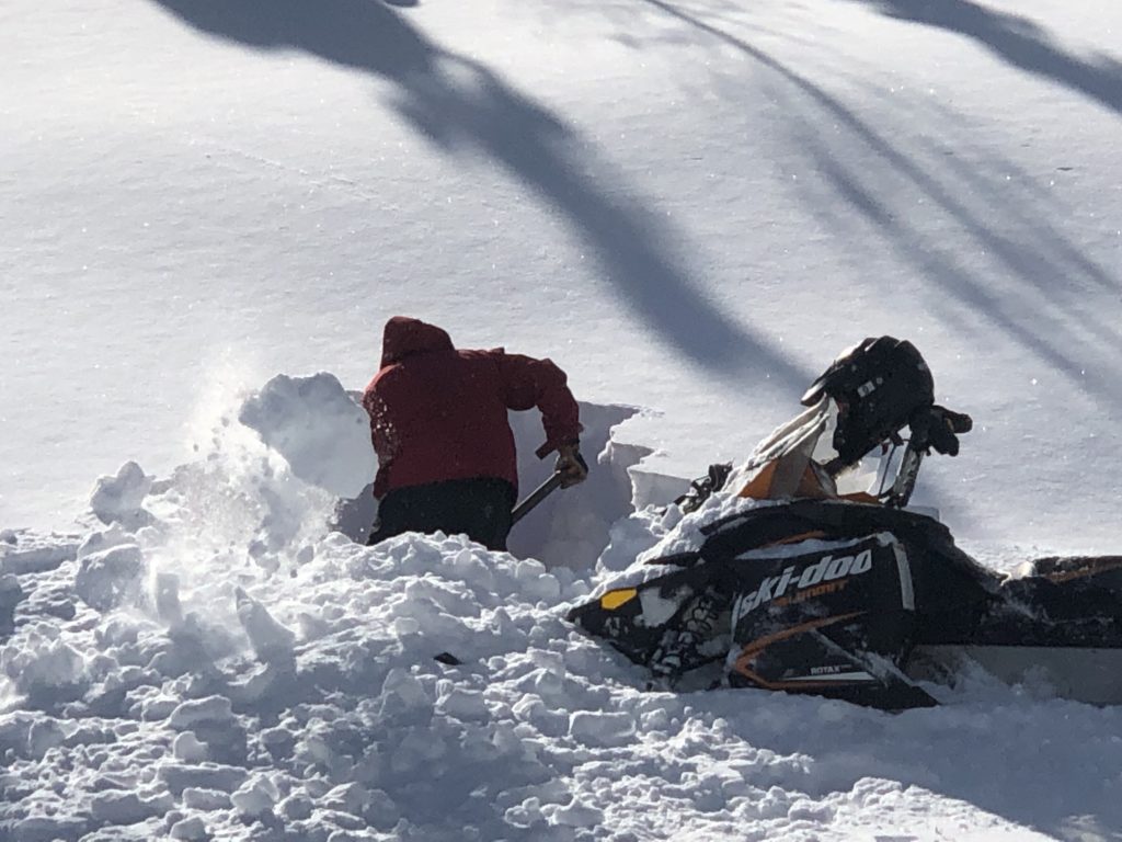
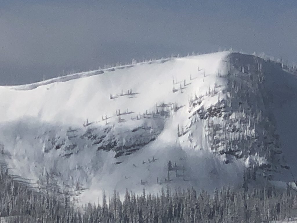
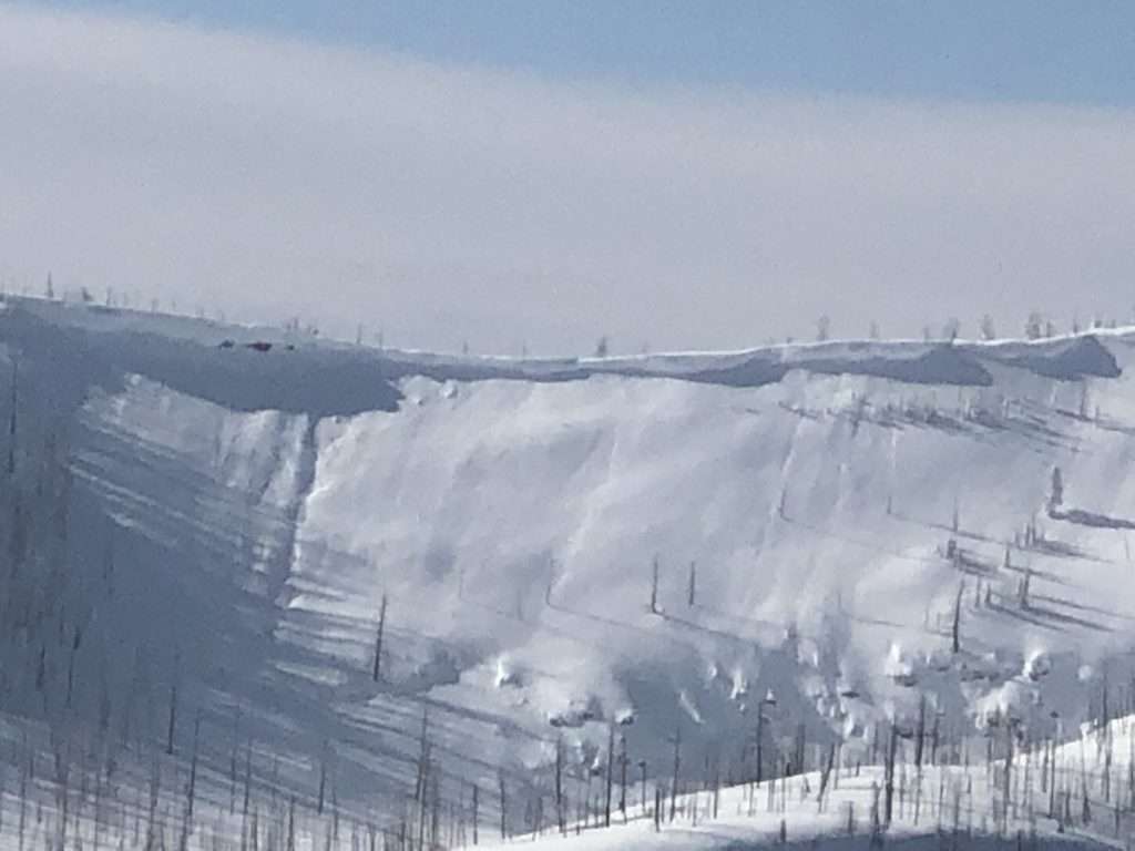
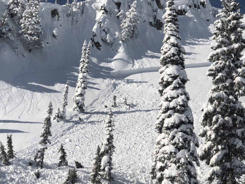
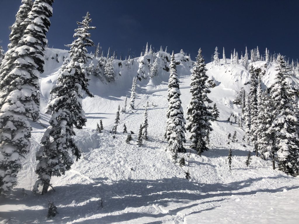
Wind slabs are the first avalanche concern today. Small wind slabs can be found on most aspects near ridges and summits. They are gaining strength but can still be reactive and will continue to pose a notable hazard. Larger wind slabs are possible at some locations under the right conditions. We observed a sizable skier triggered wind slab (video) (pic) and found some wind affected areas had propagations in stability tests. These were occurring in locations where cold storm snow is preserved under a wind slab.
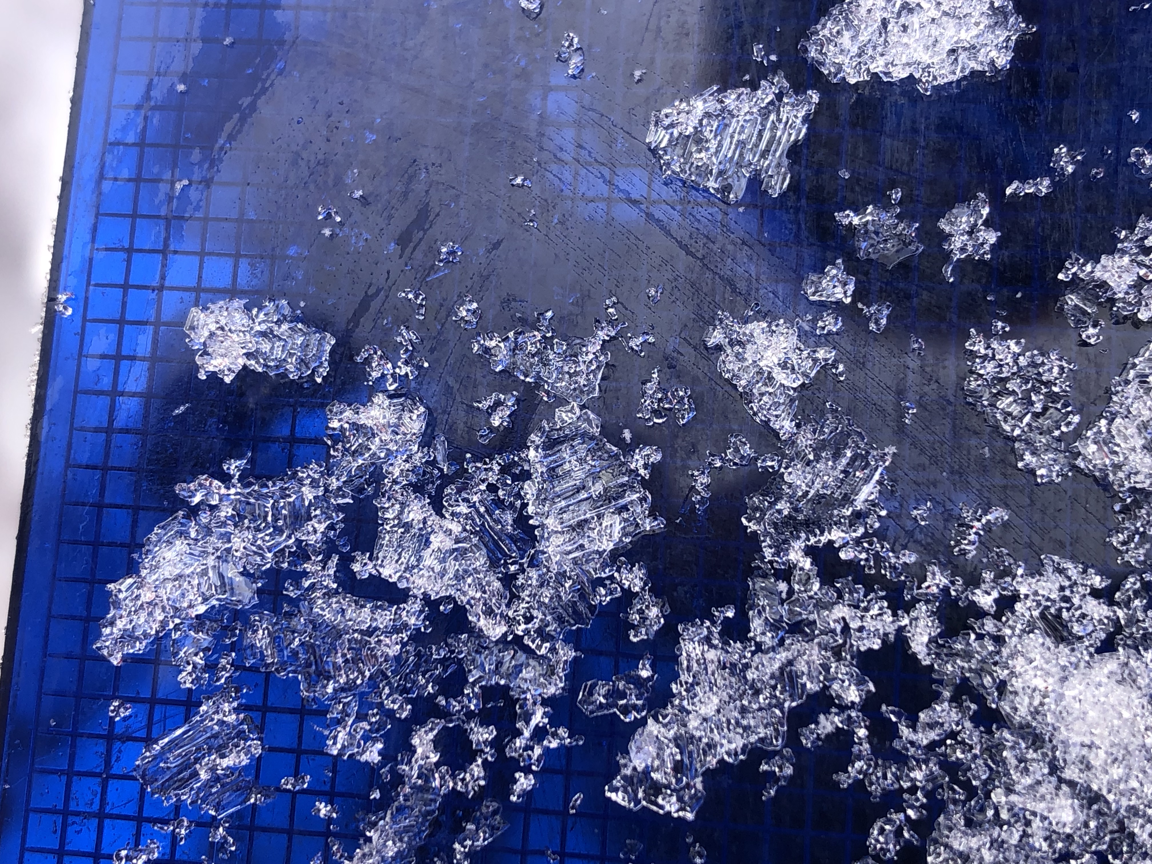
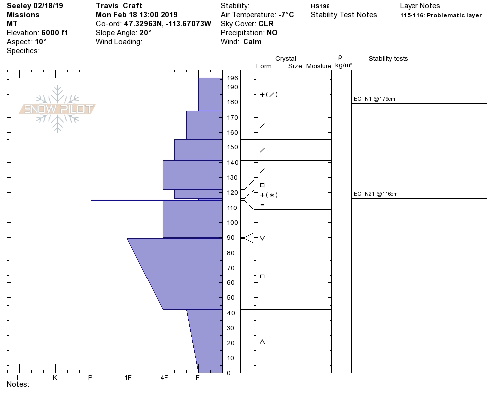
Persistent weak layers can be found throughout the forecast area and some are more prevalent at locations than others. Facets that formed during the earlier cold snap are less reactive but still present and concerning. Buried surface hoar can be found in isolated locations and is less reactive but well preserved and should give you pause (pic). Similarly, faceted snow and depth hoar near the ground is not very reactive, but would result in very large avalanches (video). Although the likelihood of triggering them is low the consequences are very high. Be wary of slopes with persistent weak layers.
Bottom line: Widespread small wind slabs exist, bigger wind slabs are possible in isolated terrain that has the right recipe. Small persistent slabs are possible and very large persistent slabs are unlikely, but not to be trifled with. Determining what problem is the greatest concern on a given slope can be challenging right now. Carefully evaluate the snowpack and perform stability tests to identify what layers are present and reactive before committing to a slope.
Avalanche and Weather Outlook
The weather forecast for today looks to be continued calm and cold. Snowfall will develop tonight but totals are unclear and could be anywhere from 1-7 inches. Winds will also trend up as a weak arctic air mass impacts the region. Avalanche danger will likely increase overnight tonight as areas of surface hoar that formed during the night last night will get buried by the new snow. Cold will persist through the week with multiple rounds of snow.
There has been an increase in public observations lately, which is invaluable to us as forecasters and a great resource for our community. Keep sharing what you are finding.
Ski and Ride Safe.


