Posted:
Feb 26, 2019 @ 6:04 am

An avalanche warning is in effect for backcountry terrain in the Bitterroot mountains from Granite Pass south to Lost Trail Pass and the Rattlesnake Mountains. The current avalanche danger is HIGh. Very dangerous avalanche conditions are present. Travel in avalanche terrain is not recommended today. Avoid runout zones.  Human triggered avalanches are very likely, and natural avalanches are likely. In the southern Missions and southern Swan, the avalanche danger is considerable.

This is Travis Craft with an avalanche warning for Tuesday, February 26, 2019.  This avalanche warning will expire at 6:00 am on February 27, 2019. The warning will either be extended or terminated at that time.

This danger rating does not apply to operating ski areas and is the sole responsibility of the U.S. Forest Service.

Weather and Snowpack

Mountain temperatures range from -3 F to 18 F. In the Bitterroot winds are 9 mph with gusts of 15 mph out of the West. In the northern part of the advisory area, winds are 3 mph and gusting 8 mph out of the NE. Snotels are reporting between .9 and 1 inches of SWE for the last 24 hours.

The storm totals have favored the Bitterroot mountains and the Rattlesnake. Between 12 and 20 inches have fallen in these ranges over the last 24 hours. Very dangerous avalanche conditions are present. Travel in avalanche terrain is not recommended today. Avoid runout zones.  Human triggered avalanches are very likely, and natural avalanches are likely.

The southern Mission and southern Swan ranges have a considerable avalanche danger.

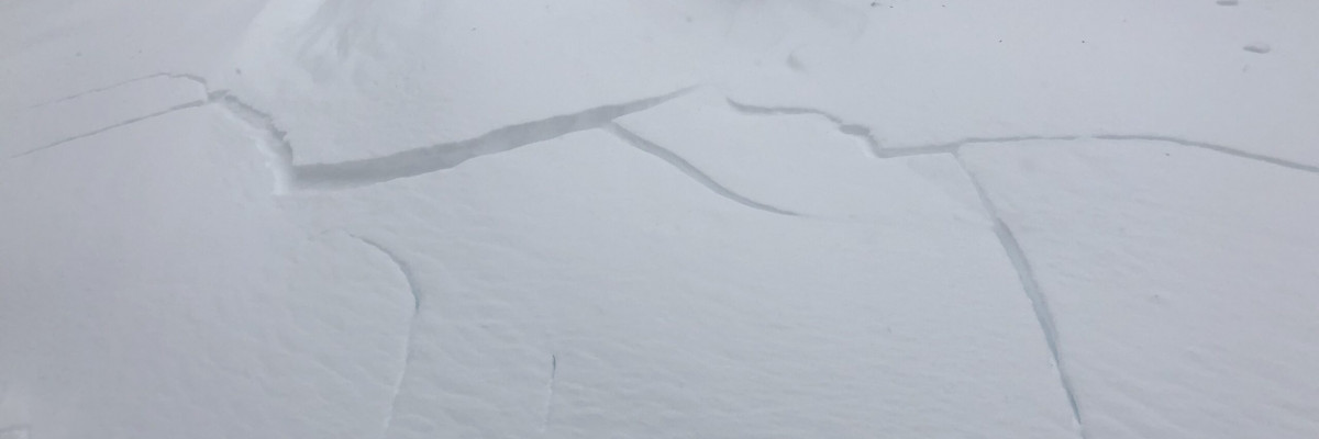
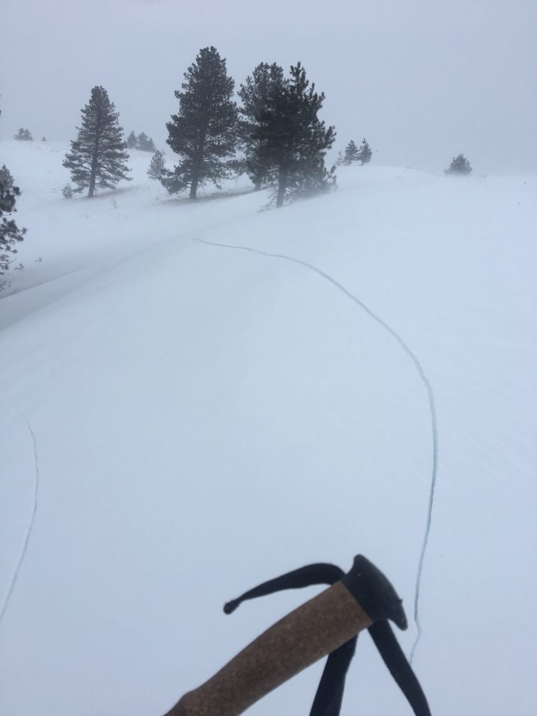
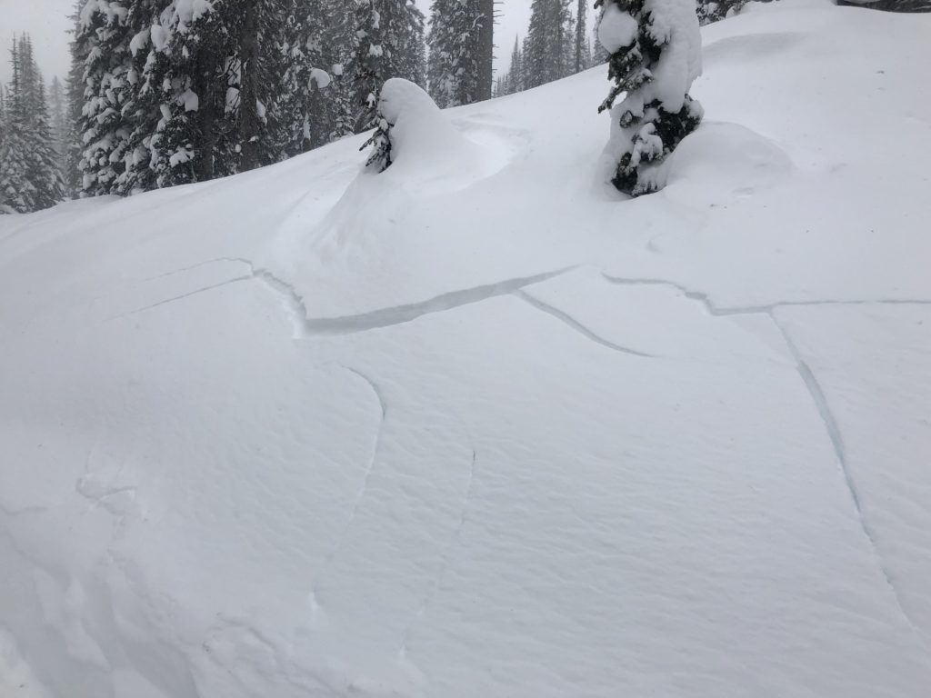
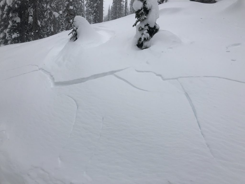
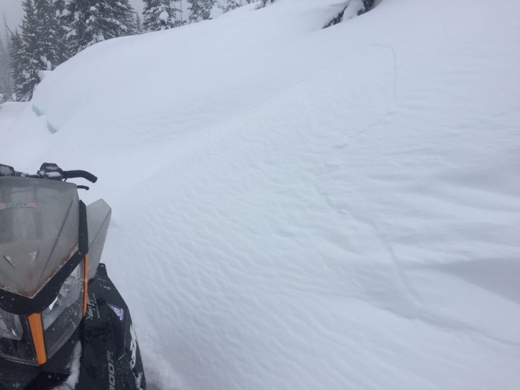
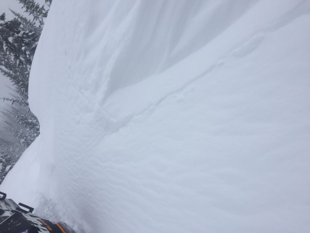
The new snow will take time to bond to old snow surfaces. Winds have created sensitive wind slabs on leeward terrain. The new snow has buried weak layers and is stressing old buried weak layers. Yesterday, we were able to trigger small test slopes very easily and got shooting cracks from our machines and skis on flat ground. We saw natural activity on slopes that had wind drifted snow on them. We have also received reports of shooting cracks that were propagating very long distances.

Avalanche and Weather Outlook

Today light snow accumulations and moderate winds. See the forecast here. The avalanche danger will remain the same.

Please feel free to share any observations on our Public Observations Page.

Ski and Ride Safe.

READ FULL ADVISORY  

Problem 1 - Storm Slabs

  • TYPE

    storm-slabs

    Storm Slabs

    Release of a soft cohesive layer (a slab) of new snow which breaks within the storm snow or on the old snow surface. Storm-slab problems typically last between a few hours and few days. Storm-slabs that form over a persistent weak layer (surface hoar, depth hoar, or near-surface facets) may be termed Persistent Slabs or may develop into Persistent Slabs.

  • SIZE

    5-6

    2-3 (Large)

    The potential size of avalanche resulting from this problem.

  • LIKELIHOOD

    Likelihood-7

    Very Likely

    The likelihood of an avalanche resulting from this problem.

Storm totals are 12-30 inches in the Bitterroot and Rattlesnake Mountains.

Problem 2 - Wind Slabs

  • TYPE

    wind-slabs

    Wind Slabs

    Release of a cohesive layer of snow (a slab) formed by the wind.  Wind typically erodes snow from the upwind sides of terrain features and deposits snow on the downwind side.  Wind slabs are often smooth and rounded and sometimes sound hollow, and can range from soft to hard. Wind slabs that form over a persistent weak layer (surface hoar, depth hoar, or near-surface facets) may be termed Persistent Slabs or may develop into Persistent Slabs.

  • SIZE

    5-6

    2-3 (Large)

    The potential size of avalanche resulting from this problem.

  • LIKELIHOOD

    Likelihood-7

    Very Likely

    The likelihood of an avalanche resulting from this problem.

Moderate to strong winds have loaded leeward slopes.

Problem 3 - Persistent Slabs

  • TYPE

    persistent-slabs

    Persistent Slabs

    Release of a cohesive layer of soft to hard snow (a slab) in the middle to upper snowpack, when the bond to an underlying persistent weak layer breaks.  Persistent layers include: surface hoar, depth hoar, near-surface facets, or faceted snow. Persistent weak layers can continue to produce avalanches for days, weeks or even months, making them especially dangerous and tricky. As additional snow and wind events build a thicker slab on top of the persistent weak layer, this avalanche problem may develop into a Persistent, Deep-Slab.

  • SIZE

    6-7

    3 (Large-Very Large)

    The potential size of avalanche resulting from this problem.

  • LIKELIHOOD

    Likelihood-5

    Likely

    The likelihood of an avalanche resulting from this problem.

Freshly buried surface hoar and older surface hoar will be under significant stress from the new load of snow and will be touchy.

VIDEO

Observations

Observations

FORECAST & OUTLOOK

  • Danger Trend

    same

    Same Danger

  • Area Forecast

    Wind

Light snow today and moderate wind.

This information is the sole responsibility of the Forest Service and does not apply to operating ski areas. The avalanche danger rating expires at midnight tonight but the information can help you make a more informed decision regarding travel in avalanche terrain for the next few days.

Our advisory area includes National Forest System lands in the Bitterroot Mountains from Lost Trail Pass north to Granite Pass, the Rattlesnake Mountains north of Missoula and the Southern Swan and Mission Mountains near Seeley Lake, MT. Avalanche information for the Lookout Pass/St. Regis Basin area is available from the Idaho Panhandle Avalanche Center.