
The avalanche danger for the west central Montana backcountry is CONSIDERABLE. Dangerous avalanche conditions are present in our forecast area. Identify wind loaded slopes and avoid traveling on or under them. Human triggered avalanches are likely today, and natural avalanches are possible. Careful snowpack evaluation, cautious route-finding, and conservative-decision making are essential today.
Good morning, this is Travis Craft with the West Central Montana Avalanche Center’s avalanche advisory for February 28, 2019. This danger rating does not apply to operating ski areas, expires at midnight tonight and is the sole responsibility of the U.S. Forest Service.
Weather and Snowpack
Mountain temperatures range from 18 F to 30 F. In the Bitterroot winds are 10 mph with gusts of 15 mph out of the SSE. In the northern part of the advisory area, winds are 5 mph and gusting 7 mph out of the NE. Snotels are reporting between .4 and .9 inches of SWE for the last 24 hours.
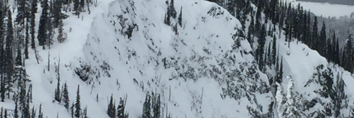
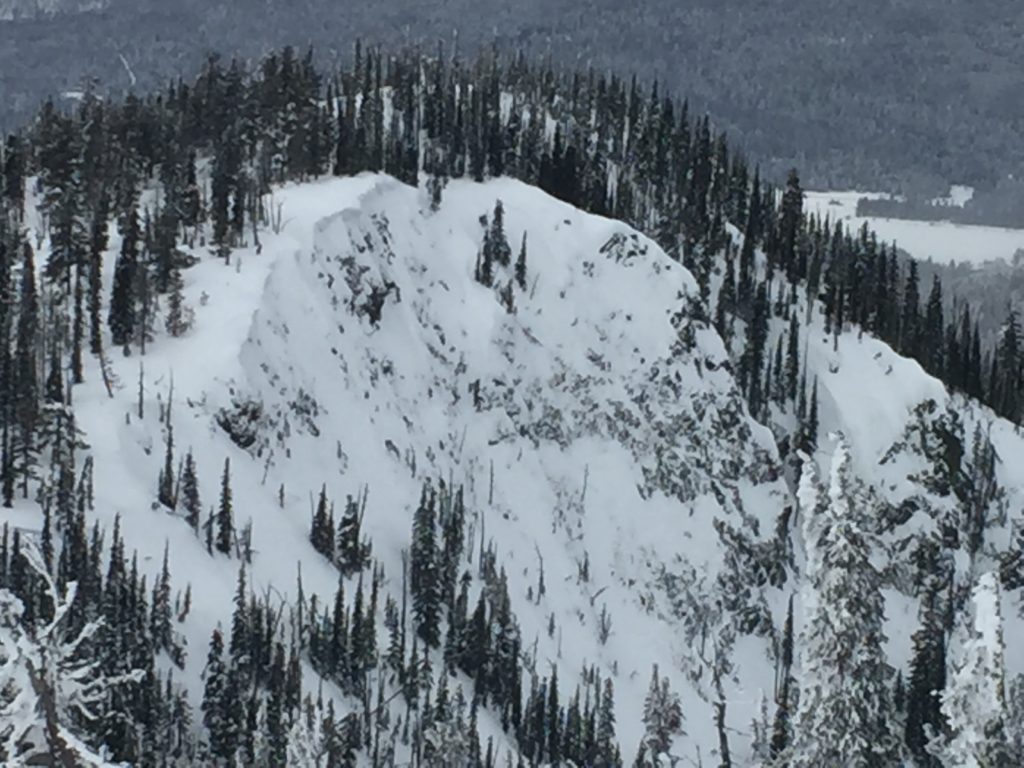
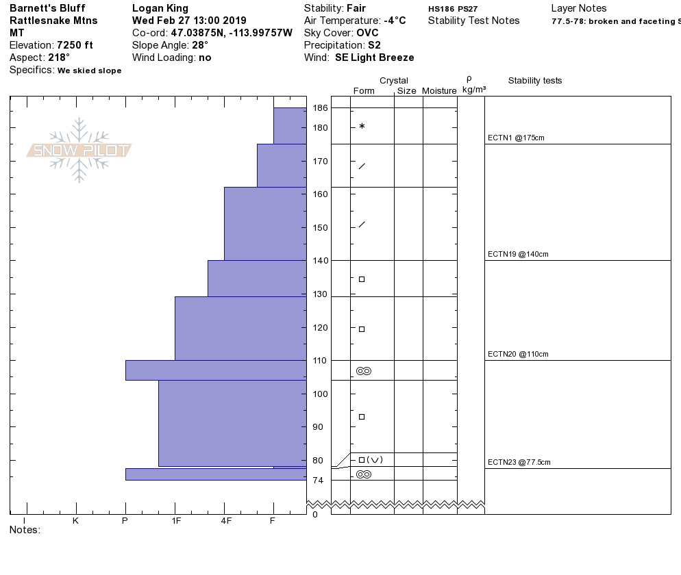
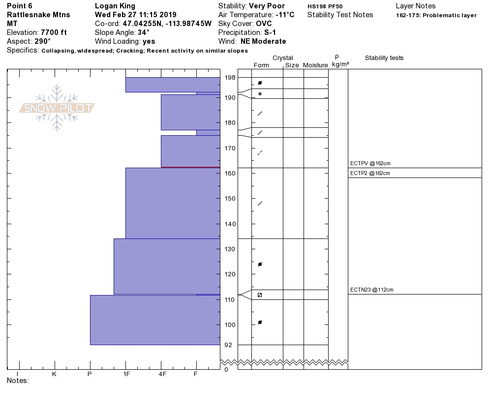
The southern Missions, southern Swans, and Rattlesnake mountains primary avalanche problem is wind slabs. Yesterday, we got easy propagations in pit tests on wind drifted terrain(video). Natural avalanches released in the last 24 hours. Look for wind slabs on cross-loaded slopes and ridges. Pay attention to slopes at low and mid elevations which have been wind loaded. Identify these slopes and avoid traveling on them. These slabs will be sensitive to human triggers today.
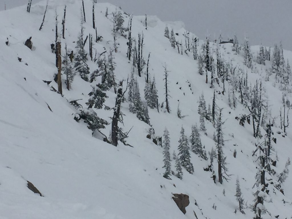
The primary avalanche problem in the central and southern Bitterroot is new snow. Look for large loose snow avalanches and storm slabs. Use small test slopes with low consequences to see how the new snow is bonding to old snow surfaces. The sluffs are very big and in steep terrain could be a problem especially if it takes you into a terrain trap(cliffs, rock bands or trees).
The second avalanche problem for the forecast area is persistent slabs. The storm dropped a significant load of snow on our buried weak layers. These layers are guilty until proven innocent. Dig a pit that is 4 feet down and see if buried surface hoar is present and reactive. Look for shooting cracks, natural activity, and collapses; these are clues to instabilities in the snowpack.
Bottom line: Dangerous avalanche conditions exist today. Avoid traveling on and under wind loaded slopes. New snow will be sensitive to human triggers. Use test slopes and lower angle terrain to check the bonding of new snow to old snow surfaces. Pay attention to changing conditions and look for red flags(shooting cracks, natural avalanche activity, collapsing, and new loading). Dig a pit 4 feet down to check for the dragons lurking(weak layers) in our snowpack.
Avalanche and Weather Outlook
Light snow showers and strong winds today. See the forecast here. This weather will increase the avalanche danger by loading leeward terrain.
As always, if you make it out, please, feel free to share, what you find on our public observations page.
Ski and ride safe.


