Posted:
Mar 2, 2019 @ 6:33 am

The avalanche danger is CONSIDERABLE for the west central Montana backcountry on wind loaded slopes. Strong winds and significant snow are creating dangerous avalanche conditions, making human-triggered avalanches likely on leeward slopes. All other slopes the danger is MODERATE. Careful snowpack evaluation, cautious route-finding, and conservative decision-making are essential for travel in the backcountry today.

Good morning, this is Travis Craft with the West Central Montana Avalanche Center’s avalanche advisory for March 02, 2019. This danger rating does not apply to operating ski areas, expires at midnight tonight and is the sole responsibility of the U.S. Forest Service.

Weather and Snowpack

Mountain temperatures range from -10 F to 20 F in the region. In the Bitterroot winds are 1 mph with gusts of 7 mph out of the WNW.  In the northern part of the advisory area, winds are reading 9 mph with gusts of 24 mph out of the ENE. The forecast area received 1 to 4 inches of new snow in the last 24 hours.

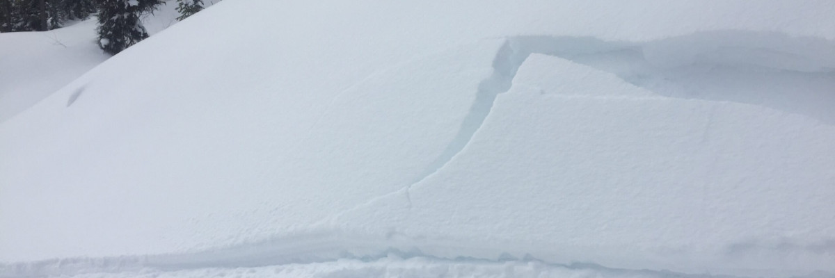
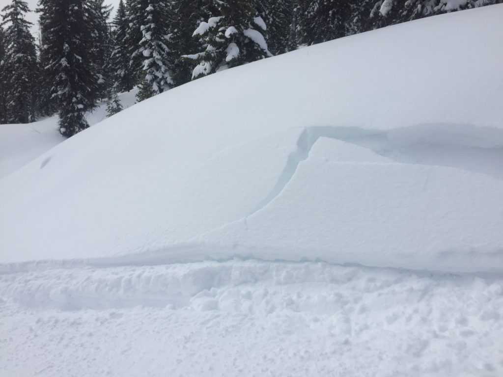
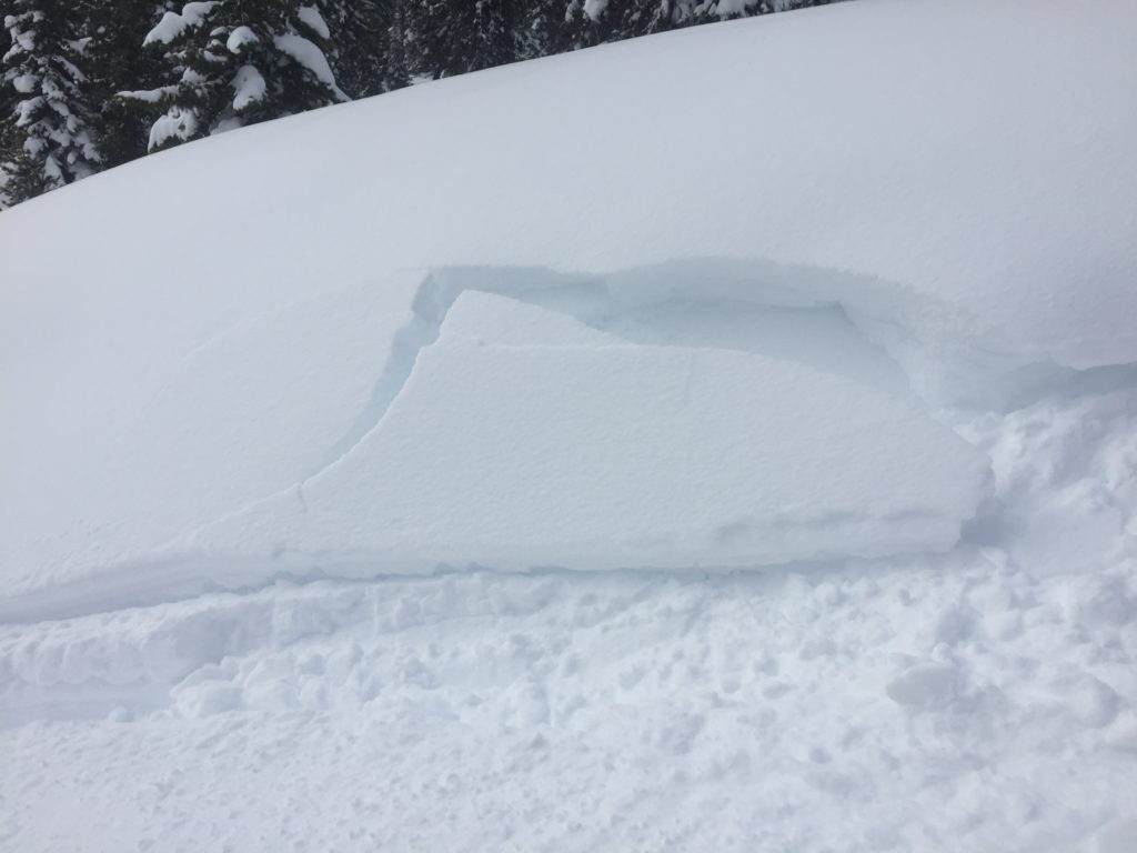
The primary avalanche problem is wind drifted snow. Leeward terrain wind loaded overnight. Look for shooting cracks from skis or machine to identify instabilities. Look for rounded pillows of snow near ridges and on cross-loaded slopes. Pay attention to slopes at low and mid elevations which have been wind loaded. Identify these slopes and avoid traveling on them. Recognize signs of instability such as cracking in the surface snow. It is possible to cause a slab avalanche on wind loaded terrain today.

The secondary avalanche problem is new snow. Look for large loose snow avalanches and storm slabs. Use small test slopes with low consequences to see how the new snow is bonding to old snow surfaces. The sluffs are very big and in steep terrain could be a problem especially if it takes you into a terrain trap(cliffs, rock bands or trees).

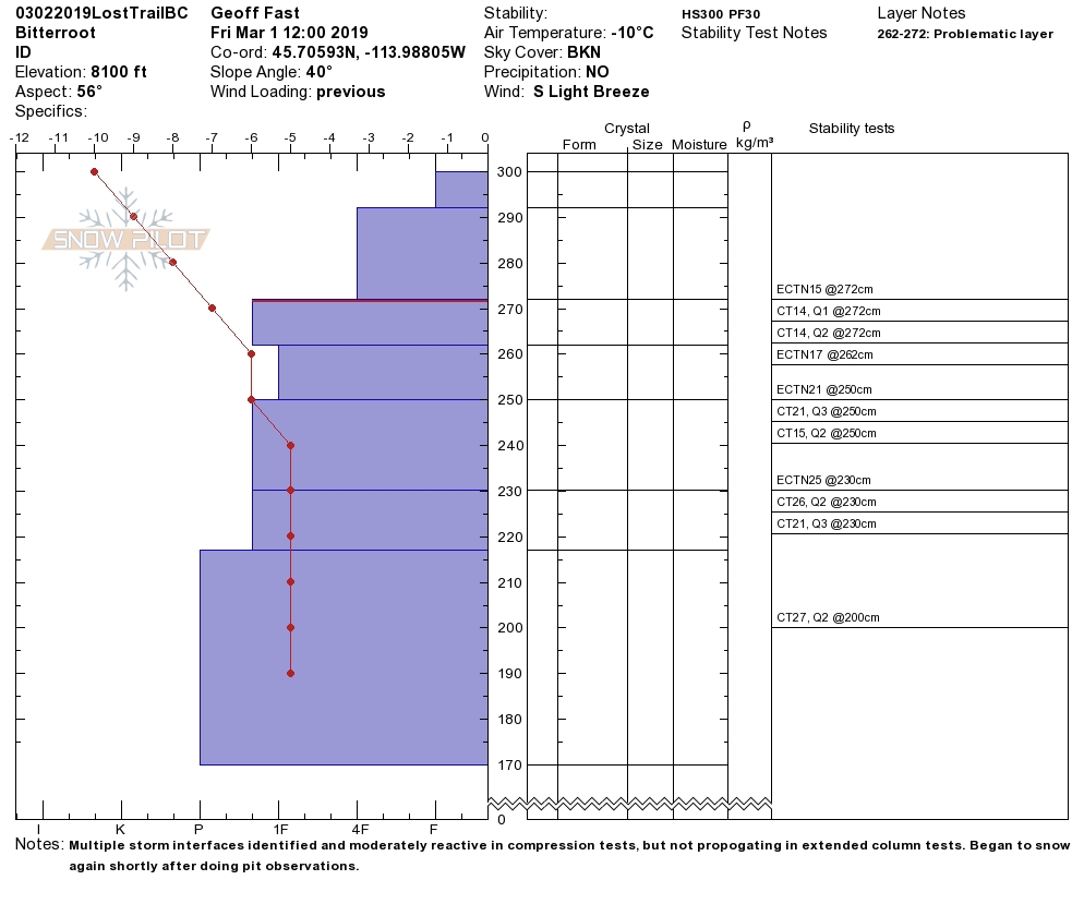
Bottom line: Avoid wind loaded slopes today. Use test slopes to see how the new snow is bonding to old snow surfaces. Dig a pit 4 feet down and check for any buried weak layers.

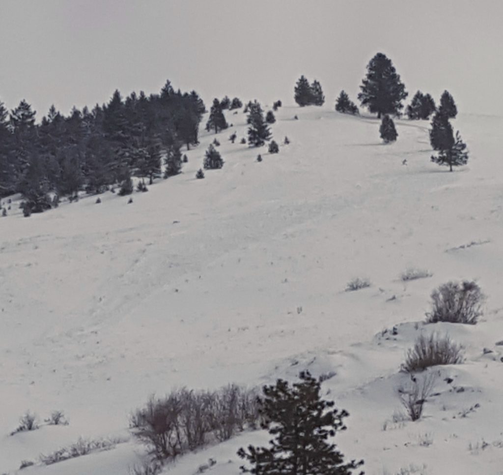
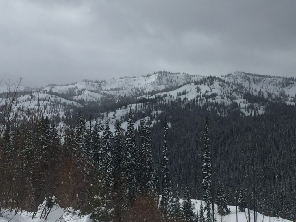
Missoula Foot Hills/Mt. Jumbo/Mt. Sentinel

There are slopes around town people are skiing. Respect closures on Mt. Jumbo. There are unstable conditions present on certain slopes. Take extra caution to what is below you and if you were to trigger an avalanche what are the consequences.

Avalanche and Weather Outlook

Strong winds and cold temperatures will continue through the weekend. Look for the avalanche danger to remain the same. See the forecast here.

As always, if you make it out, please, feel free to share, what you find on our public observations page.

Ski and ride safe.


READ FULL ADVISORY  

Problem 1 - Wind Drifted Snow

  • TYPE

    wind-slabs

    Wind Slabs

    Release of a cohesive layer of snow (a slab) formed by the wind.  Wind typically erodes snow from the upwind sides of terrain features and deposits snow on the downwind side.  Wind slabs are often smooth and rounded and sometimes sound hollow, and can range from soft to hard. Wind slabs that form over a persistent weak layer (surface hoar, depth hoar, or near-surface facets) may be termed Persistent Slabs or may develop into Persistent Slabs.

  • SIZE

    4-5

    2 (Large)

    The potential size of avalanche resulting from this problem.

  • LIKELIHOOD

    Likelihood-5

    Likely

    The likelihood of an avalanche resulting from this problem.

Leeward terrain wind loaded overnight. Look for shooting cracks from skis or machine to identify instabilities. Look for rounded pillows of snow near ridges and on cross-loaded slopes. Pay attention to slopes at low and mid elevations which have been wind loaded. Identify these slopes and avoid traveling on them. Recognize signs of instability such as cracking in the surface snow. It is possible to cause a slab avalanche on wind loaded terrain today.

Problem 2 - New Snow

  • TYPE

    storm-slabs

    Storm Slabs

    Release of a soft cohesive layer (a slab) of new snow which breaks within the storm snow or on the old snow surface. Storm-slab problems typically last between a few hours and few days. Storm-slabs that form over a persistent weak layer (surface hoar, depth hoar, or near-surface facets) may be termed Persistent Slabs or may develop into Persistent Slabs.

  • SIZE

    3-4

    1-2 (Small-Large)

    The potential size of avalanche resulting from this problem.

  • LIKELIHOOD

    Likelihood-3

    Possible

    The likelihood of an avalanche resulting from this problem.

Look for large loose snow avalanches and storm slabs. Use small test slopes with low consequences to see how the new snow is bonding to old snow surfaces. The sluffs are very big and in steep terrain could be a problem especially if it takes you into a terrain trap(cliffs, rock bands or trees).

VIDEO

Observations

Observations

FORECAST & OUTLOOK

Strong winds and cold temperatures will continue through the weekend. Look for the avalanche danger to remain the same. See the forecast here.


This information is the sole responsibility of the Forest Service and does not apply to operating ski areas. The avalanche danger rating expires at midnight tonight but the information can help you make a more informed decision regarding travel in avalanche terrain for the next few days.

Our advisory area includes National Forest System lands in the Bitterroot Mountains from Lost Trail Pass north to Granite Pass, the Rattlesnake Mountains north of Missoula and the Southern Swan and Mission Mountains near Seeley Lake, MT. Avalanche information for the Lookout Pass/St. Regis Basin area is available from the Idaho Panhandle Avalanche Center.