Posted:
Mar 19, 2019 @ 6:24 am

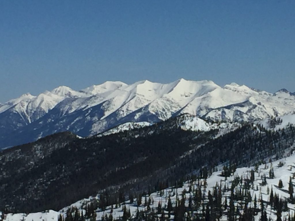
A MODERATE avalanche danger exists for the West Central Montana backcountry. Widespread loose wet avalanches can be expected later in the day and isolated hazards can be found in specific terrain. Evaluate slopes and the snow carefully to identify features of concern.

Good morning, this is Logan King with the West Central Montana Avalanche Center’s avalanche advisory for Tuesday, March 19th, 2019. This danger rating does not apply to operating ski areas, expires at midnight tonight and is the sole responsibility of the U.S. Forest Service.

Weather and Snowpack

The weather continues to go through a daily freeze-thaw cycle with temperatures warming to the 40’s during the day an then dropping below freezing and into the 20’s at night. However, Stuart Mountain snotel last night did not drop below freezing and could create some interesting conditions today. Mountain temperatures as of 5 am this morning are in the twenties at all other locations. Winds are light from the NE in the northern portion of the advisory area and the SE further south. Most locations have not received snow for the past few days but a stray dusting can be found in isolated locations.

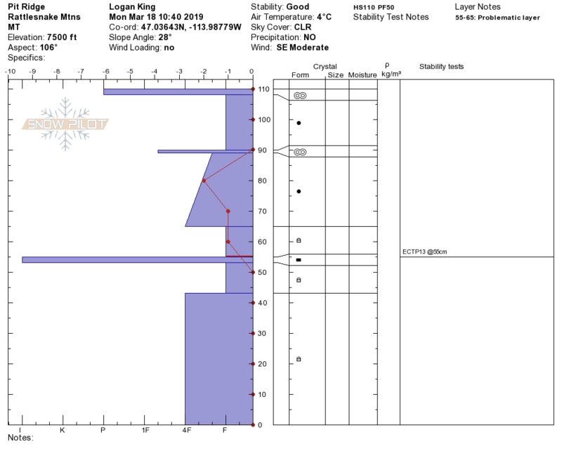
Persistent weak layers continue to round and gain strength but can be problematic in isolated locations. In areas with a shallow snowpack and near rocky terrain, facets near the bottom of the snowpack continue to easily propagate in stability tests (profile)(video). This is a very isolated problem and won’t be found everywhere but will produce large avalanches. Due to the minimal distribution but high consequence nature of this layer it warrants taking a minute to dig a pit to check the total snow depth and if the weak layers are present and reactive.

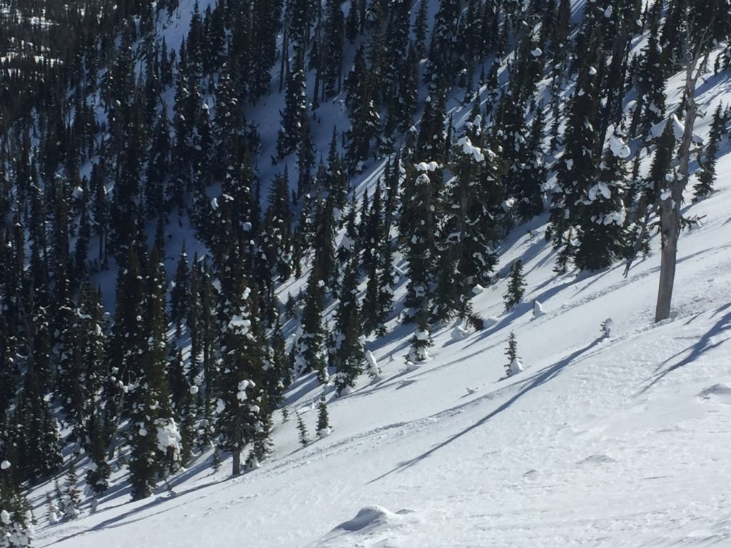
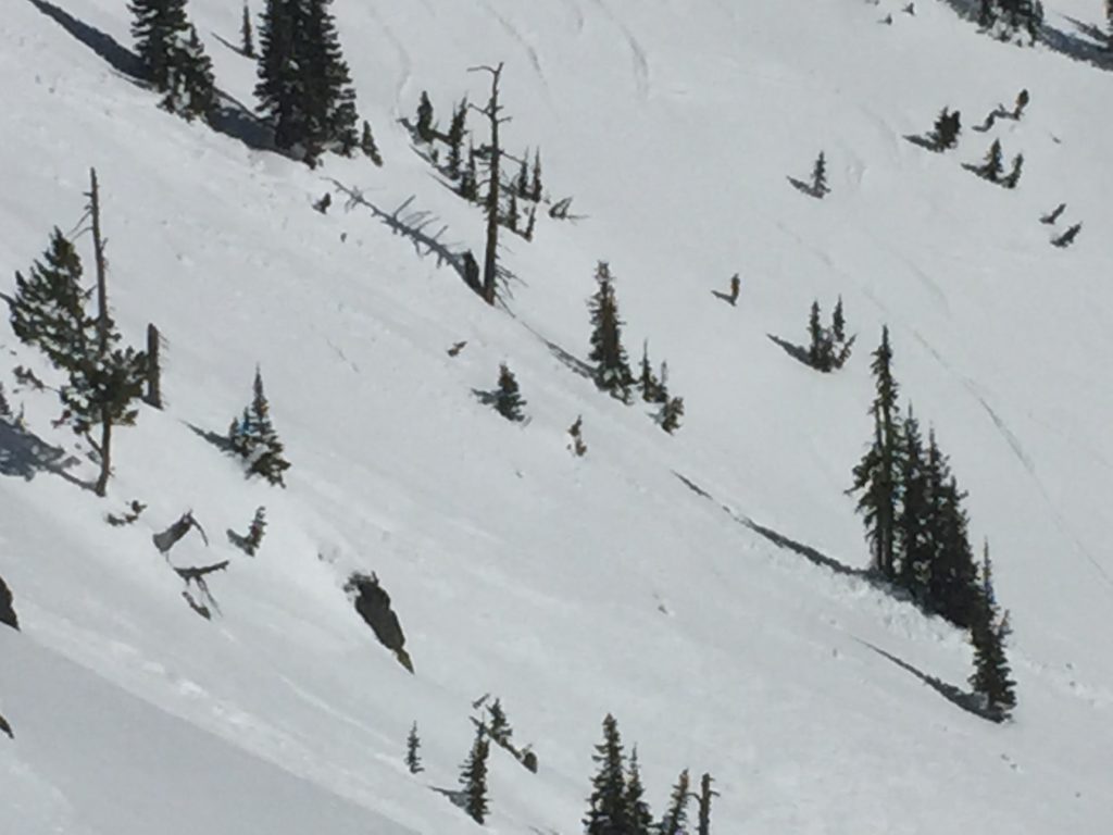
Widespread loose wet activity can be expected on terrain that is exposed to direct sunlight with activity peaking in the afternoon. Small loose wet sluffs have consistently been observed for the past few days on solar aspects with some isolated larger slides from steep rocky terrain. Although mostly small remember that even a small slide can knock you over and take you for a dangerous ride if terrain traps are present. Carefully consider the consequences of even a small slide before committing to steep terrain. Warm temperatures are also causing cornices to lose strength. A handful of natural cornice failures have been observed over the past week and will become more problematic with warm and sunny days expected this week. Give cornices a wide berth as they tend to break back farther than expected and avoid traveling below them later in the day.

In shaded and north facing terrain cold snow can still be found above 7,000 feet. In the cold snow, pockets of wind drifted snow will be the greatest concern. Look for signs of wind loading in the softer snow and avoid likely trigger points like rollovers and just below ridges. Much like the persistent weak layers this problem is isolated and won’t be found everywhere but should be considered before committing to avalanche terrain.

Avalanche and Weather Outlook

The forecast for the week calls for slightly warmer temperatures each day with clear skies as high pressure dominates the region. The avalanche danger will remain the same until a shift occurs in the weather which looks to develop sometime this weekend.

If you get out into the backcountry, please share your observations on our public observation page.

Ski and ride safe.

READ FULL ADVISORY  

Problem 1 - Persistent Slabs

  • TYPE

    persistent-slabs

    Persistent Slabs

    Release of a cohesive layer of soft to hard snow (a slab) in the middle to upper snowpack, when the bond to an underlying persistent weak layer breaks.  Persistent layers include: surface hoar, depth hoar, near-surface facets, or faceted snow. Persistent weak layers can continue to produce avalanches for days, weeks or even months, making them especially dangerous and tricky. As additional snow and wind events build a thicker slab on top of the persistent weak layer, this avalanche problem may develop into a Persistent, Deep-Slab.

  • SIZE

    4-5

    2 (Large)

    The potential size of avalanche resulting from this problem.

  • LIKELIHOOD

    Likelihood-2

    Unlikely/Possible

    The likelihood of an avalanche resulting from this problem.

  • IMAGE

Very isolated locations with shallow snow have faceted weak snow near the ground that easily propagates in stability tests. The likelihood of finding this problem is relatively low but the consequences are high, so carefully evaluate the snowpack to identify if persistent weak layers are present and reactive.

Problem 2 - Wind drifted snow

  • TYPE

    wind-slabs

    Wind Slabs

    Release of a cohesive layer of snow (a slab) formed by the wind.  Wind typically erodes snow from the upwind sides of terrain features and deposits snow on the downwind side.  Wind slabs are often smooth and rounded and sometimes sound hollow, and can range from soft to hard. Wind slabs that form over a persistent weak layer (surface hoar, depth hoar, or near-surface facets) may be termed Persistent Slabs or may develop into Persistent Slabs.

  • SIZE

    3-4

    1-2 (Small-Large)

    The potential size of avalanche resulting from this problem.

  • LIKELIHOOD

    Likelihood-2

    Unlikely/Possible

    The likelihood of an avalanche resulting from this problem.

  • ADDED DANGER

    Increased Slope Danger

    Increased/Added Danger

    There is an increased risk of avalanches on these slopes:

    N - North
    NE - Northeast
    NW - Northwest

Above 7,000 feet in sheltered areas that have cold snow pockets of wind drifted snow can be reactive near ridges and on roll overs.

Problem 3 - Loose Wet

  • TYPE

    loose-wet

    Loose Wet

    Release of wet unconsolidated snow or slush. These avalanches typically occur within layers of wet snow near the surface of the snowpack, but they may quickly gouge into lower snowpack layers. Like Loose-Dry Avalanches,they start at a point and entrain snow as they move downhill, forming a fan-shaped avalanche. They generally move slowly, but can contain enough mass to cause significant damage to trees, cars or buildings. Other names for loose-wet avalanches include point-release avalanches or sluffs. Loose-wet avalanches can trigger slab avalanches that break into deeper snow layers.

  • SIZE

    1-2

    < 1 (Small)

    The potential size of avalanche resulting from this problem.

  • LIKELIHOOD

    Likelihood-5

    Likely

    The likelihood of an avalanche resulting from this problem.

  • ADDED DANGER

    Increased Slope Danger

    Increased/Added Danger

    There is an increased risk of avalanches on these slopes:

    E - East
    SE - Southeast
    S - South
    SW - Southwest
    W - West

  • IMAGE

Loose wet avalanches are likely to increase through the day with more sizable slides possible in steep and extreme terrain.

VIDEO

FORECAST & OUTLOOK

Clear and warm conditions will continue today.

This information is the sole responsibility of the Forest Service and does not apply to operating ski areas. The avalanche danger rating expires at midnight tonight but the information can help you make a more informed decision regarding travel in avalanche terrain for the next few days.

Our advisory area includes National Forest System lands in the Bitterroot Mountains from Lost Trail Pass north to Granite Pass, the Rattlesnake Mountains north of Missoula and the Southern Swan and Mission Mountains near Seeley Lake, MT. Avalanche information for the Lookout Pass/St. Regis Basin area is available from the Idaho Panhandle Avalanche Center.