Posted:
Mar 21, 2019 @ 6:13 am

The avalanche danger for the West Central Montana backcountry remains MODERATE. Small loose wet avalanches are likely on sun-exposed terrain with potential for larger slides in extreme terrain. Larger dry avalanches are possible in isolated terrain and warrant careful evaluation of the snowpack before committing to avalanche terrain.

Good morning, this is Logan King with the West Central Montana Avalanche Center’s avalanche advisory for Thursday, March 21st, 2019. This danger rating does not apply to operating ski areas, expires at midnight tonight and is the sole responsibility of the U.S. Forest Service.

Weather and Snowpack

Mountain temperatures again this morning at most locations are just below freezing. No new snow has been seen for nearly a week and winds are light out of the E in the northern portion of the forecast area. Stronger winds can be found in the Southern Bitterroot from the SSE at 12 mph with gusts up to 17 mph.

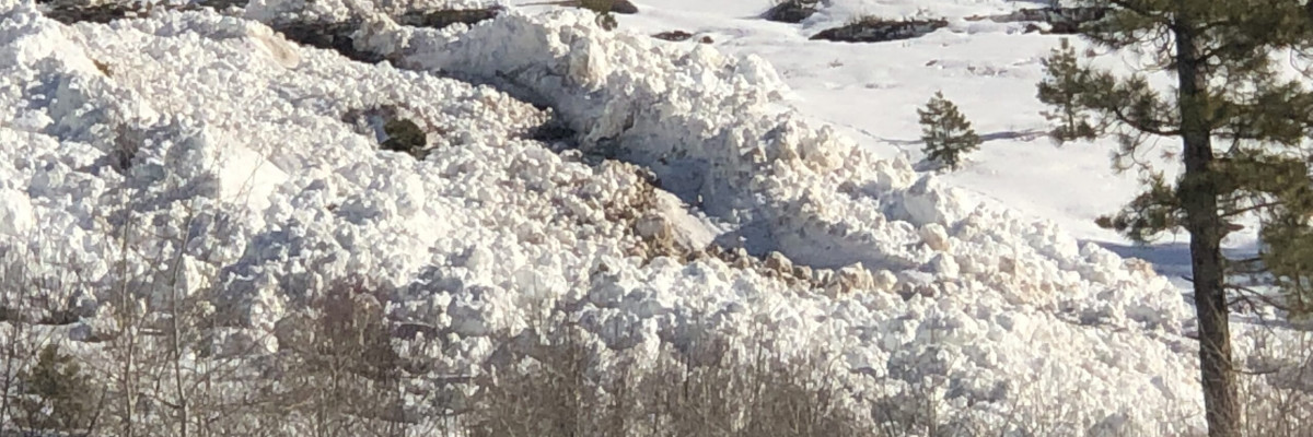
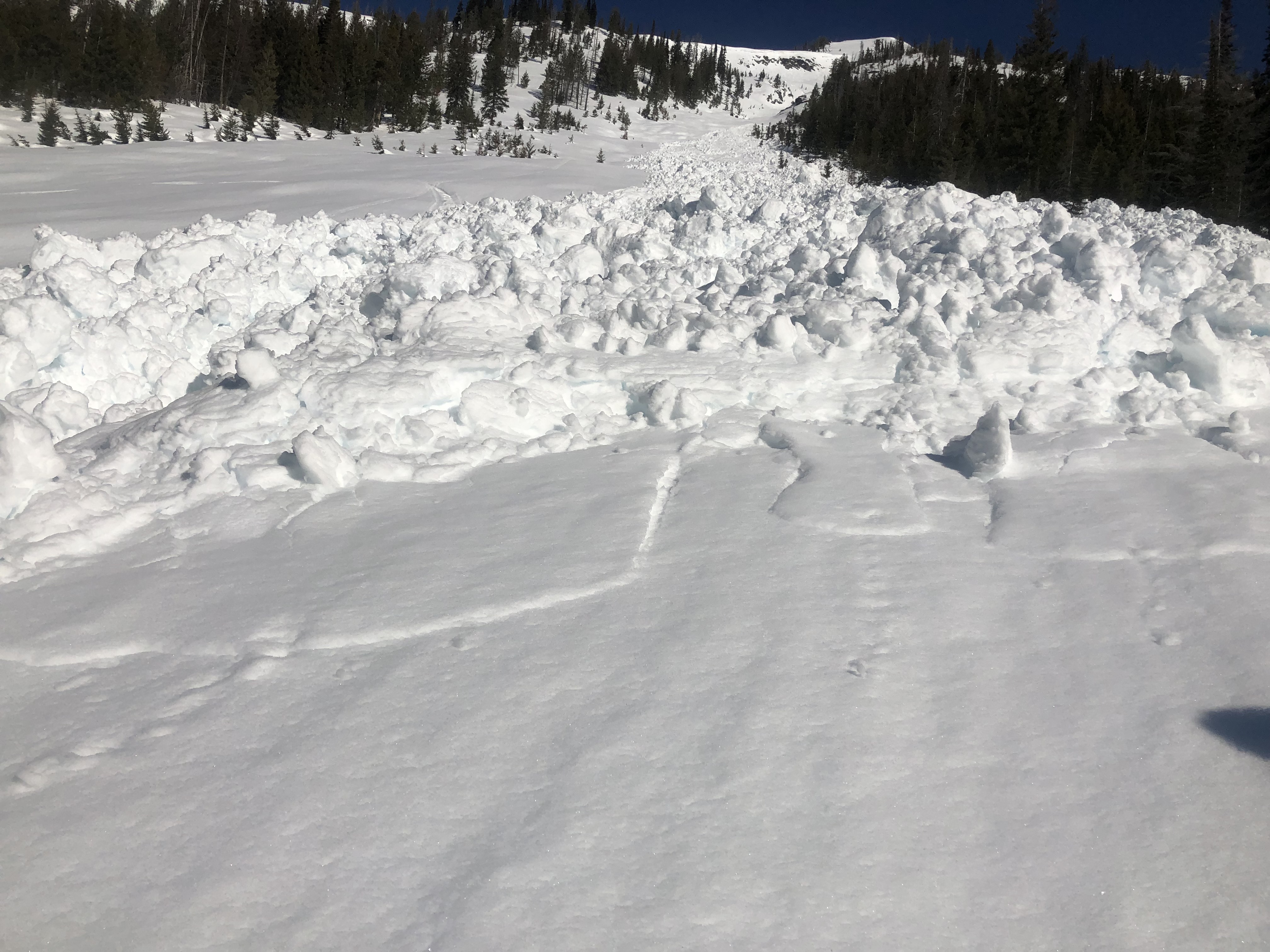
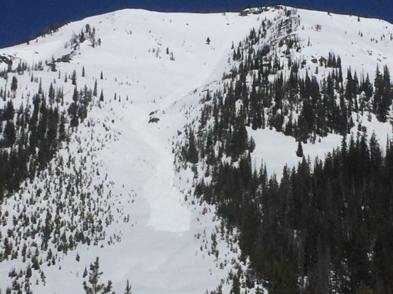
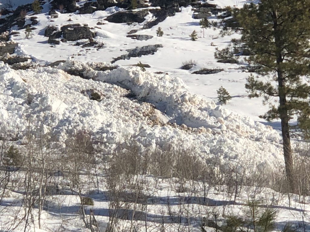
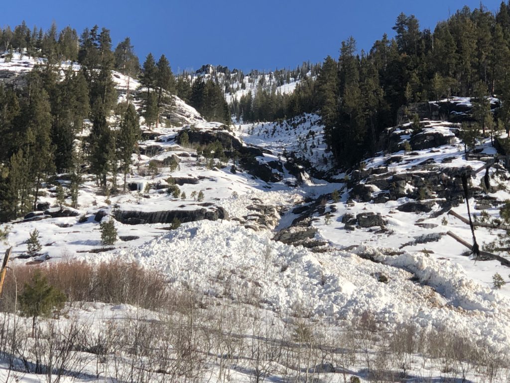
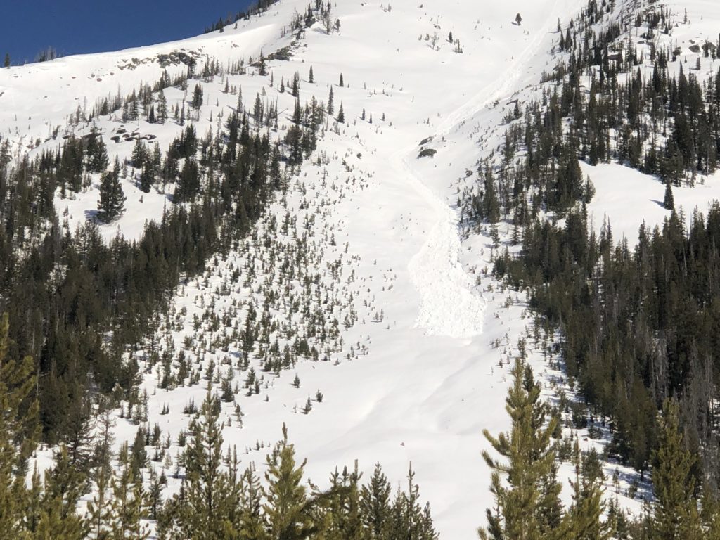
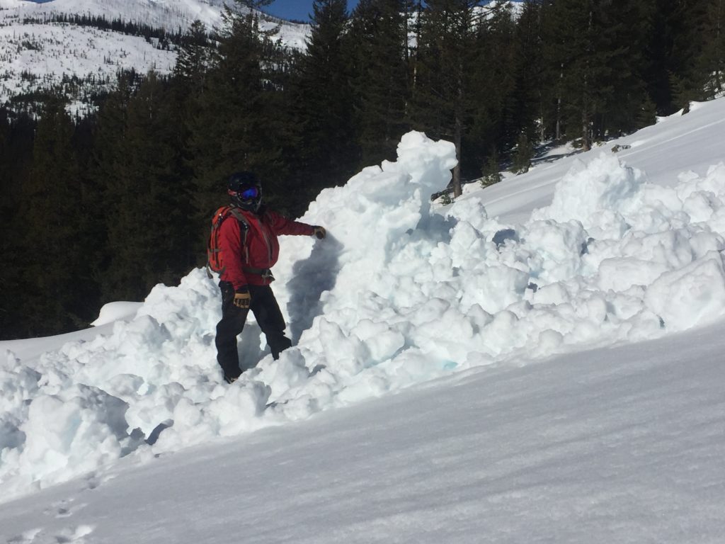
Loose wet avalanches are likely throughout the forecast area. Avalanche activity will increase through the day and will be concentrated on the southern half of the compass. Loose wet slides are primarily small but can be hazardous if terrain traps are present. Yesterday we found a handful of loose wet slides (Pic) that were able to entrain large amounts of snow (Video1). Again most loose wets will be small but be aware that in big steep terrain they have the potential to be large and destructive (video2). Warm temperatures are also resulting in cornices loosing strength and the formation of glide cracks. Give both a wide berth because they can be unpredictable and present another complex and hard to predict hazard.

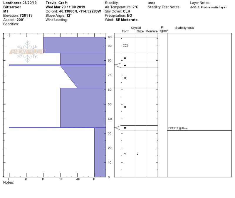
The next hazard is persistent slabs. We again found depth hoar yesterday that easily propagated in stability tests in areas with shallow snow (profile). The weak faceted snow is gaining strength but is deep enough in the snowpack that the warm temperatures haven’t been able to accelerate the process, this means that this problem can linger for a while. The persistent slabs are very isolated and will not be found everywhere but will produce large avalanches if failures occur. Carefully assess the snowpack before committing to avalanche terrain because high consequences can be expected in any slide involving these weak layers near the ground.

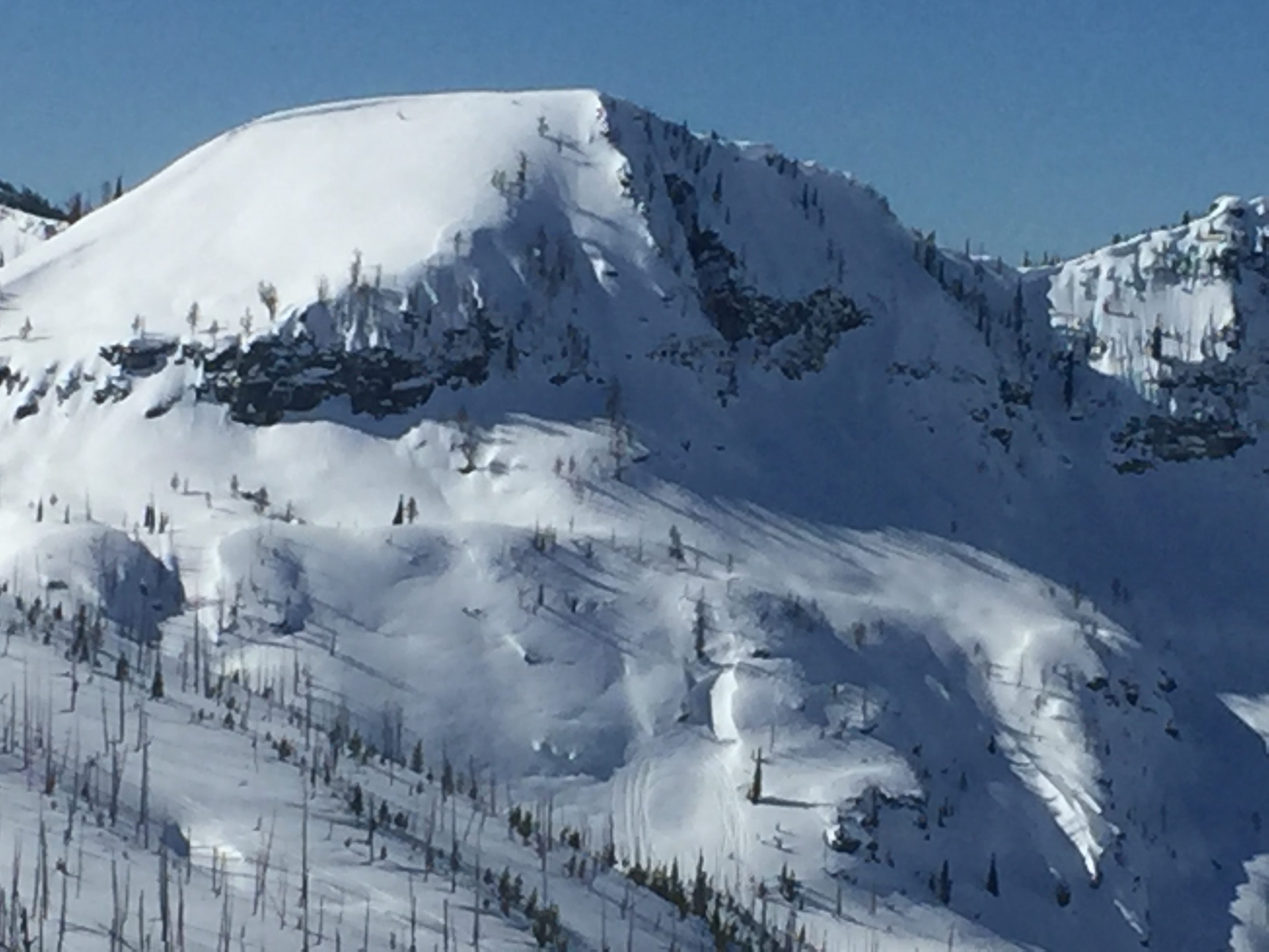
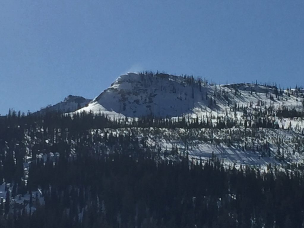
Finally, isolated wind slabs can be found above 7,000 feet on cold or shaded aspects that have been wind-loaded (Pic). The lack of new snow and warm temperatures have slowed wind slab development and areas that have been loaded are gaining strength but the instability isn’t completely settled out yet. If you find yourself in soft snow, look for signs of wind loading before committing to steep terrain.

Avalanche and Weather Outlook

Warm and dry conditions will continue through Friday (forecast). Avalanche danger will continue to go through the daily cycle of a mid-day peak in activity before refreezing at night. Overall conditions will remain the same until this weekend when precipitation returns. Returning snow and rain will bump up avalanche hazard over the weekend.

If you get out into the backcountry, please share your observations on our public observation page.

Ski and ride safe.

READ FULL ADVISORY  

Problem 1 - Loose Wet

  • TYPE

    loose-wet

    Loose Wet

    Release of wet unconsolidated snow or slush. These avalanches typically occur within layers of wet snow near the surface of the snowpack, but they may quickly gouge into lower snowpack layers. Like Loose-Dry Avalanches,they start at a point and entrain snow as they move downhill, forming a fan-shaped avalanche. They generally move slowly, but can contain enough mass to cause significant damage to trees, cars or buildings. Other names for loose-wet avalanches include point-release avalanches or sluffs. Loose-wet avalanches can trigger slab avalanches that break into deeper snow layers.

  • SIZE

    3-4

    1-2 (Small-Large)

    The potential size of avalanche resulting from this problem.

  • LIKELIHOOD

    Likelihood-5

    Likely

    The likelihood of an avalanche resulting from this problem.

  • ADDED DANGER

    Increased Slope Danger

    Increased/Added Danger

    There is an increased risk of avalanches on these slopes:

    E - East
    SE - Southeast
    S - South
    SW - Southwest
    W - West

  • IMAGE

Widespread small loose wet slides on Southern exposures with potential for isolated large loose wet avalanches in big steep terrain.

Problem 2 - Facets and Depth Hoar

  • TYPE

    persistent-slabs

    Persistent Slabs

    Release of a cohesive layer of soft to hard snow (a slab) in the middle to upper snowpack, when the bond to an underlying persistent weak layer breaks.  Persistent layers include: surface hoar, depth hoar, near-surface facets, or faceted snow. Persistent weak layers can continue to produce avalanches for days, weeks or even months, making them especially dangerous and tricky. As additional snow and wind events build a thicker slab on top of the persistent weak layer, this avalanche problem may develop into a Persistent, Deep-Slab.

  • SIZE

    6-7

    3 (Large-Very Large)

    The potential size of avalanche resulting from this problem.

  • LIKELIHOOD

    Likelihood-2

    Unlikely/Possible

    The likelihood of an avalanche resulting from this problem.

  • IMAGE

Depth hoar and facets near the ground will easily propagate in shallow snow especially later in the day.

Problem 3 - Wind Slabs

  • TYPE

    wind-slabs

    Wind Slabs

    Release of a cohesive layer of snow (a slab) formed by the wind.  Wind typically erodes snow from the upwind sides of terrain features and deposits snow on the downwind side.  Wind slabs are often smooth and rounded and sometimes sound hollow, and can range from soft to hard. Wind slabs that form over a persistent weak layer (surface hoar, depth hoar, or near-surface facets) may be termed Persistent Slabs or may develop into Persistent Slabs.

  • SIZE

    3-4

    1-2 (Small-Large)

    The potential size of avalanche resulting from this problem.

  • LIKELIHOOD

    Likelihood-2

    Unlikely/Possible

    The likelihood of an avalanche resulting from this problem.

Above 7,000 feet on cold shaded aspects wind slabs have formed and are gaining strength but can still be triggered in isolated locations.

VIDEO

FORECAST & OUTLOOK

Warm temperatures and clear skies before a low pressure system brings precipitation to the region this weekend.

This information is the sole responsibility of the Forest Service and does not apply to operating ski areas. The avalanche danger rating expires at midnight tonight but the information can help you make a more informed decision regarding travel in avalanche terrain for the next few days.

Our advisory area includes National Forest System lands in the Bitterroot Mountains from Lost Trail Pass north to Granite Pass, the Rattlesnake Mountains north of Missoula and the Southern Swan and Mission Mountains near Seeley Lake, MT. Avalanche information for the Lookout Pass/St. Regis Basin area is available from the Idaho Panhandle Avalanche Center.