Posted:
Apr 9, 2019 @ 6:05 am

The avalanche danger for the West Central Montana backcountry is CONSIDERABLE. Wind slabs are easily triggered at upper elevations and move quickly on solid bed surfaces. At mid-low elevations, saturated snow is failing from the recent load of water and continues to be reactive. Carefully evaluate the snowpack before entering avalanche terrain as human triggered avalanches are likely today.

Good morning, this is Logan King with the West Central Montana Avalanche Center’s avalanche advisory for Tuesday, April 9th, 2019. This danger rating does not apply to operating ski areas, expires at midnight tonight and is the sole responsibility of the U.S. Forest Service.

Weather and Snowpack

An atmospheric river continues to impact the forecast area adding another 0.3 to 0.8 inches of water to the snowpack over the past 24 hours. Mountain temperatures range from 34 to 36 degrees Fahrenheit as of 5am this morning. Winds continue to be unremarkable with Deer Mountain reporting 9 mph from the SSW with gusts up to 16 mph but stronger ridgetop winds are likely.

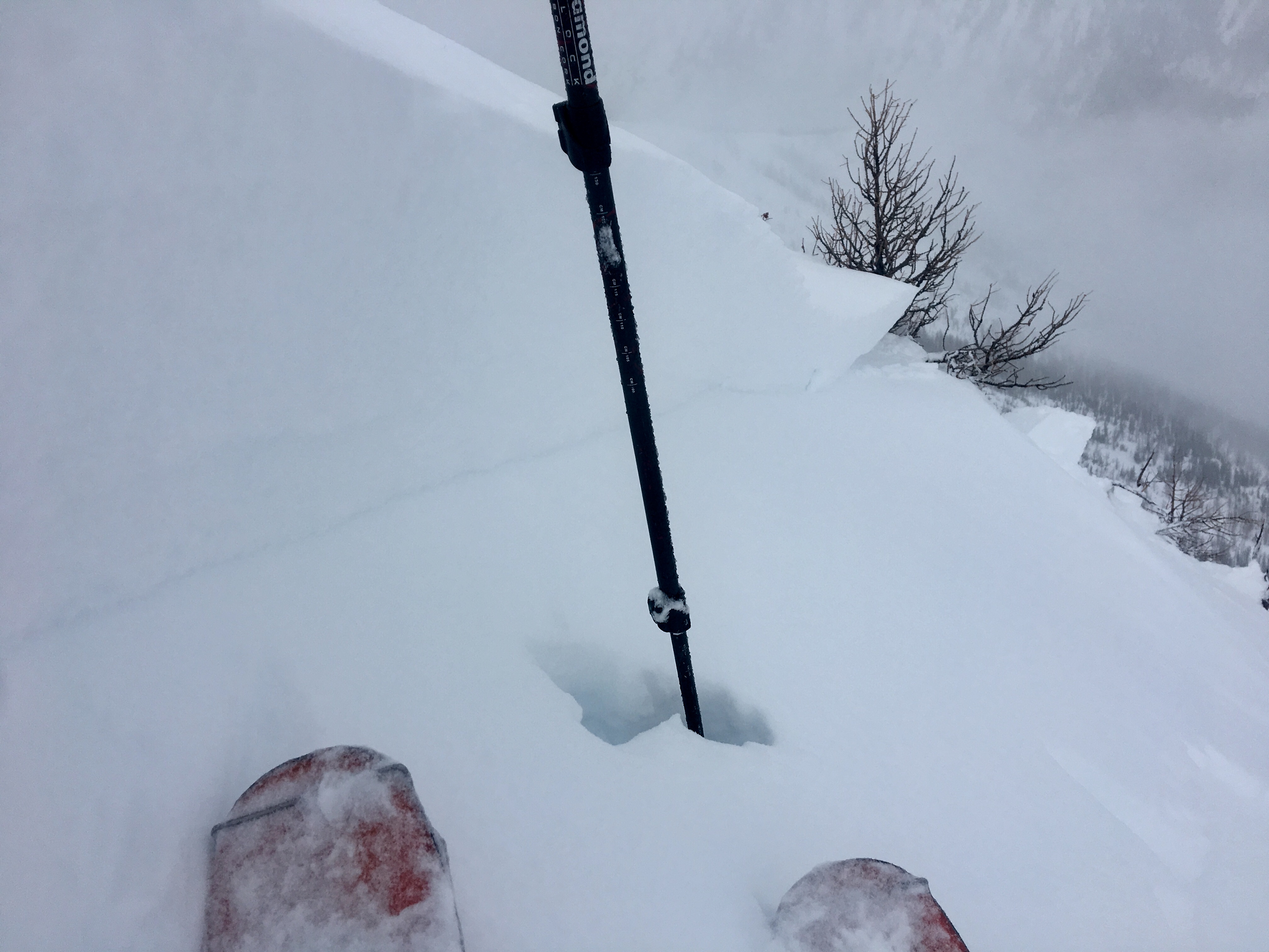
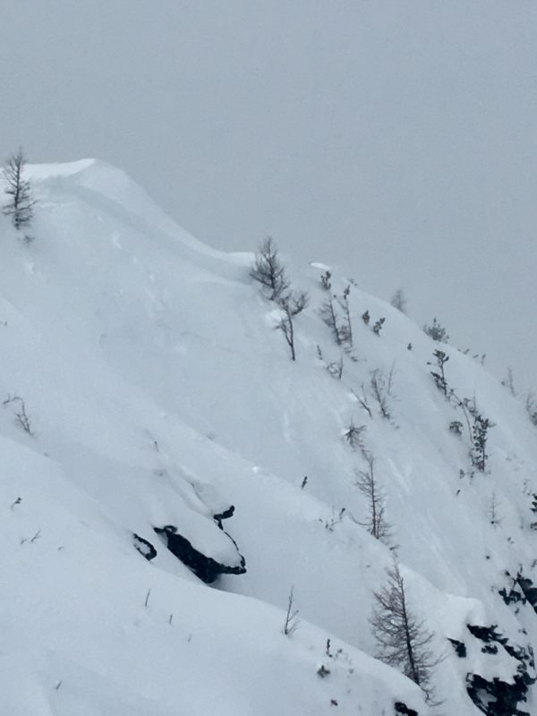
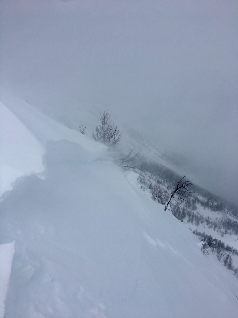
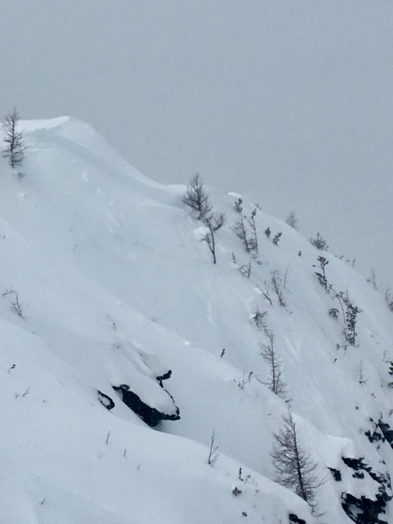
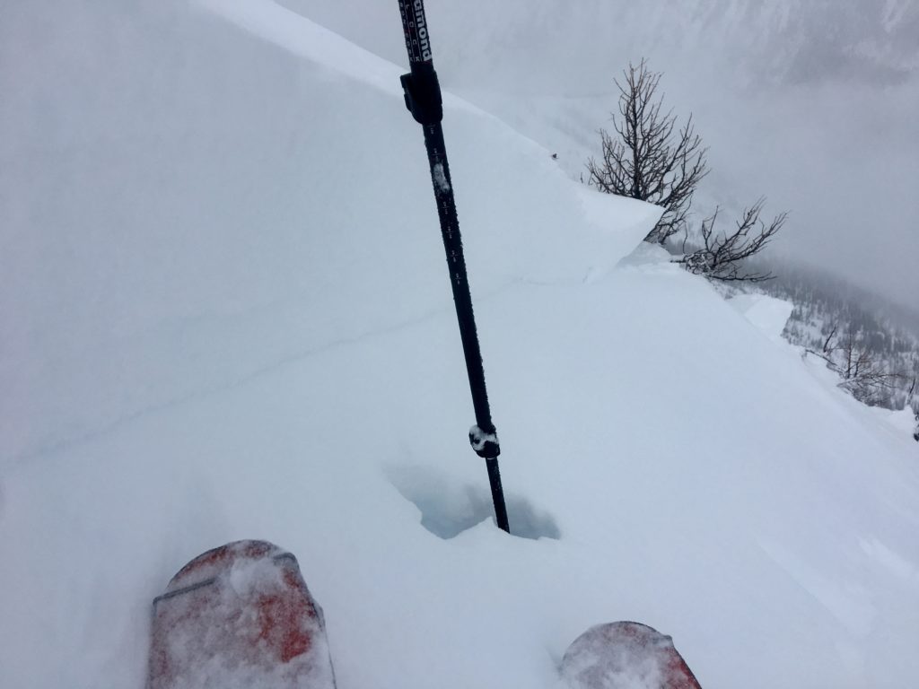
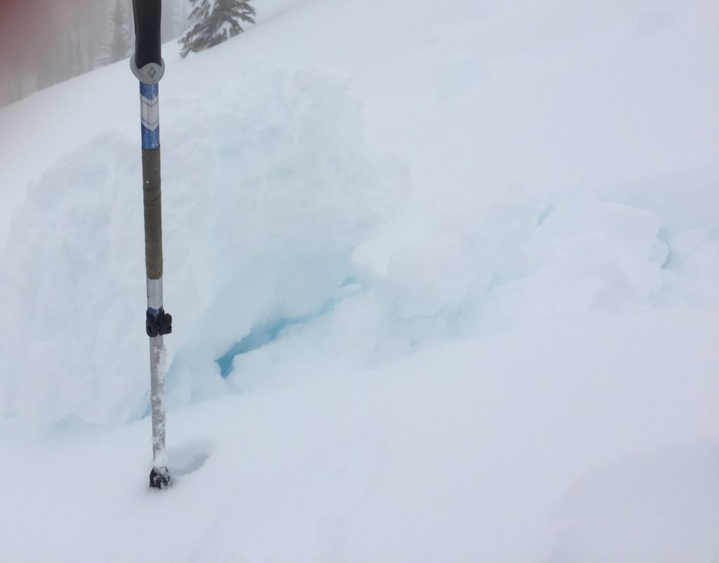
Yesterday we toured in the Central Bitterroot and found a reactive snowpack. Above 7,000 feet small wind slabs were easily triggered. Although initially small they were able to entrain large amounts of snow and create sympathetic releases, quickly developing into very large slides which were able to run far and fast on dense snow and crusts (pic). Wind slabs continue to grow as more snow and wind affects the region. Wind drifted snow will easily fail with human triggers and traveling below them is not recommended with how far and fast they were moving yesterday. Carefully assess the snowpack for signs of wind loading before venturing into avalanche terrain.

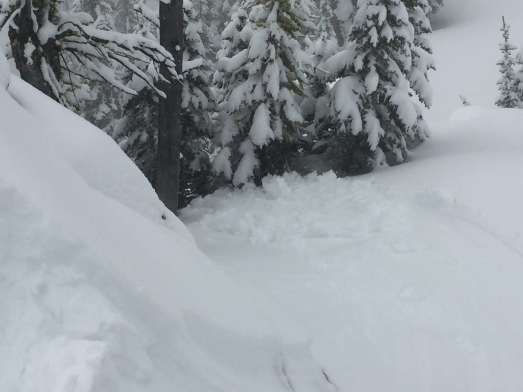
Rain to just below 7,000 feet yesterday has saturated the snowpack producing widespread loose wet slides and wet slabs. Multiple natural wet avalanches were observed up to about 8,000 feet and loose wet slides and roller balls were easily triggered on rollovers and in steep terrain. Wet activity will be concentrated between approximately 5,000 and 7,000 feet but should be considered on any slope with saturated snow.

Bottom line: Avalanches will easily be triggered today, the key is determining which problems are the greatest concern where and how to appropriately manage the hazards. Avoid wind loaded terrain and remember that wet avalanches can be challenging to predict so avoid starting zones that are saturated if you don’t want to roll the dice.

Avalanche and Weather Outlook

The atmospheric river will continue to supply plenty of moisture to the region before subsiding late Wednesday and transitioning to showery conditions for the end of the work week. Lots of additional water is expected over the next two days but will transition towards more snow than rain. Rain lines are dropping and should be around 5,500 feet today and by Wednesday will be around 4,000 feet (forecast). The avalanche danger won’t drop until the precipitation subsides.

We will conclude our regular forecasts later this week as the storm cycle ends but will continue to post updates as necessary after that. Observations on our public observations page will continue to get posted and shared with the community so keep sending in what you find.

Ski and ride safe.

READ FULL ADVISORY  

Problem 1 - Wind Slabs

  • TYPE

    wind-slabs

    Wind Slabs

    Release of a cohesive layer of snow (a slab) formed by the wind.  Wind typically erodes snow from the upwind sides of terrain features and deposits snow on the downwind side.  Wind slabs are often smooth and rounded and sometimes sound hollow, and can range from soft to hard. Wind slabs that form over a persistent weak layer (surface hoar, depth hoar, or near-surface facets) may be termed Persistent Slabs or may develop into Persistent Slabs.

  • SIZE

    5-6

    2-3 (Large)

    The potential size of avalanche resulting from this problem.

  • LIKELIHOOD

    Likelihood-5

    Likely

    The likelihood of an avalanche resulting from this problem.

  • ADDED DANGER

    Increased Slope Danger

    Increased/Added Danger

    There is an increased risk of avalanches on these slopes:

    N - North
    NE - Northeast
    E - East
    SE - Southeast
    NW - Northwest

  • IMAGE

Wind drifted snow above 7,000 feet is very reactive on crusts and interfaces. Wind slabs though generally small in start zones can travel far and move fast while entraining lots of snow and growing very large.

Problem 2 - Wet Slabs

  • TYPE

    wet-slabs

    Wet Slabs

    Release of a cohesive layer of snow (a slab) that is generally moist or wet when the flow of liquid water weakens the bond between the slab and the surface below (snow or ground). They often occur during prolonged warming events and/or rain-on-snow events. Wet slabs can be very destructive.

  • SIZE

    3-4

    1-2 (Small-Large)

    The potential size of avalanche resulting from this problem.

  • LIKELIHOOD

    Likelihood-4

    Possible/Likely

    The likelihood of an avalanche resulting from this problem.

Wet snow and rain have made wet slabs a problem. Although possible at any elevation the greatest potential for wet slabs is between 5,000 and 7,000 feet.

Problem 3 - Loose Wet

  • TYPE

    loose-wet

    Loose Wet

    Release of wet unconsolidated snow or slush. These avalanches typically occur within layers of wet snow near the surface of the snowpack, but they may quickly gouge into lower snowpack layers. Like Loose-Dry Avalanches,they start at a point and entrain snow as they move downhill, forming a fan-shaped avalanche. They generally move slowly, but can contain enough mass to cause significant damage to trees, cars or buildings. Other names for loose-wet avalanches include point-release avalanches or sluffs. Loose-wet avalanches can trigger slab avalanches that break into deeper snow layers.

  • SIZE

    1-2

    < 1 (Small)

    The potential size of avalanche resulting from this problem.

  • LIKELIHOOD

    Likelihood-6

    Likely/Very Likely

    The likelihood of an avalanche resulting from this problem.

Wet and warm surface snow can be found on any aspect or elevation and moves readily. Small slides are easily triggered in steep terrain and at rollovers and larger naturals are possible in big terrain.

FORECAST & OUTLOOK

The atmospheric river will continue to supply moisture to the region delivering heavy rain and snow.

This information is the sole responsibility of the Forest Service and does not apply to operating ski areas. The avalanche danger rating expires at midnight tonight but the information can help you make a more informed decision regarding travel in avalanche terrain for the next few days.

Our advisory area includes National Forest System lands in the Bitterroot Mountains from Lost Trail Pass north to Granite Pass, the Rattlesnake Mountains north of Missoula and the Southern Swan and Mission Mountains near Seeley Lake, MT. Avalanche information for the Lookout Pass/St. Regis Basin area is available from the Idaho Panhandle Avalanche Center.