Posted:
Sep 27, 2019 @ 2:43 pm

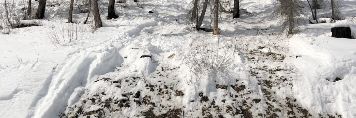
This is Logan King with an early season update for the West Central Montana Avalanche center. The calendar just officially switched over to fall but a significant winter storm is already on the horizon. Early season snow may be getting some folks excited. Skis and sleds may be coming out of the garage, but it’s important to remember that if there is enough snow to ride, then there is enough snow to slide! Avalanche preparedness starts now and even though it is early in the season, you need to stay aware of the potential for avalanches. Early season snowfall creates the greatest hazard at upper elevations and tends to be concentrated to wind loaded terrain where more snow will be found. Keep in mind that there are increased consequences of even small slides this time of year due to exposed rocks, cliffs, and stumps that raise the potential for trauma. Keep an eye on the weather as this early season snow may lead to avalanche problems that can persist for the entire season. Now is the time to start the process of watching the weather and observing how the terrain begins to fill in. If you are interested in learning more, avalanche education opportunities will be posted next week and opening for enrollment. We look forward to another great season and hope to see you at the Pray for Snow on October 4th from 5-10pm at Caras Park.

Remember, avalanches don’t care if you are skiing, climbing, sledding, hunting or just taking your dog for a walk…if there is snow on the ground consider the potential and consequences of an avalanche before you enter steep terrain.
READ FULL ADVISORY  

Problem 1 - Wind Slabs

  • TYPE

    wind-slabs

    Wind Slabs

    Release of a cohesive layer of snow (a slab) formed by the wind.  Wind typically erodes snow from the upwind sides of terrain features and deposits snow on the downwind side.  Wind slabs are often smooth and rounded and sometimes sound hollow, and can range from soft to hard. Wind slabs that form over a persistent weak layer (surface hoar, depth hoar, or near-surface facets) may be termed Persistent Slabs or may develop into Persistent Slabs.

  • SIZE

    2-3

    1 (Small)

    The potential size of avalanche resulting from this problem.

  • LIKELIHOOD

    Likelihood-3

    Possible

    The likelihood of an avalanche resulting from this problem.

Small wind loaded slopes will have the greatest potential for avalanches.

Problem 2 - Storm Slabs

  • TYPE

    storm-slabs

    Storm Slabs

    Release of a soft cohesive layer (a slab) of new snow which breaks within the storm snow or on the old snow surface. Storm-slab problems typically last between a few hours and few days. Storm-slabs that form over a persistent weak layer (surface hoar, depth hoar, or near-surface facets) may be termed Persistent Slabs or may develop into Persistent Slabs.

  • SIZE

    2-3

    1 (Small)

    The potential size of avalanche resulting from this problem.

  • LIKELIHOOD

    Likelihood-2

    Unlikely/Possible

    The likelihood of an avalanche resulting from this problem.

New and blowing snow will create the potential for small avalanches primarily at upper elevations.

VIDEO

NOAA Early Season Winter Storm Briefing

FORECAST & OUTLOOK

The National Weather Service is predicting a “Historic Winter Storm” that will bring heavy snow, strong winds, and cold temperatures to the region.

This information is the sole responsibility of the Forest Service and does not apply to operating ski areas. The avalanche danger rating expires at midnight tonight but the information can help you make a more informed decision regarding travel in avalanche terrain for the next few days.

Our advisory area includes National Forest System lands in the Bitterroot Mountains from Lost Trail Pass north to Granite Pass, the Rattlesnake Mountains north of Missoula and the Southern Swan and Mission Mountains near Seeley Lake, MT. Avalanche information for the Lookout Pass/St. Regis Basin area is available from the Idaho Panhandle Avalanche Center.