Posted:
Dec 3, 2019 @ 12:12 pm

This is Travis Craft with an early season snowpack update, on December 03, 2019.

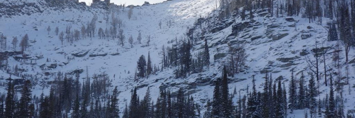
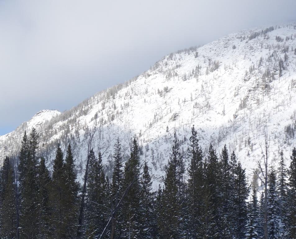
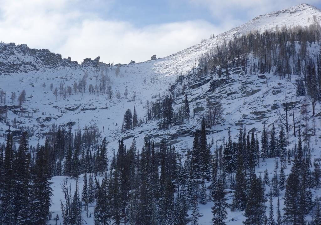
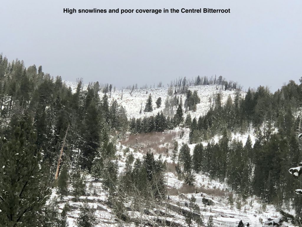
Variable snow and avalanche conditions exist throughout the forecast area. In general, a rideable base does not exist below ~6500.’

Most terrain above this does not have enough snow to produce avalanches, except in isolated areas. Remember, if there is enough snow to ride, there is enough snow to slide. Avoid terrain traps and wind loaded areas.

The most significant objective hazard that currently exists is thin snowpack coverage that could result in injury and/or gear damage. There are a lot of snags hidden just beneath the snow surface, which make for risky descent conditions. Keep this mind, and don’t let your season end before it really starts!

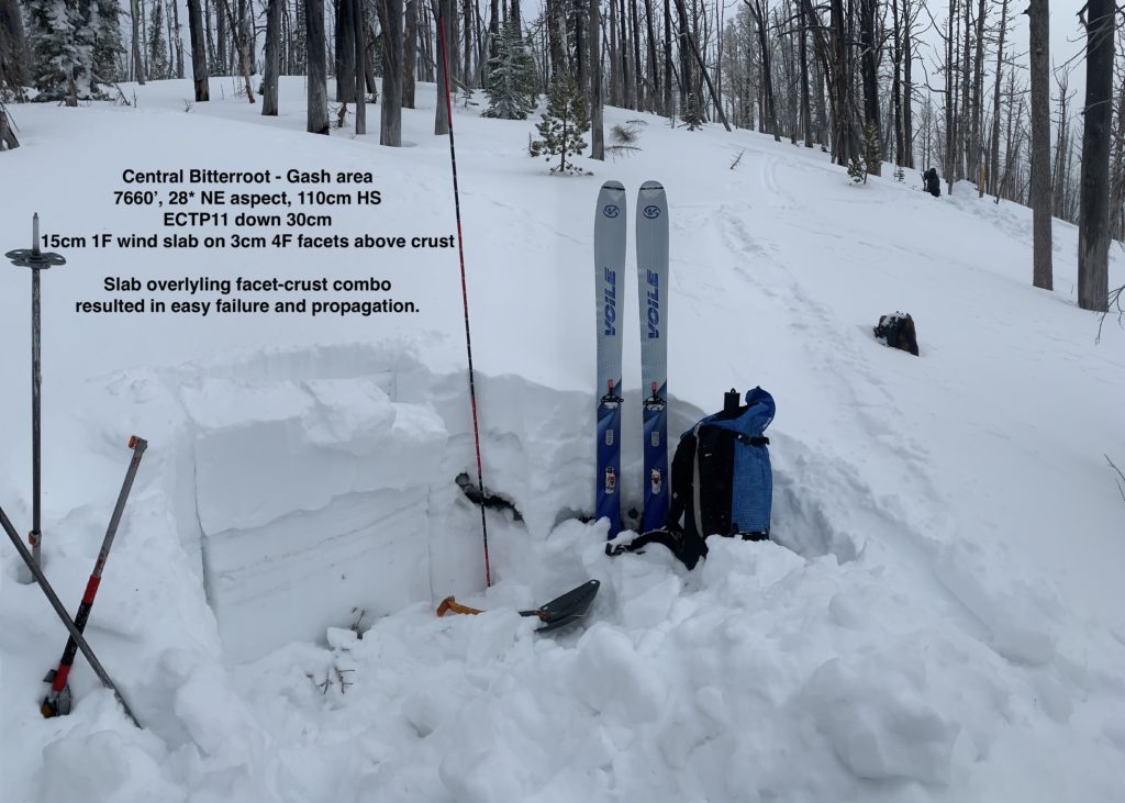
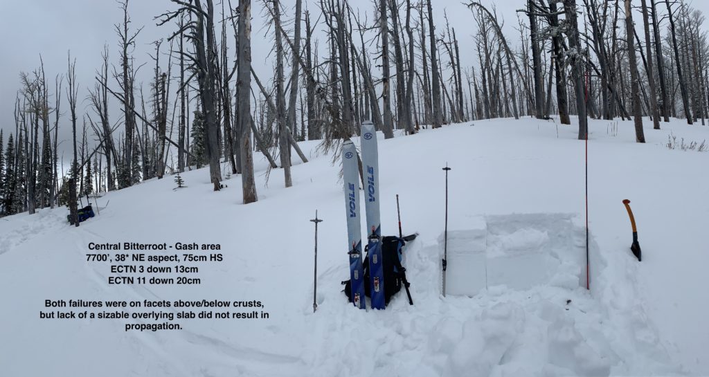
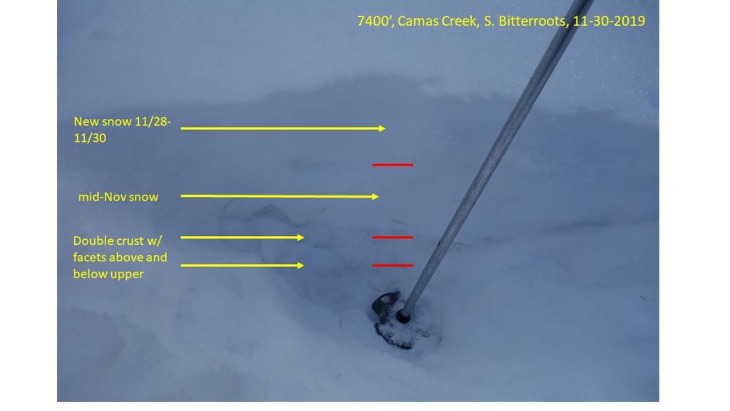
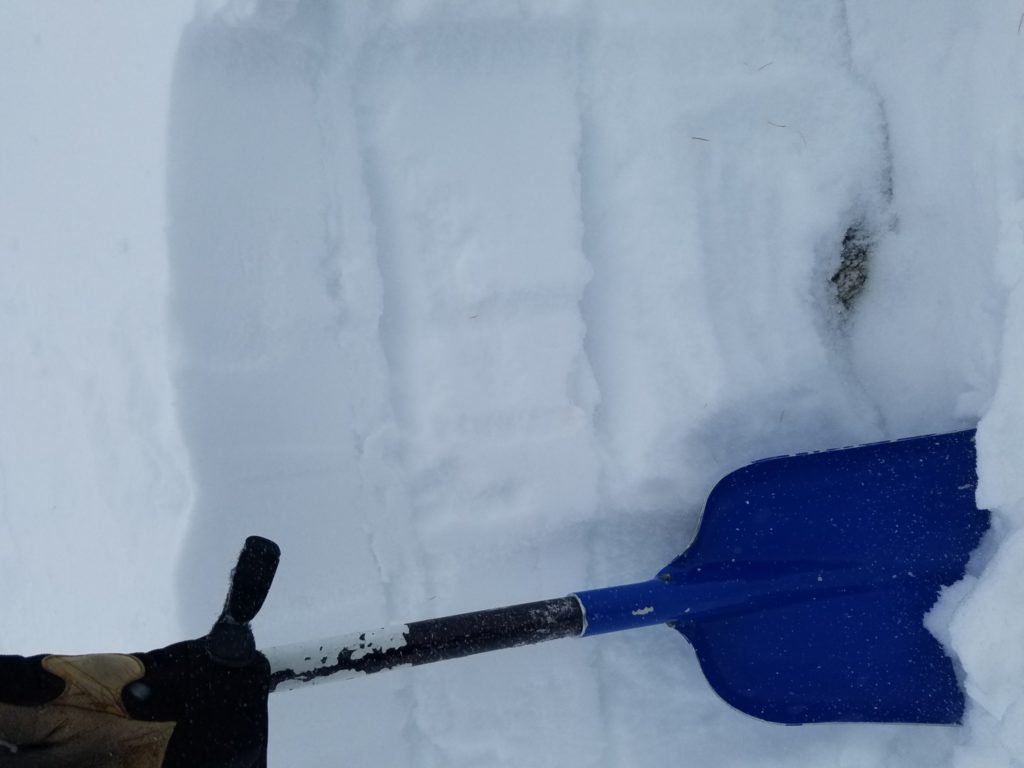
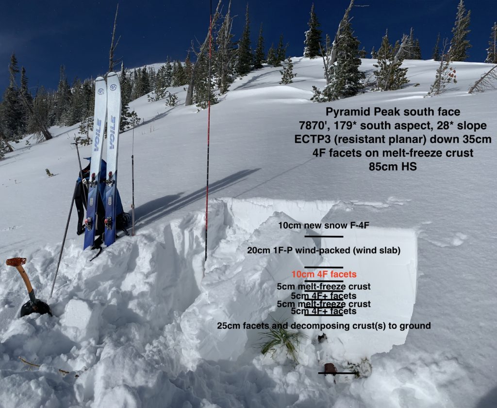
The region’s snowpack has poor structure but generally lacks large enough slabs to be problematic. Where a sizable slab exists on top of buried facets and crusts, stability tests have shown that there is very easy failure and propagation (observations).

Persistent slabs are the primary avalanche concern. On upper elevation (7000’+) terrain steeper than 35º, D1-D2 human triggered are possible. These are most likely where a consolidated slab overlies faceted snow and crusts. There may not be red flags or clues of this problem. Dig a snowpit, assess layers, and conduct a stability test.

Isolated upper elevation (7000’+) D1-D2 human triggered wind slabs are the secondary avalanche concern on leeward terrain steeper than 35º (especially if convex or unsupported). Be on the lookout for wind loaded terrain. Pole probing and hand pits are an effective means of efficiently assessing the wind slab problem as you travel.

Please send us your observations! Your findings help us produce a more accurate forecast.

Unsettled weather with relatively warm temperatures, mountain snow showers, and moderate to strong upper elevation wind is forecast. No significant precipitation is expected. However, any new snow and wind may increase avalanche danger.

We will do our next snowpack update on Friday, December 05, 2019.

Ski and ride safe.

READ FULL ADVISORY  

Problem 1 - Persistent Slabs

  • TYPE

    persistent-slabs

    Persistent Slabs

    Release of a cohesive layer of soft to hard snow (a slab) in the middle to upper snowpack, when the bond to an underlying persistent weak layer breaks.  Persistent layers include: surface hoar, depth hoar, near-surface facets, or faceted snow. Persistent weak layers can continue to produce avalanches for days, weeks or even months, making them especially dangerous and tricky. As additional snow and wind events build a thicker slab on top of the persistent weak layer, this avalanche problem may develop into a Persistent, Deep-Slab.

  • SIZE

    2-3

    1 (Small)

    The potential size of avalanche resulting from this problem.

  • LIKELIHOOD

    Likelihood-3

    Possible

    The likelihood of an avalanche resulting from this problem.

Persistent slabs are the primary avalanche concern. On upper elevation (7000’+) terrain steeper than 35º, D1-D2 human triggered are possible. These are most likely where a consolidated slab overlies faceted snow and crusts. There may not be red flags or clues of this problem. Dig a snowpit, assess layers, and conduct a stability test.


Problem 2 - Wind Slabs

  • TYPE

    wind-slabs

    Wind Slabs

    Release of a cohesive layer of snow (a slab) formed by the wind.  Wind typically erodes snow from the upwind sides of terrain features and deposits snow on the downwind side.  Wind slabs are often smooth and rounded and sometimes sound hollow, and can range from soft to hard. Wind slabs that form over a persistent weak layer (surface hoar, depth hoar, or near-surface facets) may be termed Persistent Slabs or may develop into Persistent Slabs.

  • SIZE

    2-3

    1 (Small)

    The potential size of avalanche resulting from this problem.

  • LIKELIHOOD

    Likelihood-2

    Unlikely/Possible

    The likelihood of an avalanche resulting from this problem.

Isolated upper elevation (7000’+) D1-D2 human triggered wind slabs are the secondary avalanche concern on leeward terrain steeper than 35º (especially if convex or unsupported). Be on the lookout for wind loaded terrain. Pole probing and hand pits are an effective means of efficiently assessing the wind slab problem as you travel.


FORECAST & OUTLOOK

Unsettled weather with relatively warm temperatures, mountain snow showers, and moderate to strong upper elevation wind is forecast. No significant precipitation is expected. However, any new snow and wind may increase avalanche danger.

This information is the sole responsibility of the Forest Service and does not apply to operating ski areas. The avalanche danger rating expires at midnight tonight but the information can help you make a more informed decision regarding travel in avalanche terrain for the next few days.

Our advisory area includes National Forest System lands in the Bitterroot Mountains from Lost Trail Pass north to Granite Pass, the Rattlesnake Mountains north of Missoula and the Southern Swan and Mission Mountains near Seeley Lake, MT. Avalanche information for the Lookout Pass/St. Regis Basin area is available from the Idaho Panhandle Avalanche Center.