Posted:
Dec 14, 2019 @ 7:12 am

The avalanche danger for the West Central Montana backcountry is Considerable on all aspects above 6500 feet. Fresh snow and wind have overloaded our snowpack, creating hazardous avalanche conditions. Careful route finding and snowpack evaluation are essential today.

Good morning, this is Todd Glew with the West Central Montana Avalanche Center avalanche advisory for December 14, 2019. This danger rating does not apply to operating ski areas, expires at midnight tonight, and is the sole responsibility of the U.S. Forest Service.

Weather and Snowpack

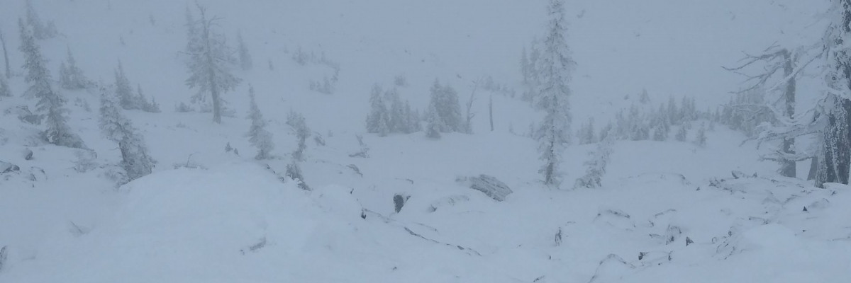
Mountain temperatures are currently in the teens. Snowtel sites are reporting over an inch of SWE and 12+ inches of snow during the past 24 hours, with gusty ridge top winds out of the WNW. 

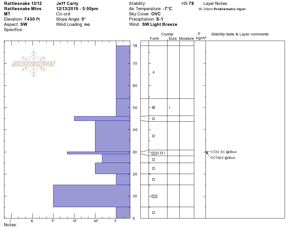
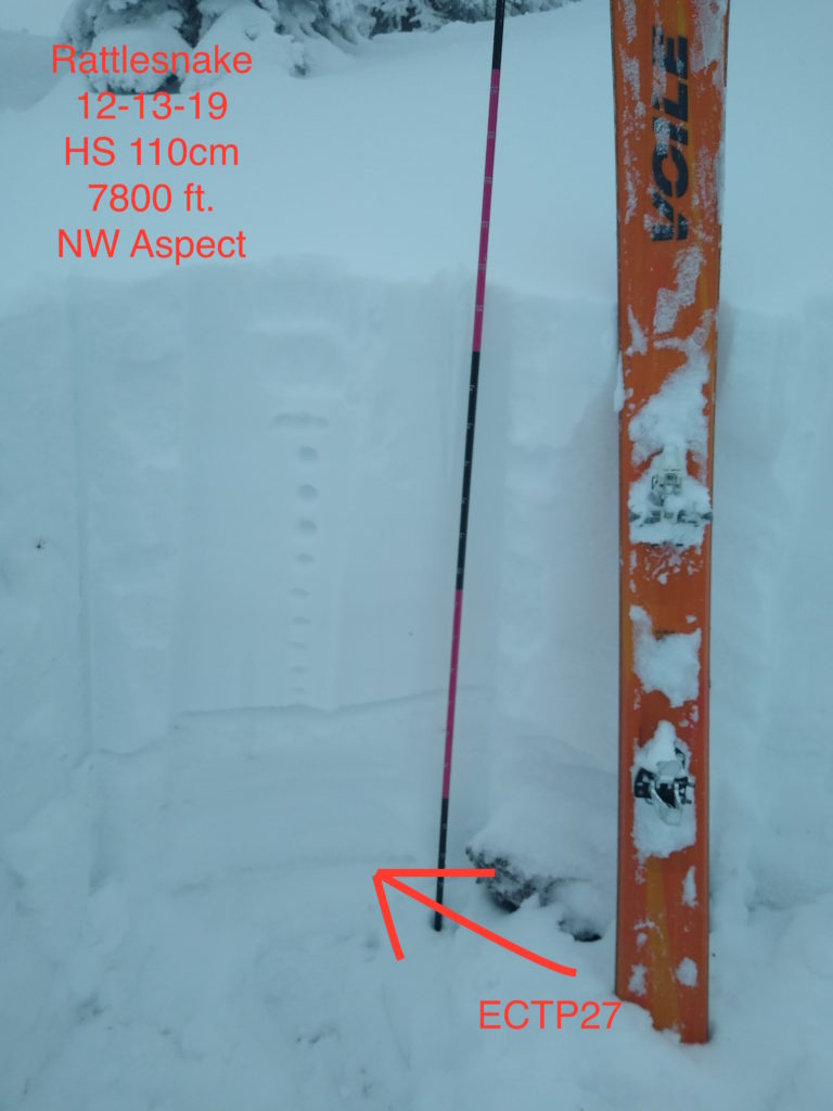
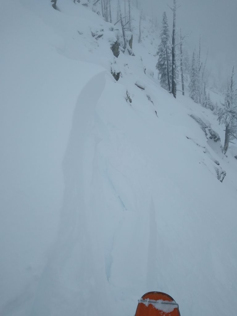
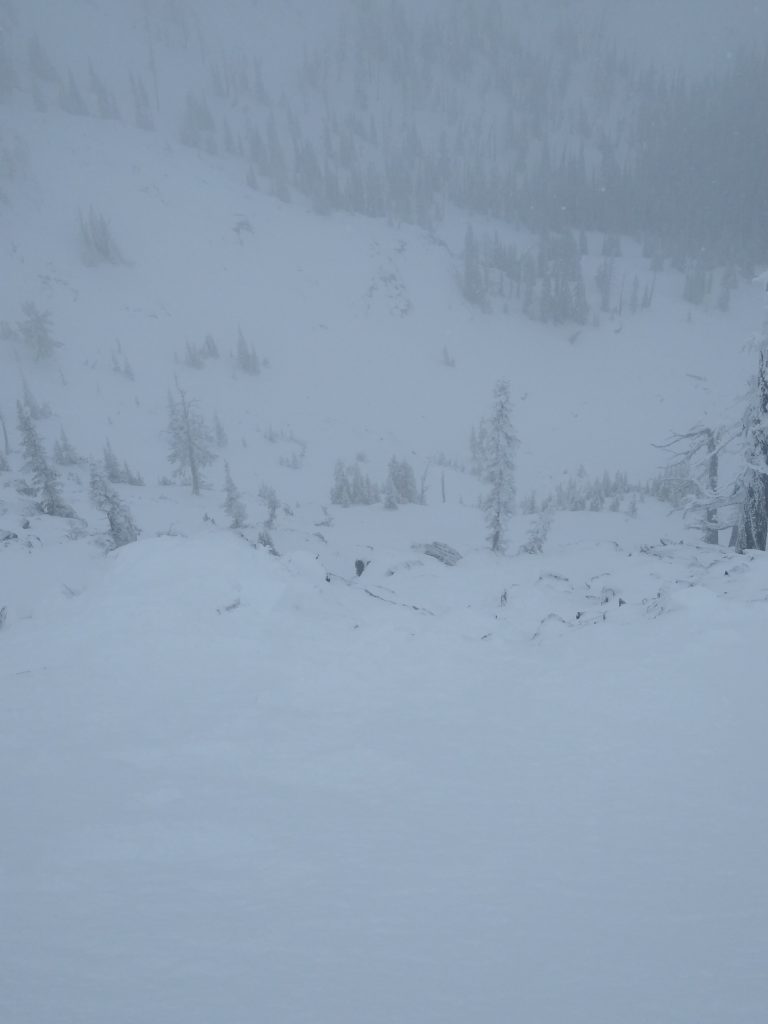
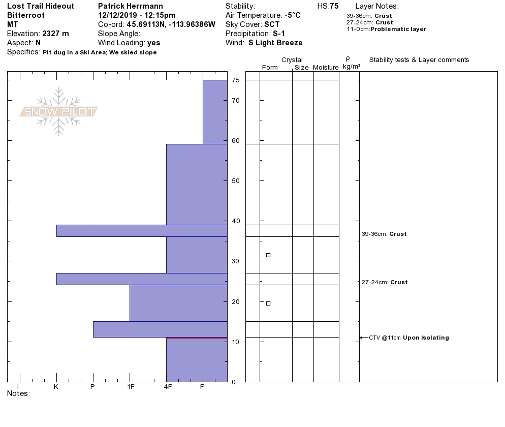
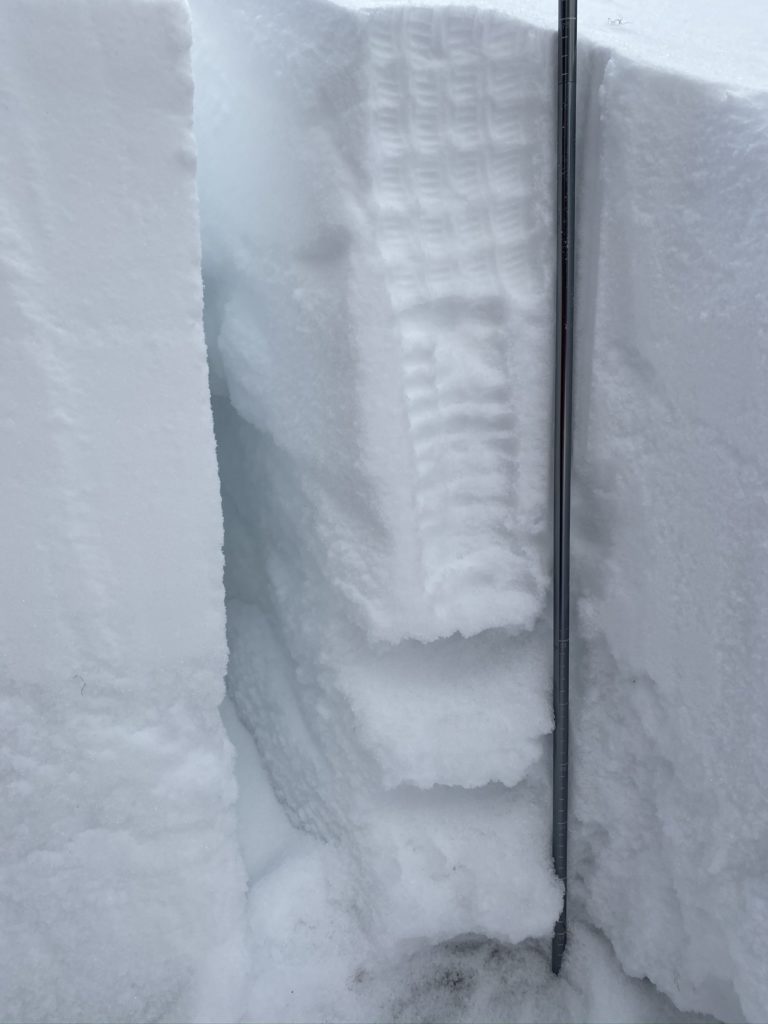
The snowpack varies significantly throughout our forecast area. The central theme is that we have a complex snowpack with the potential for large dangerous avalanches breaking near the ground. We have been experiencing red flags such as cracking and collapsing during the past week. Snow tests have also been propagating, failing near the ground. Stay off of and away from terrain steeper than 30 degrees. 

The primary avalanche concern is persistent slab avalanches on elevations above 6500 feet. We have the recipe for dangerous avalanches today, with strong snow overlying weak snow. The snowpack has poor structure and the possibility for large dangerous avalanches, breaking near the ground. 

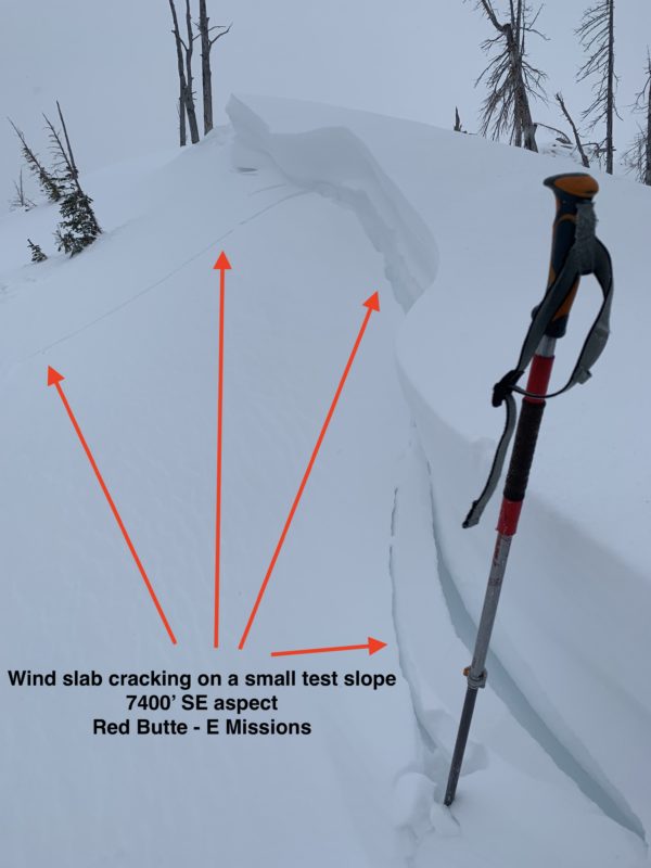
The secondary avalanche concern is wind slabs found on leeward slopes near ridge tops. Be on the lookout for pillowy features near ridge tops or cross-loaded features. Also keep an eye out for cornices, which are sensitive and can break back further than expected. If you trigger even a small wind slab or cornice, it has the potential to step down, triggering a larger persistent slab avalanche. 

If you get out in the mountains, be on the lookout for red flags such as cracking or collapsing. Dig a snow pit and perform stability tests. Be on the lookout for changing conditions as you gain elevation. Areas prone to avalanches are where strong snow overlays weak snow. Avalanches are more likely the higher you get in elevation. Conservative route-finding and terrain choice are essential today!

Any information is essential for creating an avalanche forecast. Please submit your observations here.

Avalanche and Weather Outlook

Continued snow showers are forecast through Sunday evening, with close to a foot of snow possible. Temperatures are forecast to rise into the upper 20’s above 6000 feet during the day, with gusty ridge top winds out of the WNW. 

Due to the complex structure of our snowpack, any new snow and wind can tip the scale and raise the avalanche danger.

READ FULL ADVISORY  

Problem 1 - Persistent Slabs

  • TYPE

    persistent-slabs

    Persistent Slabs

    Release of a cohesive layer of soft to hard snow (a slab) in the middle to upper snowpack, when the bond to an underlying persistent weak layer breaks.  Persistent layers include: surface hoar, depth hoar, near-surface facets, or faceted snow. Persistent weak layers can continue to produce avalanches for days, weeks or even months, making them especially dangerous and tricky. As additional snow and wind events build a thicker slab on top of the persistent weak layer, this avalanche problem may develop into a Persistent, Deep-Slab.

  • SIZE

    5-6

    2-3 (Large)

    The potential size of avalanche resulting from this problem.

  • LIKELIHOOD

    Likelihood-4

    Possible/Likely

    The likelihood of an avalanche resulting from this problem.

  • ADDED DANGER

    Increased Slope Danger

    Increased/Added Danger

    There is an increased risk of avalanches on these slopes:

    N - North
    NE - Northeast
    E - East
    SE - Southeast
    S - South
    SW - Southwest
    W - West
    NW - Northwest

  • IMAGE

Buried weak layers can be found throughout our forecast area with the potential for large dangerous avalanches, breaking near the ground.

Problem 2 - Wind Slabs

  • TYPE

    wind-slabs

    Wind Slabs

    Release of a cohesive layer of snow (a slab) formed by the wind.  Wind typically erodes snow from the upwind sides of terrain features and deposits snow on the downwind side.  Wind slabs are often smooth and rounded and sometimes sound hollow, and can range from soft to hard. Wind slabs that form over a persistent weak layer (surface hoar, depth hoar, or near-surface facets) may be termed Persistent Slabs or may develop into Persistent Slabs.

  • SIZE

    3-4

    1-2 (Small-Large)

    The potential size of avalanche resulting from this problem.

  • LIKELIHOOD

    Likelihood-3

    Possible

    The likelihood of an avalanche resulting from this problem.

  • IMAGE

Wind slabs can be found near ridge tops and cross loaded  leeward terrain.

VIDEO

Observations

Observations

FORECAST & OUTLOOK

Snow showers will continue through Sunday evening with close to 12 inches of snow expected for favored locations.

This information is the sole responsibility of the Forest Service and does not apply to operating ski areas. The avalanche danger rating expires at midnight tonight but the information can help you make a more informed decision regarding travel in avalanche terrain for the next few days.

Our advisory area includes National Forest System lands in the Bitterroot Mountains from Lost Trail Pass north to Granite Pass, the Rattlesnake Mountains north of Missoula and the Southern Swan and Mission Mountains near Seeley Lake, MT. Avalanche information for the Lookout Pass/St. Regis Basin area is available from the Idaho Panhandle Avalanche Center.