
The avalanche danger for the west central Montana backcountry is MODERATE. Evaluate snow and terrain carefully. It is possible to trigger a large avalanche on steep slopes with shallow snowpacks.
Good morning, this is Travis Craft with the West Central Montana Avalanche Center’s avalanche advisory for December 19, 2019. This danger rating does not apply to operating ski areas, expires at midnight tonight, and is the sole responsibility of the U.S. Forest Service.
Weather and Snowpack
Mountain temperatures range from 18 F to 24 F in the region. In the Bitterroot, winds are 11 mph with gusts of 17 out of the SE. In the northern part of the advisory area, winds are 16 mph and gusting 24 mph out of the SSW. No new snow.
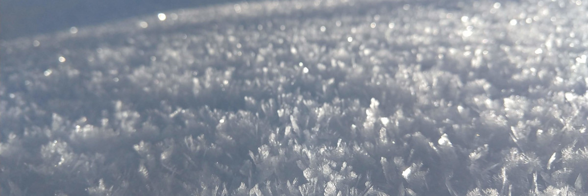
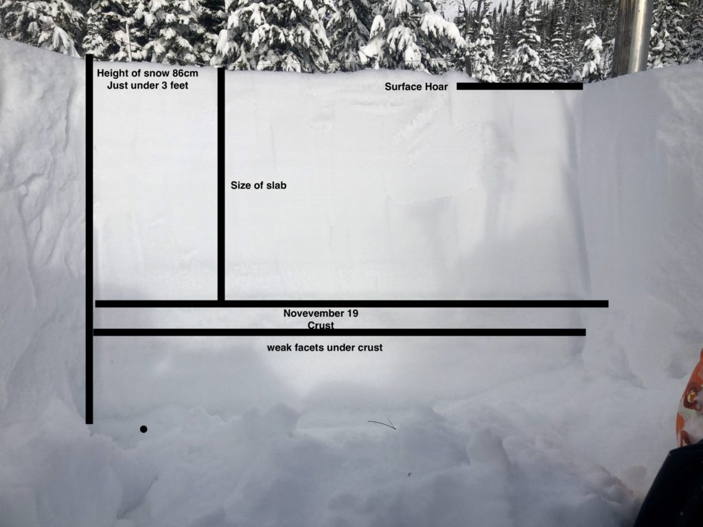
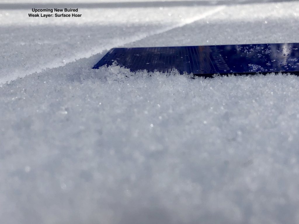
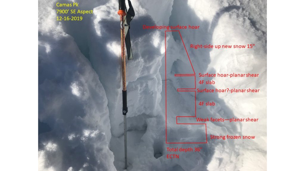
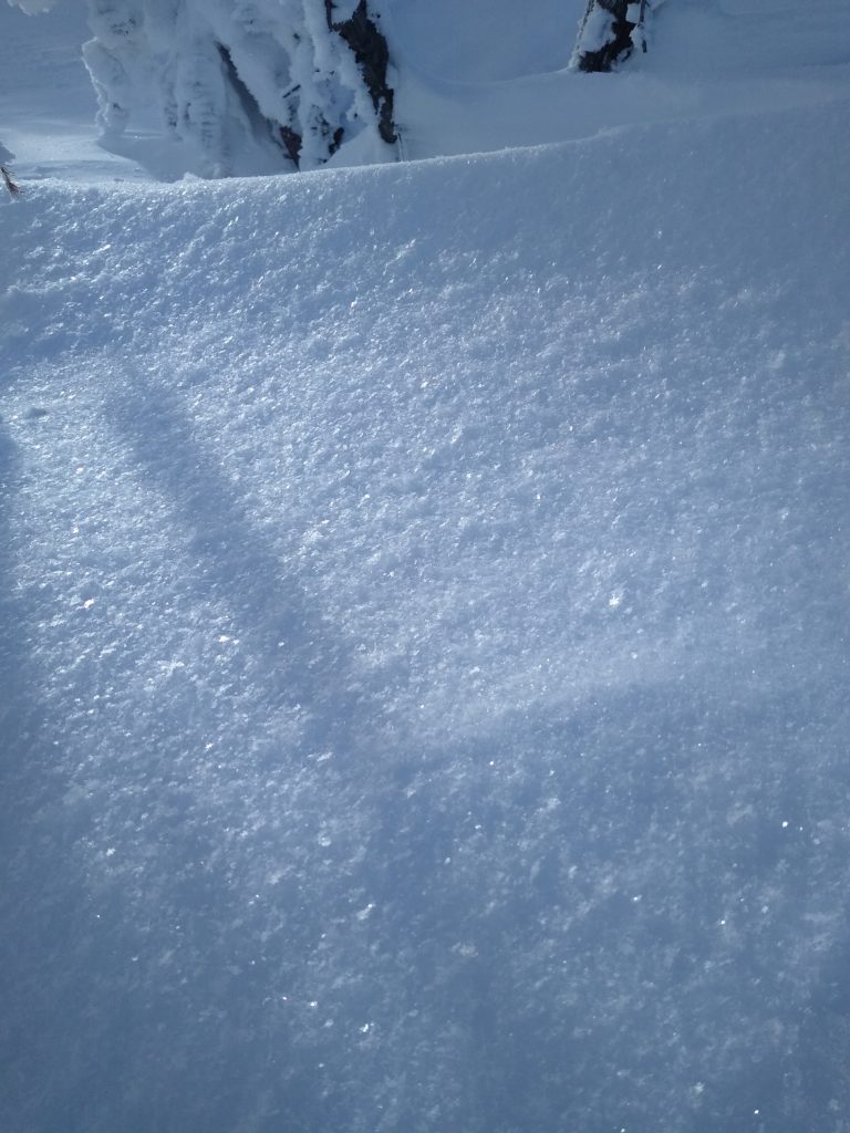
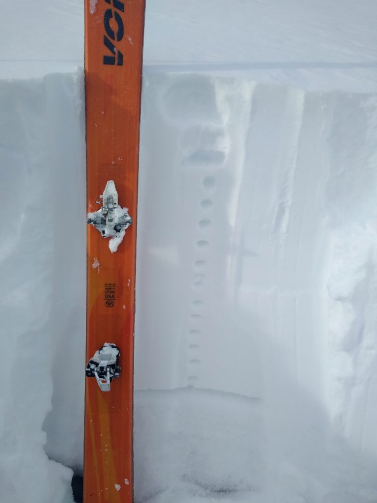
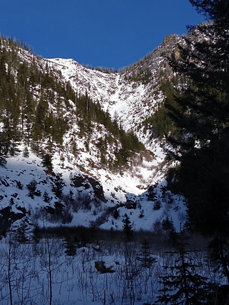
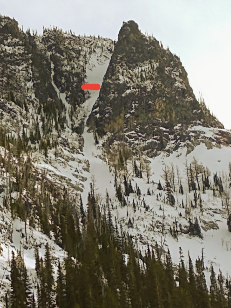
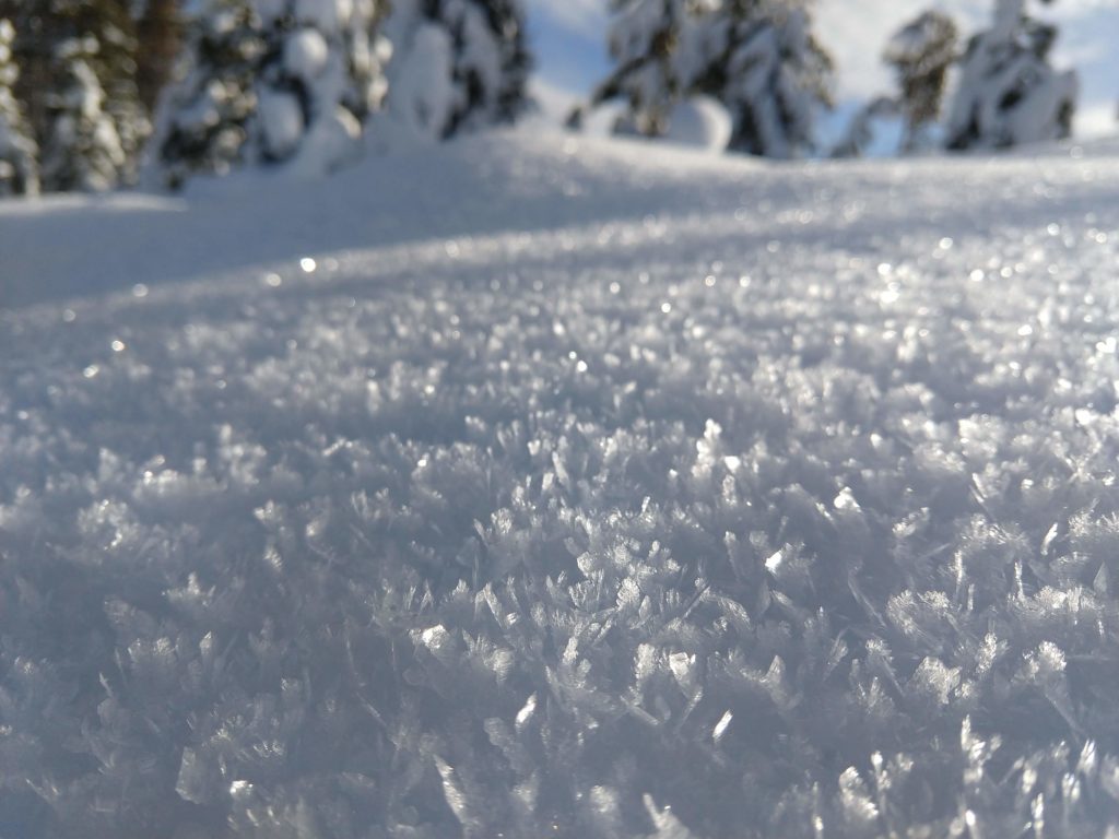
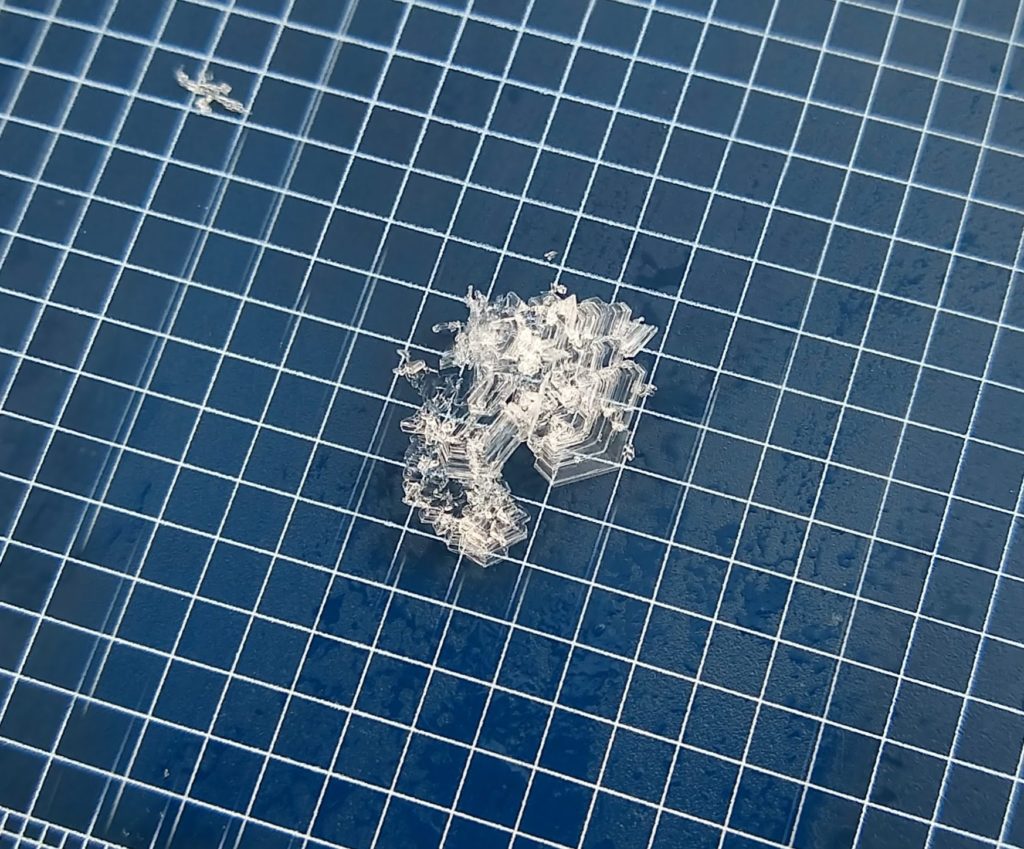
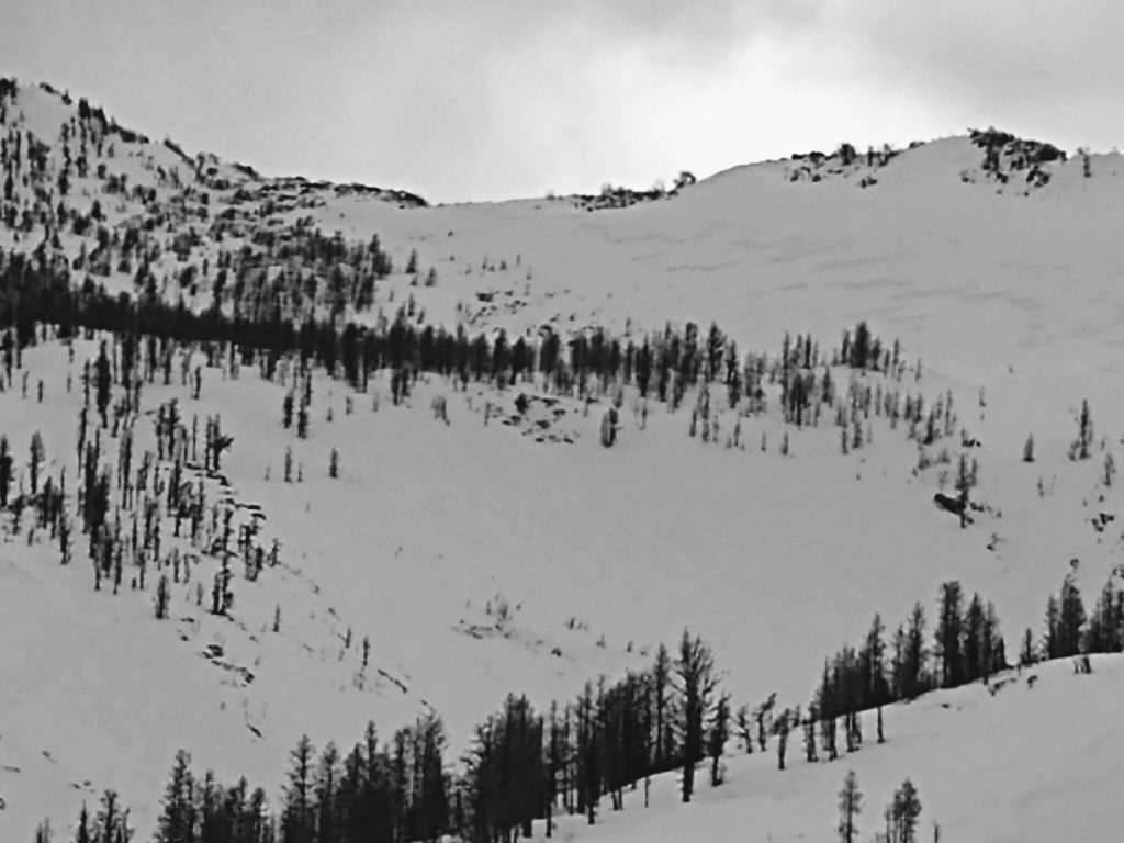
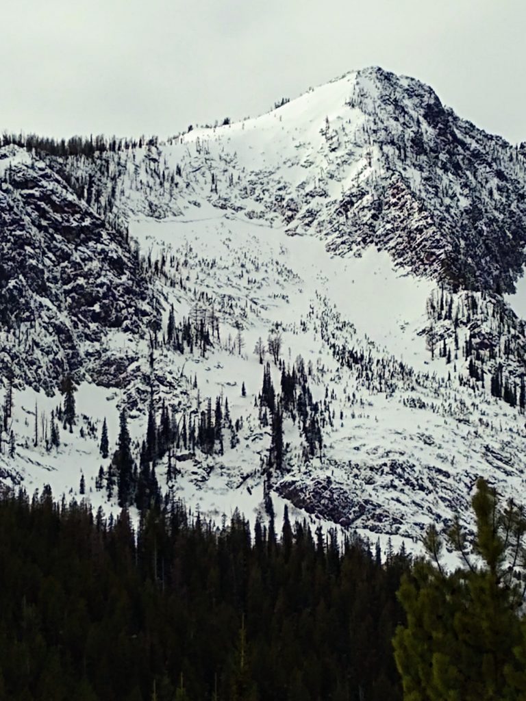
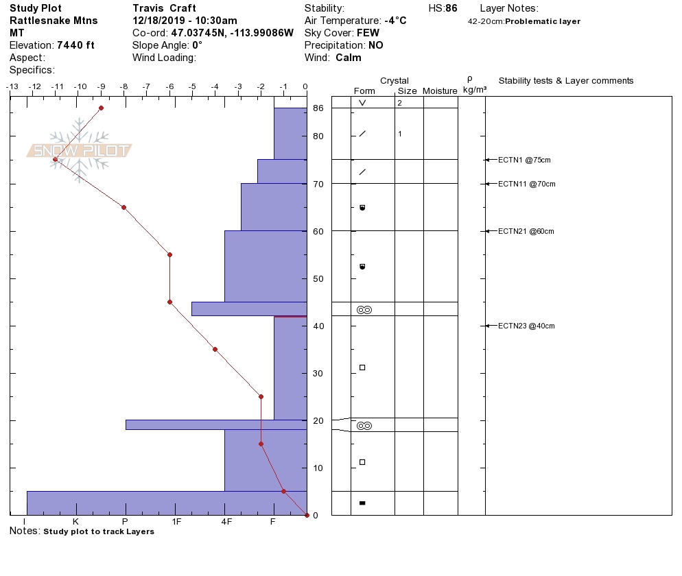
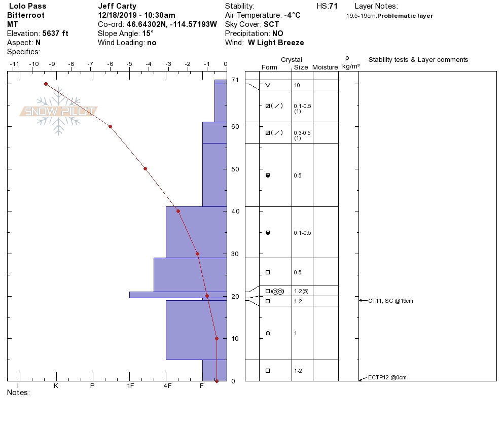
High pressure has dominated the forecast area over the last couple of days with strong winds. The snowpack is quite variable and complex. Snow depths in mid and upper elevations vary from 18 inches to 3 feet. We are still getting propagation in stability tests. We observed several natural slides that happened in our last storm cycle on North slopes that released on the 11/17 crust facet combination in the central Bitterroot. We found surface hoar development on shaded, sheltered aspects in the Rattlesnake and Lolo Pass. The surface hoar will be our next layer of concern once buried(see photo gallery).
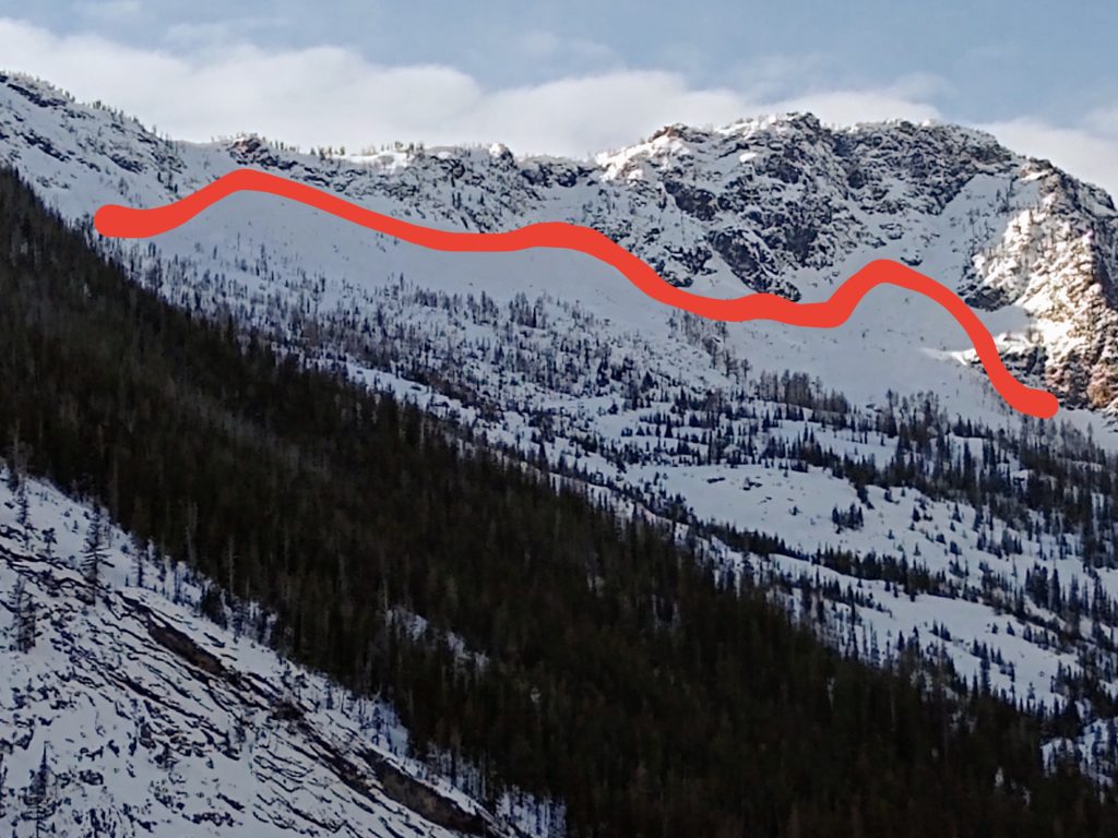
The primary avalanche problem is persistent slabs. The weak snowpack can produce large avalanches if triggered. Avoid likely trigger points(shallow rocky points and steep rollovers).
The second avalanche problem is small stubborn wind slabs. Look for wind loaded terrain. These are slabs are stubborn but can be triggered and step down into the deeper weak layers in the snowpack. Look for shooting cracks from skis or machine to identify this problem..
Bottom line: The snowpack can produce large avalanches on the 11/19 crust facet combination. Possible trigger points exist in shallow mid-elevation snowpacks and higher elevation start zones. Be diligent in terrain selection and snowpack evaluation: avoid shallow rocky sections and steep rollovers. Dig a snow pit. Look for red flags.
Avalanche and Weather Outlook
The snowpack structure is poor. New snow and wind will increase the avalanche danger. The storm should enter our forecast area later today. See the forecast. Pay attention to red flags and shifts in the weather. I will post the next avalanche forecast on December 21, 2019.
As always, if you make it out, please, feel free to share what you find on our public observations page.
Ski and ride safe.


