Thin Coverage on Burgundy

Posted:
Dec 21, 2019 @ 6:42 am

The avalanche danger for the west central Montana backcountry is MODERATE. Evaluate snow and terrain carefully. It is possible to trigger a large avalanche on steep slopes with shallow snowpacks. It is possible to trigger a small wind slab on ridge tops today.

Good morning, this is Travis Craft with the West Central Montana Avalanche Center’s avalanche advisory for December 21, 2019. This danger rating does not apply to operating ski areas, expires at midnight tonight, and is the sole responsibility of the U.S. Forest Service.

Weather and Snowpack

Mountain temperatures range from 28 F to 33 F in the region. In the Bitterroot, winds are 18 mph with gusts of 34 out of the South. In the northern part of the advisory area, winds are 8 mph and gusting 22 mph out of the SE. Trace of new snow in the last 24 hours.

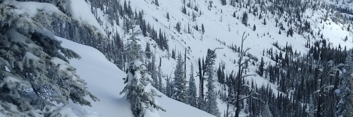
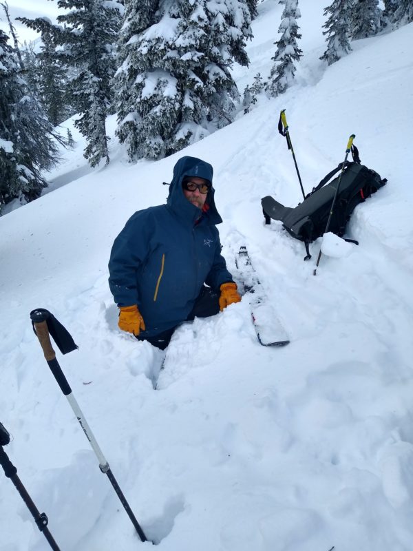
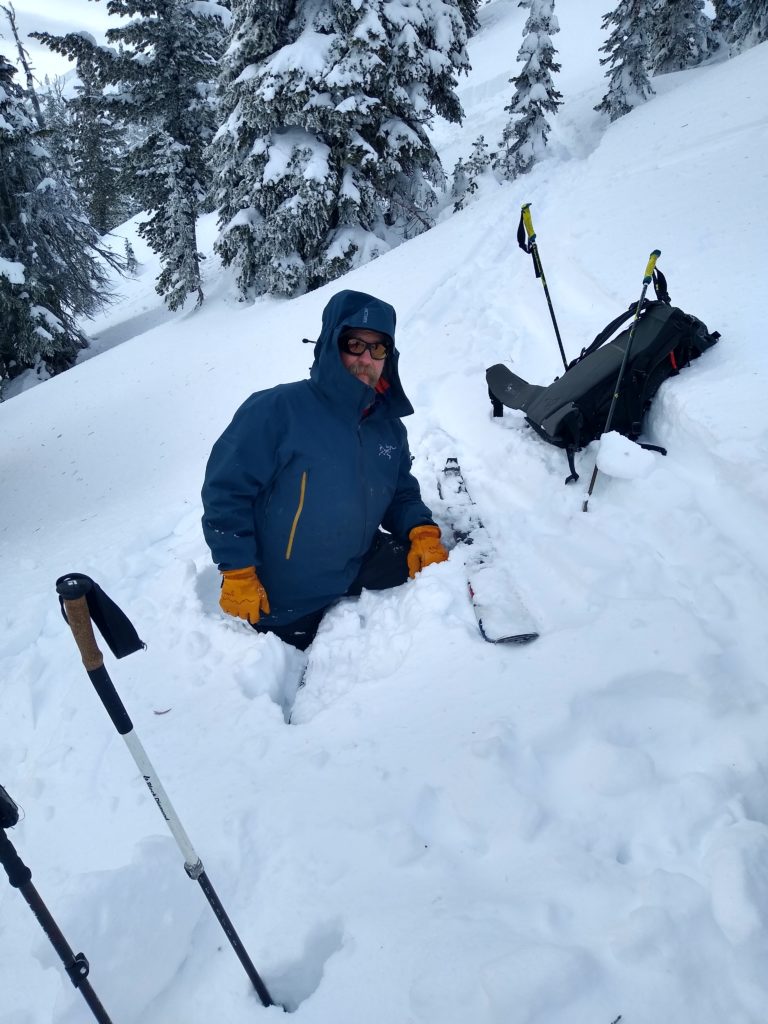
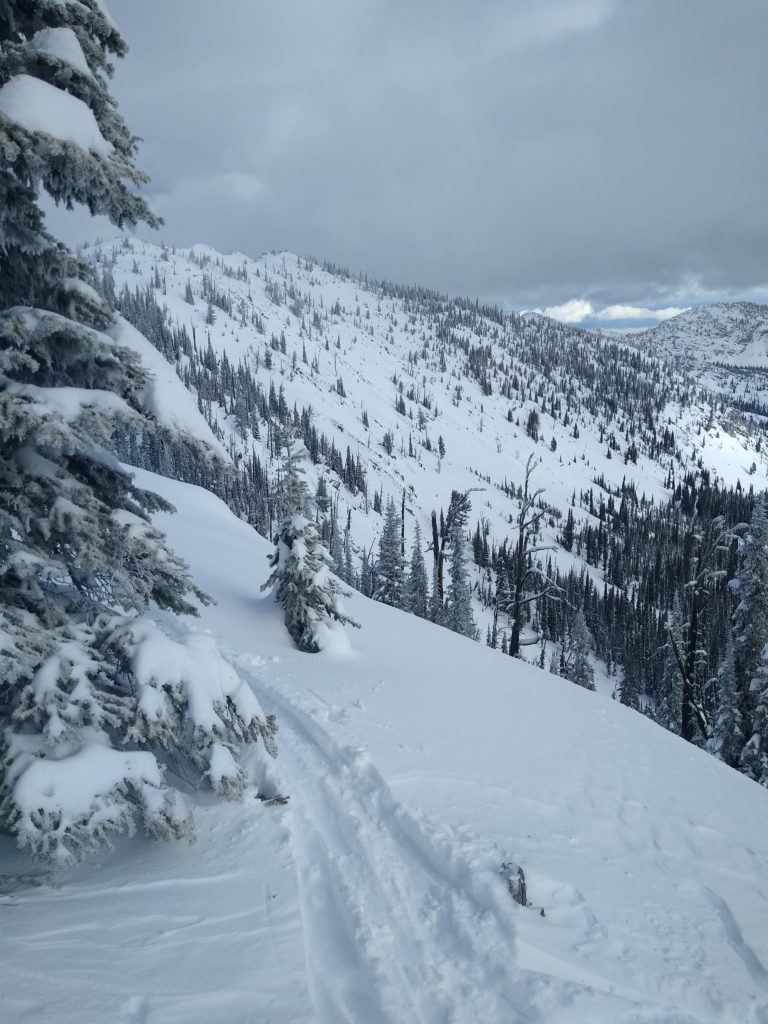
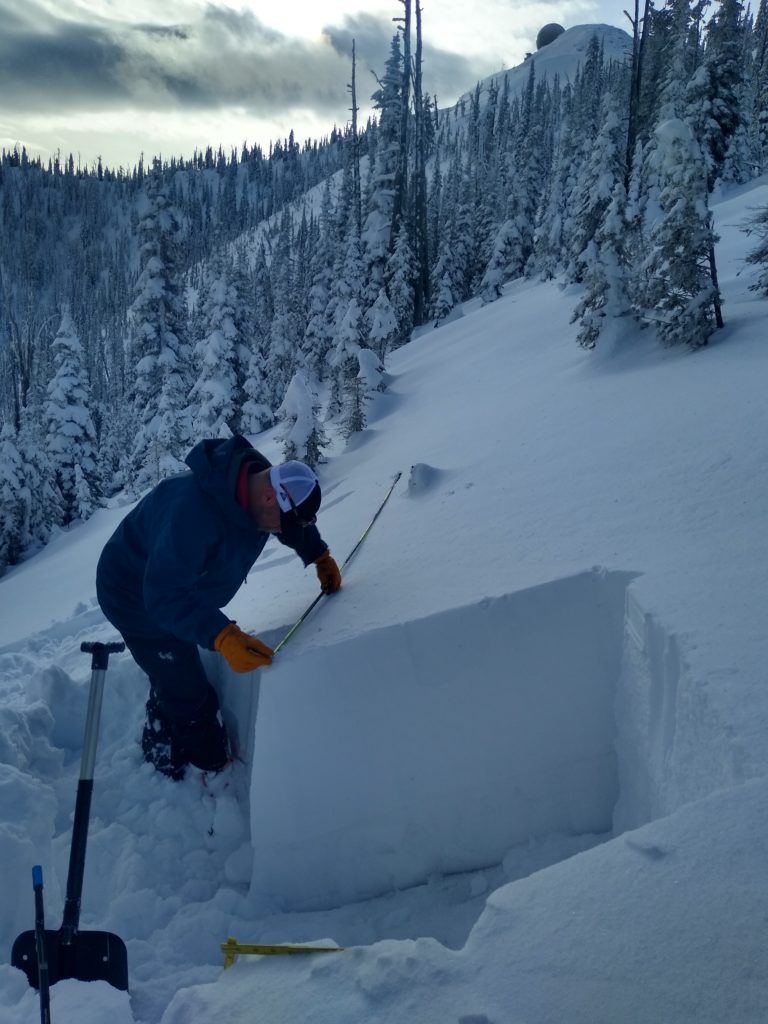
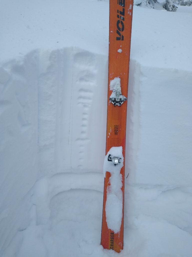
In the last two days, the forecast area received 3 new inches of snow and had strong winds primarily on ridge tops in the upper elevations above 6500 feet. The snowpack structure is weak. When stepping off skis, you are penetrating to the ground up to your waist. The snowpack varies in depth from 18 inches to 3 feet. In pit tests, we are still getting propagation. We saw active wind loading on slopes yesterday.

The primary avalanche problem is persistent slabs. The facet crust combinations are still reactive in pit tests. The recipe for an avalanche exists in our snowpack(a consolidated slab of snow over a weak layer with a bed surface). It is possible to trigger a large avalanche on this layer on slopes greater than 35 degrees at upper elevations >7000 feet. Avoid likely trigger points(shallow rocky points and steep rollovers).

The second avalanche concern is wind slabs. Over the last two days, winds have been strong and created small wind slabs. These slabs may be small but, if triggered, could step down to the deeper weak layers to create a much larger avalanche. Look for shooting cracks from skis or machines to identify this problem.

Bottom line: The recipe for a triggered human avalanche exists on steep slopes above 6500 feet. I do not trust the structure of the snowpack. Punching up to your waist is a sure sign of instability in our snowpack. Look for red flags. Dig a pit. Use caution and ride on more uniform slopes. Manage the persistent slab and wind slab avalanche problems by riding on sheltered lower angle terrain.

 Avalanche and Weather Outlook

Above-average temperatures and strong winds today. On Sunday, a cold front drops temperatures down to season averages. See the forecast. Pay attention to red flags and shifts in the weather. The avalanche danger will stay the same. Todd Glew will post the next forecast on December 24, 2019.

As always, if you make it out, please, feel free to share what you find on our public observations page.

Ski and ride safe.


READ FULL ADVISORY  

Problem 1 - Persistent Slabs

  • TYPE

    persistent-slabs

    Persistent Slabs

    Release of a cohesive layer of soft to hard snow (a slab) in the middle to upper snowpack, when the bond to an underlying persistent weak layer breaks.  Persistent layers include: surface hoar, depth hoar, near-surface facets, or faceted snow. Persistent weak layers can continue to produce avalanches for days, weeks or even months, making them especially dangerous and tricky. As additional snow and wind events build a thicker slab on top of the persistent weak layer, this avalanche problem may develop into a Persistent, Deep-Slab.

  • SIZE

    5-6

    2-3 (Large)

    The potential size of avalanche resulting from this problem.

  • LIKELIHOOD

    Likelihood-3

    Possible

    The likelihood of an avalanche resulting from this problem.

  • IMAGE

Yesterday in ECT’s and PST’s we got propagation on multiple aspects. The culprit is our early season crust facet combinations buried 2 to 3 feet in our snowpack. Dig  to the ground and perform a pit test. Getting off your machine or skis and punching up to your waist is a red flag of an unstable snowpack. Avoid likely trigger points(shallow rocky points and steep rollovers). 

Problem 2 - Wind Slabs

  • TYPE

    wind-slabs

    Wind Slabs

    Release of a cohesive layer of snow (a slab) formed by the wind.  Wind typically erodes snow from the upwind sides of terrain features and deposits snow on the downwind side.  Wind slabs are often smooth and rounded and sometimes sound hollow, and can range from soft to hard. Wind slabs that form over a persistent weak layer (surface hoar, depth hoar, or near-surface facets) may be termed Persistent Slabs or may develop into Persistent Slabs.

  • SIZE

    3-4

    1-2 (Small-Large)

    The potential size of avalanche resulting from this problem.

  • LIKELIHOOD

    Likelihood-2

    Unlikely/Possible

    The likelihood of an avalanche resulting from this problem.

These slabs may be small but, if triggered, could step down to the deeper weak layers to create a much larger avalanche. Look for shooting cracks from skis or machines to identify this problem.

VIDEO

PST Observations 12/20/2019

Observations 12/20/19 Rattlesnake

FORECAST & OUTLOOK

Small amounts of snow and warming temperatures. Look for a cold front to drop temperatures on Sunday. The avalanche danger will stay the same. See the forecast.

This information is the sole responsibility of the Forest Service and does not apply to operating ski areas. The avalanche danger rating expires at midnight tonight but the information can help you make a more informed decision regarding travel in avalanche terrain for the next few days.

Our advisory area includes National Forest System lands in the Bitterroot Mountains from Lost Trail Pass north to Granite Pass, the Rattlesnake Mountains north of Missoula and the Southern Swan and Mission Mountains near Seeley Lake, MT. Avalanche information for the Lookout Pass/St. Regis Basin area is available from the Idaho Panhandle Avalanche Center.