
The avalanche danger for the West Central Montana backcountry is MODERATE. It is possible to trigger large dangerous avalanches in steep terrain.
Good morning, this is Todd Glew with the West Central Montana Avalanche Center’s avalanche advisory for December 26, 2019. This danger rating does not apply to operating ski areas, expires at midnight tonight, and is the sole responsibility of the U.S. Forest Service.
Weather and Snowpack
Mountain temperatures are currently in the single digits to low teens, with light winds out of the WSW in most locations. Sky cover is partly cloudy with no precipitation.
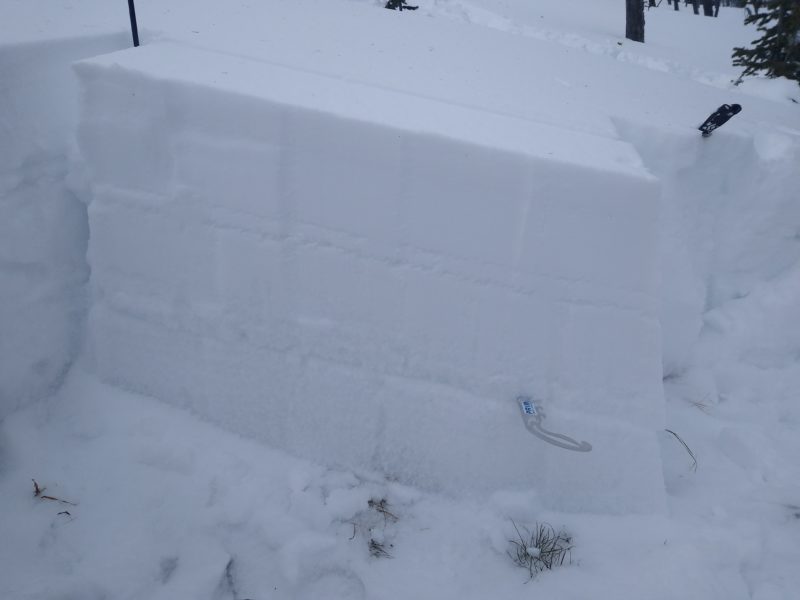
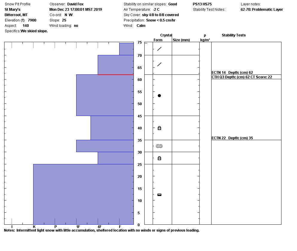
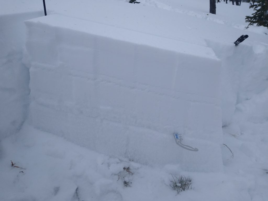
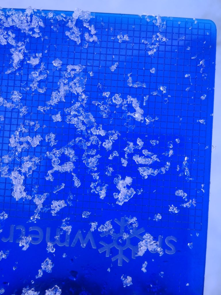
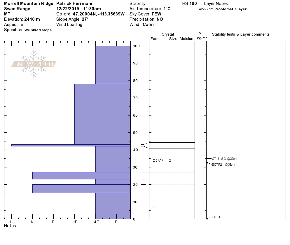
Over the past week or so, we have not received much new snow, just a few inches in favored locations. Despite the lack of snow, there is still the chance to trigger avalanches on all aspects above 7000 feet in elevation and 35 degrees or steeper. Snow pit results are still showing signs for propagation, failing near the ground. We have about 1.5 to 3 feet of snow above 6500 feet in elevation. The snowpack structure is weak and stepping off your skis or sled will quickly show you the snow depth, as you will sink to the ground.
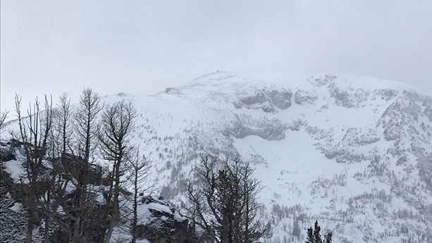
Our primary concern is persistent slab avalanches. This avalanche concern is prevalent on all aspects above 7000 feet in elevation and 35 degrees or steeper. This avalanche problem is buried close to the ground and would be catastrophic if you are caught and carried in an avalanche. The most likely place to trigger a persistent slab avalanche would be in thinner areas, primarily found near rock and cliff bands.
According to the Oxford dictionary, the definition of persistent is “continuing to exist or endure over a prolonged period.” This definition nails our primary avalanche concern on the head. We have a complex snowpack with a persistent slab avalanche problem that may exist for the foreseeable future. We have weak faceted snow, capped with a stronger slab of snow above it. The poor structure of our snowpack lends itself to the potential for dangerous slab avalanches, failing near the ground.
Bottom line: We have the possibility for human triggered persistent slab avalanches on steep slopes above about 7000 feet in elevation. Persistent slab avalanches are pesky because often times snow pit results and ski or sled tracks on a slope are not a good indicator of the stability of the slope. A good analogy is to imagine a lunch tray on the side of a mountain. People could be skiing the mountain all day, until the one unlucky person skis over the lunch tray, which is the trigger point, creating an avalanche. Remember this analogy as you get into the mountains today.
Avalanche and Weather Outlook
Mountain temperatures today are forecasted to be to 18-29 F, with wind chills below 0 F. Winds are out of the SW, blowing 5-20mph with gusts as high as 30mph. SW winds are expected to increase this evening, with up to 4 inches of snow falling tomorrow.
Any new snow will make the avalanche danger rise, especially if it is accompanied by wind. Pay attention to any new changes in regards to wind and snow. Watch out for red flags such as cracking, collapsing, recent avalanches, and wind loading.
If you make it out into the mountains, any information is greatly appreciated. Send us your observations here.
Ski and ride safe.


