
The avalanche danger for the West Central Montana backcountry is MODERATE. It is possible to trigger large dangerous avalanches in steep terrain.
Good morning, this is Todd Glew with the West Central Montana Avalanche Center’s avalanche advisory for December 28, 2019. This danger rating does not apply to operating ski areas, expires at midnight tonight, and is the sole responsibility of the U.S. Forest Service.
Weather and Snowpack
We are currently under partly cloudy skies with mountain temperatures in the teens and light winds out of the NW. Over the past 24 hours, we have received 1-6 inches of snow in favored locations and .1 to .3 inches of Snow Water Equivalent (SWE).
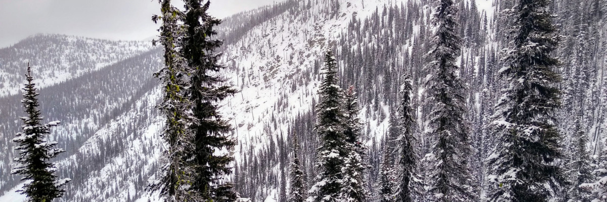
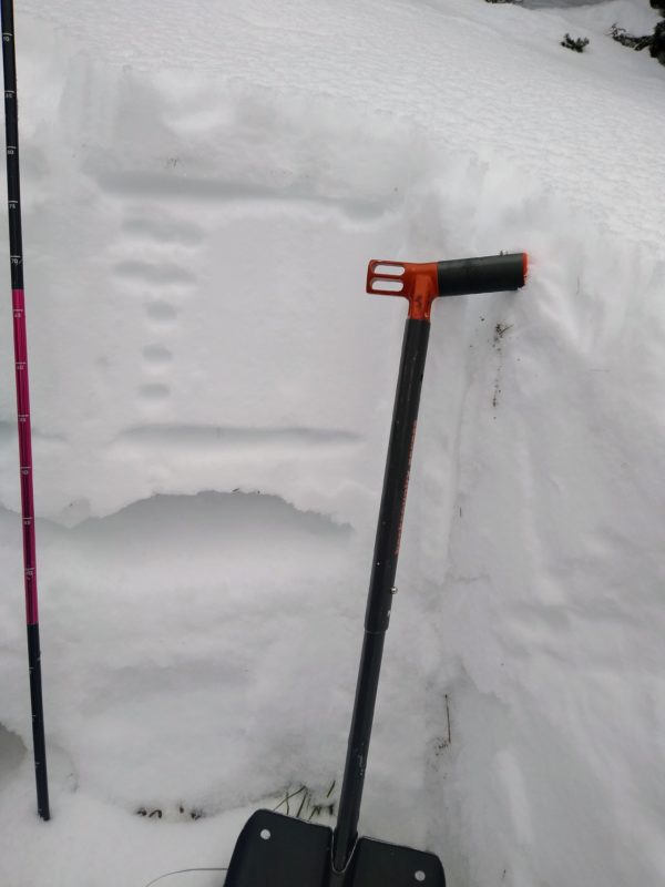
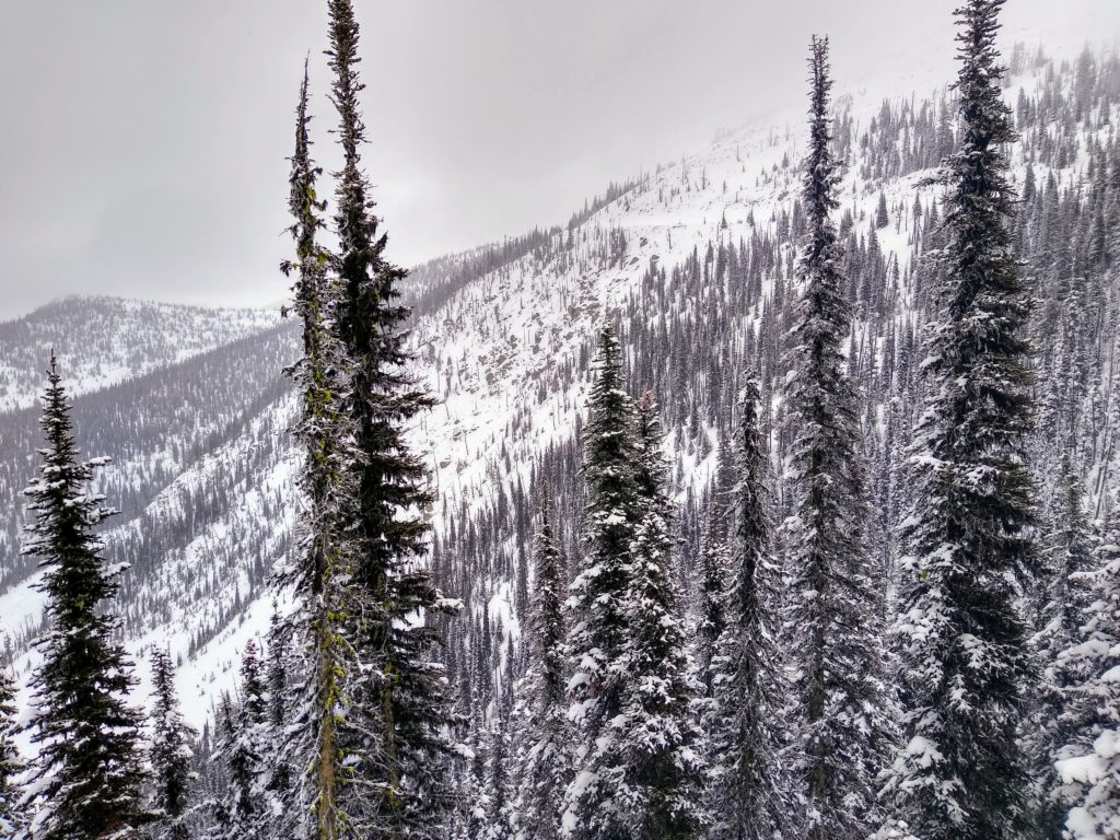
The recent snowstorm was a nice change from the lack of snow during the past couple of weeks. Throughout our forecast area, our total snow depth is 1.5 to 3 feet above 6500 feet in elevation. The snowpack is weak, and stepping off your skis or sled provides one with a quick trip to the ground. Another fun fact about our weak and complex snowpack is that dangerous avalanches breaking near the ground are possible.
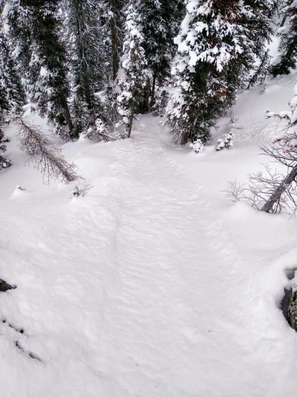
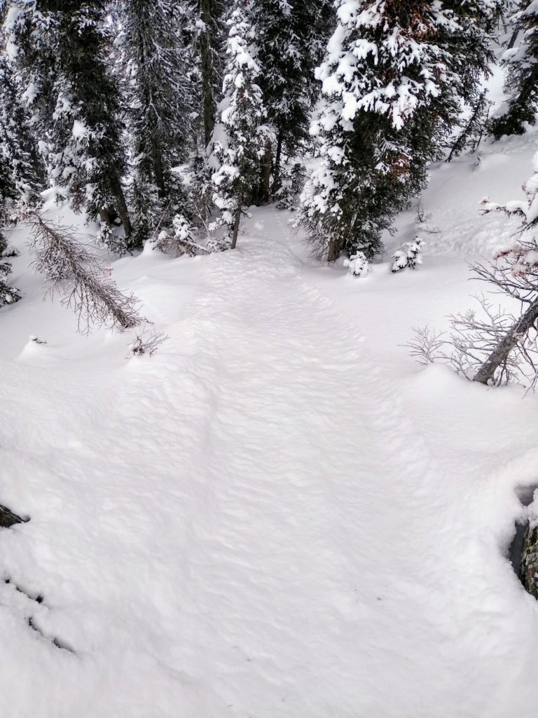
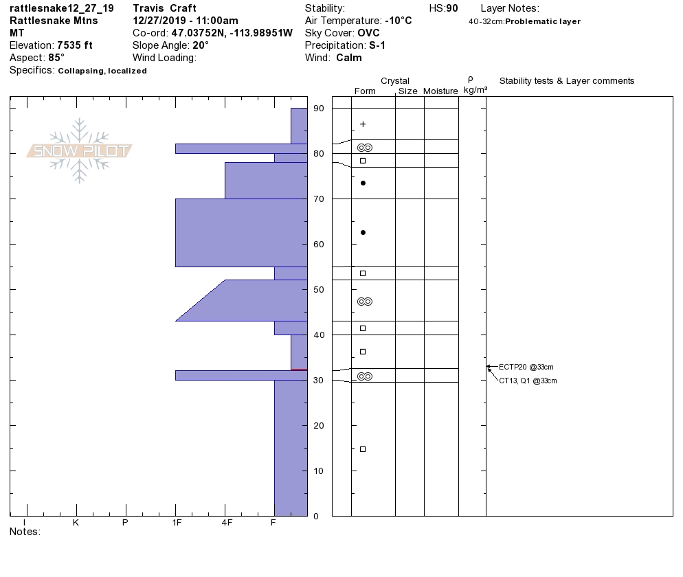
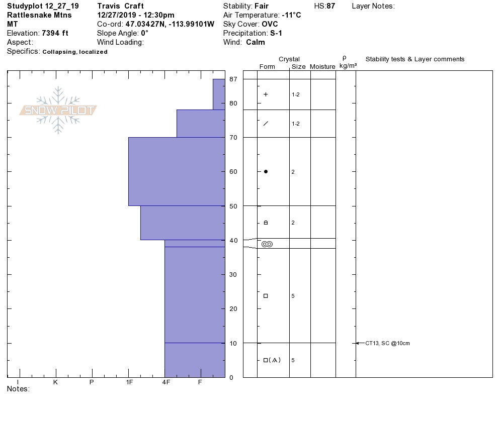
The primary concern is persistent slab avalanches. Snow pit test results are still showing signs of propagation, confirming that the snowpack is unstable. Natural avalanches have also been observed. We have weak snow located about a foot off the ground with about 1 to 2 feet of stronger snow sitting on top of it. This structure lends itself to the potential for human triggered avalanches. Persistent slab avalanches are a concern above 7000 feet in elevation with a slope steepness of 35 degrees or greater. The most likely spot you could trigger this type of avalanche is in thin rocky areas or open slopes with a connected slab of snow. I do not trust my life with this snowpack.
The secondary concern is new snow avalanches. In favored locations, we have received up to 6 inches of very light density snow. This new snow has landed on a variety of slick old snow surfaces such as melt-freeze crusts, rime ice crusts, and surface hoar. Yesterday the snow was easily sluffing on slopes above 35 degrees. I would imagine that this would be the case today. Use small, inconsequential test slopes to see how the new snow is reacting. If you notice the new snow is easily sliding on the old snow, then there is the potential for the new snow to move fast and far down steep slopes. This type of avalanche has the potential to push you off your feet, taking you for a ride.
Bottom line: The snowpack structure is weak, and the chance of getting caught in a large dangerous avalanche is possible. Avoid likely areas to trigger an avalanche, such as thin rocky areas or connected slabs of snow. Avalanches are possible in terrain above 7000 feet in elevation and 35 degrees or steeper.
Avalanche and Weather Outlook
Today mostly clear skies and light winds out of the WSW with gusts up to 28mph are expected. Temperatures will be in the twenties with wind chill values below 0 F. Late this afternoon and evening, clouds are expected to build, followed by more snow with up to 6 inches of snow by tomorrow evening in favored locations. Expect the avalanche danger to rise with any new snow or wind. Pay attention to any new changes, and look out for red flags.
As always, if you make it out, please, feel free to share what you find on our public observations page.
Ski and ride safe.


