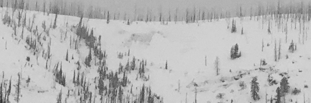

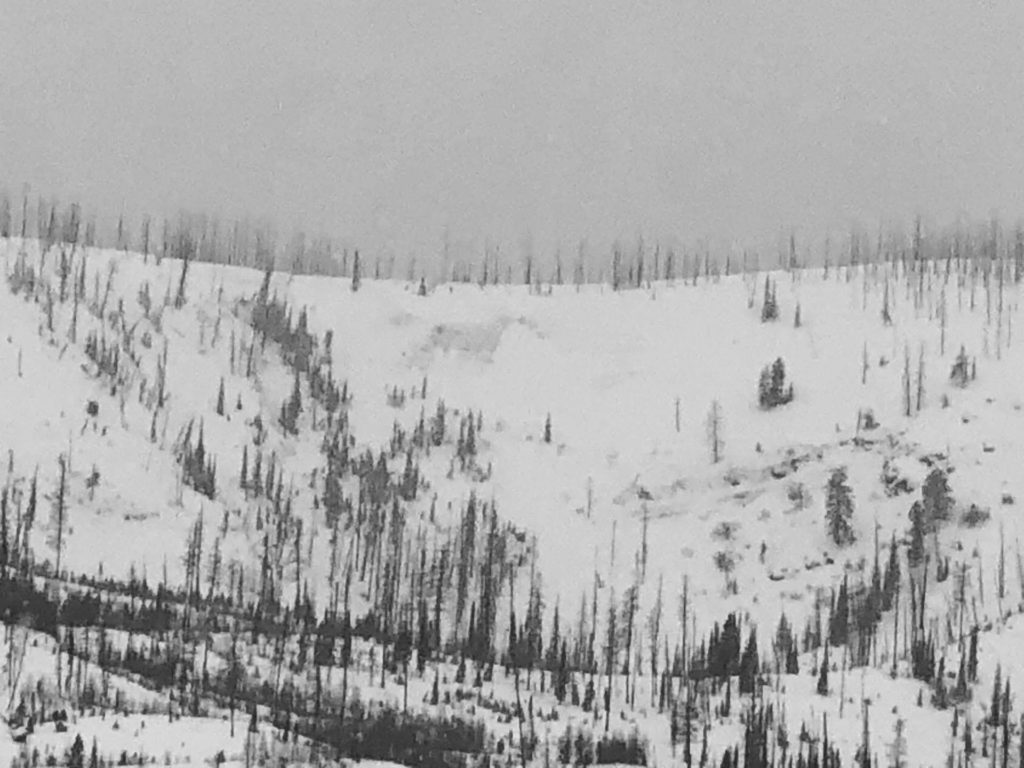
An avalanche warning continues for the southern Mission, southern Swan, Rattlesnake, and southern and central Bitterroot mountains. Our deepest condolences go out to the friends and family of two people killed in an avalanche in the Seeley Lake Region of our forecast area yesterday. We will provide more details later today or tomorrow. The avalanche danger for the west central Montana backcountry is HIGH. Human triggered avalanches are certain. The avalanche hazard is increasing with continued snowfall. Travel in avalanche terrain is not recommended. Avalanches may run long distances and avoid runout zones.
This is Todd Glew with an avalanche warning for January 02, 2020. This avalanche warning is valid for 24 hours. The avalanche warning will either be extended or terminated at 0630 on January 03, 2020. This danger rating does not apply to operating ski areas, expires at midnight tonight, and is the sole responsibility of the U.S. Forest Service.
Weather and Snowpack
Mountain temperatures are currently in the 20’s with gusty ridge top winds out of the W. It is currently snowing and blowing at many locations throughout our forecast area.
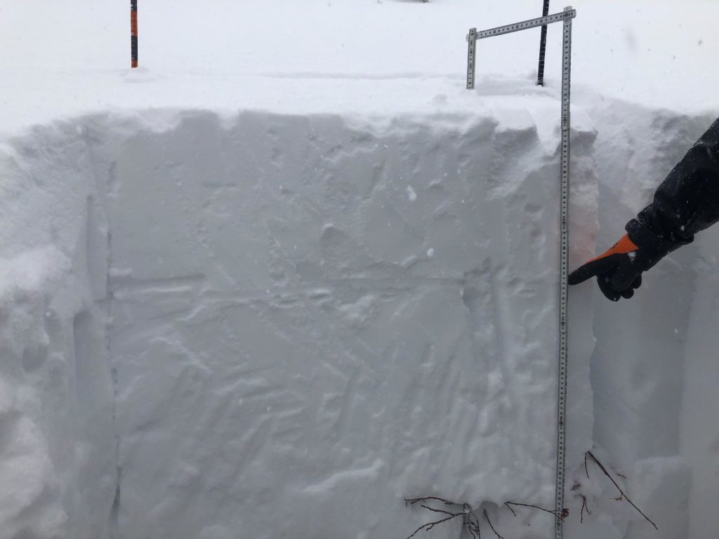
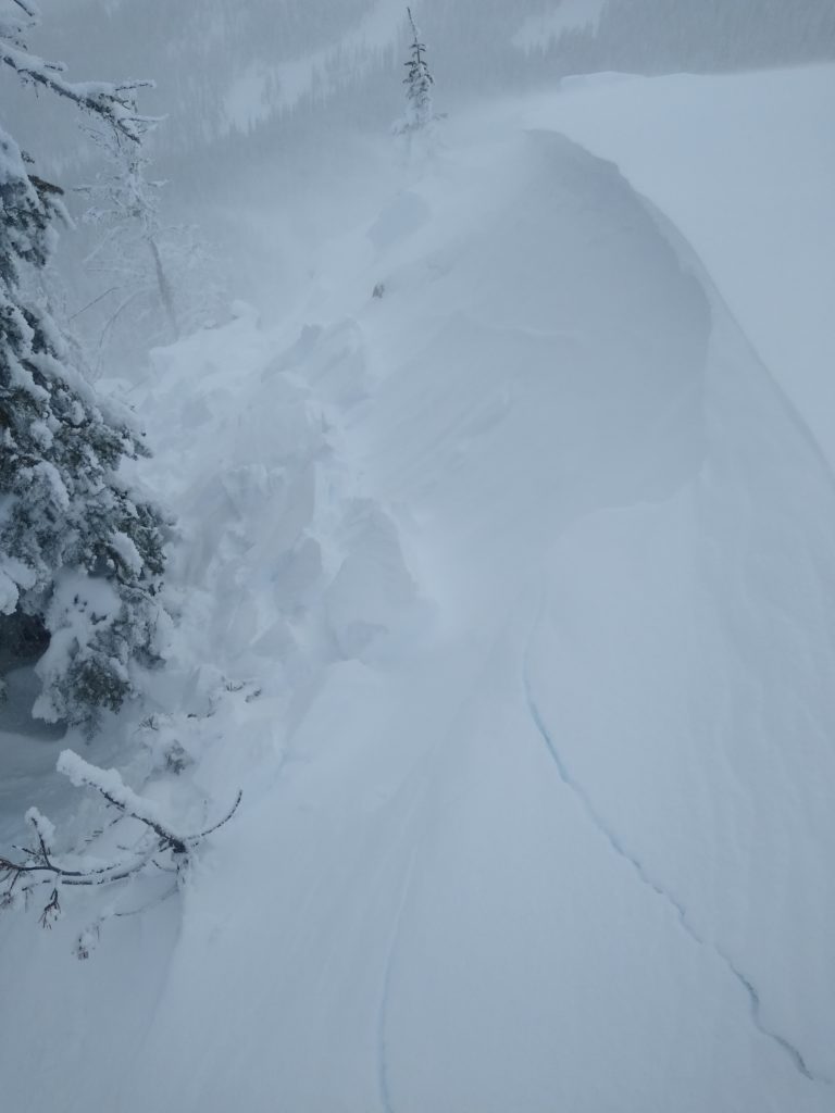
What a blockbuster of a storm, this storm just overloaded our weak snowpack with a significant amount of water weight. To help you better understand our primary avalanche concern, imagine trying to park a Mack Truck on top of a box of champagne glasses. The new storm snow being the Mack Truck, and the old snow being the box of champagne glasses. A recipe for disaster.
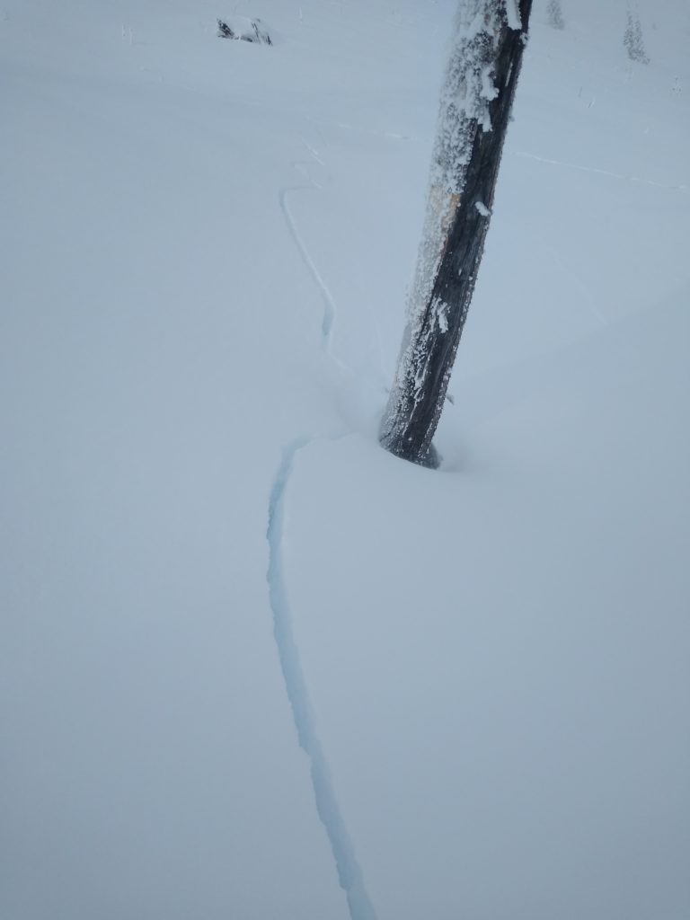
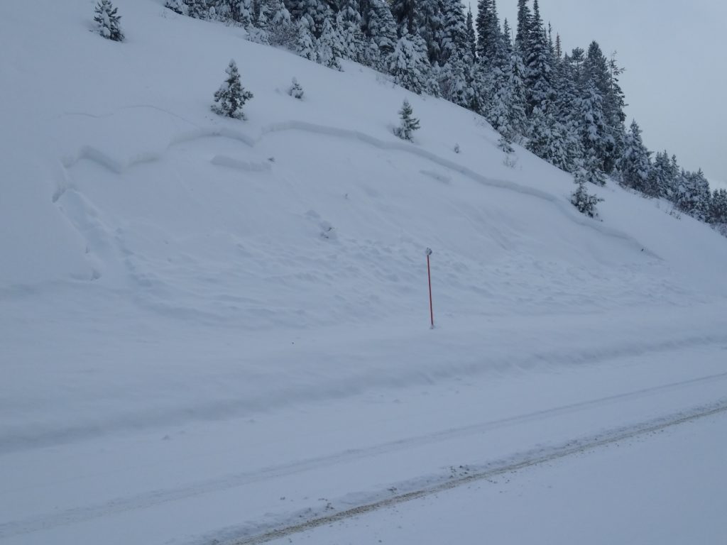
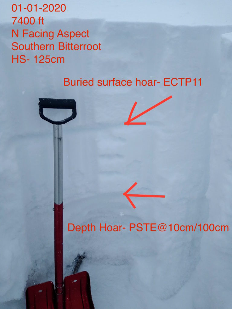
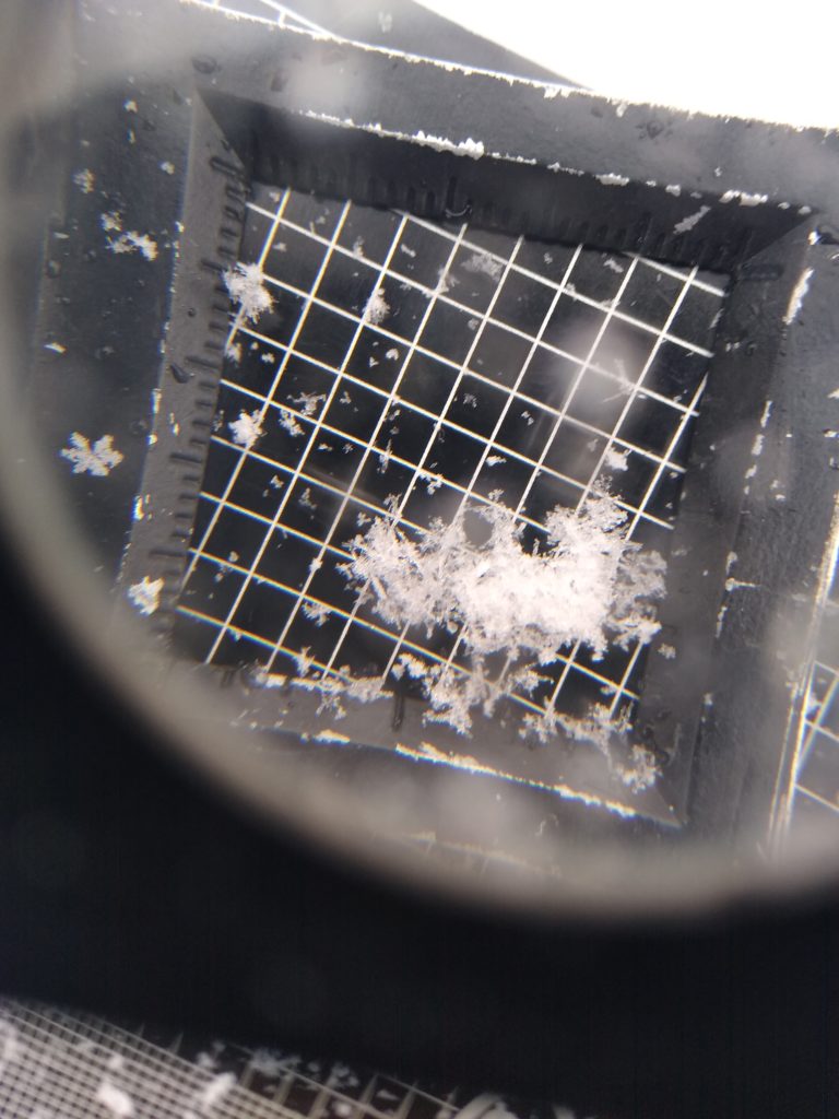
Our primary avalanche concern is persistent slab avalanches. We have multiple weak layers in our snowpack that have been overloaded by 1.5-3.5 inches of SWE in the past 48 hours. The SWE amount translates to 1.5 to 2.5 feet of new snow, sitting on top of an avalanche prone snowpack. Our first layer of concern is a surface hoar, crust, near-surface facet layer buried below the new snow. This layer has been failing in natural and human triggered avalanches. About a foot or so off the ground is another layer of concern, weak sugary depth hoar that has also been failing in natural and human triggered avalanches.
Our secondary concern is wind slab avalanches. Winds have been strong out of the W throughout this storm, forming wind slabs near ridges or on cross-loaded features. These can be identified by looking for bulbous or pillowy like features located on the leeward side of ridges. Remember, even a small wind slab has the potential to step down and create larger avalanches.
Bottom line: Avoid traveling in or below avalanche terrain today. Stay off of and far away from any slopes approaching 30 degrees in steepness. We have a dangerous snowpack that is screaming for us to stay away. Watch out for red flags such as cracking, collapsing, wind loading, and recent avalanches. There is plenty of fun to be had on low angle slopes out of avalanche terrain.
Avalanche and Weather Outlook
Today snow showers are expected throughout the day with additional accumulations of 2-6 inches possible. Winds will be strong out of the W with gusts up to 60mph expected. Temperatures will be in the 20’s today with wind chill values below 0. More snow is expected later this evening with another blast of snow this weekend. Stay tuned.
If you make it out into the mountains, any information is greatly appreciated. Please send us your observations here.
Ski and ride safe.


