Posted:
Jan 3, 2020 @ 6:50 am

The avalanche danger for the west central Montana backcountry is HIGH In wind loaded terrain and CONSIDERABLE elsewhere. Dangerous avalanche conditions exist and travel in avalanche terrain is not recommended. Hazard may increase with high winds and rising temperatures, check for updates tomorrow.

Good morning, this is Jeff Carty with the West Central Montana Avalanche Center’s avalanche advisory for January 3, 2020. This danger rating does not apply to operating ski areas, expires at midnight tonight, and is the sole responsibility of the U.S. Forest Service.

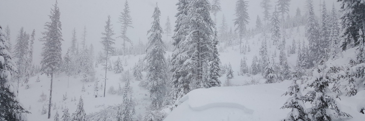
The new year came in with a bang. The storm has delivered up to 4.3″ of Snow Water Equivalent (SWE). More than 2 feet of snow fell in the Bitterroots, the southern Missions, and the Swan. The Rattlesnake received just slightly less. Winds gusted to 50mph and have averaged 35mph over the last three nights transporting considerable snow. Warm, near-freezing temperatures accompanied the storm, and much of the snow was dense as a result. 

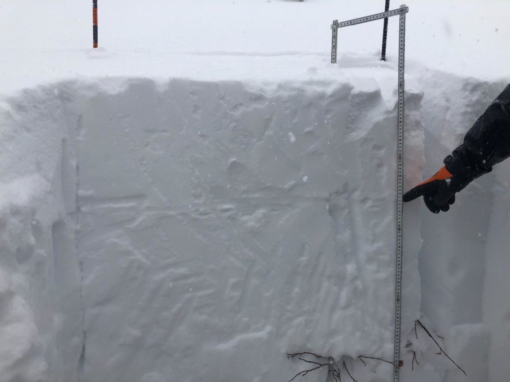
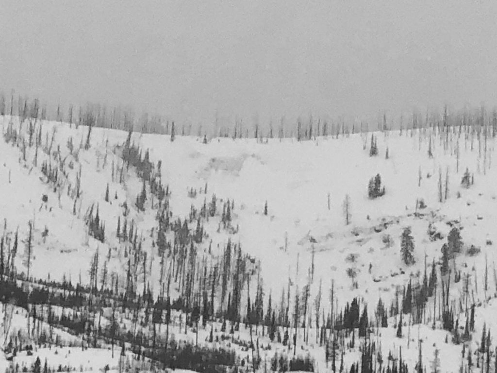
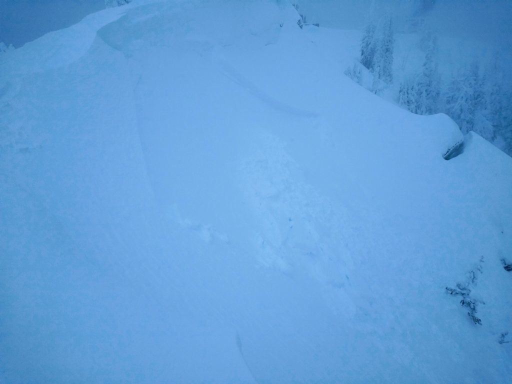
The storm has put tremendous stress on a snowpack with a very poor structure. In addition to the avalanche that resulted in the fatalities, multiple natural avalanches occurred throughout the forecast area. At least one of these failed in the buried weak layers near to the ground. A slide was remotely triggered at Lolo Pass. Widespread whumphing and cracking have been experienced throughout the forecast area. It has been difficult to assess the full extent of natural avalanching. Visibility has been poor; snow accumulation has been rapid, covering signs and travel has been hazardous. The avalanche cycle is likely more widespread than we are aware of and not yet finished.

Persistent slab is again our primary concern, the Dec. 29th surface hoar adding another persistent weak layer. It is widespread under the new snow throughout the forecast area and present at all elevations above 5000′. The nature of this layer means that avalanches can be remotely triggered from above, below, or adjacent to avalanche slopes from low angle terrain. It is very likely to trigger a slab on this layer, and it may step down to deeper persistent weak layers creating a much larger avalanche. 

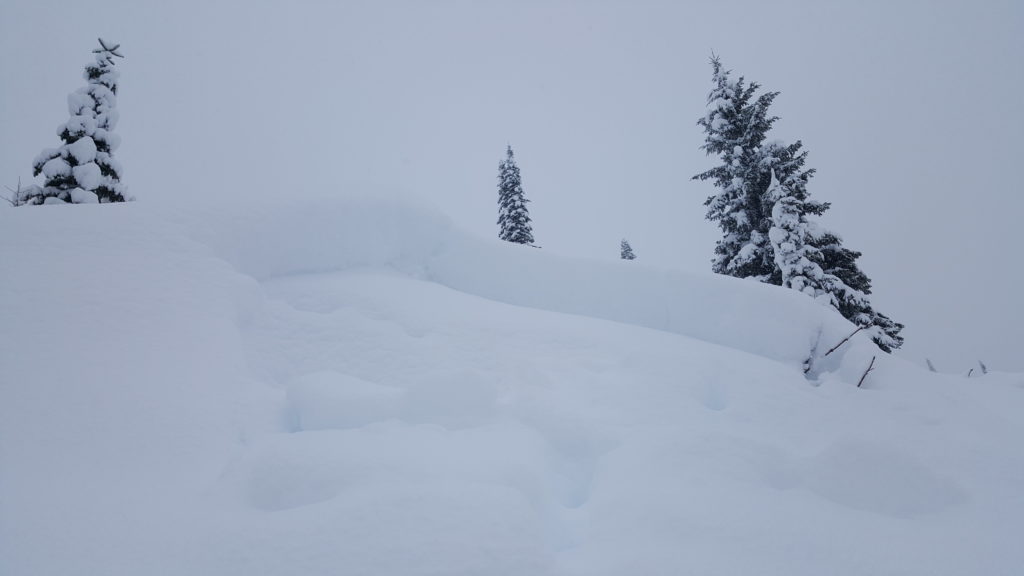
Wind slab is our other problem. I hesitate to call it a secondary concern as it is very touchy, present on all leeward and cross-loaded slopes, and certain to be triggered by the weight of a person or snowmobile. This wind slab may be several feet thick, and small slides may produce considerable debris capable of deeply burying people. Wind slab avalanches are likely to trigger persistent slabs.

Today temperatures are expected to rise above freezing throughout the forecast area at most elevations and stay elevated overnight. This will create thaw instabilities that may increase avalanche hazard by weakening bonds in the snowpack. Strong southwest winds with gusts to 50mph will continue to load slopes and build wind slabs. Minimal new snow, up to one inch is expected today.

The bottom line: 

There is lots of good riding on low angle slopes, and there will be more powder in the future. The outcome of an avalanche with our current problems is not worth the gamble.

Slopes that may not be perceived to be avalanche slopes may avalanche with our current snowpack. Because slopes lack obvious signs or haven’t been witnessed sliding does not mean they are safe. Slopes down to 30º could slide given the low friction and propagation likelihood of the problem layers. 

Very careful and critical terrain assessment is required. Travel in avalanche terrain is not recommended. Give a wide margin if traveling below slopes and paths. Always travel with a beacon, shovel, and probe, and knowledgeable partners. 

Please share any observations you have on our Public observations page.

Ski and ride safe

READ FULL ADVISORY  

Problem 1 - Persistent Slabs

  • TYPE

    persistent-slabs

    Persistent Slabs

    Release of a cohesive layer of soft to hard snow (a slab) in the middle to upper snowpack, when the bond to an underlying persistent weak layer breaks.  Persistent layers include: surface hoar, depth hoar, near-surface facets, or faceted snow. Persistent weak layers can continue to produce avalanches for days, weeks or even months, making them especially dangerous and tricky. As additional snow and wind events build a thicker slab on top of the persistent weak layer, this avalanche problem may develop into a Persistent, Deep-Slab.

  • SIZE

    5-6

    2-3 (Large)

    The potential size of avalanche resulting from this problem.

  • LIKELIHOOD

    Likelihood-6

    Likely/Very Likely

    The likelihood of an avalanche resulting from this problem.

  • ADDED DANGER

    Increased Slope Danger

    Increased/Added Danger

    There is an increased risk of avalanches on these slopes:

    N - North
    NE - Northeast
    E - East
    SE - Southeast
    S - South
    SW - Southwest
    W - West
    NW - Northwest

Persistent slab is our primary avalanche problem.

The storm slab that was our primary problem for the last two days is consolidating and sits on a thin ice crust over top of surface hoar, and near-surface facets deposited Sunday, December 29. This layer is present forecast wide, at all elevations above 5000 feet.

This is a very weak layer that is demonstrating high propagation likelihood, low strength, and low friction in test pits. Also, we have reports of remotely triggered slides, extensive whumphing, and shooting cracks on this layer.

As the overlying slab stiffens, propagations will be able to travel further within the snowpack. The potential size of avalanches on this layer is increasing.

It is possible to remotely trigger avalanches within this layer from below, above or adjacent to an avalanche slope, on low angle terrain (>30º). The friction is very low (slippery), and slopes that would not normally slide may be able to. Be very critical and suspect of all slopes over 30º.

In addition, facet and depth hoar layers interspersed with crusts remain deep in the snowpack. A natural avalanche that released on January 1 in the southern Missions appears to have slid on these deep layers. Stability tests on these layers continue to show low to moderate strength, moderate to high propagation likelihood and low friction.

In some places, this layer is now 5 feet deep and may be triggered by an avalanche in the Dec. 29th layer. The likelihood of surviving a slide on the deeper layers is very low.

This problem will be with us for a while and requires patience. Stay off slopes over 30º, stay well away from the base of slopes and avoid runout zones.

Problem 2 - Wind Slabs

  • TYPE

    wind-slabs

    Wind Slabs

    Release of a cohesive layer of snow (a slab) formed by the wind.  Wind typically erodes snow from the upwind sides of terrain features and deposits snow on the downwind side.  Wind slabs are often smooth and rounded and sometimes sound hollow, and can range from soft to hard. Wind slabs that form over a persistent weak layer (surface hoar, depth hoar, or near-surface facets) may be termed Persistent Slabs or may develop into Persistent Slabs.

  • SIZE

    3-4

    1-2 (Small-Large)

    The potential size of avalanche resulting from this problem.

  • LIKELIHOOD

    Likelihood-8

    Very Likely/Certain

    The likelihood of an avalanche resulting from this problem.

  • ADDED DANGER

    Increased Slope Danger

    Increased/Added Danger

    There is an increased risk of avalanches on these slopes:

    N - North
    NE - Northeast
    E - East
    SE - Southeast
    S - South
    SW - Southwest
    NW - Northwest

Throughout the storm, the wind has been strong to extreme. It has mainly been out of the west but has veered both southwest and northwest.

In conjunction with abundant snowfall, these winds have been creating wind slabs several feet thick that are very touchy. It is certain that these can be triggered by the weight of a single person.

In areas that did not slide naturally during the brunt of the storm, these wind slabs are sitting on the persistent weak layer discussed above.

The greatest hazard from wind slab exists at or near ridgetop. However, considerable cross-loading has been observed, and there may be pockets of windslab lower down on slopes, in gullies, and behind terrain features. High winds mean that pockets of wind slab may be lower on slopes than normally encountered.

Wind slabs may run long distances, may trigger larger slab avalanches within the persistent weak layers, and may be remotely triggered from below given our current snowpack structure.

Travel advice remains the same as for persistent slab, avoid slopes over 30º, stay well away from the base of slopes and runout zones.

FORECAST & OUTLOOK

Winds will continue to be strong today, gusting up to 50mph, tomorrow these will build to 75 mph.

Temperatures are expected to rise above freeze at most elevations and stay warm overnight.

Minimal snow is expected today, 0-1″.

Tomorrow temperatures will drop and there is a chance of up to 6 inches of snow.

This information is the sole responsibility of the Forest Service and does not apply to operating ski areas. The avalanche danger rating expires at midnight tonight but the information can help you make a more informed decision regarding travel in avalanche terrain for the next few days.

Our advisory area includes National Forest System lands in the Bitterroot Mountains from Lost Trail Pass north to Granite Pass, the Rattlesnake Mountains north of Missoula and the Southern Swan and Mission Mountains near Seeley Lake, MT. Avalanche information for the Lookout Pass/St. Regis Basin area is available from the Idaho Panhandle Avalanche Center.