
The avalanche danger for the west central Montana backcountry is HIGH on all slopes over 5500 feet in elevation. All other slopes the danger is CONSIDERABLE. New snow and winds are creating large dangerous avalanches. Travel in avalanche terrain is not recommended.
Good morning, this is Travis Craft with the West Central Montana Avalanche Center’s avalanche advisory for January 7, 2019. This danger rating does not apply to operating ski areas, expires at midnight tonight, and is the sole responsibility of the U.S. Forest Service.
Weather and Snowpack
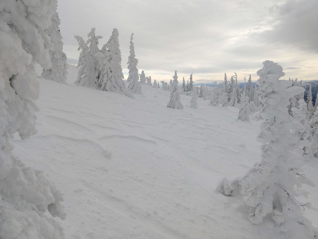
Mountain temperatures range from 26F to 33 F in the region. In the Bitterroot, winds are 7 mph with gusts of 17 out of the S. In the northern part of the advisory area, winds are 16 mph and gusting 27 mph out of the SW. Snotels are reporting between .6 and 2.1 inches of SWE for the last 24 hours for 6 to 12 inches of new snow.
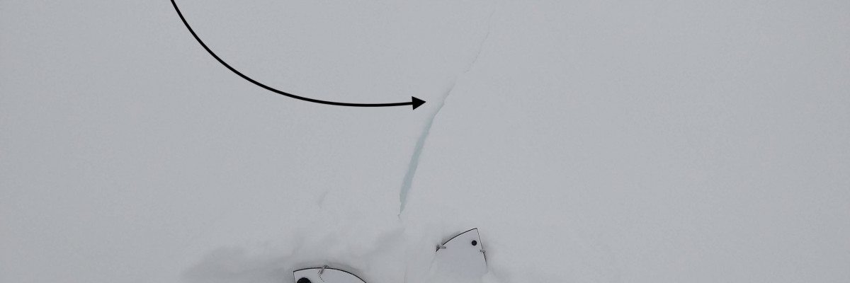
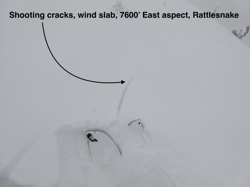
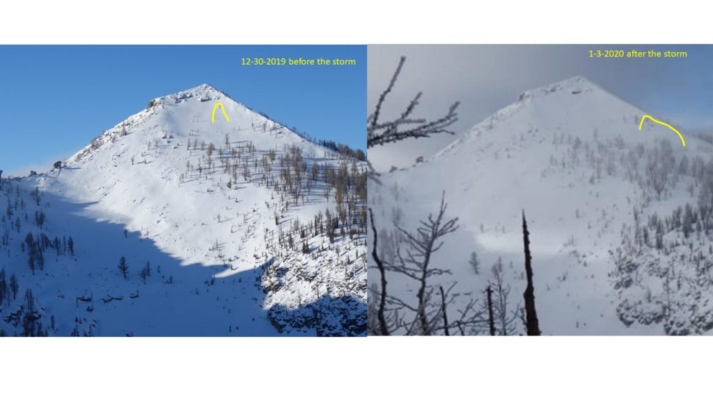
Yesterday a system of subtropical moisture entered the forecast area. Winds scoured many slopes over the weekend. The new snow from this system is loading leeward slopes and creating very dangerous avalanche conditions. Yesterday, Jeff and I were getting shooting cracks on wind loaded slopes. Overnight with the additional loading of snow, these wind slabs will be larger and more easily triggered.
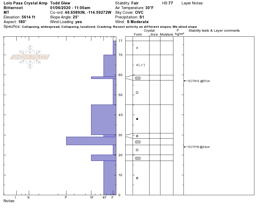
The new snow is falling on a poor snowpack structure that has the potential to create large avalanches. We are still getting propagations in our stability tests on the buried surface hoar crust combinations and a layer of depth hoar. The new snow will make these layers more sensitive today.
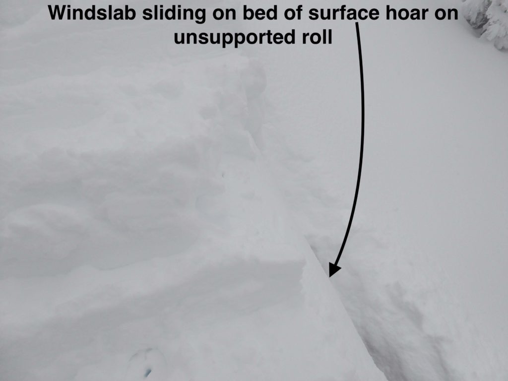
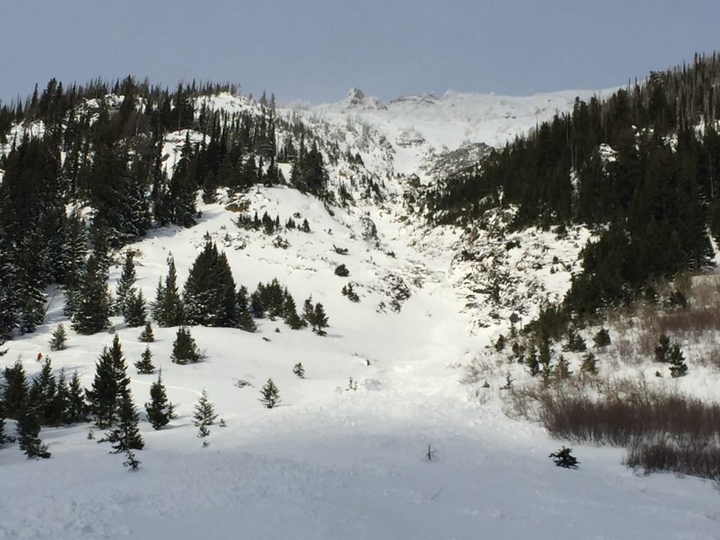
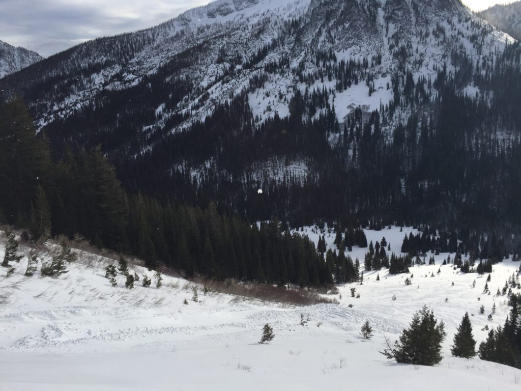
The primary avalanche problem today is persistent slabs. There are two layers of concern in our snowpack, a layer of surface hoar and near-surface facets below a thin crust that the New Year’s storm buried about 2 to 3 feet deep. This layer failed several times, producing both natural and human triggered avalanches during the New Years’ cycle. The other is a layer of facets or depth hoar below a crust near the bottom of our snowpack. We are still getting these to fail in stability tests. There is the possibility of triggering the whole season’s snowpack in a very large slide on this layer near the ground.
The second avalanche problem is wind slabs. Leeward slopes have been loaded and are easily triggered. Identify wind loaded terrain and avoid traveling on or below these slopes today.
The third avalanche problem is new snow. Trigging storm slabs that step down into deeper buried weak layers today is possible. Avoid slopes over 30 degrees.
Bottom line: There are very dangerous avalanche conditions today. Do not travel on or below wind loaded terrain. Travel in avalanche terrain is not recommended. Stick to lower angled sheltered slopes that are not connected to steep terrain because it is possible to trigger our buried weak layers remotely from the side, below, or above. The buried weak layers in our snowpack have the potential to create large dangerous avalanches, proof of this comes from observations of the natural and human triggered slides over New Years and the weekend(see public observations and report). Everyone in your group should have a beacon, shovel, and probe. Only one person on a slope at a time.
Avalanche and Weather Outlook
More snow and rising temperatures predicted today. Watch out for red flags such as cracking, collapsing, and recent avalanches. The avalanche danger will rise throughout the day with wind and more snow. See the forecast.
Thank you to everyone who has been sending in public observations. As always, if you make it out, please, feel free to share what you find on our public observations page.
Ski and ride safe.


