Posted:
Jan 8, 2020 @ 7:02 am

The avalanche danger for the west central Montana backcountry is Considerable. Dangerous avalanche conditions in the mountains exist and travel in avalanche terrain is not recommended. Good morning, this is Todd Glew with the West Central Montana Avalanche Center’s avalanche advisory for January 8, 2019. This danger rating does not apply to operating ski areas, expires at midnight tonight, and is the sole responsibility of the U.S. Forest Service.

Weather and Snowpack

Mountain temperatures are in the low 20’s with increasing strong winds out of the WSW. USGS Snotel sites report from .3 to 1 inch of snow water equivalent SWE In the past 24 hours. This could translate to up to 12″ of snow in the heavier hit areas such as the southern Missions and Swan and 4″ in the lighter areas yesterday. Up to a couple of inches came in overnight throughout the forecast area.

Yesterday there was a fatal avalanche at Silver Mountain Ski Resort, a close neighbor to us in Kellogg, Idaho. Our deepest condolences go out to the avalanche victims and their friends and family. We have now had two separate avalanche accidents during the past week in and around our forecast area, totaling 4 deaths. The mountains are screaming at us to stay out of avalanche terrain. 

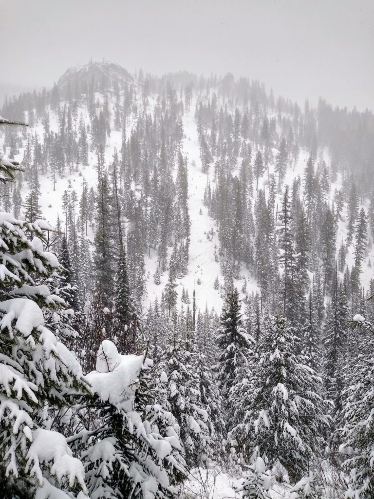
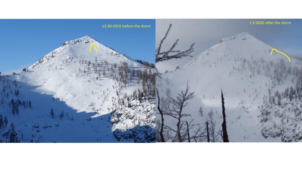
Before the New Year there was barely enough snow to ski or sled. On New Year’s Eve, it began snowing and has not stopped. We have received over 7 inches of Snow Water Equivalent (SWE) in some locations, which translates to 2-4 feet of heavy snow. This is a ton of weight, stressing multiple weak layers buried in our snowpack, primed for a deadly avalanche. Sometimes you cannot ski or ride in avalanche terrain, right now is that time. 

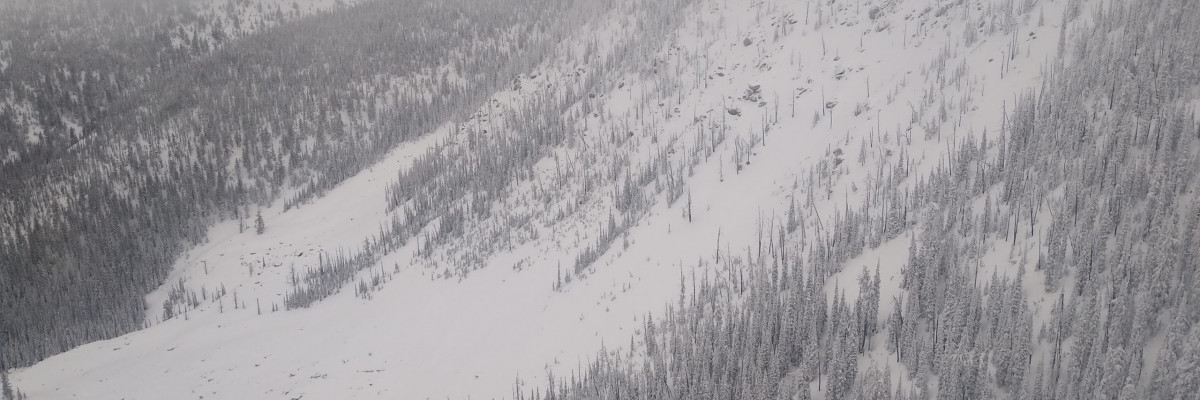
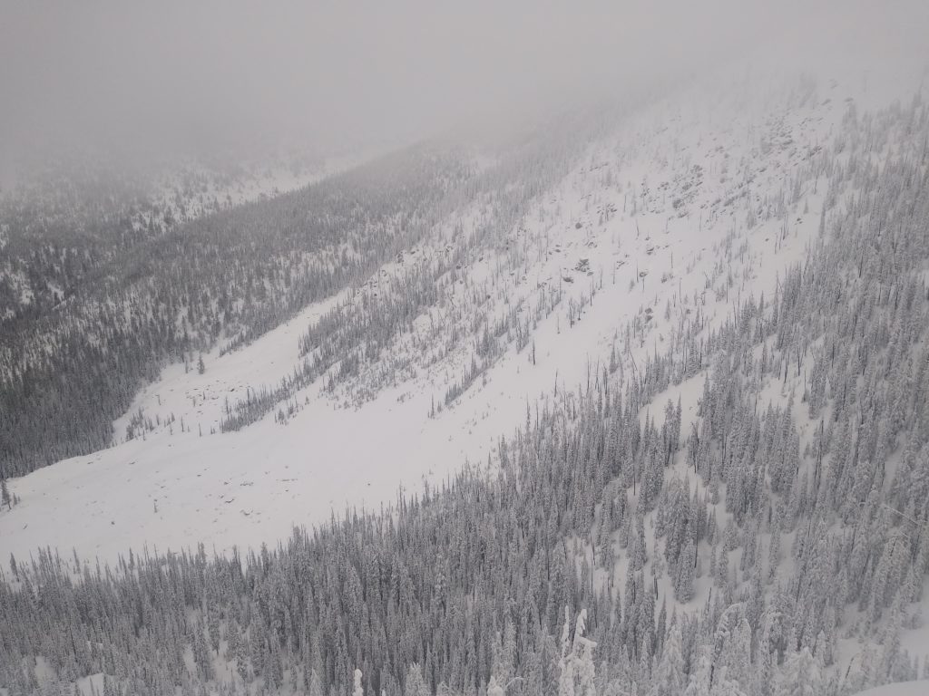
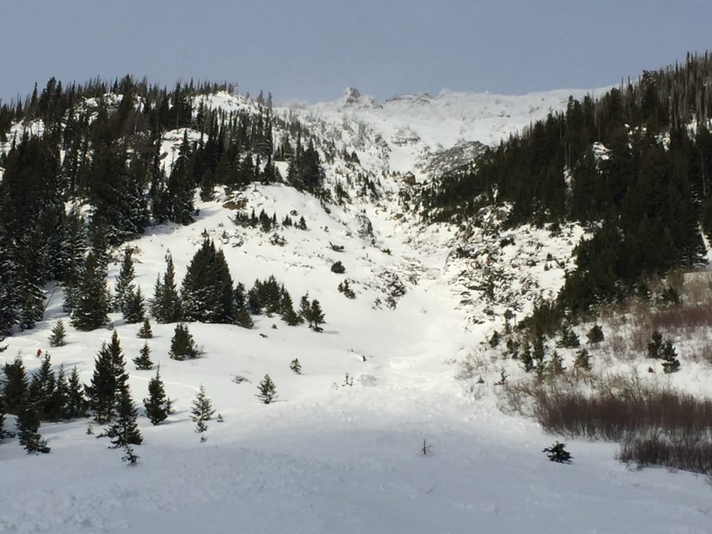
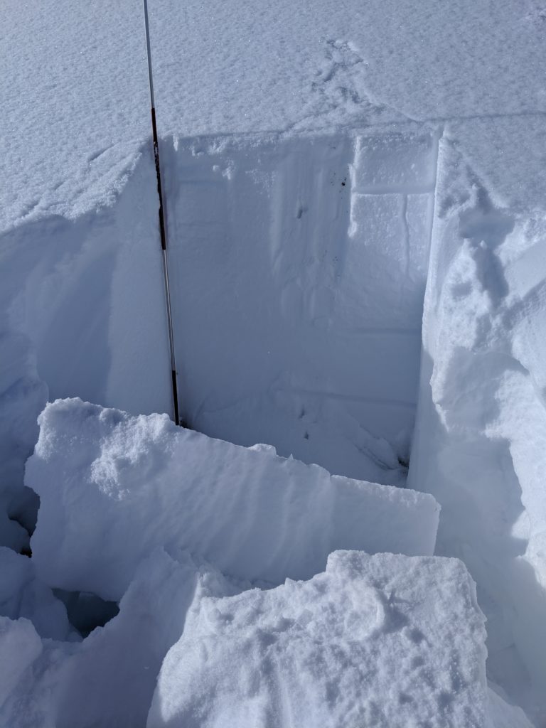
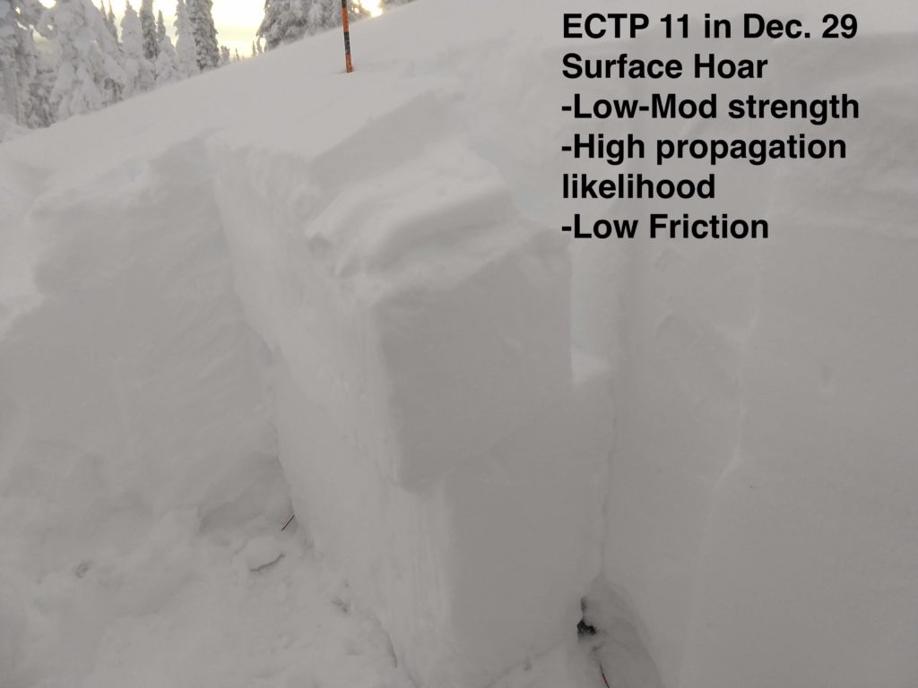
Our primary avalanche concern is persistent slab avalanches. There are two distinct buried weak layers in our snowpack capable of producing avalanches. The first is a surface hoar, crust, near-surface facet combo buried about 2-4 feet deep, and the second is weak sugary depth hoar and facets near the ground. Both of these layers have produced numerous natural and human triggered avalanches over the past week and will continue to do so.

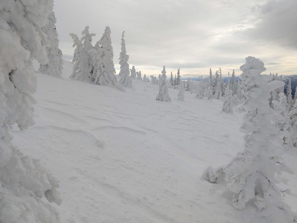
Our secondary avalanche concern is wind slab avalanches. It is forecasted to be windy and snowing today, creating wind slabs in leeward terrain. Wind slabs can be easily identified by looking for bulbous and pillowy features located on the leeward side of ridges or in cross-loaded terrain. Remember, even a small wind slab can step down and create a deadly persistent slab avalanche. 

Bottom line: If you are going out in the mountains today, stay out of and well away from avalanche terrain. Stay off of and far away from slopes approaching 30 degrees in steepness, as avalanches can be remotely triggered. Also, make sure you and all of your partners have a beacon, probe, shovel, and know how to use them. The kicker is that if you need to use this gear to dig out your partner, it will most likely be a body recovery. 

Avalanche and Weather Outlook

Increasing WSW winds with gusts to 66mph are expected today. Average wind speeds are forecasted to be 20-30 mph with wind chill values below 0. 2-7 inches of snow are expected today with a few more inches tonight.

The avalanche danger will rise with new snow and more wind. Pay attention to red flags such as cracking, collapsing, wind transported snow, and recent avalanches.

Any and all observations are greatly appreciated. If you get out in the mountains please send us information here. Thank you very much to those of you who have been sending in observations as it is very helpful.

Ski and ride safe.

READ FULL ADVISORY  

Problem 1 - Persistent Slabs

  • TYPE

    persistent-slabs

    Persistent Slabs

    Release of a cohesive layer of soft to hard snow (a slab) in the middle to upper snowpack, when the bond to an underlying persistent weak layer breaks.  Persistent layers include: surface hoar, depth hoar, near-surface facets, or faceted snow. Persistent weak layers can continue to produce avalanches for days, weeks or even months, making them especially dangerous and tricky. As additional snow and wind events build a thicker slab on top of the persistent weak layer, this avalanche problem may develop into a Persistent, Deep-Slab.

  • SIZE

    6-7

    3 (Large-Very Large)

    The potential size of avalanche resulting from this problem.

  • LIKELIHOOD

    Likelihood-6

    Likely/Very Likely

    The likelihood of an avalanche resulting from this problem.

  • ADDED DANGER

    Increased Slope Danger

    Increased/Added Danger

    There is an increased risk of avalanches on these slopes:

    N - North
    NE - Northeast
    E - East
    SE - Southeast
    S - South
    SW - Southwest
    W - West
    NW - Northwest

Numerous human and natural triggered avalanches have occurred over the past week. The tricky thing about this avalanche concern is that it is getting buried deeper and red flags such as cracking and collapsing do not present themselves as much. The new snow we have received since the new year is gaining strength and making it harder for the weight of a human to collapse. However, the danger remains the same.

Problem 2 - Wind Slabs

  • TYPE

    wind-slabs

    Wind Slabs

    Release of a cohesive layer of snow (a slab) formed by the wind.  Wind typically erodes snow from the upwind sides of terrain features and deposits snow on the downwind side.  Wind slabs are often smooth and rounded and sometimes sound hollow, and can range from soft to hard. Wind slabs that form over a persistent weak layer (surface hoar, depth hoar, or near-surface facets) may be termed Persistent Slabs or may develop into Persistent Slabs.

  • SIZE

    3-4

    1-2 (Small-Large)

    The potential size of avalanche resulting from this problem.

  • LIKELIHOOD

    Likelihood-5

    Likely

    The likelihood of an avalanche resulting from this problem.

With strong winds and new snow, be on the lookout for increasing danger of winds slabs. If you trigger even a small wind slab it has the potential to step-down and create a larger persistent slab avalanche.

Problem 3 - Storm Slab

  • TYPE

    storm-slabs

    Storm Slabs

    Release of a soft cohesive layer (a slab) of new snow which breaks within the storm snow or on the old snow surface. Storm-slab problems typically last between a few hours and few days. Storm-slabs that form over a persistent weak layer (surface hoar, depth hoar, or near-surface facets) may be termed Persistent Slabs or may develop into Persistent Slabs.

  • SIZE

    3-4

    1-2 (Small-Large)

    The potential size of avalanche resulting from this problem.

  • LIKELIHOOD

    Likelihood-4

    Possible/Likely

    The likelihood of an avalanche resulting from this problem.

New snow often times takes time to adhere to the old snow surface. Pay attention to how the new snow is bonding to the old snow surface. A small storm slab has the potential to step down and create a larger persistent slab avalanche.

FORECAST & OUTLOOK

A cold front rolling in this morning with increased WSW winds and more snow.

This information is the sole responsibility of the Forest Service and does not apply to operating ski areas. The avalanche danger rating expires at midnight tonight but the information can help you make a more informed decision regarding travel in avalanche terrain for the next few days.

Our advisory area includes National Forest System lands in the Bitterroot Mountains from Lost Trail Pass north to Granite Pass, the Rattlesnake Mountains north of Missoula and the Southern Swan and Mission Mountains near Seeley Lake, MT. Avalanche information for the Lookout Pass/St. Regis Basin area is available from the Idaho Panhandle Avalanche Center.