Posted:
Mar 17, 2020 @ 6:26 am

The avalanche danger is LOW this morning and MODERATE this afternoon in the west central Montana backcountry. Warming temperatures increase the avalanche danger this afternoon.

Good morning, this is Travis Craft with the West Central Montana avalanche advisory for March 17, 2020. Today’s advisory is sponsored by Krispy Kreme. This advisory does not apply to operating ski areas, expires at midnight tonight, and is the sole responsibility of the U.S. Forest Service.

Weather and Snowpack

Mountain temperatures range from 17 F to 25 F in the region. In the Bitterroot, winds are 11 mph with gusts of 14 out of the SSE. In the northern part of the advisory area, winds are 14 mph and gusting 19 mph out of the W. 

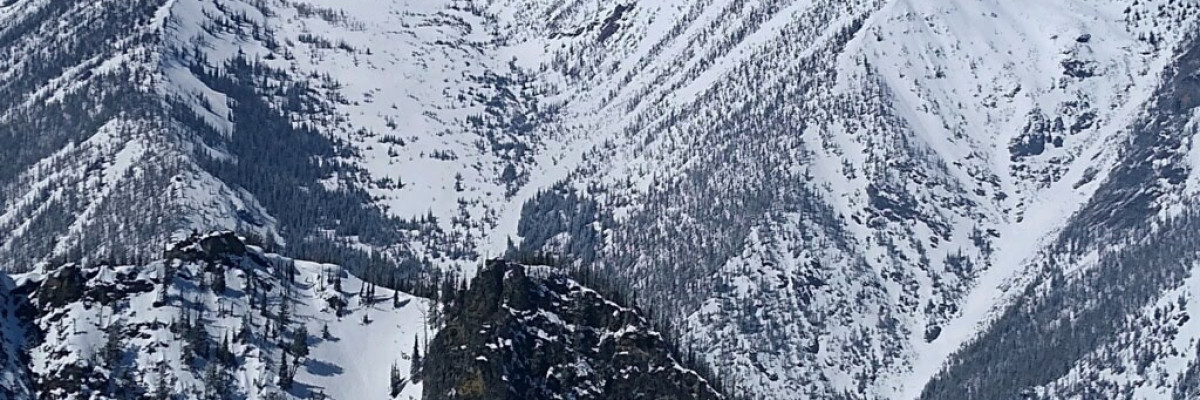
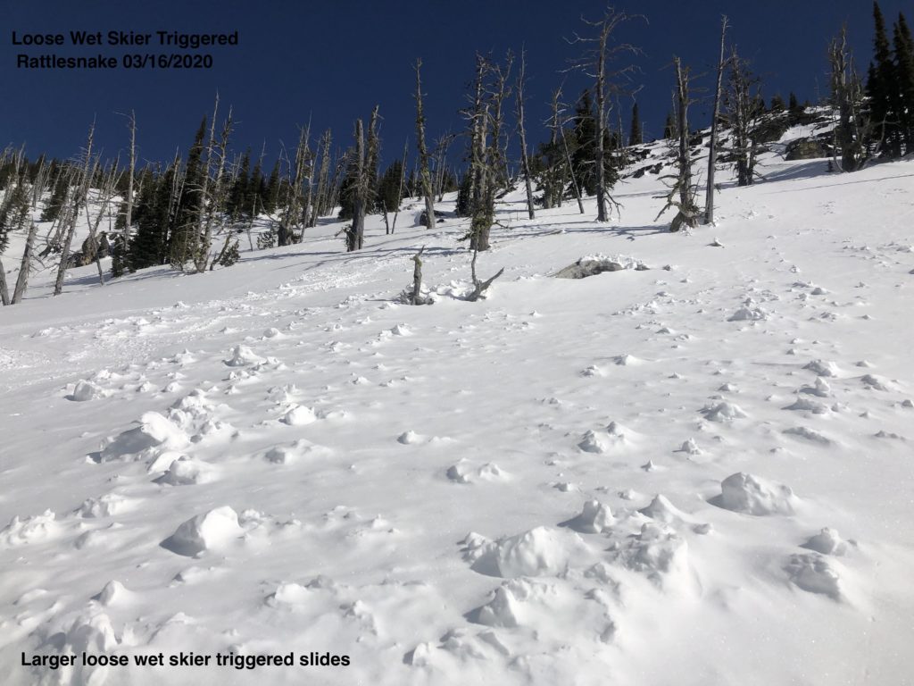
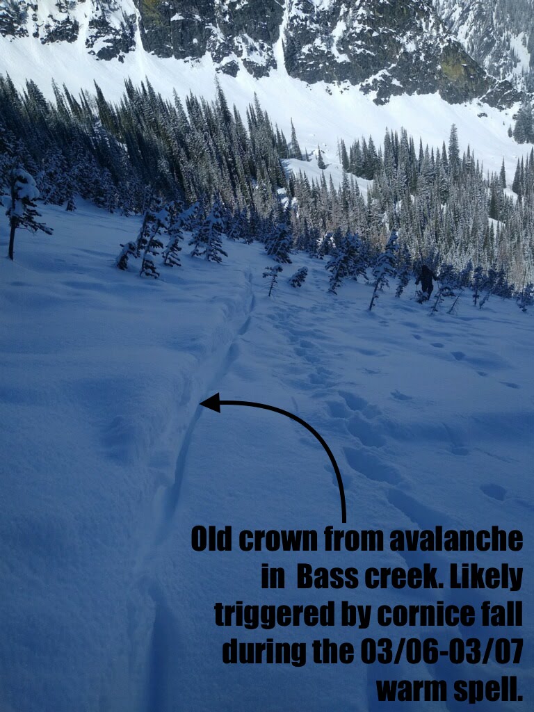
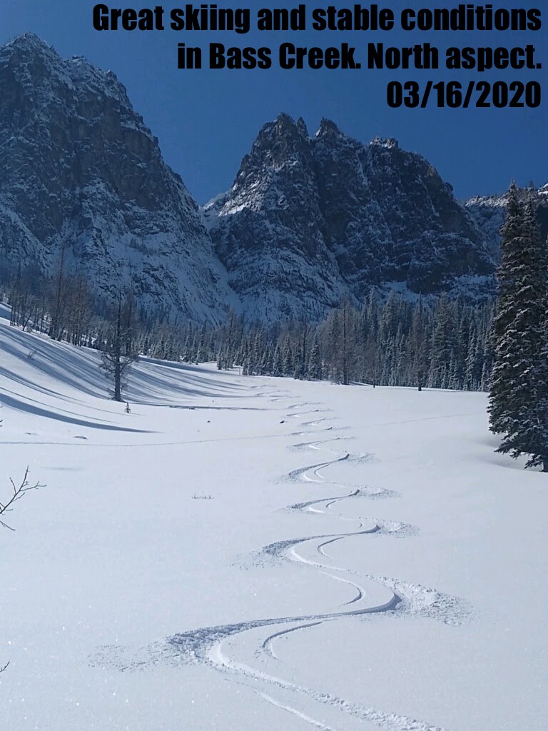
Yesterday, we found a reasonably stable snowpack throughout the advisory area. Cornices are very large, and a cornice fall in the last couple of days triggered a small slab avalanche in the bass creek drainage. In the Rattlesnake, skier triggered, and natural loose wet avalanches were the primary concern.(video) Near Lake Dinah stability was good, and loose wet avalanches on sun-exposed slopes were the main problem. 

Overnight temperatures dropped into the high teens or twenties. Temperatures will increase into the mid 40’s today. Look for rollerballs and pinwheels on sun-exposed slopes. These will be clues to find more sheltered and shadier aspects. True North slopes are still holding dry snow above 6500 feet.

The primary avalanche concern is loose wet avalanches in the afternoon. Warm temperatures on sun-exposed slopes will increase the avalanche danger today. Rollerballs are clues to find shadier slopes. 

The second avalanche problem is cornice fall. Warming temperatures will weaken cornices. Give these giants a wide berth and travel quickly below them.

Bottom Line

Use normal caution to travel in avalanche terrain today. Continue to practice safe travel protocols in case you find an exception to a generally stable snowpack. Travel one at a time in avalanche terrain, carry a beacon, shovel, and probe, and stay alert for signs of instability. Dig a pit. Look for red flags. As the snow heats up during the day, be aware of the increasing likelihood of loose wet avalanches, especially if you notice pinwheelsrollerballs, or if you are sinking up past your boots in heavy, wet snow. Pay attention to weather changes that will increase avalanche danger. 

Your observations are extremely helpful! If you get out, please take a minute to fill out the observation form on our website (missoulaavalanche.org), or shoot us a quick email at [email protected].

Ski and ride safe.


READ FULL ADVISORY  

Problem 1 - Loose Wet

  • TYPE

    loose-wet

    Loose Wet

    Release of wet unconsolidated snow or slush. These avalanches typically occur within layers of wet snow near the surface of the snowpack, but they may quickly gouge into lower snowpack layers. Like Loose-Dry Avalanches,they start at a point and entrain snow as they move downhill, forming a fan-shaped avalanche. They generally move slowly, but can contain enough mass to cause significant damage to trees, cars or buildings. Other names for loose-wet avalanches include point-release avalanches or sluffs. Loose-wet avalanches can trigger slab avalanches that break into deeper snow layers.

  • SIZE

    3-4

    1-2 (Small-Large)

    The potential size of avalanche resulting from this problem.

  • LIKELIHOOD

    Likelihood-3

    Possible

    The likelihood of an avalanche resulting from this problem.

Rollerballs and pinwheels are clues to move to shadier aspects.

Problem 2 - Cornice Fall

  • TYPE

    cornices

    Cornices / Cornice Fall

    Release of an overhanging mass of snow that forms as the wind moves snow over a sharp terrain feature, such as a ridge, and deposits snow on the down-wind side. They range from small wind lips of soft snow to large overhangs of hard snow that are 30 feet (~10 meters) or taller. They can break off the terrain suddenly and pull back onto the ridge top and catch people by surprise even on the flat ground above the slope. Even small cornices can have enough mass to be destructive and deadly. Cornice fall can entrain loose surface snow or trigger slab avalanches.

  • SIZE

    5-6

    2-3 (Large)

    The potential size of avalanche resulting from this problem.

  • LIKELIHOOD

    Likelihood-2

    Unlikely/Possible

    The likelihood of an avalanche resulting from this problem.

Treat cornices with respect. Warm temperatures will weaken these giants today. Give cornices a wide berth.

VIDEO

Observations 03/16/2020

Observations 03/16/2020 for 03/17/2020 Advisory


FORECAST & OUTLOOK

Tonight a colder Canadian air moves in. This surge will last until Thursday. See the forecast. Chance of light precipitin. This paternities will keep the avalanche danger the same.

This information is the sole responsibility of the Forest Service and does not apply to operating ski areas. The avalanche danger rating expires at midnight tonight but the information can help you make a more informed decision regarding travel in avalanche terrain for the next few days.

Our advisory area includes National Forest System lands in the Bitterroot Mountains from Lost Trail Pass north to Granite Pass, the Rattlesnake Mountains north of Missoula and the Southern Swan and Mission Mountains near Seeley Lake, MT. Avalanche information for the Lookout Pass/St. Regis Basin area is available from the Idaho Panhandle Avalanche Center.