
The avalanche danger is LOW in the west central Montana backcountry. Low danger does not mean no avalanche danger.
Good morning, this is Travis Craft with the West Central Montana avalanche advisory for March 19, 2020. Today’s advisory is sponsored by Krispy Kreme. This advisory does not apply to operating ski areas, expires at midnight tonight, and is the sole responsibility of the U.S. Forest Service.
Weather and Snowpack
Mountain temperatures range from 17 F to 30 F in the region. In the Bitterroot, winds are 5 mph with gusts of 8 out of the NE. In the northern part of the advisory area, winds are 9 mph and gusting 11 mph out of the ENE.
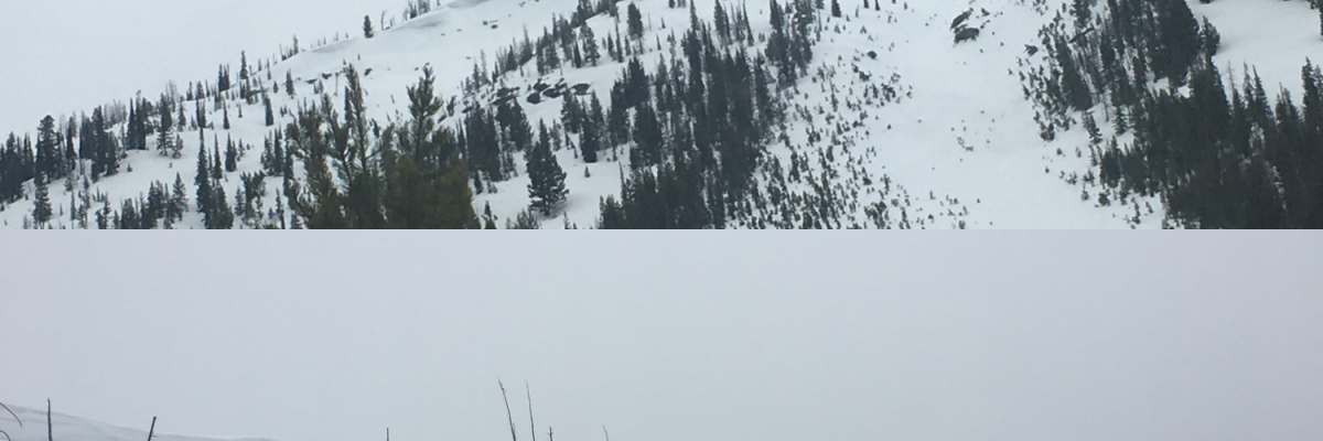
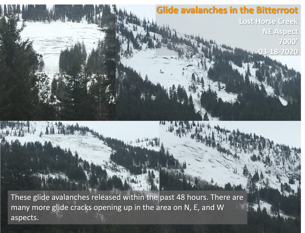
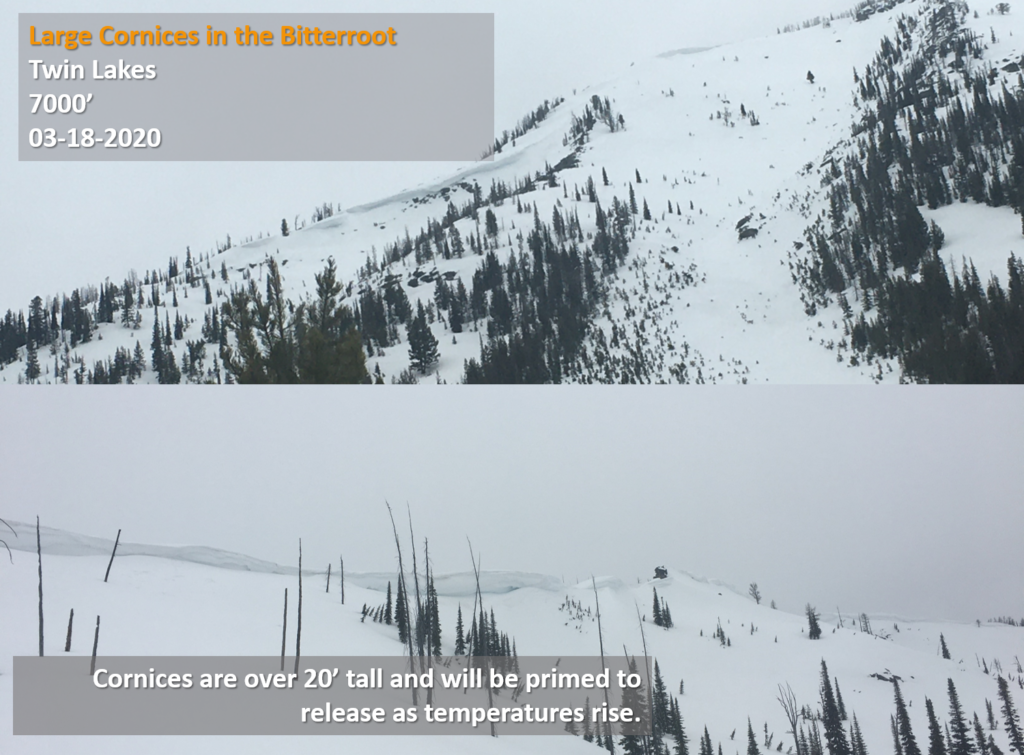
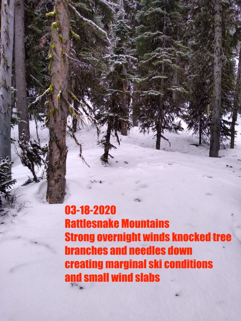
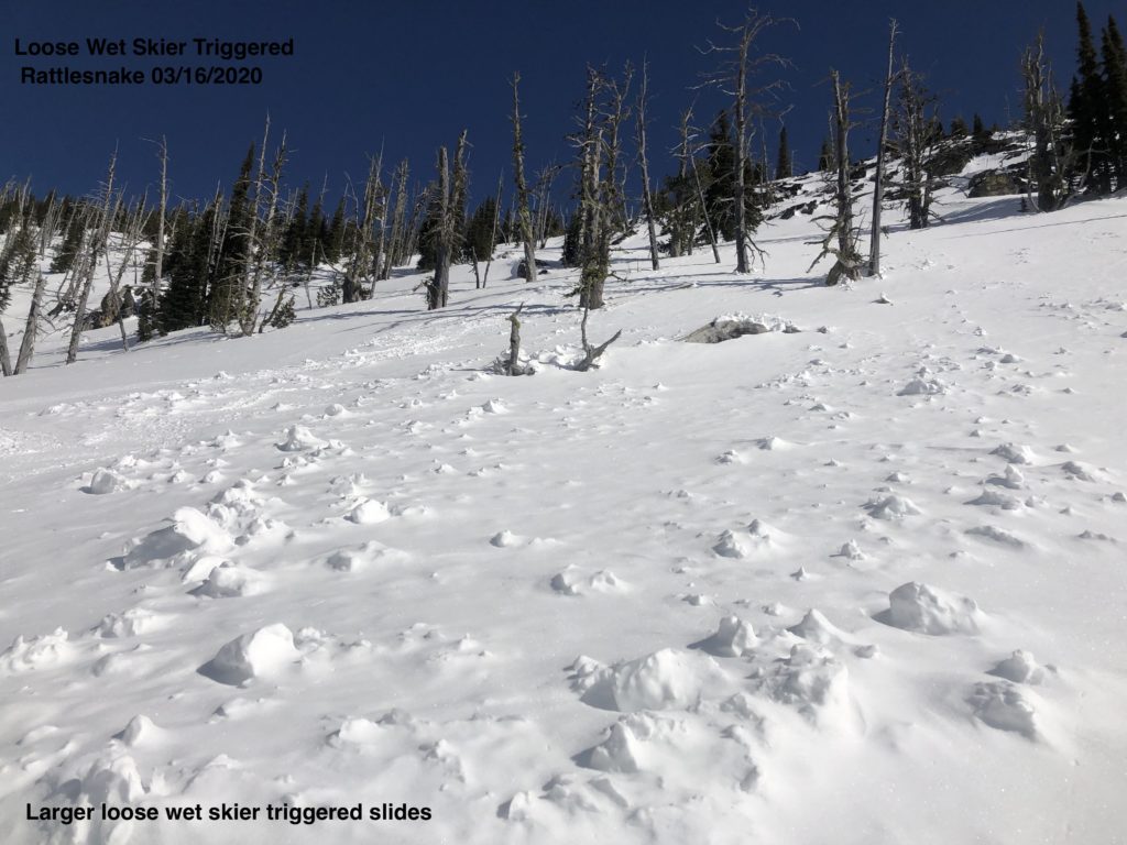
Yesterday in the Lost Horse drainage in the Bitterroot and Rattlesnake, we found isolated avalanche problems. We found large cornices and glide cracks in Lost Horse. In the Rattlesnake, the main avalanche problem was small wind slabs.
Overnight temperatures dropped into the low twenties. We are starting to transition to a spring cycle on many slopes. Temperatures are forecasted to be below average as cold air from Canada moves into the area. This, combined with cloud cover, will keep the avalanche danger Low today.
The primary avalanche problem is wind slabs in isolated pockets. Look for these small slabs on ridgelines at higher elevations.
Glide cracks and avalanches are functions of warming temperatures and terrain features. Avoid glide cracks and terrain with granite slabs underlying the snowpack.
Cornices are large, give them a wide berth.
Bottom Line
Low avalanche danger does not mean no avalanche danger. Use normal caution to travel in avalanche terrain today. Continue to practice safe travel protocols in case you find an exception to a generally stable snowpack. Travel one at a time in avalanche terrain, carry a beacon, shovel, and probe, and stay alert for signs of instability. Dig a pit. Look for red flags. If the clouds break today and the sun comes out, look for rollerballs and pinwheels. They are clues that the snowpack is changing.
Your observations are extremely helpful! If you get out, please take a minute to fill out the observation form on our website (missoulaavalanche.org), or shoot us a quick email at [email protected].
Ski and ride safe.


