
The avalanche danger is low in the west central Montana backcountry. Use normal caution when traveling today to assess the snowpack and avalanche danger.
Good morning, this is Travis Craft with the West Central Montana avalanche advisory for March 21, 2020. Today’s advisory is sponsored by Krispy Kreme. This advisory does not apply to operating ski areas, expires at midnight tonight, and is the sole responsibility of the U.S. Forest Service.
Weather and Snowpack
Mountain temperatures range from 21 F to 30 F in the region. In the Bitterroot, winds are 5 mph with gusts of 10 out of the SSW. In the northern part of the advisory area, winds are 20 mph and gusting 29 mph out of the W.
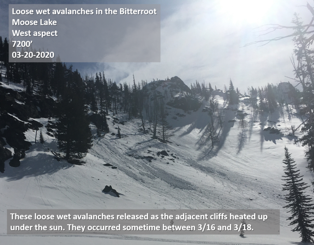
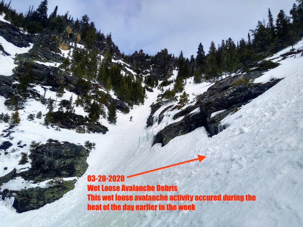
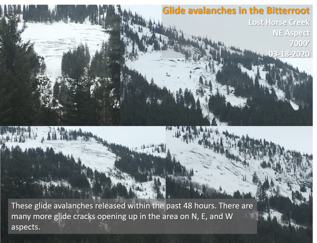
Yesterday, we found a snowpack that was generally stable. We observed loose wet activity from a few days ago near Moose Lake in the Bitterroot. Near Lil St. Joe in the Bitterroot, we saw some cornice failure from warming temperatures. In the Missions, we got reports of large loose wet releases from yesterday or the day before.
Overall our snowpack is stable. The snowpack is going through melt-freeze cycles on all slopes except true north ones where you can still find some dry snow. Most slopes have a firm supportable crust. Today temperatures are expected to rise into the low 40’s or high 30’s in the advisory area with some cloud cover. Temperatures are already rising on snotels this morning. Expect to find generally stable conditions today. Pay attention to warming temperatures, and if the clouds break, could create some loose wet activity on sun-exposed steep terrain.
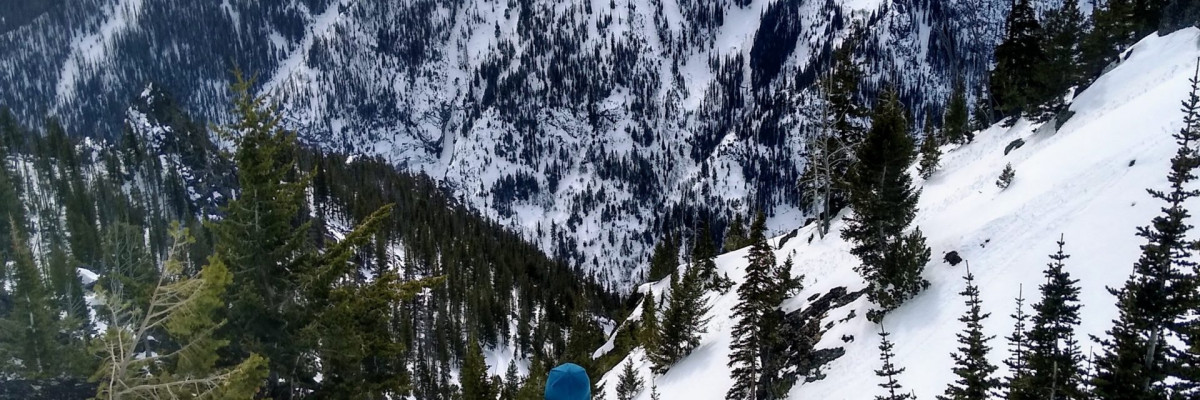
The primary avalanche problem is loose wet avalanches on steep sun-exposed slopes.
Cornices are large give them, and the slopes below them respect.
Bottom Line
Low avalanche danger does not mean no avalanche danger. Use normal caution to travel in avalanche terrain today. Continue to practice safe travel protocols in case you find an exception to a generally stable snowpack. Travel one at a time in avalanche terrain, carry a beacon, shovel, and probe, and stay alert for signs of instability. Dig a pit. Look for red flags. If the clouds break today and the sun comes out, look for rollerballs and pinwheels. They are clues that the snowpack is changing. Most ski resorts are closed. Check each ski area page to find its uphill ski policies. Remember, when the ski resort is closed, there is no ski patrol for rescue or avalanche mitigation. The rules for travel and riding are the same for the backcountry. Here is a link to some excellent online learning material. KBYG
Your observations are extremely helpful! If you get out, please take a minute to fill out the observation form on our website (missoulaavalanche.org), or shoot us a quick email at [email protected].
Ski and ride safe.


