
The avalanche danger is Low in the west central Montana backcountry. Use normal caution when traveling today to assess the snowpack and avalanche danger.
Good morning, this is Jeff Carty with the West Central Montana avalanche advisory for March 26, 2020. Today’s advisory is sponsored by onX Maps. This advisory does not apply to operating ski areas, expires at midnight tonight, and is the sole responsibility of the U.S. Forest Service.
Weather and Snowpack
Mountain temperatures range from 13ºF to 25ºF and are forecast to reach into the low 30s above 6000’ today. Winds are forecast to be light with moderate to strong gusts out of the west.
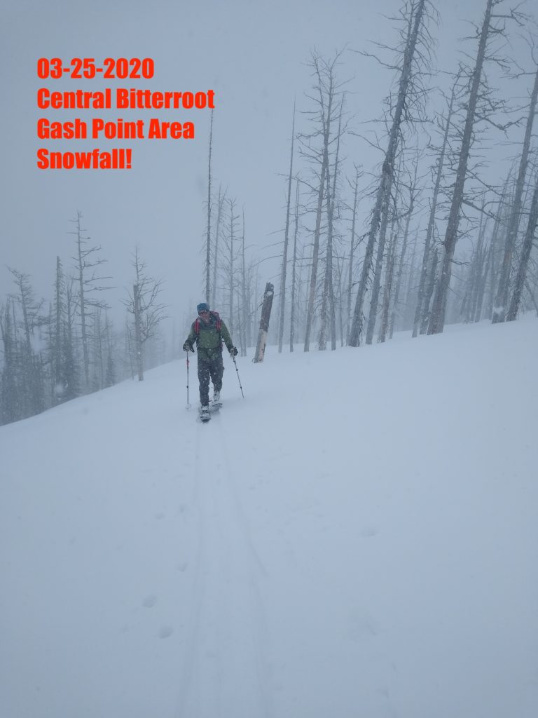
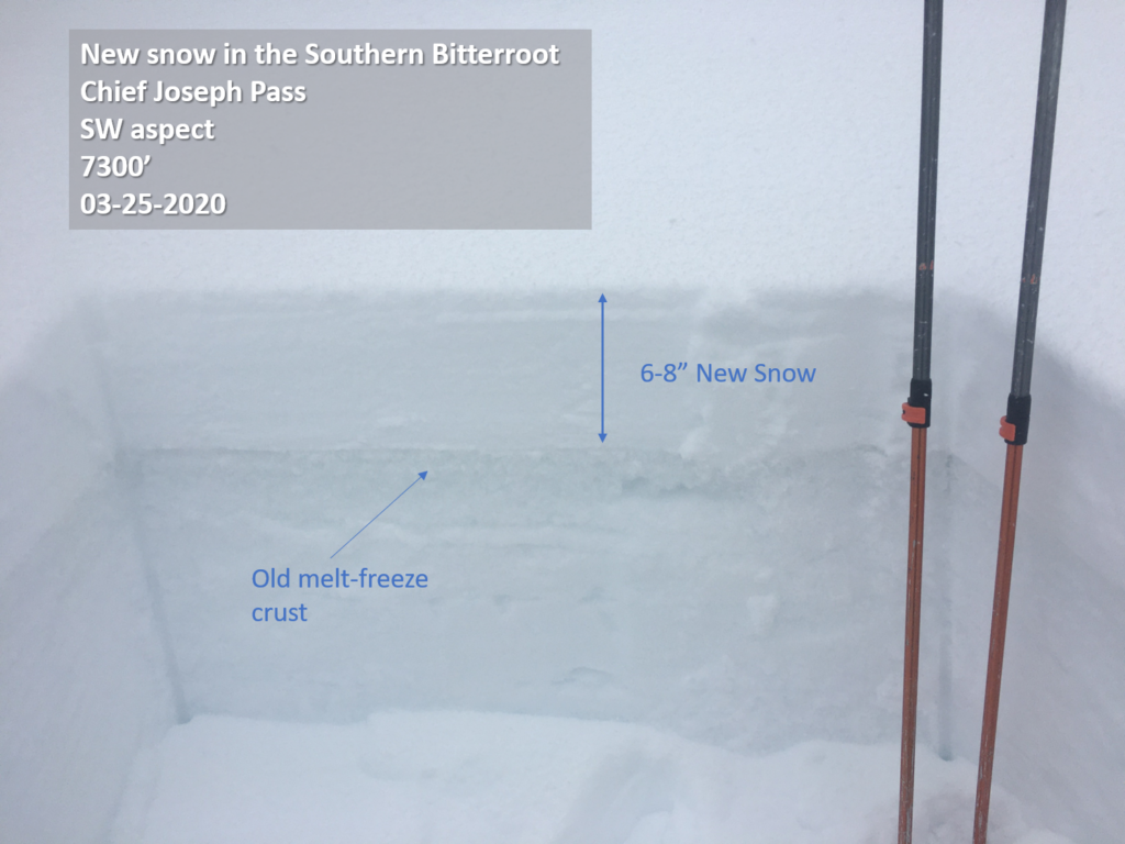
In the last 48 hours, we’ve received 0.3-0.7″ of snow water equivalent (SWE) or about 3-7 inches of new snow throughout the forecast area. The Gash had about 4” of fresh at upper elevations yesterday and the area around Chief Joseph Pass had 4-8”. Cooler temps, cloudy skies, and snow showers throughout the day made it feel like winter in the mountains again.
Southern aspects didn’t get much sun the past two days, but it’s been enough to consolidate and begin bonding the new snow. Loose wet avalanche potential could increase with solar warming today, if the clouds part for long enough, but they should be small and manageable.
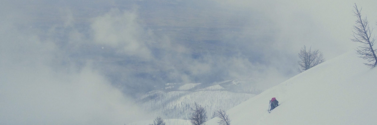
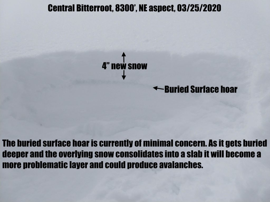
North faces have dry new snow that is overlying a variety of surfaces including surface hoar, near surface facets and crusts. The surface hoar under the new snow, where present, is well preserved and will likely persist as a weak layer for a while. Yesterday loose dry avalanches were running fast and far indicating how slippery these surfaces are. The new snow is shallow, has not consolidated and overall slab avalanches are not yet a concern. However, we did kick off a very small 4” deep slab on a steep NE aspect off the Gash indicating there is isolated potential. With further loading by wind or snowfall more consequential slabs could form. Isolated areas may have received enough snow to form thicker slabs and winds may have loaded slopes at ridge top. Pay attention to snow depth and consistency as you tour and check for the presence of a low density band of surface hoar under the new snow. Even small slides and loose dry avalanches can be consequential with terrain traps.
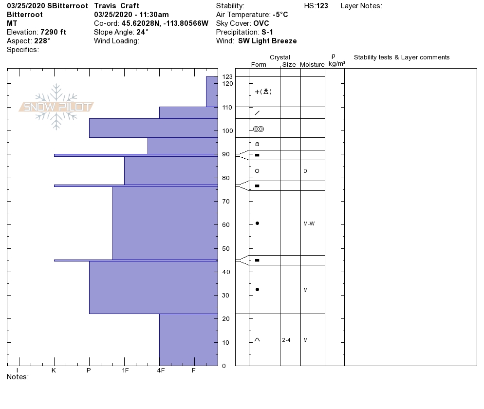
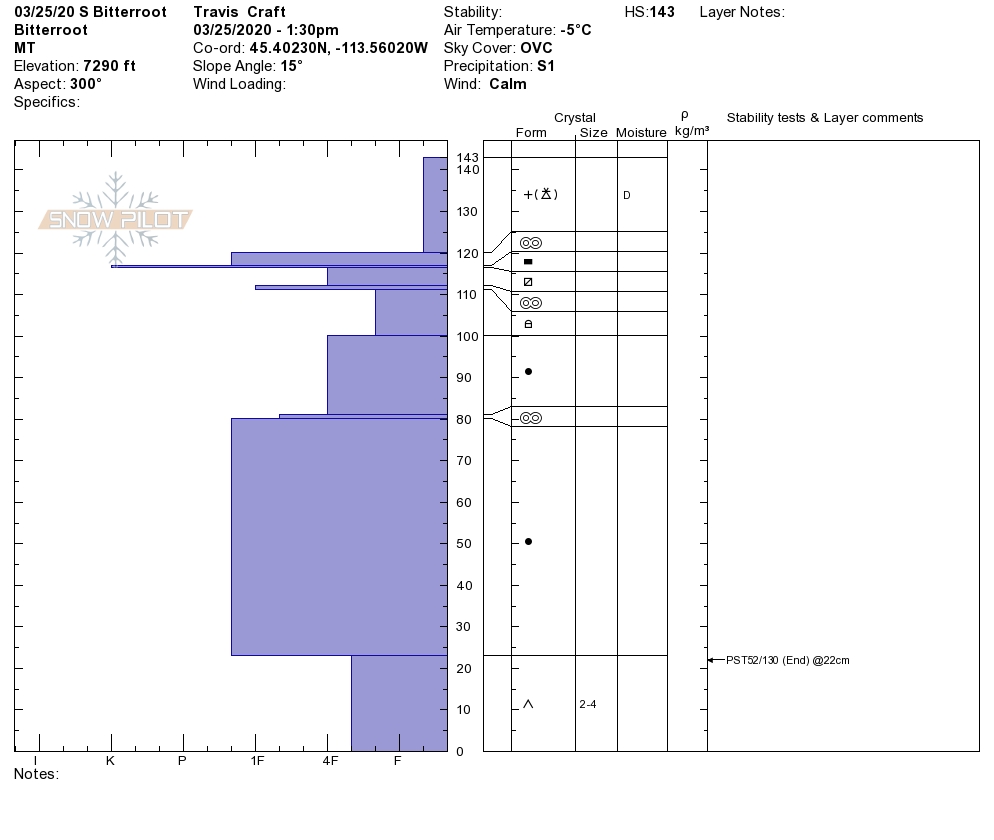
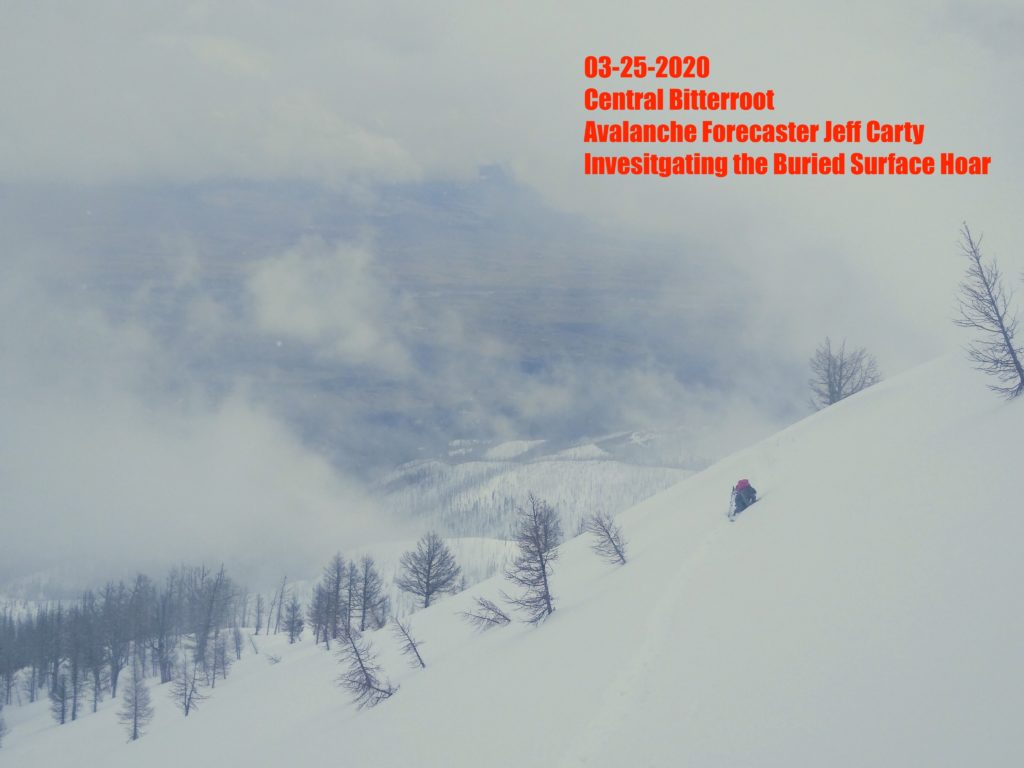
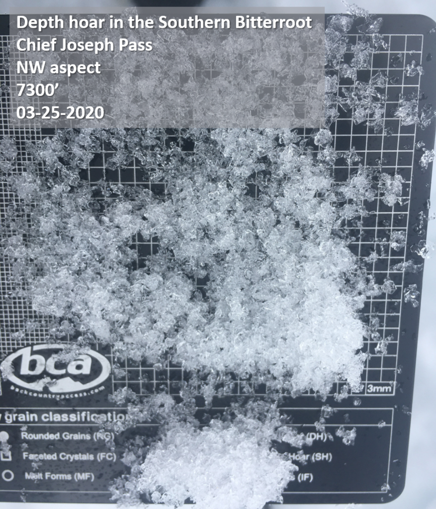
In the southern Bitterroot yesterday, Travis and Andrew found the depth hoar that formed earlier this season is still persisting at the base of the snowpack and still propagating in snowpit tests. It is unlikely for a skier or rider to trigger an avalanche on this layer, however, a rain on snow event or significant loading could cause it to fail (video).
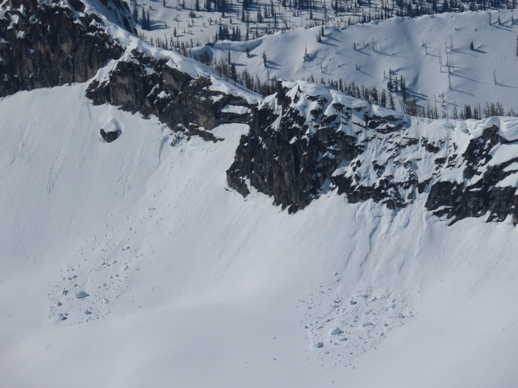
Large cornices are still lurking out there, and recent cornice fall was observed this past weekend. Avoid traveling below cornices and stay well away from the edge when above.
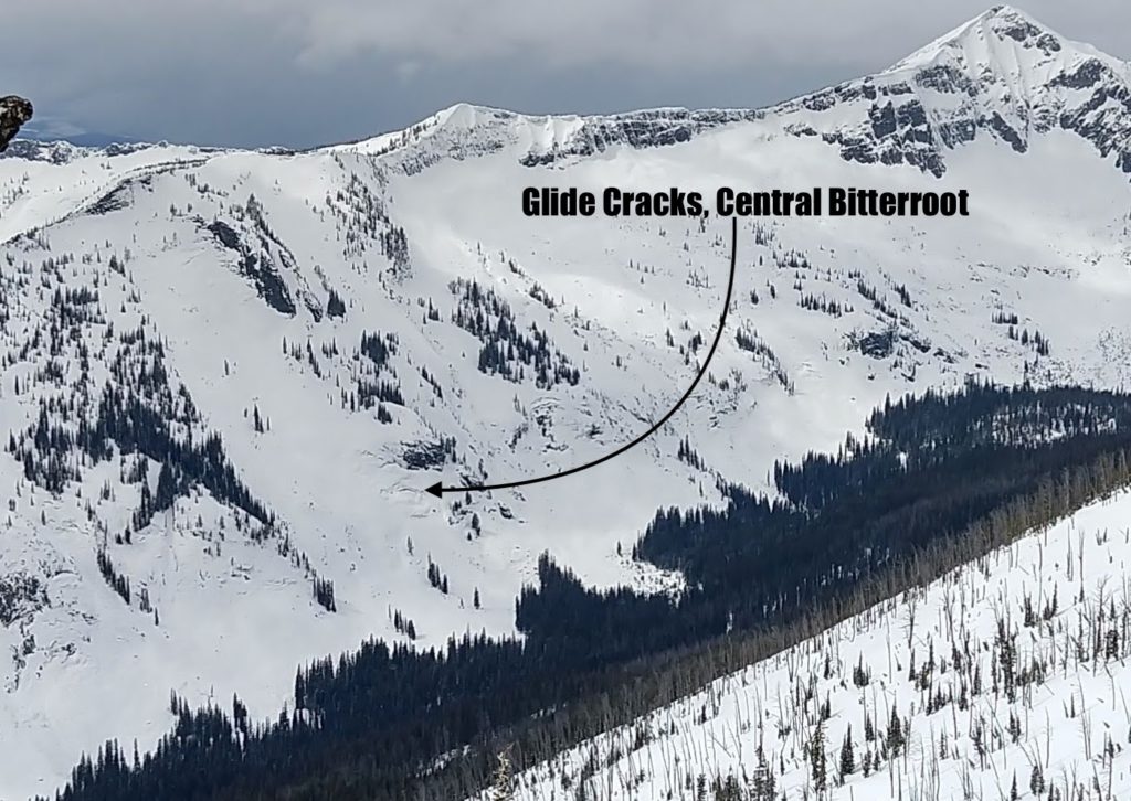
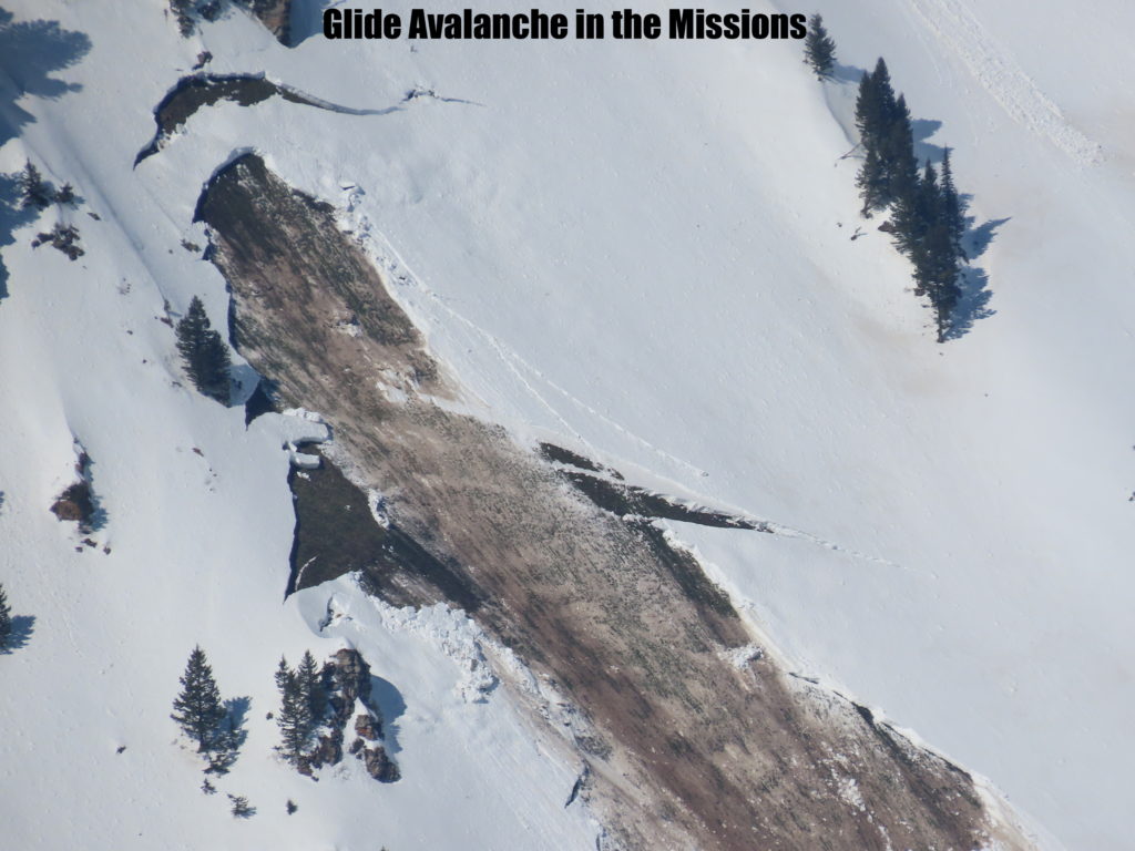
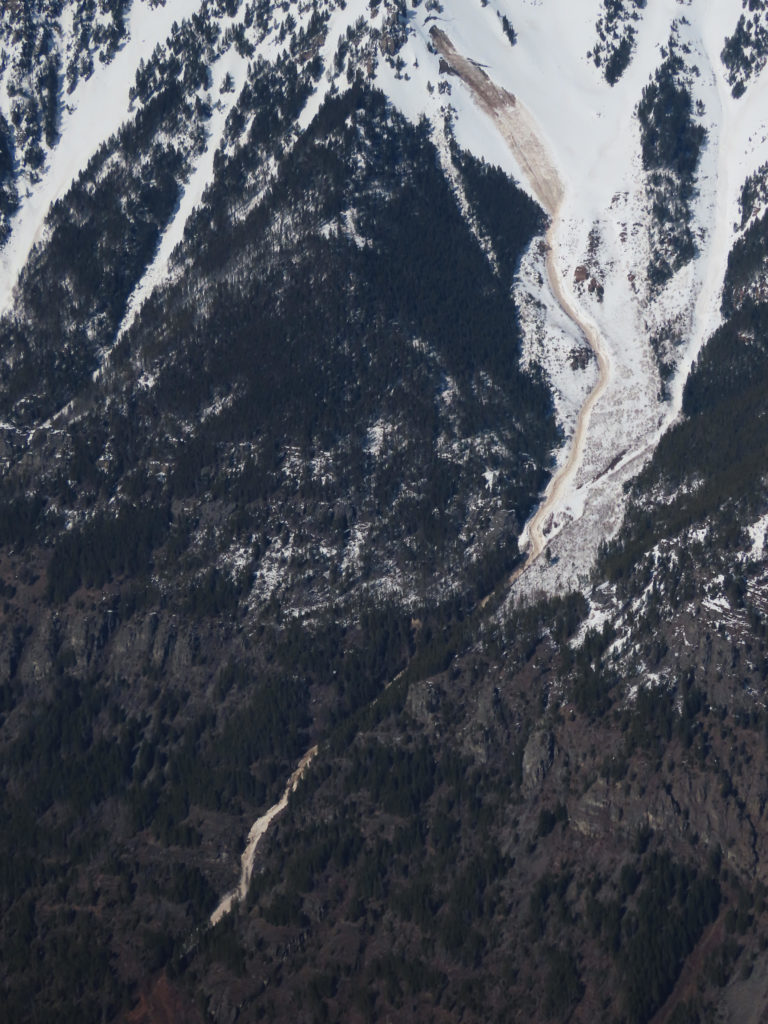
Glide cracks are opening in isolated areas of the Bitterroot and Missions. These are the result of the entire snowpack sliding on a wet ground surface and they can slowly open for weeks at a time. They can also fail suddenly and unpredictably producing avalanches the full depth of the snowpack. Stay well away from slopes where glide cracks are present.
Bottom Line
Generally stable avalanche conditions exist throughout the forecast area. However, low avalanche danger does not mean no avalanche danger. The main concern is loose dry avalanches on northern aspects. These could entrain enough snow to knock you off your feet and push you into hazards and may require management. Small soft slabs may be present in isolated areas. Loose wet avalanches are possible on southern aspects. Continue to practice safe travel protocols in case you find an exception to a generally stable snowpack. Travel one at a time in avalanche terrain, carry a beacon, shovel, and probe, and stay alert for signs of instability. Dig a pit. Look for red flags.
Please take a moment to read this message from Missoula Avalanche, Greater than the Sum of Our Parts.
Your observations are extremely helpful! If you get out, please take a minute to fill out the observation form, or shoot us a quick email at [email protected].
Ski and ride safe.


![IMG_1610[1]](https://missoulaavalanche.org/wp-content/uploads/IMG_16101-855x1024.jpg)