Posted:
Mar 28, 2020 @ 6:46 am

The avalanche danger in the west central Montana backcountry is moderate in wind loaded terrain and low in all other terrain. 

Good morning, this is Jeff Carty with the West Central Montana avalanche advisory for March 28, 2020. Today’s advisory is sponsored by onX Maps. This advisory does not apply to operating ski areas, expires at midnight tonight, and is the sole responsibility of the U.S. Forest Service.

Weather and Snowpack

Mountain temperatures range from 18º to 26º and are forecast to reach into the low 40s above 6000’ today. Winds are forecast to be low with moderate to strong gusts out of the west.

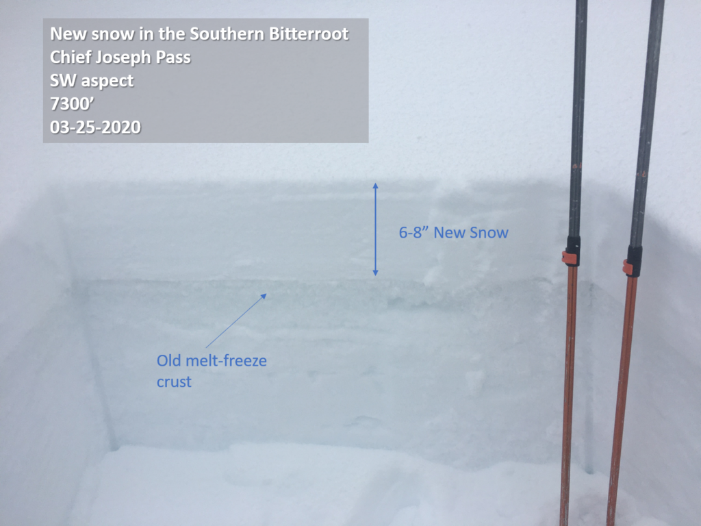
In the last 48 hours, we’ve received an average of 0.5″ of snow water equivalent (SWE) or about 5″ inches of new snow throughout the forecast area. The northern portion of the forecast area received a bit more while the southern Bitterroot received less.

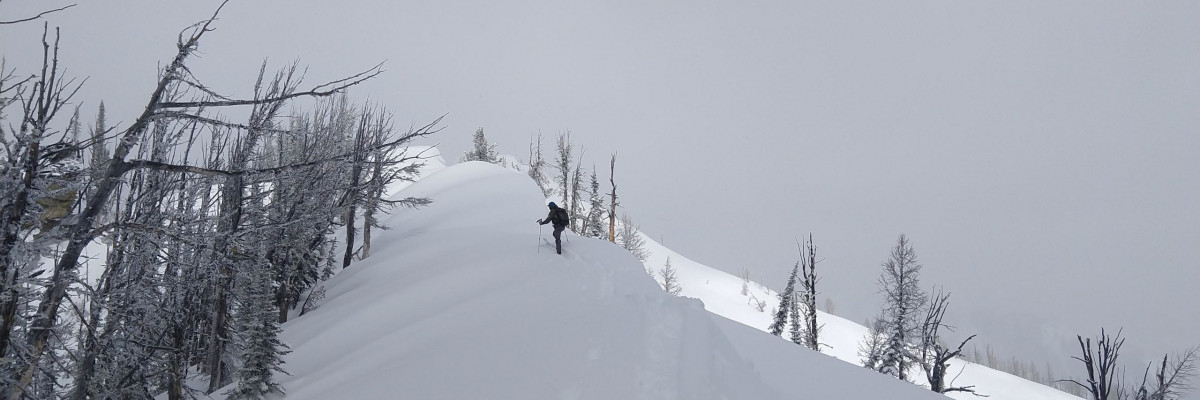
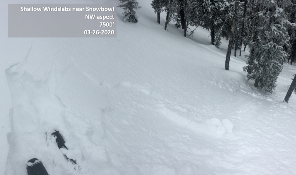
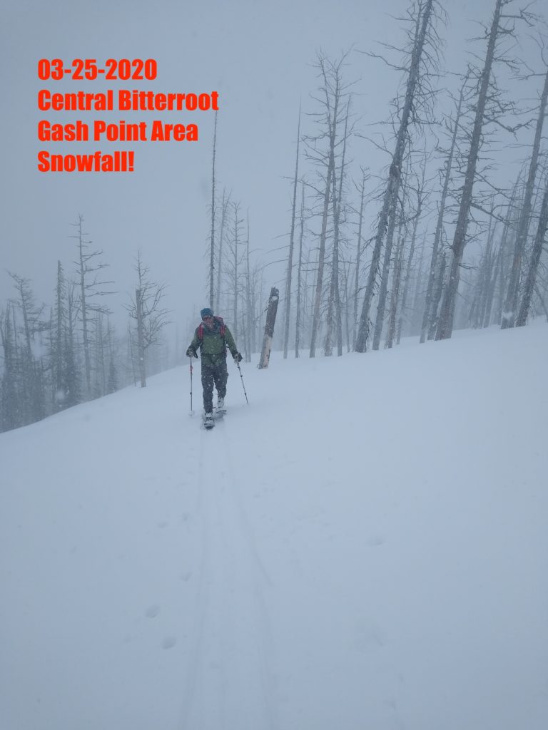
The snow has been trickling in and slowly piling up over the past week. Yesterday at the Gash we found 6-8” of dry powder at upper elevations. Wind is further loading start zones just below ridge top. The new snow is overlying a variety of surfaces including surface hoar, near surface facets, and crusts. We are finding the surface hoar on protected northerly aspects. Distribution is somewhat patchy but where found it is well preserved. It and will likely persist as a weak layer for a while. 

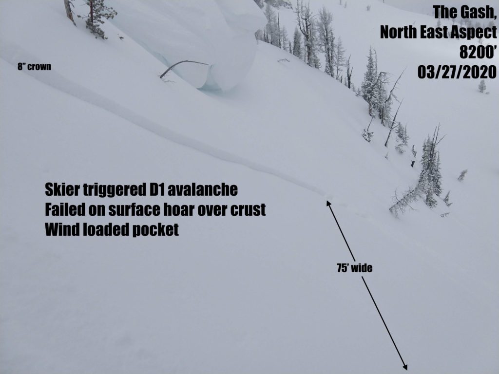
Yesterday near Gash Point we ski cut a northeast slope that released a D1 avalanche, with an 8” crown, on the surface hoar over a crust layer. Similar avalanches are possible on similar slopes. With further loading by wind or snowfall more consequential slabs could form. Pay attention to snow depth and consistency as you tour and check for the presence of a low density band of surface hoar under the new snow. Avoid steep start zones near ridgetop. 

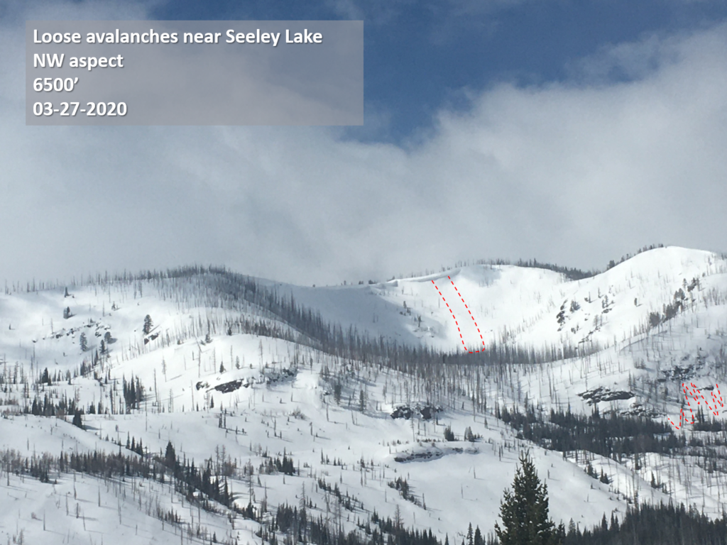
Travis and Andrew found up to 8″ of new snow in the southern Missions yesterday with wintery conditions and loose snow avalanches above 6500′ (video).

Loose dry avalanches were running fast and far on north aspects yesterday, They are likely in steep, >35º terrain today.

Cooler temps and mostly cold skies have kept solar warming to a minimum and there has been minimal wet loose activity in the past couple of days. Wet loose avalanches are possible on sun warmed slopes today, although cloud cover should keep them to a minimum. 

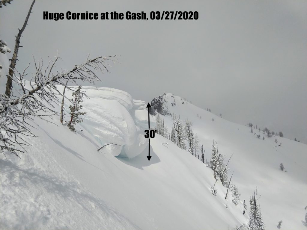
Large cornices are still lurking out there, cornice fall is possible. Avoid traveling below cornices and stay well away from the edge when above.

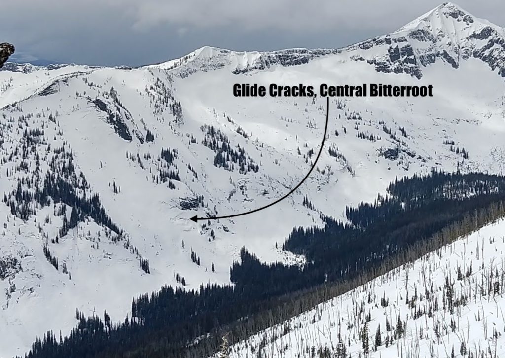
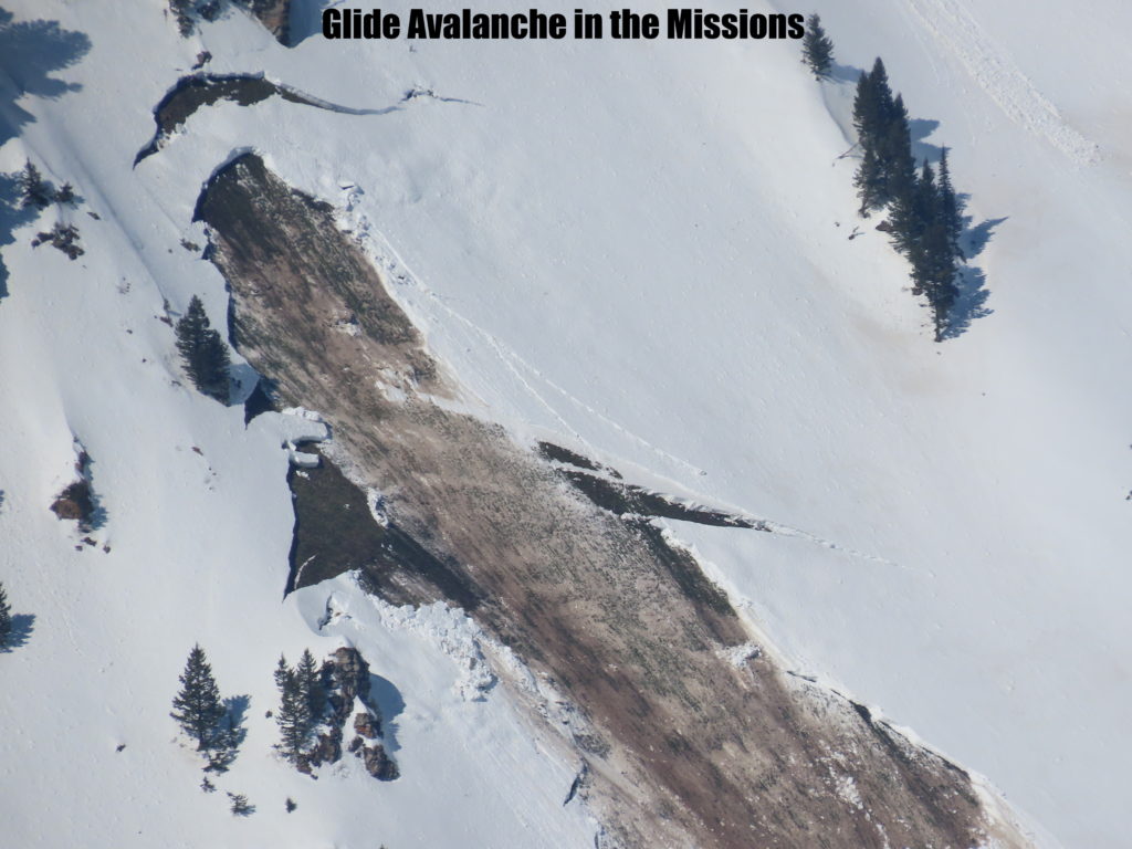
Glide cracks are opening in isolated areas of the Bitterroot and Missions. These are the result of the entire snowpack sliding on a wet ground surface and they can slowly open for weeks at a time. They can also fail suddenly and unpredictably producing avalanches the full depth of the snowpack. Stay well away from slopes where glide cracks are present.

Bottom Line

It is possible to trigger small slab avalanches that are failing on a surface hoar layer in steep wind loaded terrain. Generally stable avalanche conditions exist in all other terrain. Loose dry avalanches are possible on northern aspects. These could entrain enough snow to knock you off your feet and push you into hazards and may require management. Loose wet avalanches are possible on southern aspects. Continue to practice safe travel protocols in case you find an exception to a generally stable snowpack. Travel one at a time in avalanche terrain, carry a beacon, shovel, and probe, and stay alert for signs of instability. Dig a pit. Look for red flags

Please take a moment to read this message from Missoula Avalanche, Greater than the Sum of Our Parts.

Your observations are extremely helpful! If you get out, please take a minute to fill out the observation form, or shoot us a quick email at [email protected].

Ski and ride safe.


READ FULL ADVISORY  

Problem 1 - Persistent Slab-Buried Surface Hoar

  • TYPE

    persistent-slabs

    Persistent Slabs

    Release of a cohesive layer of soft to hard snow (a slab) in the middle to upper snowpack, when the bond to an underlying persistent weak layer breaks.  Persistent layers include: surface hoar, depth hoar, near-surface facets, or faceted snow. Persistent weak layers can continue to produce avalanches for days, weeks or even months, making them especially dangerous and tricky. As additional snow and wind events build a thicker slab on top of the persistent weak layer, this avalanche problem may develop into a Persistent, Deep-Slab.

  • SIZE

    2-3

    1 (Small)

    The potential size of avalanche resulting from this problem.

  • LIKELIHOOD

    Likelihood-3

    Possible

    The likelihood of an avalanche resulting from this problem.

  • ADDED DANGER

    Increased Slope Danger

    Increased/Added Danger

    There is an increased risk of avalanches on these slopes:

    N - North
    NE - Northeast
    NW - Northwest

Northern aspects throughout the forecast area have a layer of surface hoar buried under the new snow. The distribution is patchy as warm temps and wind knocked some of it down in the past week. Where found it is well preserved and will persist as a problem layer for a while. In most places, the new snow has lacked the cohesion to form slab avalanches on this layer. However, new snow and wind have loaded start zones just below ridge top and it is possible to trigger small soft slab avalanches on the surface hoar in steep, >35º terrain above 7000′. The size and consequence of these slides will increase with further wind and snow. As snow consolidates slabs may propagate further creating larger avalanches.

Avoid steep start zones just below ridge top and steep convexities.

Dig below the new snow and check for the presence of surface hoar before committing to steep terrain.

Problem 2 - Loose snow

  • TYPE

    loose-dry

    Loose Dry

    Release of wet unconsolidated snow or slush. These avalanches typically occur within layers of wet snow near the surface of the snowpack, but they may quickly gouge into lower snowpack layers. Like Loose-Dry Avalanches,they start at a point and entrain snow as they move downhill, forming a fan-shaped avalanche. They generally move slowly, but can contain enough mass to cause significant damage to trees, cars or buildings. Other names for loose-wet avalanches include point-release avalanches or sluffs. Loose-wet avalanches can trigger slab avalanches that break into deeper snow layers.

  • SIZE

    2-3

    1 (Small)

    The potential size of avalanche resulting from this problem.

  • LIKELIHOOD

    Likelihood-3

    Possible

    The likelihood of an avalanche resulting from this problem.

  • ADDED DANGER

    Increased Slope Danger

    Increased/Added Danger

    There is an increased risk of avalanches on these slopes:

    N - North
    NE - Northeast
    E - East
    SE - Southeast
    S - South
    SW - Southwest
    W - West
    NW - Northwest

On northern aspects, loose dry avalanches are possible on steep terrain. These could entrain enough snow to knock you off your feet and push you into hazards. Terrain traps will increase consequences.

On southern aspects wet loose avalanches are possible. Look for rollerballs and pinwheels. They are clues that the snowpack is changing. Move to lower angle slopes or more shaded aspects.

VIDEO

FORECAST & OUTLOOK

Snow showers possible today with generally light accumulations overall. Some breezy afternoon winds will also be possible, but mainly in areas near mountain showers. Temperatures this weekend will be warmer, likely the warmest for at least a week, and near normal. A deepening trough of low pressure along the Pacific Coast will bring progressively more moisture over the Northern Rockies starting Sunday night and continuing through at least the early part of next week. Significant mountain snow may be possible by Monday night.

This information is the sole responsibility of the Forest Service and does not apply to operating ski areas. The avalanche danger rating expires at midnight tonight but the information can help you make a more informed decision regarding travel in avalanche terrain for the next few days.

Our advisory area includes National Forest System lands in the Bitterroot Mountains from Lost Trail Pass north to Granite Pass, the Rattlesnake Mountains north of Missoula and the Southern Swan and Mission Mountains near Seeley Lake, MT. Avalanche information for the Lookout Pass/St. Regis Basin area is available from the Idaho Panhandle Avalanche Center.