Posted:
Dec 3, 2020 @ 6:46 am

The avalanche danger in the west central Montana backcountry is  LOW 

Good morning, this is Jeff Carty with the West Central Montana Avalanche Center’s avalanche advisory for December 3, 2020. This advisory does not apply to operating ski areas, expires at midnight tonight, and is the sole responsibility of the U.S. Forest Service.

There has been no new snow since Monday. 

Temps have ranged from 17º to 42º. Winds were westerly 8mph with gusts to 20mph.

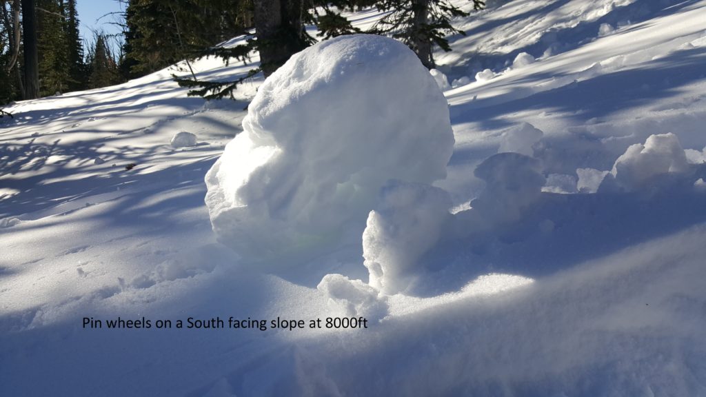
Remember that low danger does not mean no danger. Windslab may still be an isolated issue on high elevation wind-loaded slopes greater than 35º. The snowpack is mostly stable. However, variations do exist within the region, approach all slopes with suspicion. Isolated slopes in the Swans have a buried, but apparently well-bonded layer of surface hoar, down 10″. Other pockets of shallowly buried surface hoar likely exist throughout the forecast area. Solar warming was strong on southern aspects and rollerballs were forming above 8000′ yesterday. With strong inversion temperatures and sun, watch for wet loose avalanches late in the day. Move to shaded aspects as the snow heats up.

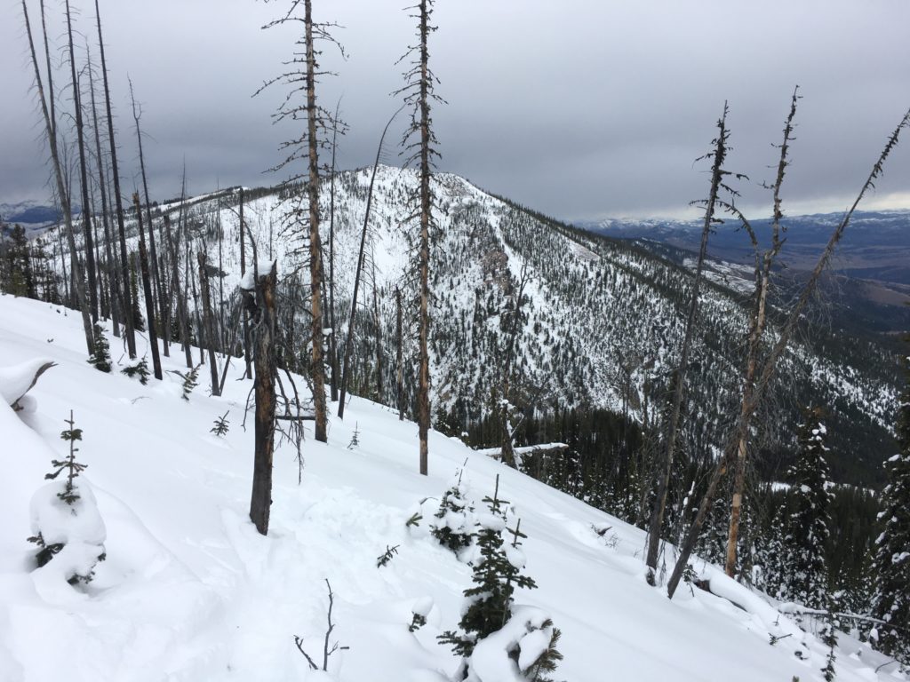
Below 7000′ feet, the snowpack is minimal, early season hazards abound. The snowpack will be shrinking this week, expect more hazards to appear. Above 7000′, snow depths grow. At upper elevations, they are at or above average and mostly stable conditions exist. However, this base is starting to change with the high pressure we’ve had and will continue to change with the fair weather forecast until Monday or Tuesday. 

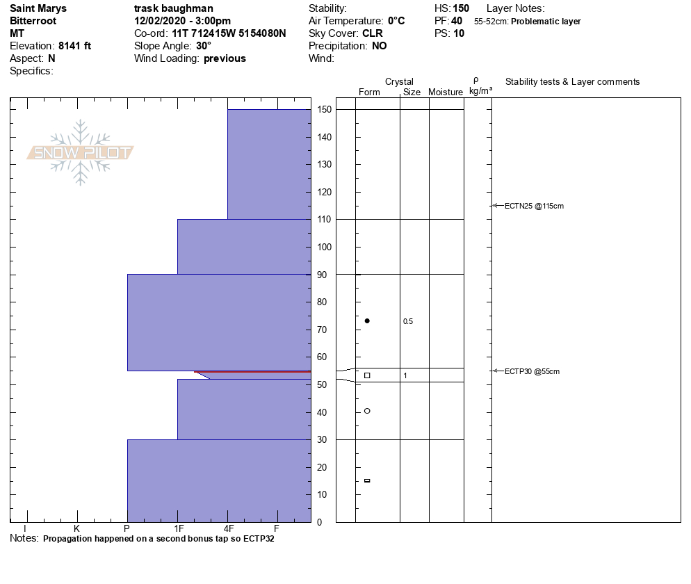
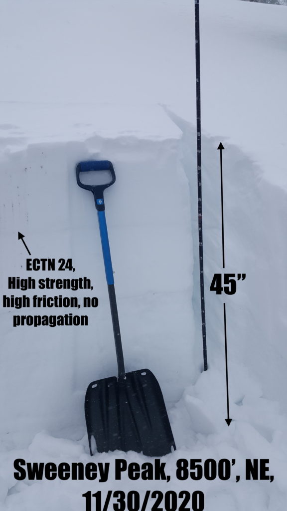
We are starting to see near-surface faceting in the upper 10″ and faceting grains below the rain crust, about 15″ from the ground. The lower layer is still showing high strength in stability tests but we are beginning to see planer fractures. This is something to keep an eye on. With an extended period of high pressure, we could see further faceting of the snowpack, although the warm temperatures in the forecast should slow it down. Areas with a shallower snowpack will be more susceptible to faceting.

In addition to facets within the snowpack, there is surface hoar to be aware of. Cold, clear nights with mild winds, as we are currently experiencing, are perfect for surface hoar growth. Expect widespread surface hoar throughout the region, concentrated on northerly aspects. This will be a stability concern when the next storm lands on this very weak layer. 

The bottom line:

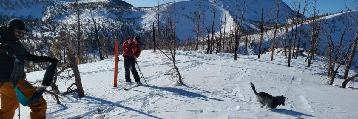
Above 7000′, we have a mostly stable snowpack. Wind slabs may still be present on steep leeward terrain, avoid wind-loaded start zones greater than 35º. Isolated pockets of buried surface hoar exist. Warm temps and sun are affecting southern aspects, wet loose avalanches could be an issue. Continue to practice safe travel protocols in case you find an exception to a generally stable snowpack. Travel one at a time in avalanche terrain, carry a beacon, shovel, and probe, and stay alert for signs of instability. Dig a pit. Look for red flags

Below 7000′, the snow mostly lacks the depth for decent skiing or avalanches.

High pressure has weakened the snowpack with faceting and created surface hoar. It will continue to do this through the rest of the week. These layers will be important to take note of as they will affect stability with subsequent snowfall. Please help us track these layers by submitting an observation if you get out in the backcountry. 

Ski and ride safe


READ FULL ADVISORY  

Problem 1 - Wind Slab

  • TYPE

    wind-slabs

    Wind Slabs

    Release of a cohesive layer of snow (a slab) formed by the wind.  Wind typically erodes snow from the upwind sides of terrain features and deposits snow on the downwind side.  Wind slabs are often smooth and rounded and sometimes sound hollow, and can range from soft to hard. Wind slabs that form over a persistent weak layer (surface hoar, depth hoar, or near-surface facets) may be termed Persistent Slabs or may develop into Persistent Slabs.

  • SIZE

    2-3

    1 (Small)

    The potential size of avalanche resulting from this problem.

  • LIKELIHOOD

    Likelihood-2

    Unlikely/Possible

    The likelihood of an avalanche resulting from this problem.

  • ADDED DANGER

    Increased Slope Danger

    Increased/Added Danger

    There is an increased risk of avalanches on these slopes:

    NE - Northeast
    E - East
    SE - Southeast

The wind slab deposited Monday is stabilizing, however it is still possible to trigger an avalanche in steep start zones.

Upper elevation slopes, above 7500′ are most suspect.

It is possible to trigger wind slab avalanches on slopes greater than 35º

Watch for stiff hollow sounding snow, wind pillows, shooting cracks, and avoid steep start zones.

Problem 2 - Loose Wet

  • TYPE

    loose-wet

    Loose Wet

    Release of wet unconsolidated snow or slush. These avalanches typically occur within layers of wet snow near the surface of the snowpack, but they may quickly gouge into lower snowpack layers. Like Loose-Dry Avalanches,they start at a point and entrain snow as they move downhill, forming a fan-shaped avalanche. They generally move slowly, but can contain enough mass to cause significant damage to trees, cars or buildings. Other names for loose-wet avalanches include point-release avalanches or sluffs. Loose-wet avalanches can trigger slab avalanches that break into deeper snow layers.

  • SIZE

    2-3

    1 (Small)

    The potential size of avalanche resulting from this problem.

  • LIKELIHOOD

    Likelihood-3

    Possible

    The likelihood of an avalanche resulting from this problem.

  • ADDED DANGER

    Increased Slope Danger

    Increased/Added Danger

    There is an increased risk of avalanches on these slopes:

    SE - Southeast
    S - South
    SW - Southwest
    W - West

Temperatures to 40º and solar warming will be heating the snow and loosening bonds on southerly aspects.

Loose wet avalanches are possible

As the snow warms and pinballs start to form move to shaded aspects and avoid steep terrain, greater than 35º

FORECAST & OUTLOOK

Strong high pressure will remain through the weekend. This pattern closely resembles what happened in early 2017, although it will be short-lived as a more active pattern is possible by Tuesday or Wednesday of next week. Between now and then, expect plenty of sunshine up high in the daytime, but clear and cold nights with generally weak winds less than 15 mph on ridges. Low clouds and/or fog may form in the valleys. Temperatures above 6000′ ranging from 29º-41º today, and 14º to 27º tonight.

This information is the sole responsibility of the Forest Service and does not apply to operating ski areas. The avalanche danger rating expires at midnight tonight but the information can help you make a more informed decision regarding travel in avalanche terrain for the next few days.

Our advisory area includes National Forest System lands in the Bitterroot Mountains from Lost Trail Pass north to Granite Pass, the Rattlesnake Mountains north of Missoula and the Southern Swan and Mission Mountains near Seeley Lake, MT. Avalanche information for the Lookout Pass/St. Regis Basin area is available from the Idaho Panhandle Avalanche Center.